Sun
- Sunrise
- 6:58 AM
- Sunset
- 5:07 PM
- First light
- 6:31 AM
- Last light
- 5:34 PM
Reservoir · Pittsylvania County, Virginia
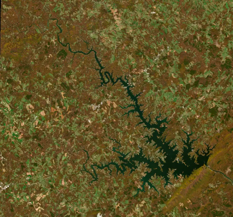
A reservoir on the Roanoke in Pittsylvania County, Virginia, held back by Smith Mountain Combination Pump Storage Dam since 1964.

There is no recent reading for Smith Mountain Lake. The gauge may be offline; check back later.
No readings yet.
Solunar periods for Smith Mountain Lake, local time. How they work
Not detected · as of Nov 9, 2026
The satellite found no cyanobacteria at the surface.
Week of Aug 16Week of Nov 1
Each bar is one week, colored by the worst reading of that week.
From the U.S. EPA's Cyanobacteria Assessment Network (CyAN), which reads the color of lakes from the Sentinel-3 satellites; it sees open water only, not coves or the shoreline. Blooms can be patchy: what you see on the water matters more. Swimming closures and health advisories come from Virginia health and environment agencies. How to read it
Surface water temperature
64°F on Nov 9, 2026
81°F · Jul 2964°F · Nov 9
17°F cooler than on Jul 29, 2026.
Estimated from Landsat 8/9 (USGS) passes on clear days: the top layer of the water, a few degrees either way. Coves and the shallows can be warmer.
Smith Mountain Lake water temperature: trend, swimming and the fish →
On or near the shore of Smith Mountain Lake: 15 boat ramps, 33 marinas, 11 rental outfits, 8 campgrounds, 2 beaches, 14 trails and 1 fishing guide. The lake has about 438 miles of shoreline, counting its islands.
Tap an icon for details; use two fingers (or Ctrl + scroll) to move the map. Tap a dot for details. Map and lake outline © OpenStreetMap contributors. Places from OpenStreetMap, Overture Maps and Recreation.gov. Not for navigation.
What you’ll find on the shore
← AllBoating 48
← AllRentals & tours 11
← AllFishing spots 3
← AllBeaches 2
← AllCamping 8
← AllLodging 24+
← AllTrails 14
← AllParks 3
← AllDining 24+
These invasive plants and animals have been recorded in Smith Mountain Lake: clean, drain and dry everything before you go to another lake.
Virginia: Before leaving the launch area, remove all aquatic plants from the boat, trailer and equipment and pull or open bilge drain plugs, and take reasonable steps to dry livewells, baitwells and ballast tanks before using another water. Knowingly moving aquatic nuisance species is illegal. State rules
Records: USGS Nonindigenous Aquatic Species database. A species not listed may still be present.
Species with open-licensed records inside Smith Mountain Lake's outline, from GBIF.org (surveys, museum collections and angler reports). A record shows a fish was found here, not how many there are now.
Channel edges and river arms; best after dark in summer, and after a rain.
Rocky shorelines at night after ice-out; deep weed edges and humps in summer.
Run up the river arms in spring; follow shad to cool, deep water near the dam in summer.
Weed beds and rock bars; fall is trophy season.
Beds in shallow, firm bottoms; around docks and weeds all summer.
Water temperature sets off each spawn; the bars show the usual months at this latitude and elevation, and move with a warm or cold spring. The water is about 64°F now.
Smith Mountain Lake is the upper reservoir of Appalachian Power's Smith Mountain pumped-storage project on the Roanoke River, in the Virginia piedmont between Roanoke and Lynchburg. It is the largest lake entirely within Virginia, and it is known for its striped bass, its shore lined with homes and its busy summer weekends on the water.
The Roanoke cuts through Smith Mountain, a hard ridge at the edge of the Blue Ridge, and the narrow gap drew dam builders early. A dam there was first proposed in 1906. In 1924 a power company bought about 4,500 acres in Bedford and Pittsylvania counties, then judged the project would not pay. After World War II the gap became part of a national argument over whether private utilities or the federal government should build dams on rivers like this one. Appalachian Power asked federal regulators for approval in 1949, against opposition from coal and railroad interests worried about losing business. A 1953 Supreme Court decision let regulators license private dams, and in 1954 AEP bought the old rights and more of the farmland to be flooded, over the objections of families who would have to leave. Work began in 1960, the gates closed in 1963, and runoff from heavy January snow helped bring the lake to full pool on March 7, 1966.
Smith Mountain Lake works as a pair with Leesville Lake just downstream. When demand for electricity peaks, water runs through the turbines at Smith Mountain Dam into Leesville. When demand is low, often late at night, it is pumped back uphill. The swaps move Smith Mountain up and down by as much as 2 feet while Leesville rises and falls about 13 feet. Twice a year Appalachian Power tests the system by drawing the upper lake down 2 feet and pumping it back within two days. In droughts, including 1999, 2001 and 2007, releases downstream were cut back to hold the lake up, while a minimum flow keeps the Roanoke below Leesville from running dry.
The lake has two main arms, one up the Roanoke and one up the Blackwater. Bedford County holds the north shore, Franklin County most of the south, and Pittsylvania County a small piece at the dam. State Route 122 is the only primary highway across the water. Moneta, Huddleston, Union Hall and Penhook are among the communities around it, and the Booker T. Washington National Monument sits near the west end. This was rural tobacco country until the 1960s and 1970s. Houses now stand on most of the buildable lakefront lots, mainly in Franklin and Bedford counties.
Smith Mountain Lake State Park, on the Bedford County side about 40 miles from both Roanoke and Lynchburg, began with a first parcel Appalachian Power donated the year after the dam was finished, and the state bought the rest. It opened in 1983 with 16 miles of lakefront and has a swimming beach.
Striped bass have been stocked since 1963, because the lake lacks the spawning habitat they need, and it produced several Virginia record stripers in the 1980s and 1990s. They gather in the lower lake in summer and early fall, and shallow plugs at night work best from April through June. Black bass are the most sought-after fish, with largemouth far outnumbering smallmouth, which are more common in the lower lake. Coves give the best largemouth fishing, and in summer many anglers go out at night or very early to avoid boat traffic. Flathead catfish do well in the upper arms. Since 2017 Appalachian Power has paid for fish habitat structures, and the state wildlife agency had built more than 300 of them by the end of 2022.
Written by Lake by Lake from Virginia Places, Virginia Department of Wildlife Resources, Virginia Department of Conservation and Recreation and Wikipedia. Checked November 2026.
Smith Mountain Combination Pump Storage Dam is a concrete arch dam 229 feet high and 816 feet long on the Roanoke, completed in 1964. It belongs to Appalachian Power Company and is run for hydropower. At its normal level the reservoir holds 1.15 million acre-ft, drained from 1,024 square miles of land.
From the National Inventory of Dams (U.S. Army Corps of Engineers), NID ID VA019002. Lake or reservoir: what’s the difference?
Where the level comes from: Roanoke River at Smith Mountain Lake (NOAA National Water Prediction Service).
| Lake | Miles | Level (ft) | vs full | 7 days |
|---|---|---|---|---|
| Philpott Lake Slightly below full | 32 | 970.51 | −3.49 | −0.08 |
| Hyco Lake Slightly below full | 44 | 407.41 | −2.35 | −0.08 |
| Claytor Lake At or near full pool | 58 | 1845.68 | −0.32 | +0.03 |
| Island Creek Reservoir Live reading | 67 | 258.28 | — | −0.02 |
| Lake Moomaw Well below full | 68 | 1564.35 | −17.65 | −0.59 |
| Kerr Lake Live reading | 74 | 287.07 | — | −0.39 |
Compare Smith Mountain Lake with Philpott Lake, Hyco Lake, Claytor Lake or Island Creek Reservoir: size, level, ramps and fish side by side.
Smith Mountain Lake is about 76 mi from High Point, NC. See all the lakes near each city.
There is no recent reading for Smith Mountain Lake. The gauge may be offline; check back later.
Smith Mountain Lake's full pond is 795.00 ft, according to Appalachian Power.
Smith Mountain Lake has 15 boat ramps on our map, including Boat ramp at Crazy Horse Marina, Boat ramp at Gills Creek Marina, Boat ramp near Crazy Horse Marina, and 33 marinas. Low water can close ramps, so check today's level above and the operator before you go.
Yes. There are 8 campgrounds and RV parks within about a mile of the shore, such as Hannabass Campground, Palmers Trailer Park & Marina, Arrowhead Campground.
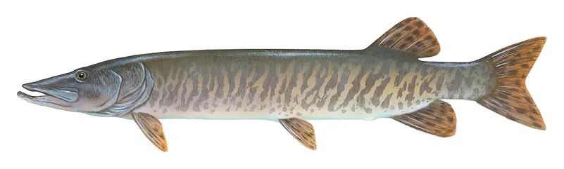
Game fish recorded in Smith Mountain Lake include flathead catfish, bluegill, walleye, channel catfish, striped bass, muskellunge. In all, 13 fish species have open records inside the lake on GBIF.
The surface of Smith Mountain Lake was about 64°F on November 9, estimated from a satellite pass on a clear day. It is the top layer of the water, a few degrees either way; coves and shallows run warmer in the sun.
Anglers 16 and older need a Virginia fishing license, sold online by the Virginia Department of Wildlife Resources. Free fishing days: First weekend in June and the last weekend of September (2026: June 5-7 and September 25-27). Size and bag limits can be set lake by lake: check the current regulations.
NOAA's flood categories for the Smith Mountain Lake gauge: action stage at 796.0 ft, minor flooding at 797.0 ft, moderate flooding at 798.0 ft and major flooding at 799.0 ft.
Smith Mountain Lake averages about 56 ft deep. Depth changes with the lake level.
In summer a white Secchi disk lowered into Smith Mountain Lake stays visible to about 6.2 ft (the median of 671 readings, 2016–2026, by VIRGINIA DEPARTMENT OF ENVIRONMENTAL QUALITY and North American Lake Management Society): somewhat murky water. With the algae measured too (chlorophyll about 3 µg/L), that makes it mesotrophic: moderately rich in nutrients. Clarity drops after storms and during algae blooms.
boating (15 boat ramps and 33 marinas), kayaks, boats & jet skis (11 rental outfits on or near the water), fishing (8 game fish and 1 fishing guide), swimming (2 beaches and swimming areas), hiking & walking (14 trails along the shore, the longest Roanoke River Greenway (3.7 mi)) and camping (8 campgrounds), according to our map of the shore.
EPA's CyAN satellite rated cyanobacteria in Smith Mountain Lake not detected on November 9. The satellite sees open water only; blooms can be patchy, so avoid water that looks like spilled paint or pea soup and keep dogs out of scum. Swimming advisories come from Virginia health and environment agencies.
Yes. 14 trails run along or near the shore, including Chestnut Ridge Trail (1.3 mi), Lakeview Trail (0.5 mi) and Turtle Island Trail (1.3 mi), according to OpenStreetMap.
Smith Mountain Lake is held back by Smith Mountain Combination Pump Storage, completed in 1964 and 229 ft high, according to the National Inventory of Dams.
From the official gauge (Roanoke River at Smith Mountain Lake). Lake by Lake checks it every hour; the agency's own figure is always the reference, and provisional readings can be revised.
Lake levels are refreshed every hour. Texas and California reservoirs report once a day; most USGS and NOAA gauges report every 15 to 60 minutes.