Sun
- Sunrise
- 6:15 AM
- Sunset
- 4:39 PM
- First light
- 5:49 AM
- Last light
- 5:05 PM
Reservoir · Randolph County, Alabama
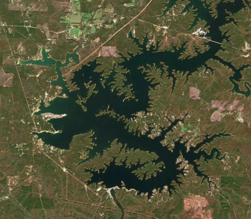
A reservoir on the Tallapoosa River in Randolph County, Alabama, held back by R. L. Harris Dam since 1983. Also called R.L. Harris Reservoir.
Lake Wedowee is at 786.74 feet above sea level — 6.26 ft below full summer pool, as of Nov 17, 2026, 8:00 PM CST. It has dropped 0.98 ft in the past 7 days.
3rd lowest of 13 Alabama lakes today against full pool · See the ranking
Record low 780.11 ft (2007), record high 793.12 ft (2013) · Level history since 2004
A notification from this browser, once, when the level crosses the line (checked every hour). No account and no email. On an iPhone, add Lake by Lake to your home screen first (Share → Add to Home Screen) and open it from there. Or follow the lake in a feed reader: RSS feed.
Lake Wedowee is down 0.98 ft over the last 7 days, at 786.74 ft today.
Daily values from the NOAA National Water Prediction Service.
Lake Wedowee is down 3.62 ft over the last 30 days, at 786.74 ft today.
Daily values from the NOAA National Water Prediction Service.
Over the past 12 months, Lake Wedowee ranged from 784.63 ft (Feb 1, 2026) to 793.04 ft (Aug 6, 2026), a swing of 8.4 ft. Today's level is in the lower half of that range. It is about where it was a year ago.
Daily values from the NOAA National Water Prediction Service. Why lake levels rise and fall
In the U.S. Army Corps of Engineers record, which starts in 2004, the lowest level was 780.11 ft on November 24, 2007 and the highest 793.12 ft on May 18, 2013. Today’s 786.74 ft is 6.6 ft above the record low and 6.4 ft below the record high.
Lake Wedowee level history: every year since 2004, the lowest and highest years →
Solunar periods for Lake Wedowee, local time. How they work
Low · as of Nov 9, 2026
Some cyanobacteria at the surface, under 100,000 cells/mL. About 87,100 cells/mL at the worst spot, covering 1% of the lake.
Week of Aug 16Week of Nov 1
Each bar is one week, colored by the worst reading of that week.
From the U.S. EPA's Cyanobacteria Assessment Network (CyAN), which reads the color of lakes from the Sentinel-3 satellites; it sees open water only, not coves or the shoreline. Blooms can be patchy: what you see on the water matters more. Swimming closures and health advisories come from Alabama health and environment agencies. How to read it
Surface water temperature
63°F on Nov 14, 2026
88°F · Aug 263°F · Nov 14
25°F cooler than on Aug 2, 2026.
Estimated from Landsat 8/9 (USGS) passes on clear days: the top layer of the water, a few degrees either way. Coves and the shallows can be warmer.
Lake Wedowee water temperature: trend, swimming and the fish →
On or near the shore of Lake Wedowee: 15 boat ramps, 1 marina and 8 campgrounds. The lake has about 326 miles of shoreline, counting its islands.
Tap an icon for details; use two fingers (or Ctrl + scroll) to move the map. Tap a dot for details. Map and lake outline © OpenStreetMap contributors. Places from OpenStreetMap, Overture Maps and Recreation.gov. Not for navigation.
No aquatic invasive species are on record for Lake Wedowee in the USGS database. Keep it that way: clean, drain and dry your boat between lakes.
Alabama: Alabama has no clean-drain-dry law for boaters, but the state asks you to remove mud, plants and animals, drain all water and dry your boat and gear before moving them. Releasing bait or stocking any fish or aquatic organism without a permit is illegal, as is putting non-native aquatic plants into public waters. State rules
Records: USGS Nonindigenous Aquatic Species database. A species not listed may still be present.
Lake Wedowee is the local name for Harris Reservoir, the Alabama Power lake on the upper Tallapoosa River in Randolph and Clay counties of east Alabama. It is the youngest of the company's hydro lakes in the state, filled in 1983, and many of its visitors come over from Atlanta and west Georgia. The name comes from the small county-seat town of Wedowee near its shore.
Engineers picked out this stretch of the Tallapoosa for a dam in the mid-1920s, but federal approval did not come until 1973. Construction started in 1974, and the gates closed on April 20, 1983, more than half a century after the site was first studied. The dam is named for Rother L. Harris, an Alabama Power director and vice president of electric operations, and Alabama Power runs it as a peaking plant, sending water through its two generators when demand for power is highest. Those surges change the river below quickly, and their effects on downstream erosion, cold water and the safety of people on the river were central issues when the project came up for its first new federal license in the 2020s.
Wedowee takes its name from a Creek leader whose town stood beside the creek that also carries his name, and the name means old water in the Muscogean language. People lived along Wedowee Creek as early as 6,000 BCE. The town was settled in the early 1830s and became the seat of Randolph County by 1835. For most of the 20th century it was a small farm town, and much of its growth since has come from the lake and from visitors and retirees who cross over from Georgia. The lake is fed by the Tallapoosa and the Little Tallapoosa, which meet just north of the Highway 48 bridge, about 8.5 river miles above the dam, giving the lake two long arms. Alabama Power keeps boat ramps at eight sites around the shore and protects tracts of land it calls The Preserves. The best known is Flat Rock Park, about 25 acres of smooth granite on the shore, with swimming, picnic areas and a nature trail. Little Fox, a day-use area built with the property owners' association, has walking trails and fishing spots.
Lake Wedowee is a lean, low-fertility lake, and its many rocky points are what bass anglers come for. Largemouth and spotted bass both do well, though the state's biologists note that the lean water and scarce forage keep many fish thin. Wedowee Creek, a richer tributary of the Little Tallapoosa, is one of the better spots for largemouth, and in the state's 2008 bass tournament report the lake earned more quality points than any other reservoir in Alabama. Medium and deep-diving crankbaits and Carolina rigs work around the points. Bluegill and shellcracker bite well around the mayfly hatch from late May through August. Crappie gather around blown-down trees along the main channel in early spring and under lighted docks on summer nights. Catfish bite through the summer. Yellow perch, newcomers to the Tallapoosa drainage, now turn up as well. Some large boats and houseboats may be barred from the lake, so check before bringing one.
Written by Lake by Lake from Alabama Department of Conservation and Natural Resources, Alabama Power Shorelines, Encyclopedia of Alabama (Wedowee, R. L. Harris Dam), Energy Global and Wikipedia. Checked November 2026.
R. L. Harris Dam is a concrete gravity dam 152 feet high and 2,142 feet long on the Tallapoosa River, completed in 1983. It belongs to Alabama Power Company and is run for hydropower, fish and wildlife and recreation. At its normal level the reservoir holds 426,000 acre-ft, drained from 1,453 square miles of land.
From the National Inventory of Dams (U.S. Army Corps of Engineers), NID ID AL83001. Lake or reservoir: what’s the difference?
Where the level comes from: Tallapoosa River at Harris Dam (NOAA National Water Prediction Service).
| Lake | Miles | Level (ft) | vs full | 7 days |
|---|---|---|---|---|
| West Point Lake Below full | 34 | 622.46 | −12.54 | −0.19 |
| Logan Martin Lake Slightly below full | 43 | 462.62 | −2.38 | −0.50 |
| Lake Martin Below full | 43 | 483.63 | −7.37 | −0.76 |
| Neely Henry Lake At or near full pool | 44 | 506.77 | −1.23 | −0.30 |
| Yates Lake At or near full pool | 50 | 343.56 | −1.44 | +0.37 |
| Lay Lake At or near full pool | 56 | 395.68 | −0.32 | −0.09 |
Compare Lake Wedowee with West Point Lake, Logan Martin Lake, Lake Martin or Neely Henry Lake: size, level, ramps and fish side by side.
Lake Wedowee is about 67 mi from Columbus, GA. See all the lakes near each city.
Lake Wedowee is also known as R.L. Harris Reservoir.
Lake Wedowee is at 786.74 feet above sea level — 6.26 ft below full summer pool, as of Nov 17, 2026, 8:00 PM CST. It has dropped 0.98 ft in the past 7 days.
Lake Wedowee's full summer pool is 793.00 ft, according to U.S. Army Corps of Engineers. Today the lake is 6.26 ft below that mark.
Today's level is 0.17 ft above the median for this date (786.57 ft), from the gauge’s long-term daily record.
780.11 ft, on November 24, 2007, in the U.S. Army Corps of Engineers record, which starts in 2004. Today the lake is 6.6 ft above that.
793.12 ft, on May 18, 2013, in the U.S. Army Corps of Engineers record since 2004. That is 0.1 ft above full summer pool.
Lake Wedowee has 15 boat ramps on our map, including Big Fox Creek Boat Ramp, and 1 marina. Low water can close ramps, so check today's level above and the operator before you go.
Yes. There are 8 campgrounds and RV parks within about a mile of the shore, such as Harmony Pointe RV Park, EdgeWater RV Park, Hidden Cove RV Park.
The surface of Lake Wedowee was about 63°F on November 14, estimated from a satellite pass on a clear day. It is the top layer of the water, a few degrees either way; coves and shallows run warmer in the sun.
Anglers 16 and older need an Alabama fishing license, sold online by the Alabama Department of Conservation and Natural Resources. Free fishing days: One Saturday in June (2026: June 13). Size and bag limits can be set lake by lake: check the current regulations.
Lake Wedowee averages about 40 ft deep. Depth changes with the lake level.
In summer a white Secchi disk lowered into Lake Wedowee stays visible to about 8.6 ft (the median of 34 readings, 2016–2025, by ALABAMA DEPT. OF ENVIRONMENTAL MANAGEMENT - WATER QUALITY DATA and Alabama Water Watch): clear water. With the algae measured too (chlorophyll about 8 µg/L), that makes it mesotrophic: moderately rich in nutrients. Clarity drops after storms and during algae blooms.
boating (15 boat ramps and 1 marina), camping (8 campgrounds), cabins & lodging (9 places to stay close to the water), parks & picnics (1 park on the shore) and waterfront dining (3 waterfront restaurants), according to our map of the shore.
EPA's CyAN satellite rated cyanobacteria in Lake Wedowee low on November 9. The satellite sees open water only; blooms can be patchy, so avoid water that looks like spilled paint or pea soup and keep dogs out of scum. Swimming advisories come from Alabama health and environment agencies.
Lake Wedowee is held back by R. L. Harris, completed in 1983 and 152 ft high, according to the National Inventory of Dams.
From the NOAA National Water Prediction Service (Tallapoosa River at Harris Dam). Lake by Lake checks it every hour; the agency's own figure is always the reference, and provisional readings can be revised.
Lake levels are refreshed every hour. Texas and California reservoirs report once a day; most USGS and NOAA gauges report every 15 to 60 minutes.