Sun
- Sunrise
- 7:05 AM
- Sunset
- 5:23 PM
- First light
- 6:38 AM
- Last light
- 5:50 PM
Reservoir · Yavapai County, Arizona
A reservoir on the Agua Fria in Yavapai County, Arizona, held back by New Waddell Dam since 1992.
Lake Pleasant is at 1,663.76 feet above sea level — 38.24 ft below top of conservation pool, as of Nov 18, 2026, 11:31 PM MST. The level has held steady over the past week.
2nd lowest of 6 Arizona lakes today against full pool · See the ranking
Which boat ramps are usable at today’s level →
A notification from this browser, once, when the level crosses the line (checked every hour). No account and no email. On an iPhone, add Lake by Lake to your home screen first (Share → Add to Home Screen) and open it from there. Or follow the lake in a feed reader: RSS feed.
Lake Pleasant has held steady over the last 7 days (within 0.05 ft).
Daily values from the NOAA National Water Prediction Service.
Lake Pleasant is up 9.92 ft over the last 30 days, at 1,663.76 ft today.
Daily values from the NOAA National Water Prediction Service. Why lake levels rise and fall
Solunar periods for Lake Pleasant, local time. How they work
Not detected · as of Nov 9, 2026
The satellite found no cyanobacteria at the surface.
Week of Aug 16Week of Nov 1
Each bar is one week, colored by the worst reading of that week.
From the U.S. EPA's Cyanobacteria Assessment Network (CyAN), which reads the color of lakes from the Sentinel-3 satellites; it sees open water only, not coves or the shoreline. Blooms can be patchy: what you see on the water matters more. Swimming closures and health advisories come from Arizona health and environment agencies. How to read it
Surface water temperature
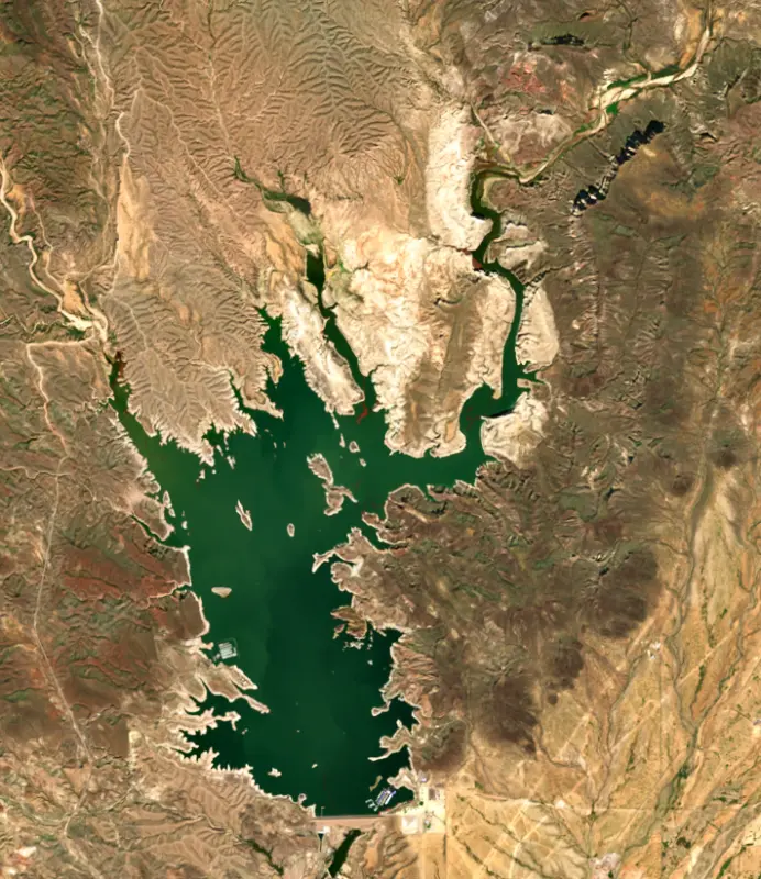
70°F on Nov 5, 2026
96°F · Jul 2470°F · Nov 5
26°F cooler than on Jul 24, 2026.
Estimated from Landsat 8/9 (USGS) passes on clear days: the top layer of the water, a few degrees either way. Coves and the shallows can be warmer.
Lake Pleasant water temperature: trend, swimming and the fish →
On or near the shore of Lake Pleasant: 7 boat ramps, 5 marinas, 5 rental outfits, 5 campgrounds and 6 trails. The lake has about 106 miles of shoreline, counting its islands.
Tap an icon for details; use two fingers (or Ctrl + scroll) to move the map. Tap a dot for details. Map and lake outline © OpenStreetMap contributors. Places from OpenStreetMap, Overture Maps and Recreation.gov. Not for navigation.
What you’ll find on the shore
← AllBoating 12
Which boat ramps are usable at today’s level →
← AllRentals & tours 7
← AllCamping 5
← AllTrails 6
← AllParks 2
← AllDining 7
Quagga mussels have been found in Lake Pleasant. They clog intakes and engines and spread on boats and trailers: clean, drain and dry everything before you go to another lake.
Arizona: When leaving waters listed as having invasive species (such as Lakes Mead, Mohave, Havasu and Powell and the lower Colorado River) you must remove plants, mud and animals, drain all water and keep drain plugs out while transporting. Boats kept on a listed water for 6 or more days must get a free professional decontamination before they are moved. State rules
Records: USGS Nonindigenous Aquatic Species database. A species not listed may still be present.
Species with open-licensed records inside Lake Pleasant's outline, from GBIF.org (surveys, museum collections and angler reports). A record shows a fish was found here, not how many there are now.
Shallow, protected flats in spring; docks, grass and deep edges in summer heat.
Channel edges and river arms; best after dark in summer, and after a rain.
Run up the river arms in spring; follow shad to cool, deep water near the dam in summer.
Spring runs up the tributaries; schools busting shad in late summer.
Beds in shallow, firm bottoms; around docks and weeds all summer.
Water temperature sets off each spawn; the bars show the usual months at this latitude and elevation, and move with a warm or cold spring. The water is about 70°F now.
Lake Pleasant is a desert reservoir on the Agua Fria River, about 35 miles northwest of Phoenix, on the line between Maricopa and Yavapai counties. It does two jobs at once. It is the main storage reservoir of the Central Arizona Project, which carries Colorado River water across the state, and it is the only lake in the Maricopa County park system, drawing more than a million visitors a year.
The first dam here was a private irrigation project. The Maricopa Water District finished it in 1927, a concrete multiple-arch dam that was then the largest of its kind in the world. It was first called Pleasant Dam and later renamed Waddell Dam. A diversion dam downstream, begun in 1895, turned the stored river water out onto desert farmland in the district.
Maricopa County opened a regional park around the old lake in 1965. In 1984 federal legislation folded the lake into the Central Arizona Project, and work on New Waddell Dam, a large earthfill dam about half a mile downstream, began the next year. The new dam roughly tripled the size of the lake. The old one was never torn down. Crews cut a breach through it with a diamond wire saw and toppled the loose sections into the water in December 1992, so the level stays the same on both sides and boats can pass through. For most of the year the old arches sit beneath the surface.
Lake Pleasant is filled two ways: by runoff from the Agua Fria, and by Colorado River water pumped uphill from the main CAP canal through the Waddell Canal, a short channel that branches off near State Route 303. Pumping happens in winter and spring, when electricity is cheaper. In summer, when demand for water and power peaks, the water flows back out through the Waddell pump-generating plant, making hydropower on the way, and heads to farms in the West Valley and to cities as far south as Tucson.
That cycle sets the rhythm of the lake. The water usually peaks in March or April and is lowest in October or November, and CAP puts the average swing at about 65 feet a year. Beaches and coves change shape over a season, and the small Agua Fria launch at the north end works only when the lake is high.
Most boaters launch at the 10 Lane Boat Ramp. A 4 Lane ramp serves the north end, and motorized boats may launch only from the ramps, never from the shore. Scorpion Bay Marina sits on the west shore. The park also has campgrounds, boat-in camping by reservation, hiking trails and a Discovery Center. Waterskiing, sailing, windsurfing and scuba diving are all common, and summer weekends bring heavy boat traffic. Officials have warned over the years about deep water and about carbon monoxide around idling boats.
People lived here long before the dams. Indian Mesa holds the ruins of a Hohokam village roughly 1,000 years old, and federal law forbids taking artifacts. Reclamation closes the area around a bald eagle nest during the breeding season, and a fish barrier on an upper tributary keeps the lake's non-native fish away from endangered Gila topminnow.
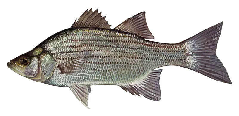
Arizona Game and Fish began stocking the lake after the original dams went in, and today it is a warm-water fishery. Striped bass, white bass and largemouth bass share the lake with flathead and channel catfish, white and black crappie, bluegill, redear sunfish, bigmouth buffalo and tilapia. Organized fishing tournaments run here through the year. An Arizona fishing license is required for anglers 10 and older.
Written by Lake by Lake from Bureau of Reclamation, Phoenix Area Office, Central Arizona Project, Maricopa County Parks and Recreation (Lake Pleasant Regional Park, Waddell Dam, Lake Pleasant Regional Park, Boat Ramps, Lake Pleasant Regional Park, Fishing) and Wikipedia. Checked November 2026.
Activities listed by the Bureau of Reclamation: Biking · Boating · Historic sites · Camping · Fishing · Hiking · Off-road vehicles · Picnicking · Visitor center · Water sports · Wildlife viewing
New Waddell Dam is a rockfill dam 438 feet high and 4,700 feet long on the Agua Fria, completed in 1992. It belongs to the Bureau of Reclamation and is run for flood control, recreation, hydropower and water supply. At its normal level the reservoir holds 811,784 acre-ft, drained from 1,438 square miles of land.
From the National Inventory of Dams (U.S. Army Corps of Engineers), NID ID AZ82929. Lake or reservoir: what’s the difference?
Where the level comes from: Agua Fria River at Lake Pleasant (NOAA National Water Prediction Service).
| Lake | Miles | Level (ft) | vs full | 7 days |
|---|---|---|---|---|
| Horseshoe Lake Slightly below full | 33 | 2017.93 | −8.07 | +3.67 |
| Bartlett Lake Below full | 38 | 1791.09 | −6.91 | −4.21 |
| Saguaro Lake At or near full pool | 50 | 1527.64 | −1.36 | +0.26 |
| Canyon Lake Well below full | 55 | 1604.46 | −56.04 | −0.41 |
| Apache Lake At or near full pool | 59 | 1908.43 | −5.57 | 0.00 |
| Theodore Roosevelt Lake Below full | 67 | 2122.02 | −28.98 | +1.01 |
Compare Lake Pleasant with Horseshoe Lake, Bartlett Lake, Saguaro Lake or Canyon Lake: size, level, ramps and fish side by side.
Lake Pleasant is about 10 mi from Peoria, AZ, 21 mi from Surprise, AZ and 27 mi from Phoenix, AZ. See all the lakes near each city.
Lake Pleasant is at 1,663.76 feet above sea level — 38.24 ft below top of conservation pool, as of Nov 18, 2026, 11:31 PM MST. The level has held steady over the past week.
Lake Pleasant's top of conservation pool is 1,702.00 ft, according to Bureau of Reclamation. Today the lake is 38.24 ft below that mark.
Lake Pleasant has 7 boat ramps on our map, including 10-Lane Boat Ramp (main entrance), Boat ramp near Pleasant Harbor Marina, Castle Creek Boat Ramp, and 5 marinas. Low water can close ramps, so check today's level above and the operator before you go.
Yes. There are 5 campgrounds and RV parks within about a mile of the shore, such as Desert Tortoise Campground, Lake Pleasant Camp, Lake Pleasant Campground.
Game fish recorded in Lake Pleasant include striped bass, flathead catfish, white bass, largemouth bass, channel catfish, redear sunfish. In all, 11 fish species have open records inside the lake on GBIF.
The surface of Lake Pleasant was about 70°F on November 5, estimated from a satellite pass on a clear day. It is the top layer of the water, a few degrees either way; coves and shallows run warmer in the sun.
Anglers 10 and older need an Arizona fishing license, sold online by the Arizona Game and Fish Department. Free fishing days: Usually the first Saturday of National Fishing and Boating Week (June). Size and bag limits can be set lake by lake: check the current regulations.
Lake Pleasant averages about 82 ft deep. Depth changes with the lake level.
Bureau of Reclamation lists biking, boating, historic sites, camping, fishing, hiking, off-road vehicles and picnicking at Lake Pleasant.
EPA's CyAN satellite rated cyanobacteria in Lake Pleasant not detected on November 9. The satellite sees open water only; blooms can be patchy, so avoid water that looks like spilled paint or pea soup and keep dogs out of scum. Swimming advisories come from Arizona health and environment agencies.
Yes. 6 trails run along or near the shore, including Maricopa Trail, Pipeline Canyon Trail (2.0 mi) and Wild Burro Trail (5.1 mi), according to OpenStreetMap.
Lake Pleasant is held back by New Waddell Dam, completed in 1992 and 438 ft high, according to the National Inventory of Dams.
From the NOAA National Water Prediction Service (Agua Fria River at Lake Pleasant). Lake by Lake checks it every hour; the agency's own figure is always the reference, and provisional readings can be revised.
Lake levels are refreshed every hour. Texas and California reservoirs report once a day; most USGS and NOAA gauges report every 15 to 60 minutes.
Cookies for analytics With your OK we use Google Analytics and Microsoft Clarity to count visits and see how the site is used, so we can make it better. No advertising cookies. Privacy policy