Sun
- Sunrise
- 7:00 AM
- Sunset
- 5:19 PM
- First light
- 6:33 AM
- Last light
- 5:46 PM
Reservoir · Gila County, Arizona
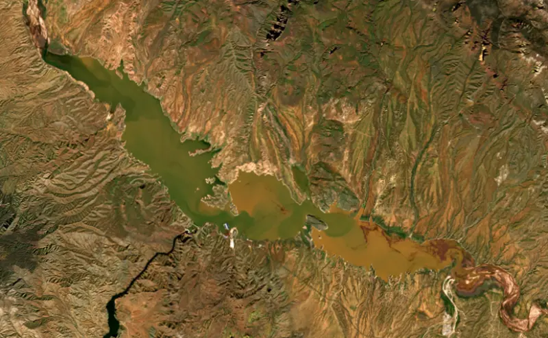
A reservoir on the Salt River in Gila County, Arizona, held back by Theodore Roosevelt Dam since 1911.

Theodore Roosevelt Lake is at 2,122.02 feet above sea level — 28.98 ft below top of conservation pool, 66.0% full, as of Nov 18, 2026. It has risen 1.01 ft in the past 7 days.
2nd lowest of 5 Arizona lakes today by percent full · See the ranking
Which boat ramps are usable at today’s level →
A notification from this browser, once, when the level crosses the line (checked every hour). No account and no email. On an iPhone, add Lake by Lake to your home screen first (Share → Add to Home Screen) and open it from there. Or follow the lake in a feed reader: RSS feed.
Theodore Roosevelt Lake is up 30.98 ft over the last 30 days, at 2,122.02 ft today.
Daily values from the Salt River Project.
Over the past 80 days, Theodore Roosevelt Lake ranged from 2,085.70 ft (Sep 14, 2026) to 2,122.02 ft (Nov 18, 2026), a swing of 36.3 ft. Today's level is the highest of the past 80 days. It is 23.42 ft higher than on this date last year.
Daily values from the Salt River Project. Why lake levels rise and fall
Solunar periods for Theodore Roosevelt Lake, local time. How they work
Not detected · as of Nov 9, 2026
The satellite found no cyanobacteria at the surface.
Week of Aug 16Week of Nov 1
Each bar is one week, colored by the worst reading of that week.
From the U.S. EPA's Cyanobacteria Assessment Network (CyAN), which reads the color of lakes from the Sentinel-3 satellites; it sees open water only, not coves or the shoreline. Blooms can be patchy: what you see on the water matters more. Swimming closures and health advisories come from Arizona health and environment agencies. How to read it
Surface water temperature
68°F on Nov 15, 2026
94°F · Jul 2368°F · Nov 15
27°F cooler than on Jul 23, 2026.
Estimated from MODIS Aqua (NASA) passes on clear days: the top layer of the water, a few degrees either way. Coves and the shallows can be warmer.
Theodore Roosevelt Lake water temperature: trend, swimming and the fish →
On or near the shore of Theodore Roosevelt Lake: 8 boat ramps, 1 marina, 11 campgrounds and 2 trails. The lake has about 97 miles of shoreline, counting its islands.
Tap an icon for details; use two fingers (or Ctrl + scroll) to move the map. Tap a dot for details. Map and lake outline © OpenStreetMap contributors. Places from OpenStreetMap, Overture Maps and Recreation.gov. Not for navigation.
What you’ll find on the shore
← AllBoating 9
Which boat ramps are usable at today’s level →
← AllCamping 11
← AllTrails 2
← AllParks 5
← AllDining 1
No aquatic invasive species are on record for Theodore Roosevelt Lake in the USGS database. Keep it that way: clean, drain and dry your boat between lakes.
Arizona: When leaving waters listed as having invasive species (such as Lakes Mead, Mohave, Havasu and Powell and the lower Colorado River) you must remove plants, mud and animals, drain all water and keep drain plugs out while transporting. Boats kept on a listed water for 6 or more days must get a free professional decontamination before they are moved. State rules
Records: USGS Nonindigenous Aquatic Species database. A species not listed may still be present.
Species with open-licensed records inside Theodore Roosevelt Lake's outline, from GBIF.org (surveys, museum collections and angler reports). A record shows a fish was found here, not how many there are now.
Shallow, protected flats in spring; docks, grass and deep edges in summer heat.
Brush piles, docks and bridge pilings; shallow for a few weeks in spring.
Channel edges and river arms; best after dark in summer, and after a rain.
Beds in shallow, firm bottoms; around docks and weeds all summer.
On the bottom near snail beds; spawns around the full moon.
Water temperature sets off each spawn; the bars show the usual months at this latitude and elevation, and move with a warm or cold spring. The water is about 68°F now.
Theodore Roosevelt Lake fills the valley where Tonto Creek meets the Salt River in Gila County, about 80 miles northeast of Phoenix. It is the oldest reservoir in the Salt River Project system and the largest lake that lies entirely inside Arizona. Its dam, finished in 1911, was built to store water for the farms of the Salt River Valley.
After the droughts of the 1890s, farmers around Phoenix wanted a way to hold back spring floods and save the water for summer. In 1903 they formed the Salt River Valley Water Users' Association and pledged their own land as collateral for a federal loan under the new Reclamation Act, and the project became one of the first five of its kind in the country. The site they chose was a narrow gorge just below the mouth of Tonto Creek, a ford that early pioneers called The Crossing. To reach it, crews that included Apache workers built a road of about 60 miles from Mesa, finished in 1905 and later known as the Apache Trail. Floods in 1905 and 1907 swept away equipment, but the first stone was laid on September 20, 1906, and by 1909 power from the site was running over a line to Mesa. Theodore Roosevelt rode the Apache Trail to dedicate the dam on March 18, 1911, and at 5:48 in the afternoon pressed a button to release water from the reservoir while about 1,000 people watched. It was then the tallest stone masonry dam in the world. The lake first spilled on April 14, 1915.
The original dam was 280 feet tall. In a project that ended in 1996, the Bureau of Reclamation wrapped the old masonry in concrete and raised it 77 feet, adding flood control space and about 20 percent more storage for valley cities. The work took eight years and cost $430 million. Floods in January 1993 overtopped a cofferdam and pushed the lake to the highest level in its history, setting the job back almost six months. Since 1990, traffic has crossed the canyon on the Roosevelt Lake Bridge, a single steel arch with a span of 1,080 feet, instead of on top of the dam, whose road had been built for two Model T Fords to pass. Reclamation also spent $42 million rebuilding the ramps, marina and campgrounds that the higher lake would reach. In 2019 the dam became the first structure in the United States on the World Heritage Irrigation Structures list.
People farmed this basin long before the dam. Hohokam settlers arrived around AD 750, and by about 1150 their way of life had turned into what archaeologists call the Salado culture, named for the Rio Salado, or Salt River. Salado farmers dug canals from the river to grow corn, beans, squash and amaranth, and those canals could still be seen until the lake covered them in 1911. Around 1300 some families moved up into shallow caves, and their cliff dwellings at Tonto National Monument still look out over the water.
The lake runs about 8 miles up Tonto Creek and about 10 miles up the old Salt River channel. The Tonto National Forest manages the shore, with large campgrounds such as Cholla, about 5 miles north of the dam, where the boat ramps can be used only when the lake is above 2,110 feet. Bald eagles and geese are often seen along the shore. Summer highs often pass 100 degrees from June through August, so fall through spring is the easier season to camp. The lake holds crappie, largemouth and smallmouth bass, flathead and channel catfish, sunfish and carp. The usual drive from Mesa is by State Routes 87 and 188, while the old Apache Trail, State Route 88, is the historic way in.
Written by Lake by Lake from Bureau of Reclamation, National Park Service, Salt River Project, National Park Service, Tonto National Monument, Recreation.gov and Wikipedia. Checked November 2026.
Theodore Roosevelt Dam is a masonry dam 357 feet high and 723 feet long on the Salt River, completed in 1911. It belongs to the Bureau of Reclamation and is run for hydropower, irrigation and recreation. At its normal level the reservoir holds 1.65 million acre-ft, drained from 5,802 square miles of land.
From the National Inventory of Dams (U.S. Army Corps of Engineers), NID ID AZ10317. Lake or reservoir: what’s the difference?
Where the level comes from: Theodore Roosevelt Lake (Salt River Project).
| Lake | Miles | Level (ft) | vs full | 7 days |
|---|---|---|---|---|
| Apache Lake At or near full pool | 13 | 1908.43 | −5.57 | 0.00 |
| Canyon Lake Well below full | 19 | 1604.46 | −56.04 | −0.41 |
| Saguaro Lake At or near full pool | 23 | 1527.64 | −1.36 | +0.26 |
| Bartlett Lake Below full | 29 | 1791.06 | −6.94 | −4.24 |
| Horseshoe Lake Slightly below full | 39 | 2017.93 | −8.07 | +3.67 |
| San Carlos Lake Well below full | 50 | 2450.22 | −60.78 | +1.51 |
Compare Theodore Roosevelt Lake with Apache Lake, Canyon Lake, Saguaro Lake or Bartlett Lake: size, level, ramps and fish side by side.
Theodore Roosevelt Lake is about 38 mi from Mesa, AZ, 41 mi from Scottsdale, AZ and 43 mi from Gilbert, AZ. See all the lakes near each city.
Theodore Roosevelt Lake is at 2,122.02 feet above sea level — 28.98 ft below top of conservation pool, 66.0% full, as of Nov 18, 2026. It has risen 1.01 ft in the past 7 days.
Theodore Roosevelt Lake's top of conservation pool is 2,151.00 ft, according to Salt River Project. Today the lake is 28.98 ft below that mark.
Theodore Roosevelt Lake has 8 boat ramps on our map, including Indian Point, Grapevine, Boat ramp at Windy Hill Recreation Site, and 1 marina. Low water can close ramps, so check today's level above and the operator before you go.
Yes. There are 11 campgrounds and RV parks within about a mile of the shore, such as Schoolhouse Campground, Lake Roosevelt Salt River Project Resort, Frazier Group Campground.
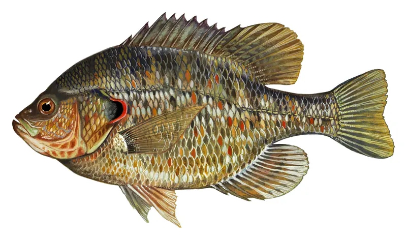
Game fish recorded in Theodore Roosevelt Lake include black crappie, largemouth bass, channel catfish, white crappie, bluegill, redear sunfish. In all, 15 fish species have open records inside the lake on GBIF.
The surface of Theodore Roosevelt Lake was about 68°F on November 15, estimated from a satellite pass on a clear day. It is the top layer of the water, a few degrees either way; coves and shallows run warmer in the sun.
Anglers 10 and older need an Arizona fishing license, sold online by the Arizona Game and Fish Department. Free fishing days: Usually the first Saturday of National Fishing and Boating Week (June). Size and bag limits can be set lake by lake: check the current regulations.
Theodore Roosevelt Lake averages about 134 ft deep. Depth changes with the lake level.
Yes: reservoir survey report with contour maps from the U.S. Bureau of Reclamation (2013). It is linked in the lake facts on this page. Depths on a map are measured at a reference level: subtract how far the lake is below it today.
boating (8 boat ramps and 1 marina, with the ramps usable at today’s level), fishing (7 game fish), hiking & walking (2 trails along the shore, the longest Frazier Trail (1.3 mi)), camping (11 campgrounds, 6 bookable on Recreation.gov), parks & picnics (5 parks on the shore) and waterfront dining (1 waterfront restaurant), according to our map of the shore.
EPA's CyAN satellite rated cyanobacteria in Theodore Roosevelt Lake not detected on November 9. The satellite sees open water only; blooms can be patchy, so avoid water that looks like spilled paint or pea soup and keep dogs out of scum. Swimming advisories come from Arizona health and environment agencies.
Yes. 2 trails run along or near the shore, including Arizona Trail and Frazier Trail (1.3 mi), according to OpenStreetMap.
Theodore Roosevelt Lake is held back by Theodore Roosevelt Dam, completed in 1911 and 357 ft high, according to the National Inventory of Dams.
From the Salt River Project (Theodore Roosevelt Lake). Lake by Lake checks it every hour; the agency's own figure is always the reference, and provisional readings can be revised.
Lake levels are refreshed every hour. Texas and California reservoirs report once a day; most USGS and NOAA gauges report every 15 to 60 minutes.
Cookies for analytics With your OK we use Google Analytics and Microsoft Clarity to count visits and see how the site is used, so we can make it better. No advertising cookies. Privacy policy