Sun
- Sunrise
- 6:23 AM
- Sunset
- 4:41 PM
- First light
- 5:56 AM
- Last light
- 5:08 PM
Reservoir · San Bernardino County, California
A reservoir on Bear Creek in San Bernardino County, California, held back by Bear Valley Dam since 1911.

Big Bear Lake is at 6,733.69 feet above sea level — 9.56 ft below full lake, 64.2% full, as of Nov 16, 2026. The level has held steady over the past week.
21st fullest of 41 California lakes today by percent full · See the ranking
A notification from this browser, once, when the level crosses the line (checked every hour). No account and no email. On an iPhone, add Lake by Lake to your home screen first (Share → Add to Home Screen) and open it from there. Or follow the lake in a feed reader: RSS feed.
Daily values from the Big Bear Municipal Water District. Why lake levels rise and fall
Solunar periods for Big Bear Lake, local time. How they work
Stay away from algae and scum, and keep dogs out of the water near them.
From the California State Water Resources Control Board, checked Nov 18. Advisories change with the weather: check the agency's page and the signs at the water before you go.
Very high · as of Nov 9, 2026
The satellite sees a strong bloom on part of the lake. Stay out of discolored water, keep pets away and check for state advisories. About 3,730,000 cells/mL at the worst spot, covering 62% of the lake.
Week of Aug 16Week of Nov 1
Each bar is one week, colored by the worst reading of that week.
From the U.S. EPA's Cyanobacteria Assessment Network (CyAN), which reads the color of lakes from the Sentinel-3 satellites; it sees open water only, not coves or the shoreline. Blooms can be patchy: what you see on the water matters more. Swimming closures and health advisories come from California health and environment agencies. How to read it
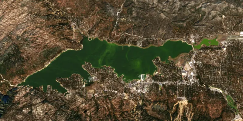
The last 10 satellite passes
75°F · Jul 2153°F · Nov 10
22°F cooler than on Jul 21, 2026.
Estimated from Landsat 8/9 (USGS) passes on clear days: the top layer of the water, a few degrees either way. Coves and the shallows can be warmer.
Big Bear Lake water temperature: trend, swimming and the fish →
On or near the shore of Big Bear Lake: 4 boat ramps, 7 marinas, 4 rental outfits, 17 campgrounds, 2 beaches, 6 trails and 1 fishing guide. The lake has about 26 miles of shoreline, counting its islands.
Tap an icon for details; use two fingers (or Ctrl + scroll) to move the map. Tap a dot for details. Map and lake outline © OpenStreetMap contributors. Places from OpenStreetMap, Overture Maps and Recreation.gov. Not for navigation.
What you’ll find on the shore
← AllBoating 11
← AllRentals & tours 7
← AllFishing spots 3
← AllBeaches 2
← AllCamping 17
← AllLodging 24+
← AllTrails 6
← AllParks 10
← AllDining 14
These invasive plants and animals have been recorded in Big Bear Lake: clean, drain and dry everything before you go to another lake.
California: California-registered motorized boats used in fresh water must display a current Mussel Fee sticker. Many lakes and reservoirs run mandatory inspections or quarantines, moving quagga, zebra or golden mussels is illegal, and boaters are asked to clean, drain and dry. Required: Quagga and Zebra Mussel Fee sticker ($42 every two years ($21 if bought in an even-numbered year)). State rules
Records: USGS Nonindigenous Aquatic Species database. A species not listed may still be present.
Species with open-licensed records inside Big Bear Lake's outline, from GBIF.org (surveys, museum collections and angler reports). A record shows a fish was found here, not how many there are now.
Cool water: near the surface in spring and fall, deep in summer.
Low light and cold water; the inflows in fall.
Beds in shallow, firm bottoms; around docks and weeds all summer.
Shallow, muddy bays and flooded grass in spring; mud flats and inflows in summer.
Shallow weedbeds and docks; nests closer to shore and shallower than bluegill.
Water temperature sets off each spawn; the bars show the usual months at this latitude and elevation, and move with a warm or cold spring. The water is about 47°F now.
Big Bear Lake is a mountain reservoir high in the San Bernardino Mountains of Southern California. It was built to send water to citrus country in the valleys below, but since the 1960s it has been kept for boating, fishing and wildlife, the center of a resort valley with ski slopes rising from its south shore.
The Serrano people lived in this valley for some 2,500 years. In 1845 Benjamin Wilson gave Bear Valley its name and called a seasonal marsh nearby Big Bear Lake. That marsh is now Baldwin Lake, and the old name passed to the reservoir. Prospecting began in 1859, and a gold strike near Holcomb Valley set off a rush.
In May 1883 Frank Brown and Hiram Barton rode into the valley on horseback and proposed a dam at its narrow west end to store water for the communities downhill around Redlands. To save money they chose a stone arch built of hand-cut granite blocks, some weighing 5 tons. Finished in 1884, it created what was then the largest man-made lake in the world. As citrus planting spread below, a bigger dam was ordered in 1910. Engineer John Eastwood designed an unusual multiple-arch structure about 300 feet downstream, with supplies hauled up from Victorville by horse teams. It was finished in 1912, stood 20 feet higher than the first dam and tripled the lake's capacity. The unusual design worried people at first, but the dam came through a strong earthquake in 1921 without a crack. The old granite dam still stands behind it, usually under water.
A drought in the late 1950s and early 1960s, together with heavy draws for farms downhill, left only a shallow remnant of the lake. In 1964 Big Bear voters overwhelmingly created the Big Bear Municipal Water District to steady the lake level. After a 13-year legal fight, a settlement gave the district title to the dam, the lake bottom and the surface recreation rights, and the dams changed hands in 1977. Each year the Bear Valley Mutual Water Company estimates how much water its irrigators need downstream, and the district either releases it from the lake or supplies it from another source, which keeps the lake higher than it used to sit. The district's job is to maintain the lake for recreation and wildlife. It does not run household water service.
Highway 38 follows the North Shore past Fawnskin and Grout Bay. Big Bear Boulevard runs the South Shore past Boulder Bay, the Village and the Snow Summit and Bear Mountain ski areas. Highways 18, 38 and 330 climb to the valley. Swimming is discouraged because the water is cold and hides underwater obstacles. Trout, largemouth and smallmouth bass, channel and blue catfish, crappie, bluegill and carp all appear in the district's lake records. To keep out quagga mussels, every boat must arrive clean, drained and dry, and kayaks, canoes, paddleboards and float tubes need an inspection and a lake use permit before launching. Bald eagles nest in the valley, and since October 2015 a camera installed by Friends of Big Bear Valley with the Forest Service has streamed the nest of the pair known as Jackie and Shadow.
Written by Lake by Lake from Big Bear Municipal Water District (General Information, Quagga Information), KBHR 93.3 (1884 Big Bear Dam, MWD celebrates 50th anniversary), Friends of Big Bear Valley and Wikipedia. Checked November 2026.
Bear Valley Dam is a multiple-arch dam 80 feet high and 360 feet long on Bear Creek, completed in 1911. It belongs to Big Bear Municipal Water District and is run for water supply, irrigation and recreation. Water reaches it from 39 square miles of land.
From the National Inventory of Dams (U.S. Army Corps of Engineers), NID ID CA00757. Lake or reservoir: what’s the difference?
Where the level comes from: Big Bear Lake (Big Bear Municipal Water District).
| Lake | Miles | Level (ft) | vs full | 7 days |
|---|---|---|---|---|
| Lake Perris Slightly below full | 31 | 1583.03 | −4.97 | −0.34 |
| Vail Lake Live reading | 52 | 1416.68 | — | −0.04 |
| San Vicente Reservoir Live reading | 92 | 644.95 | — | −1.56 |
Compare Big Bear Lake with Lake Perris, Vail Lake or San Vicente Reservoir: size, level, ramps and fish side by side.
Big Bear Lake is about 23 mi from San Bernardino, CA, 26 mi from Hesperia, CA and 28 mi from Moreno Valley, CA. See all the lakes near each city.
Big Bear Lake is at 6,733.69 feet above sea level — 9.56 ft below full lake, 64.2% full, as of Nov 16, 2026. The level has held steady over the past week.
Big Bear Lake's full lake is 6,743.25 ft, according to Big Bear Municipal Water District. Today the lake is 9.56 ft below that mark.
Big Bear Lake has 4 boat ramps on our map, including Boat ramp at Big Bear Marina, Carol Morrison East Boat Ramp, Boat ramp at Pine Knot Marina, and 7 marinas. Low water can close ramps, so check today's level above and the operator before you go.
Yes. There are 17 campgrounds and RV parks within about a mile of the shore, such as Boulder Bay Station, Bear's Lair, Lighthouse Trailer Resort and Marina.
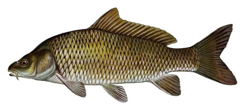
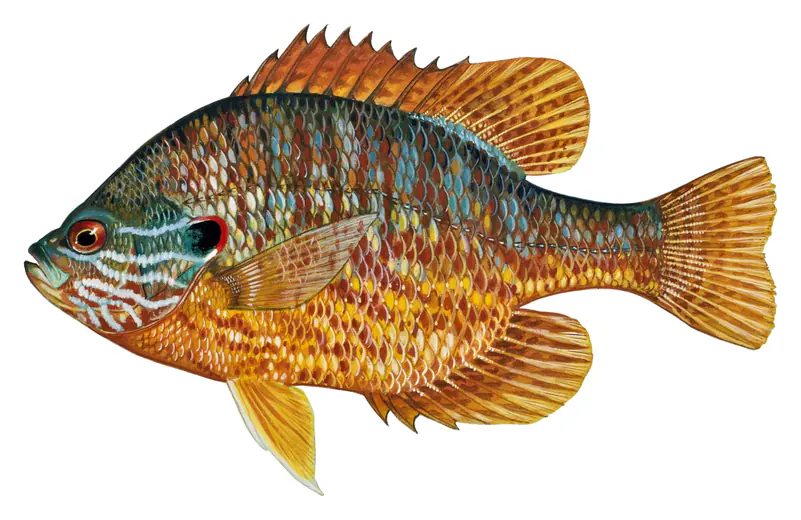
Game fish recorded in Big Bear Lake include rainbow trout, brown trout, bluegill, common carp, pumpkinseed. In all, 9 fish species have open records inside the lake on GBIF.
The water at Big Bear Lake is 47°F, measured 25 min ago by the lake operator. Surface temperature changes through the day and with depth.
Anglers 16 and older need a California fishing license, sold online by the California Department of Fish and Wildlife. Free fishing days: Two Saturdays a year (2027: July 3 and September 4). Size and bag limits can be set lake by lake: check the current regulations.
Big Bear Lake is about 72 ft deep at its deepest point, usually near the dam. Depth changes with the lake level.
boating (4 boat ramps and 7 marinas), kayaks, boats & jet skis (4 rental outfits on or near the water), boat tours (3 boat tours and charters), fishing (5 game fish and 1 fishing guide), swimming (2 beaches and swimming areas) and hiking & walking (6 trails along the shore, the longest Gray's Peak Trail (3.0 mi)), according to our map of the shore.
EPA's CyAN satellite rated cyanobacteria in Big Bear Lake very high on November 9. The satellite sees open water only; blooms can be patchy, so avoid water that looks like spilled paint or pea soup and keep dogs out of scum. Swimming advisories come from California health and environment agencies.
Yes. 6 trails run along or near the shore, including Alpine Pedal Path (2.5 mi), Gray's Peak Trail (3.0 mi) and Woodland Interpretive Trail 1E23 (1.5 mi), according to OpenStreetMap.
Big Bear Lake is held back by Bear Valley, completed in 1911 and 80 ft high, according to the National Inventory of Dams.
From the Big Bear Municipal Water District (Big Bear Lake). Lake by Lake checks it every hour; the agency's own figure is always the reference, and provisional readings can be revised.
Lake by Lake checks every hour, but Big Bear Municipal Water District measures Big Bear Lake once a week, so the level changes weekly.
Cookies for analytics With your OK we use Google Analytics and Microsoft Clarity to count visits and see how the site is used, so we can make it better. No advertising cookies. Privacy policy