Sun
- Sunrise
- 6:55 AM
- Sunset
- 4:53 PM
- First light
- 6:26 AM
- Last light
- 5:22 PM
Reservoir · Gunnison County, Colorado
A reservoir on the Gunnison River in Gunnison County, Colorado, held back by Blue Mesa Dam since 1966.

Blue Mesa Reservoir is at 7,423.70 feet above sea level — 95.70 ft below full pool, as of Nov 17, 2026. It has risen 2.23 ft in the past 7 days.
2nd lowest of 34 Colorado lakes today against full pool · See the ranking
Record low 7,411.73 ft (2026), record high 7,519.64 ft (1970) · Level history since 1967
Which boat ramps are usable at today’s level →
A notification from this browser, once, when the level crosses the line (checked every hour). No account and no email. On an iPhone, add Lake by Lake to your home screen first (Share → Add to Home Screen) and open it from there. Or follow the lake in a feed reader: RSS feed.
Blue Mesa Reservoir is up 11.92 ft over the last 30 days, at 7,423.70 ft today.
Daily values from the Bureau of Reclamation.
Over the past 12 months, Blue Mesa Reservoir ranged from 7,411.73 ft (Oct 19, 2026) to 7,468.56 ft (Jan 20, 2026), a swing of 56.8 ft. Today's level is in the lower half of that range. It is 41.34 ft lower than on this date last year.
Daily values from the Bureau of Reclamation. Why lake levels rise and fall
In the Bureau of Reclamation record, which starts in 1967, the lowest level was 7,411.73 ft on October 19, 2026 and the highest 7,519.64 ft on July 8, 1970. Today’s 7,423.70 ft is 12.0 ft above the record low and 95.9 ft below the record high.
Blue Mesa Reservoir level history: every year since 1967, the lowest and highest years →
Solunar periods for Blue Mesa Reservoir, local time. How they work
Not detected · as of Nov 9, 2026
The satellite found no cyanobacteria at the surface.
Week of Aug 9Week of Nov 1
Each bar is one week, colored by the worst reading of that week.
From the U.S. EPA's Cyanobacteria Assessment Network (CyAN), which reads the color of lakes from the Sentinel-3 satellites; it sees open water only, not coves or the shoreline. Blooms can be patchy: what you see on the water matters more. Swimming closures and health advisories come from Colorado health and environment agencies. How to read it
Surface water temperature
48°F on Nov 16, 2026
74°F · Jul 2748°F · Nov 16
27°F cooler than on Jul 27, 2026.
Estimated from Landsat 8/9 (USGS) passes on clear days: the top layer of the water, a few degrees either way. Coves and the shallows can be warmer.
Blue Mesa Reservoir water temperature: trend, swimming and the fish →
On or near the shore of Blue Mesa Reservoir: 12 boat ramps, 3 marinas, 10 campgrounds and 2 trails. The lake has about 95 miles of shoreline, counting its islands.
Tap an icon for details; use two fingers (or Ctrl + scroll) to move the map. Tap a dot for details. Map and lake outline © OpenStreetMap contributors. Places from OpenStreetMap, Overture Maps and Recreation.gov. Not for navigation.
What you’ll find on the shore
← AllBoating 15
Which boat ramps are usable at today’s level →
← AllCamping 10
← AllLodging 2
← AllTrails 2
← AllParks 3
← AllDining 2
No aquatic invasive species are on record for Blue Mesa Reservoir in the USGS database. Keep it that way: clean, drain and dry your boat between lakes.
Colorado: Clean, drain and dry is the law: remove plants and mud, pull the drain plug and drain all water every time you leave the water. Motorboats and sailboats need an ANS stamp, and trailered or motorized boats must pass a state inspection (and decontamination if needed) before launching where required, always when arriving from out of state or from infested waters. Required: Aquatic Nuisance Species (ANS) stamp ($25 a year for Colorado boats (added at registration), $50 for out-of-state boats). State rules
Records: USGS Nonindigenous Aquatic Species database. A species not listed may still be present.
Species with open-licensed records inside Blue Mesa Reservoir's outline, from GBIF.org (surveys, museum collections and angler reports). A record shows a fish was found here, not how many there are now.
Cool water: near the surface in spring and fall, deep in summer.
Low light and cold water; the inflows in fall.
Deep and cold most of the year; shallow reefs in fall and right after ice-out.
Schools at a set depth in summer: trolling at the right depth is everything.
Schools near the bottom; a favorite through the ice.
Water temperature sets off each spawn; the bars show the usual months at this latitude and elevation, and move with a warm or cold spring. The water is about 48°F now.
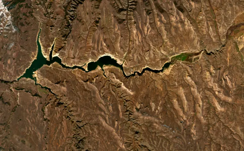
Blue Mesa Reservoir is a long, branching lake on the Gunnison River in western Colorado. Its dam stands about 30 miles downstream of the town of Gunnison, and the water backs up roughly 20 miles east toward town. It is the largest body of water in Colorado, the centerpiece of Curecanti National Recreation Area, and the home of the biggest kokanee salmon fishery in the country.
Blue Mesa is the uppermost of three dams the Bureau of Reclamation built on this stretch of the Gunnison under the Colorado River Storage Project Act of 1956. Morrow Point and Crystal lie below it. Blue Mesa's job is storage: it holds back the river's spring runoff and lets it out through the year, making hydropower along the way. Gunnison County residents objected to the size first proposed, and Reclamation scaled the reservoir back. Construction and land purchases began in the early 1960s, U.S. 50 and Colorado 149 were moved to new alignments, and the dam was finished in 1966, when the lake began to fill.
The water covered the towns of Iola and Cebolla, along with ranches and fishing resorts along the river. Sapinero was moved uphill to the south shore. The lake's three main basins, Iola, Cebolla and Sapinero from east to west, carry their names. The project was first called the Curecanti Unit. In 1980 Congress renamed it for Wayne N. Aspinall, the Colorado congressman who helped push the 1956 act through.
U.S. 50 follows the north shore of the Iola and Cebolla basins, crosses the lake on the Middle Bridge near Sapinero and runs on west to the dam. Colorado 149 leaves the highway at the Lake City Bridge and reaches the south side of the Iola Basin. Long arms reach into side canyons at the Lake Fork of the Gunnison, Cebolla Creek and Soap Creek, and the far ends of the Cebolla and Soap Creek arms are reached only by boat or dirt road.
The marinas are at Elk Creek and Lake Fork, with more ramps at Iola, Stevens Creek and Ponderosa. Motorboats, sailboats and anything on a trailer must pass an inspection for zebra and quagga mussels before launching. This is high, cold water. It stays chilly through most of the season, so skiers and windsurfers wear wetsuits, and late summer is the warmest time to be in it. Afternoon winds and thunderstorms build quickly, and the park service tells boaters to head for shore as soon as the wind picks up. Windsurfers favor the Bay of Chickens and the Iola Basin.
Because the lake is drawn on for downstream needs, dry years show quickly. In 2022, drought and releases sent down to shore up Lake Powell left Blue Mesa too low for its marinas to open that season.
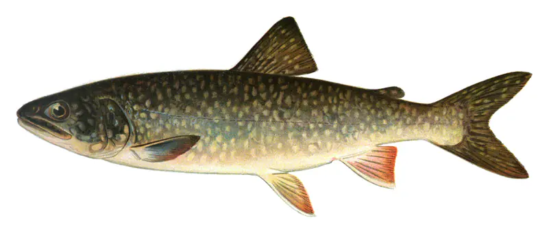
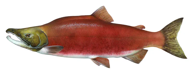
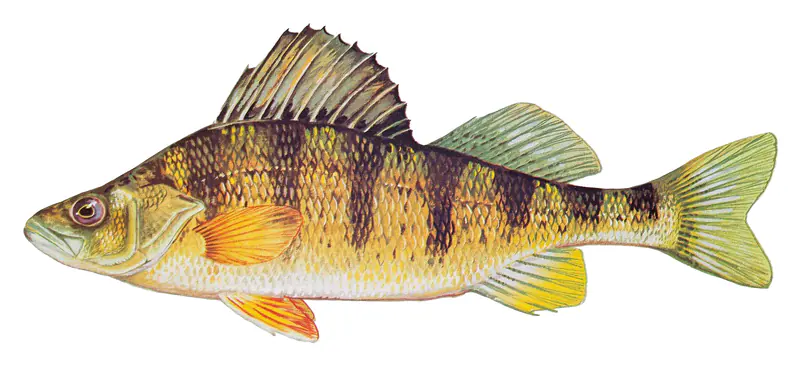
The reservoir became a major coldwater fishery soon after it filled. Kokanee are the backbone. Eggs taken from Blue Mesa fish help restock as many as 25 other Colorado waters, and the kokanee in turn feed the lake trout, which here reach trophy size, with fish over 70 pounds on record. In earlier decades the lake trout multiplied unchecked and cut deeply into kokanee numbers. Colorado Parks and Wildlife now asks anglers to keep small lake trout, since fish 24 inches and under eat the most kokanee, and it has run harvest tournaments in 2020, 2021 and 2025. There is no bag limit on lake trout 32 inches or shorter, but only one longer fish may be kept per day. Rainbow and brown trout and yellow perch round out the catch, kokanee snagging opens on November 1, and in winter the Iola Basin is a popular ice fishing spot.
Below the dams, the Gunnison through the Black Canyon is Gold Medal trout water, fished with flies and lures only.
Written by Lake by Lake from National Park Service, Curecanti National Recreation Area (Wayne N. Aspinall Unit, Boating, Fishing), Bureau of Reclamation, Upper Colorado Basin Region, Colorado Parks and Wildlife and Wikipedia. Checked November 2026.
Blue Mesa Dam is an earthfill dam 390 feet high and 785 feet long on the Gunnison River, completed in 1966. It belongs to the Bureau of Reclamation and is run for flood control, irrigation, recreation and hydropower. At its normal level the reservoir holds 748,430 acre-ft, drained from 3,429 square miles of land.
From the National Inventory of Dams (U.S. Army Corps of Engineers), NID ID CO01675. Lake or reservoir: what’s the difference?
Where the level comes from: Blue Mesa Reservoir (Bureau of Reclamation, used on this page) and Blue Mesa Reservoir Dam and Powerplant (Bureau of Reclamation (RISE)).
| Lake | Miles | Level (ft) | vs full | 7 days |
|---|---|---|---|---|
| Morrow Point Reservoir Below full | 11 | 7150.95 | −9.05 | +0.05 |
| Crystal Reservoir Slightly below full | 16 | 6750.85 | −4.15 | +0.28 |
| Silver Jack Reservoir Live reading | 19 | 8882.46 | — | +1.15 |
| Crawford Reservoir Well below full | 22 | 6511.72 | −41.28 | +2.82 |
| Ridgway Reservoir Below full | 27 | 6860.37 | −10.76 | −0.79 |
| Paonia Reservoir Well below full | 34 | 6404.69 | −42.81 | +2.28 |
Compare Blue Mesa Reservoir with Morrow Point Reservoir, Crystal Reservoir, Silver Jack Reservoir or Crawford Reservoir: size, level, ramps and fish side by side.
Blue Mesa Reservoir is at 7,423.70 feet above sea level — 95.70 ft below full pool, as of Nov 17, 2026. It has risen 2.23 ft in the past 7 days.
Blue Mesa Reservoir's full pool is 7,519.40 ft, according to Bureau of Reclamation. Today the lake is 95.70 ft below that mark.
Today's level is 66.97 ft below the median for this date (7,490.67 ft), from the gauge’s long-term daily record.
7,411.73 ft, on October 19, 2026, in the Bureau of Reclamation record, which starts in 1967. Today the lake is 12.0 ft above that.
7,519.64 ft, on July 8, 1970, in the Bureau of Reclamation record since 1967. That is 0.2 ft above full pool.
Blue Mesa Reservoir has 12 boat ramps on our map, including Bay of Chickens, Dillon Pinnacles, Elk Creek, and 3 marinas. Low water can close ramps, so check today's level above and the operator before you go.
Yes. There are 10 campgrounds and RV parks within about a mile of the shore, such as Lake Fork Resort, Lake Fork Campground, Elk Creek Campground.
Game fish recorded in Blue Mesa Reservoir include brown trout, lake trout, rainbow trout, kokanee salmon, yellow perch, Coho salmon. In all, 9 fish species have open records inside the lake on GBIF.
The surface of Blue Mesa Reservoir was about 48°F on November 16, estimated from a satellite pass on a clear day. It is the top layer of the water, a few degrees either way; coves and shallows run warmer in the sun.
Anglers 16 and older need a Colorado fishing license, sold online by the Colorado Parks and Wildlife. Free fishing days: First full weekend of June. Size and bag limits can be set lake by lake: check the current regulations.
Blue Mesa Reservoir averages about 82 ft deep. Depth changes with the lake level.
In summer a white Secchi disk lowered into Blue Mesa Reservoir stays visible to about 12.6 ft (the median of 100 readings, 2016–2023, by National Park Service Water Resources Division and Colorado Dept. of Public Health & Environment-WQCD): clear water. With the algae measured too (chlorophyll about 3 µg/L), that makes it mesotrophic: moderately rich in nutrients. Clarity drops after storms and during algae blooms.
Yes: reservoir survey report with bathymetric maps from the U.S. Bureau of Reclamation (2019). It is linked in the lake facts on this page. Depths on a map are measured at a reference level: subtract how far the lake is below it today.
boating (12 boat ramps and 3 marinas, with the ramps usable at today’s level), fishing (6 game fish), hiking & walking (2 trails along the shore, the longest Dillon Pinnacles Trail (2.0 mi)), camping (10 campgrounds, 5 bookable on Recreation.gov), cabins & lodging (2 places to stay close to the water) and parks & picnics (3 parks on the shore), according to our map of the shore.
EPA's CyAN satellite rated cyanobacteria in Blue Mesa Reservoir not detected on November 9. The satellite sees open water only; blooms can be patchy, so avoid water that looks like spilled paint or pea soup and keep dogs out of scum. Swimming advisories come from Colorado health and environment agencies.
Yes. 2 trails run along or near the shore, including Dillon Pinnacles Trail (2.0 mi) and Lake Fork Gunnison River Trail (0.5 mi), according to OpenStreetMap.
Blue Mesa Reservoir is held back by Blue Mesa Dam, completed in 1966 and 390 ft high, according to the National Inventory of Dams.
From the Bureau of Reclamation (Blue Mesa Reservoir). Lake by Lake checks it every hour; the agency's own figure is always the reference, and provisional readings can be revised.
Lake levels are refreshed every hour. Texas and California reservoirs report once a day; most USGS and NOAA gauges report every 15 to 60 minutes.
Cookies for analytics With your OK we use Google Analytics and Microsoft Clarity to count visits and see how the site is used, so we can make it better. No advertising cookies. Privacy policy