Sun
- Sunrise
- 7:15 AM
- Sunset
- 5:32 PM
- First light
- 6:48 AM
- Last light
- 5:59 PM
Reservoir · Bartow County, Georgia
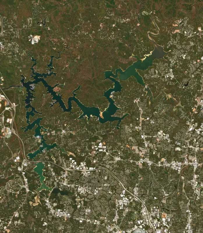
A reservoir on the Etowah in Bartow County, Georgia, held back by Allatoona Dam since 1965. Also called Lake Allatoona.

Allatoona Lake is at 830.48 feet above sea level — 9.52 ft below full summer pool, as of Nov 19, 2026, 12:15 AM EST. It has dropped 1.10 ft in the past 7 days.
4th lowest of 17 Georgia lakes today against full pool · See the ranking
Record low 818.90 ft (2007), record high 855.81 ft (1990) · Level history since 1989
A notification from this browser, once, when the level crosses the line (checked every hour). No account and no email. On an iPhone, add Lake by Lake to your home screen first (Share → Add to Home Screen) and open it from there. Or follow the lake in a feed reader: RSS feed.
Allatoona Lake is down 1.10 ft over the last 7 days, at 830.48 ft today.
Daily values from the U.S. Geological Survey.
Allatoona Lake is down 4.28 ft over the last 30 days, at 830.48 ft today.
Daily values from the U.S. Geological Survey.
Over the past 12 months, Allatoona Lake ranged from 824.44 ft (Jan 1, 2026) to 841.59 ft (Jul 27, 2026), a swing of 17.1 ft. Today's level is in the lower half of that range. It is 0.72 ft lower than on this date last year.
Daily values from the U.S. Geological Survey. Why lake levels rise and fall
In the U.S. Geological Survey record, which starts in 1989, the lowest level was 818.90 ft on December 14, 2007 and the highest 855.81 ft on March 23, 1990. Today’s 830.48 ft is 11.6 ft above the record low and 25.3 ft below the record high.
Allatoona Lake level history: every year since 1989, the lowest and highest years →
Solunar periods for Allatoona Lake, local time. How they work
Not detected · as of Nov 9, 2026
The satellite found no cyanobacteria at the surface.
Week of Aug 16Week of Nov 1
Each bar is one week, colored by the worst reading of that week.
From the U.S. EPA's Cyanobacteria Assessment Network (CyAN), which reads the color of lakes from the Sentinel-3 satellites; it sees open water only, not coves or the shoreline. Blooms can be patchy: what you see on the water matters more. Swimming closures and health advisories come from Georgia health and environment agencies. How to read it
Surface water temperature
62°F on Nov 7, 2026
85°F · Jul 2662°F · Nov 7
23°F cooler than on Jul 26, 2026.
Estimated from Landsat 8/9 (USGS) passes on clear days: the top layer of the water, a few degrees either way. Coves and the shallows can be warmer.
Allatoona Lake water temperature: trend, swimming and the fish →
On or near the shore of Allatoona Lake: 36 boat ramps, 17 marinas, 4 rental outfits, 30 campgrounds, 16 beaches, 1 fishing pier and 14 trails. The lake has about 241 miles of shoreline, counting its islands.
Tap an icon for details; use two fingers (or Ctrl + scroll) to move the map. Tap a dot for details. Map and lake outline © OpenStreetMap contributors. Places from OpenStreetMap, Overture Maps and Recreation.gov. Not for navigation.
What you’ll find on the shore
← AllBoating 53
← AllRentals & tours 4
← AllFishing spots 5
← AllBeaches 16
← AllCamping 30
← AllLodging 9
← AllTrails 14
← AllParks 20+
← AllDining 8
These invasive plants and animals have been recorded in Allatoona Lake: clean, drain and dry everything before you go to another lake.
Georgia: Georgia has no clean-drain-dry law; WRD asks boaters to remove plants, mussels and mud, pull the drain plug and drain all water away from the ramp, never dump bait buckets, and dry gear for five days before using other waters. State rules
Records: USGS Nonindigenous Aquatic Species database. A species not listed may still be present.
Species with open-licensed records inside Allatoona Lake's outline, from GBIF.org (surveys, museum collections and angler reports). A record shows a fish was found here, not how many there are now.
Shallow, protected flats in spring; docks, grass and deep edges in summer heat.
Brush piles, docks and bridge pilings; shallow for a few weeks in spring.
Channel edges and river arms; best after dark in summer, and after a rain.
Run up the river arms in spring; follow shad to cool, deep water near the dam in summer.
Cool water: near the surface in spring and fall, deep in summer.
Water temperature sets off each spawn; the bars show the usual months at this latitude and elevation, and move with a warm or cold spring. The water is about 62°F now.
Allatoona Lake is an Army Corps of Engineers reservoir on the Etowah River in northwest Georgia, about 30 miles from Atlanta. Most of it lies in Bartow and Cherokee counties, with a small piece in Cobb County near Acworth, and Cartersville is the closest city to the dam. With more than 6 million visitors a year, it is one of the busiest Corps lakes in the country, and it supplies drinking water to much of the area around it.
Congress authorized the dam in the Flood Control Acts of 1941 and 1944, but World War II held up the work until 1946. The concrete dam rose across the Etowah near Cartersville, the lake began filling just after Christmas 1949, and the power station went on line in January 1950. The Corps runs it for flood control, hydropower, water supply, recreation, fish and wildlife, water quality and navigation.
The lake shares its name with a town it erased. Allatoona was founded in 1838 as a farm community and crossroads on Allatoona Creek, with a railroad running through it, and before the Civil War it drew gold seekers. The town was destroyed to make way for the lake, and roads such as the old Acworth to Dallas highway were cut or rerouted. The Clayton-Mooney house, built around 1836, is the only original building still standing. It served as a Union headquarters and field hospital in the Civil War, and bullet holes still mark it. The founders, John Clayton among them, rest in the cemetery beside the old church.
On October 5, 1864, Confederate troops under Major General Samuel G. French attacked the Union garrison holding the Western and Atlantic Railroad cut at Allatoona Pass, which guarded a supply base of about one million rations for Sherman's army. Brigadier General John M. Corse was wounded but held, and French pulled back that afternoon. Sherman's signal to the garrison inspired the hymn Hold the Fort. The battlefield's trenches and earthworks are still well preserved and are cared for by Red Top Mountain State Park.
Red Top Mountain sits on a peninsula between the lake's two main arms. It takes its name from red soil rich in iron ore, and the area was once an important mining district. The park has a sand swimming beach in a wooded cove, boat ramps, and more than 15 miles of trails, among them the 4-mile Iron Hill Trail for hikers and cyclists, plus a short paved path past a rebuilt 1860s homestead. The Corps runs its own campgrounds around the lake, such as Victoria, Payne and Sweetwater, and day use areas including Galt's Ferry and Cooper's Furnace, and its visitor center covers the area's story from Native American times through gold mining, iron making and the Civil War.
The Etowah River, Allatoona Creek, Noonday Creek and the Little River, which joins at Bell's Ferry, all feed the lake. Its drainage basin is nearly as large as Lake Lanier's, but because the lake itself is much smaller it rises and falls faster in floods and droughts. Since 1957 the Corps has held it about 17 feet lower in winter than at summer pool. The highest water on record came on April 9, 1964. In the drought of the late 1980s, which peaked in 1986, the lake fell far enough to bare tree stumps, old roads and the foundations of houses.
Cartersville and the Cobb County-Marietta Water Authority both draw drinking water from the lake. It is busy in summer with swimmers, water skiers, anglers and boaters, and it has a sobering safety record: 281 people drowned here between 1950 and 2006. Wear a life jacket, and watch for posted notices about blue-green algae.
Written by Lake by Lake from Recreation.gov, U.S. Army Corps of Engineers, Georgia State Parks and Wikipedia (Allatoona Lake, Allatoona, Georgia, Battle of Allatoona). Checked November 2026.
Activities listed by the U.S. Army Corps of Engineers: Biking · Boating · Historic sites · Camping · Fishing · Hiking · Picnicking · Water sports · Wildlife viewing · Swimming
Allatoona Dam is a concrete gravity dam 188 feet high and 1,250 feet long on the Etowah, completed in 1965. It belongs to the U.S. Army Corps of Engineers (Mobile District) and is run for flood control, recreation, hydropower and water supply. At its normal level the reservoir holds 367,471 acre-ft, drained from 1,122 square miles of land.
From the National Inventory of Dams (U.S. Army Corps of Engineers), NID ID GA03742. Lake or reservoir: what’s the difference?
Where the level comes from: ALLATOONA LAKE NEAR CARTERSVILLE, GA (U.S. Geological Survey, used on this page) and Etowah River at Allatoona Lake near Cartersville (NOAA National Water Prediction Service).
| Lake | Miles | Level (ft) | vs full | 7 days |
|---|---|---|---|---|
| Carters Lake Slightly below full | 31 | 1070.51 | −3.49 | −1.95 |
| Lake Lanier Below full | 37 | 1062.04 | −8.96 | −0.33 |
| Lake Kedron Live reading | 52 | 833.98 | — | −0.09 |
| Randy Poynter Lake Live reading | 54 | 730.75 | — | −0.44 |
| Lake Peachtree Live reading | 55 | 784.44 | — | 0.00 |
| Lake Blue Ridge Well below full | 56 | 1668.79 | −18.21 | −2.04 |
Compare Allatoona Lake with Carters Lake, Lake Lanier, Lake Kedron or Randy Poynter Lake: size, level, ramps and fish side by side.
Allatoona Lake is about 26 mi from Sandy Springs, GA, 33 mi from Atlanta, GA and 37 mi from South Fulton, GA. See all the lakes near each city.
Allatoona Lake is also known as Lake Allatoona.
Allatoona Lake is at 830.48 feet above sea level — 9.52 ft below full summer pool, as of Nov 19, 2026, 12:15 AM EST. It has dropped 1.10 ft in the past 7 days.
Allatoona Lake's full summer pool is 840.00 ft, according to U.S. Army Corps of Engineers. Today the lake is 9.52 ft below that mark.
Today's level is 0.73 ft below the median for this date (831.21 ft), from the gauge’s long-term daily record.
818.90 ft, on December 14, 2007, in the U.S. Geological Survey record, which starts in 1989. Today the lake is 11.6 ft above that.
855.81 ft, on March 23, 1990, in the U.S. Geological Survey record since 1989. That is 15.8 ft above full summer pool.
Allatoona Lake has 36 boat ramps on our map, including Allatoona Landing Marina, Bartow-Carver Park, Boat ramp near Cushing Park, and 17 marinas. Low water can close ramps, so check today's level above and the operator before you go.
Yes. There are 30 campgrounds and RV parks within about a mile of the shore, such as McKinney camp ground, Old Highway 41 Recreation Area, Holiday Harbor Campground.
Game fish recorded in Allatoona Lake include bluegill, spotted bass, largemouth bass, channel catfish, black crappie, white bass. In all, 37 fish species have open records inside the lake on GBIF.
The surface of Allatoona Lake was about 62°F on November 7, estimated from a satellite pass on a clear day. It is the top layer of the water, a few degrees either way; coves and shallows run warmer in the sun.
Anglers 16 and older need a Georgia fishing license, sold online by the Georgia Department of Natural Resources, Wildlife Resources Division. Free fishing days: Two days during National Fishing and Boating Week (June) and National Hunting and Fishing Day (September). Size and bag limits can be set lake by lake: check the current regulations.
Allatoona Lake averages about 31 ft deep. Depth changes with the lake level.
In summer a white Secchi disk lowered into Allatoona Lake stays visible to about 4.9 ft (the median of 165 readings, 2016–2026, by Georgia DNR Environmental Protection Division and EPA National Aquatic Resources Survey (NARS)): somewhat murky water. With the algae measured too (chlorophyll about 16 µg/L), that makes it eutrophic: rich in nutrients, greener water. Clarity drops after storms and during algae blooms.
U.S. Army Corps of Engineers lists biking, boating, historic sites, camping, fishing, hiking, picnicking and water sports at Allatoona Lake. 2 campgrounds can be booked on Recreation.gov.
EPA's CyAN satellite rated cyanobacteria in Allatoona Lake not detected on November 9. The satellite sees open water only; blooms can be patchy, so avoid water that looks like spilled paint or pea soup and keep dogs out of scum. Swimming advisories come from Georgia health and environment agencies.
Yes. 14 trails run along or near the shore, including Homestead Trail (2.8 mi), South Loop (Advanced) (3.7 mi) and White Tail Trail (0.4 mi), according to OpenStreetMap.
Allatoona Lake is held back by Allatoona Dam, completed in 1965 and 188 ft high, according to the National Inventory of Dams.
From the U.S. Geological Survey (ALLATOONA LAKE NEAR CARTERSVILLE, GA). Lake by Lake checks it every hour; the agency's own figure is always the reference, and provisional readings can be revised.
Lake levels are refreshed every hour. Texas and California reservoirs report once a day; most USGS and NOAA gauges report every 15 to 60 minutes.
Cookies for analytics With your OK we use Google Analytics and Microsoft Clarity to count visits and see how the site is used, so we can make it better. No advertising cookies. Privacy policy




