Sun
- Sunrise
- 7:11 AM
- Sunset
- 5:31 PM
- First light
- 6:44 AM
- Last light
- 5:57 PM
Reservoir · Forsyth County, Georgia
A reservoir on the Chattahoochee River in Forsyth County, Georgia, held back by Buford Dam since 1958. Also called Lake Sidney Lanier.

Lake Lanier is at 1,062.08 feet above sea level — 8.92 ft below full summer pool, as of Nov 17, 2026, 9:15 PM EST. It has dropped 0.36 ft in the past 7 days. That is the lowest level since 2017.
5th lowest of 17 Georgia lakes today against full pool · See the ranking
Record low 1,050.82 ft (2007), record high 1,076.67 ft (2020) · Level history since 1989
Which boat ramps are usable at today’s level →
A notification from this browser, once, when the level crosses the line (checked every hour). No account and no email. On an iPhone, add Lake by Lake to your home screen first (Share → Add to Home Screen) and open it from there. Or follow the lake in a feed reader: RSS feed.
Lake Lanier is down 1.44 ft over the last 30 days, at 1,062.08 ft today.
Daily values from the U.S. Geological Survey.
Over the past 12 months, Lake Lanier ranged from 1,062.08 ft (Nov 17, 2026) to 1,066.78 ft (Jun 20, 2026), a swing of 4.7 ft. Today's level is the lowest of the past 12 months. It is 2.91 ft lower than on this date last year.
Daily values from the U.S. Geological Survey. Why lake levels rise and fall
In the U.S. Geological Survey record, which starts in 1989, the lowest level was 1,050.82 ft on December 27, 2007 and the highest 1,076.67 ft on February 20, 2020. Today’s 1,062.08 ft is 11.3 ft above the record low and 14.6 ft below the record high. That is the lowest level since 2017.
Lake Lanier level history: every year since 1989, the lowest and highest years →
Solunar periods for Lake Lanier, local time. How they work
Moderate · as of Nov 9, 2026
A bloom may be forming somewhere on the lake. Avoid water that looks like spilled paint or pea soup. About 200,000 cells/mL at the worst spot, covering less than 1% of the lake.
Week of Aug 16Week of Nov 1
Each bar is one week, colored by the worst reading of that week.
From the U.S. EPA's Cyanobacteria Assessment Network (CyAN), which reads the color of lakes from the Sentinel-3 satellites; it sees open water only, not coves or the shoreline. Blooms can be patchy: what you see on the water matters more. Swimming closures and health advisories come from Georgia health and environment agencies. How to read it
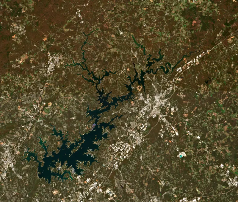
Surface water temperature
63°F on Nov 7, 2026
90°F · Jul 1963°F · Nov 7
27°F cooler than on Jul 19, 2026.
Estimated from Landsat 8/9 (USGS) passes on clear days: the top layer of the water, a few degrees either way. Coves and the shallows can be warmer.
Lake Lanier water temperature: trend, swimming and the fish →
On or near the shore of Lake Lanier: 85 boat ramps, 24 marinas, 13 rental outfits, 22 campgrounds, 7 beaches, 5 trails and 2 fishing guides. The lake has about 704 miles of shoreline, counting its islands.
Tap an icon for details; use two fingers (or Ctrl + scroll) to move the map. Tap a dot for details. Map and lake outline © OpenStreetMap contributors. Places from OpenStreetMap, Overture Maps and Recreation.gov. Not for navigation.
What you’ll find on the shore
← AllBoating 109
Which boat ramps are usable at today’s level →
← AllRentals & tours 13
← AllFishing spots 13
← AllBeaches 7
← AllCamping 22
← AllLodging 24+
← AllTrails 5
← AllParks 20+
← AllDining 24+
These invasive plants and animals have been recorded in Lake Lanier: clean, drain and dry everything before you go to another lake.
Georgia: Georgia has no clean-drain-dry law; WRD asks boaters to remove plants, mussels and mud, pull the drain plug and drain all water away from the ramp, never dump bait buckets, and dry gear for five days before using other waters. State rules
Records: USGS Nonindigenous Aquatic Species database. A species not listed may still be present.
Species with open-licensed records inside Lake Lanier's outline, from GBIF.org (surveys, museum collections and angler reports). A record shows a fish was found here, not how many there are now.
Shallow, protected flats in spring; docks, grass and deep edges in summer heat.
Brush piles, docks and bridge pilings; shallow for a few weeks in spring.
Channel edges and river arms; best after dark in summer, and after a rain.
Rocky shorelines and riprap at night in late winter; deep weed edges and humps in summer.
Run up the river arms in spring; follow shad to cool, deep water near the dam in summer.
Water temperature sets off each spawn; the bars show the usual months at this latitude and elevation, and move with a warm or cold spring. The water is about 63°F now.
Lake Lanier is the reservoir behind Buford Dam on the Chattahoochee River in north Georgia, spread across Hall, Forsyth, Dawson, Gwinnett and Lumpkin counties. It is a major source of drinking water for metro Atlanta, and its parks, marinas and beaches draw millions of visits a year.
Congress authorized the project in 1946, and the Army Corps of Engineers broke ground on Buford Dam on March 1, 1950. When a House committee refused more money in 1951, Atlanta mayor William Hartsfield lobbied Georgia's senators to keep it going. The gates closed on February 1, 1956, and drought slowed the filling so much that the lake did not reach full pool until August 1, 1958. The dam was built for flood control, hydropower, navigation and a steady water supply for Atlanta.
Making room for the lake meant buying about 50,000 acres of farms and woods. Some 250 families, 15 businesses, six churches and 20 cemeteries were moved. Gainesville's Looper Speedway, the old Lake Warner and Chattahoochee Park went under, along with a stretch of Highway 53. So did what was left of Oscarville, a Forsyth County community whose Black residents had been driven out of the county by white residents in 1912. Crews cut down the trees before the water rose but left tall stumps, and in places they still stand a short way below the surface.
The lake carries the name of Sidney Lanier, the 19th-century Georgia poet whose 1877 poem Song of the Chattahoochee lets the river tell of its run through Habersham and Hall counties.
The Chattahoochee, which rises in the Blue Ridge Mountains, forms the main body of the lake, and the Chestatee River fills a second arm. Their drowned channels still mark parts of the county lines between Hall and Gwinnett and between Dawson and Forsyth. Hall County holds roughly 60 percent of the lake and Forsyth about 30 percent.
The water level usually climbs through winter and early spring and falls in the heat of summer. In the 2007-2009 drought it fell to record lows, about 20 feet below full pool in December 2007, and exposed old roads and house foundations. The lake did not refill until heavy rain in October 2009. The drought sharpened a dispute among Georgia, Alabama and Florida over the river that dates to the 1990s. A federal judge ruled in 2009 that Congress never authorized the lake as a water supply for metro Atlanta, but an appeals court reversed that decision in 2011 and upheld the Corps' authority.
The rowing and sprint canoe races of the 1996 Atlanta Olympics were held on the north end of the lake, and the same venue later hosted the 2003 canoe sprint world championships and the 2018 dragon boat world championships. Lake Lanier Islands, a resort complex with a water park, hotel and golf course, opened in 1974 on land leased from the Corps by a state authority the Georgia legislature created in 1962. Corps, state, county and city parks ring the rest of the shore, and many of them have swim beaches.
For anglers, the state's fishing forecast lists Alabama bass, striped bass, largemouth bass, black crappie and walleye as the best bets.
The water released through the dam comes from the bottom of the lake at about 50 degrees, cold enough to support trout in the river and a trout hatchery downstream. That same water can bring on hypothermia even in summer, and exhaustion or unconsciousness can follow in under 30 minutes. Sirens sound when the turbines start. The National Park Service requires a life jacket between Buford Dam and the Highway 20 bridge and advises checking the release schedule before going out.
Written by Lake by Lake from Wikipedia (Lake Lanier, Buford Dam), Gwinnett County, New Georgia Encyclopedia, National Park Service, Chattahoochee River National Recreation Area and Georgia DNR Wildlife Resources Division. Checked November 2026.
Activities listed by the U.S. Army Corps of Engineers: Biking · Boating · Camping · Fishing · Hiking · Horseback riding · Picnicking · Water sports · Wildlife viewing · Swimming
Buford Dam is an earthfill dam 231 feet high and 2,470 feet long on the Chattahoochee River, completed in 1958. It belongs to the U.S. Army Corps of Engineers (Mobile District) and is run for flood control, recreation and hydropower. At its normal level the reservoir holds 1.92 million acre-ft, drained from 1,040 square miles of land.
From the National Inventory of Dams (U.S. Army Corps of Engineers), NID ID GA00824. Lake or reservoir: what’s the difference?
Where the level comes from: LAKE SIDNEY LANIER NEAR BUFORD, GA (U.S. Geological Survey, used on this page) and Chattahoochee River at Lake Sidney Lanier near Buford (NOAA National Water Prediction Service).
| Lake | Miles | Level (ft) | vs full | 7 days |
|---|---|---|---|---|
| Randy Poynter Lake Live reading | 31 | 730.84 | — | −0.38 |
| Allatoona Lake Below full | 37 | 830.63 | −9.37 | −1.01 |
| Carters Lake Slightly below full | 46 | 1069.75 | −4.25 | −2.76 |
| Lake Blue Ridge Well below full | 51 | 1669.05 | −17.95 | — |
| Lake Seed At or near full pool | 52 | 1751.00 | −1.50 | −0.07 |
| Lake Burton At or near full pool | 53 | 1864.67 | −1.93 | −0.22 |
Compare Lake Lanier with Randy Poynter Lake, Allatoona Lake, Carters Lake or Lake Blue Ridge: size, level, ramps and fish side by side.
Lake Lanier is about 23 mi from Sandy Springs, GA, 34 mi from Atlanta, GA and 43 mi from Athens, GA. See all the lakes near each city.
Lake Lanier is also known as Lake Sidney Lanier.
Lake Lanier is at 1,062.08 feet above sea level — 8.92 ft below full summer pool, as of Nov 17, 2026, 9:15 PM EST. It has dropped 0.36 ft in the past 7 days. That is the lowest level since 2017.
Lake Lanier's full summer pool is 1,071.00 ft, according to U.S. Army Corps of Engineers. Today the lake is 8.92 ft below that mark.
Today's level is 5.22 ft below the median for this date (1,067.30 ft), from the gauge’s long-term daily record.
1,050.82 ft, on December 27, 2007, in the U.S. Geological Survey record, which starts in 1989. Today the lake is 11.3 ft above that.
1,076.67 ft, on February 20, 2020, in the U.S. Geological Survey record since 1989. That is 5.7 ft above full summer pool.
Lake Lanier has 85 boat ramps on our map, including American Legion, Aqualand Marina, Aqualand Marina (ramp #2), and 24 marinas. Low water can close ramps, so check today's level above and the operator before you go.
Yes. There are 22 campgrounds and RV parks within about a mile of the shore, such as Chestnut Ridge Park, Camp Lanier, Lake Lanier Islands Campground.
Game fish recorded in Lake Lanier include spotted bass, black crappie, largemouth bass, channel catfish, striped bass, bluegill. In all, 28 fish species have open records inside the lake on GBIF.
The surface of Lake Lanier was about 63°F on November 7, estimated from a satellite pass on a clear day. It is the top layer of the water, a few degrees either way; coves and shallows run warmer in the sun.
Anglers 16 and older need a Georgia fishing license, sold online by the Georgia Department of Natural Resources, Wildlife Resources Division. Free fishing days: Two days during National Fishing and Boating Week (June) and National Hunting and Fishing Day (September). Size and bag limits can be set lake by lake: check the current regulations.
Lake Lanier averages about 41 ft deep. Depth changes with the lake level.
In summer a white Secchi disk lowered into Lake Lanier stays visible to about 8.9 ft (the median of 381 readings, 2016–2026, by Georgia DNR Environmental Protection Division): clear water. With the algae measured too (chlorophyll about 9 µg/L), that makes it mesotrophic: moderately rich in nutrients. Clarity drops after storms and during algae blooms.
U.S. Army Corps of Engineers lists biking, boating, camping, fishing, hiking, horseback riding, picnicking and water sports at Lake Sidney Lanier. 6 campgrounds can be booked on Recreation.gov.
EPA's CyAN satellite rated cyanobacteria in Lake Lanier moderate on November 9. The satellite sees open water only; blooms can be patchy, so avoid water that looks like spilled paint or pea soup and keep dogs out of scum. Swimming advisories come from Georgia health and environment agencies.
Yes. 5 trails run along or near the shore, including Huckleberry Trail (0.5 mi), Little Ridge Trail (0.5 mi) and Charleston Park Trail (5.0 mi), according to OpenStreetMap.
Lake Lanier is held back by Buford Dam, completed in 1958 and 231 ft high, according to the National Inventory of Dams.
From the U.S. Geological Survey (LAKE SIDNEY LANIER NEAR BUFORD, GA). Lake by Lake checks it every hour; the agency's own figure is always the reference, and provisional readings can be revised.
Lake levels are refreshed every hour. Texas and California reservoirs report once a day; most USGS and NOAA gauges report every 15 to 60 minutes.




