Sun
- Sunrise
- 7:08 AM
- Sunset
- 5:31 PM
- First light
- 6:42 AM
- Last light
- 5:58 PM
Reservoir · Butts County, Georgia
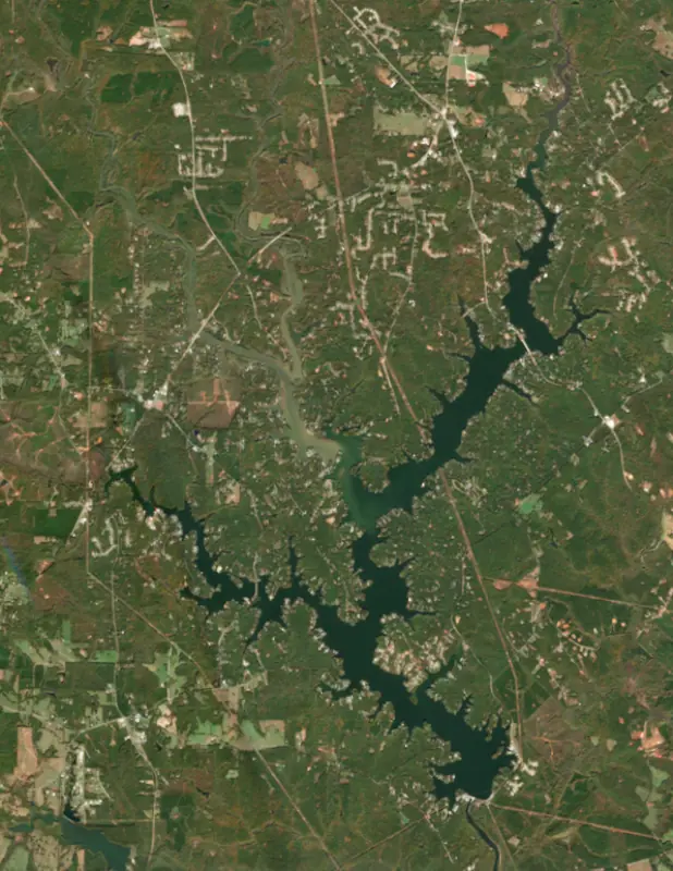
A reservoir on the Ocmulgee in Butts County, Georgia, held back by Lloyd Shoals Main Dam since 1911.

Jackson Lake is at 528.28 feet above sea level — 1.72 ft below full pool, as of Nov 17, 2026, 9:00 PM EST. It has dropped 0.22 ft in the past 7 days.
6th fullest of 17 Georgia lakes today against full pool · See the ranking
A notification from this browser, once, when the level crosses the line (checked every hour). No account and no email. On an iPhone, add Lake by Lake to your home screen first (Share → Add to Home Screen) and open it from there. Or follow the lake in a feed reader: RSS feed.
Jackson Lake is down 0.33 ft over the last 30 days, at 528.28 ft today.
Daily values from the NOAA National Water Prediction Service. Why lake levels rise and fall
Solunar periods for Jackson Lake, local time. How they work
Not detected · as of Nov 9, 2026
The satellite found no cyanobacteria at the surface.
Week of Aug 9Week of Nov 1
Each bar is one week, colored by the worst reading of that week.
From the U.S. EPA's Cyanobacteria Assessment Network (CyAN), which reads the color of lakes from the Sentinel-3 satellites; it sees open water only, not coves or the shoreline. Blooms can be patchy: what you see on the water matters more. Swimming closures and health advisories come from Georgia health and environment agencies. How to read it
Surface water temperature
70°F on Oct 23, 2026
90°F · Jul 1970°F · Oct 23
20°F cooler than on Jul 19, 2026.
Estimated from Landsat 8/9 (USGS) passes on clear days: the top layer of the water, a few degrees either way. Coves and the shallows can be warmer.
Jackson Lake water temperature: trend, swimming and the fish →
On or near the shore of Jackson Lake: 3 boat ramps, 5 marinas, 1 rental outfit, 3 campgrounds and 3 beaches. The lake has about 101 miles of shoreline, counting its islands.
Tap an icon for details; use two fingers (or Ctrl + scroll) to move the map. Tap a dot for details. Map and lake outline © OpenStreetMap contributors. Places from OpenStreetMap, Overture Maps and Recreation.gov. Not for navigation.
No aquatic invasive species are on record for Jackson Lake in the USGS database. Keep it that way: clean, drain and dry your boat between lakes.
Georgia: Georgia has no clean-drain-dry law; WRD asks boaters to remove plants, mussels and mud, pull the drain plug and drain all water away from the ramp, never dump bait buckets, and dry gear for five days before using other waters. State rules
Records: USGS Nonindigenous Aquatic Species database. A species not listed may still be present.
Species with open-licensed records inside Jackson Lake's outline, from GBIF.org (surveys, museum collections and angler reports). A record shows a fish was found here, not how many there are now.
Shallow, protected flats in spring; docks, grass and deep edges in summer heat.
Brush piles, docks and bridge pilings; shallow for a few weeks in spring.
Channel edges and river arms; best after dark in summer, and after a rain.
Run up the river arms in spring; follow shad to cool, deep water near the dam in summer.
Clear water and steep rock; they often suspend deeper than largemouth.
Water temperature sets off each spawn; the bars show the usual months at this latitude and elevation, and move with a warm or cold spring.
Jackson Lake is a Georgia Power reservoir about 44 miles southeast of Atlanta, formed where the South, Yellow and Alcovy rivers meet, and it drains into the Ocmulgee River. It spreads across Butts, Jasper and Newton counties, and its dam at Lloyd Shoals has been making electricity since the early 1910s, which makes it one of the oldest reservoirs in the state. In summer its built-up shoreline is busy with boaters and skiers, and anglers come year-round for catfish, stripers, crappie and bass.
The project began in Macon. In 1907 Jordan Massee Sr. and his partners bought the city's railway and light company, and Massee went on to organize the Bibb Power Company, soon renamed the Central Georgia Power Company. To raise money he brought about 200 northern bankers to the shoals and fed them a barbecue, and New York backers came through. The company bought the site from Capt. William F. Smith of Butts County and started work in 1908. Local farmers lost their river bottomland, and work crews slept in tents. The dam, about 100 feet high, was finished in 1911, and four generating units went into service that year, with two more added in 1916 and 1917. Power lines ran to Macon, Forsyth, Griffin, Barnesville and the town of Jackson, and electricity helped bring industry to Butts County.
The lake was slow to fill. Standing water bred mosquitoes, a malaria outbreak drove more people away, and for a time the water ran red and muddy. It cleared over the years, and fish camps grew up along the shore. Georgia Power bought the Central Georgia Power Company and the dam in 1928.
The lake's main arms follow its rivers. Highway 36 crosses the South River arm, the Yellow River arm holds varied habitat, and the Alcovy joins them where the three rivers meet. Tussahaw Creek forms an arm of its own, with flooded timber in its upper reaches above Barnetts Bridge. Highway 212 crosses the lake as well.
The town of Jackson, the Butts County seat, was named for Andrew Jackson, who spent a few weeks in the area in 1818. Nearby Indian Springs State Park, established in 1927, grew up around sulfur springs where the Creek leader William McIntosh built a hotel in 1823. In 1825 he signed away all Creek lands in Georgia there, and angry Creeks killed him three months later.
Georgia Power runs the plant mainly at hours of peak demand. In January 1983 a transformer explosion and fire wrecked the upper level of the powerhouse, which was rebuilt with modern equipment. In 1994 a near-record flood on the Ocmulgee pushed the lake more than 4 feet above its normal level at the dam. In 2012 the spillway was fitted with Obermeyer gates, which hold the normal level more precisely, and the lake no longer needs a yearly drawdown.
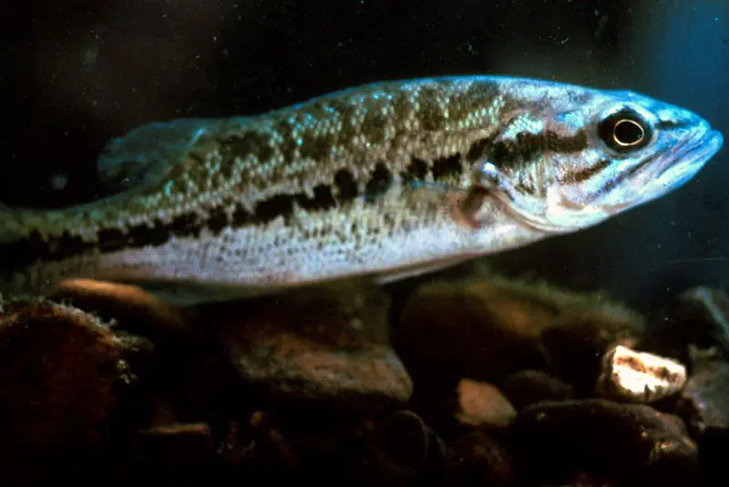
State biologists say channel and blue catfish typically run 3 to 5 pounds, channel cats over 20 pounds are possible, and the lake record flathead tops 50 pounds. Most big cats are caught at night. Striped bass are stocked and typically run 4 to 5 pounds, with fish over 18 pounds reported; anglers troll through suspended shad or watch for stripers breaking on the surface at dawn and dusk. Crappie are plentiful, and the flooded timber in the Tussahaw arm is among the most reliable spots. Largemouth outnumber spotted bass and run bigger, with the best chances for a large fish from February through May and again from October through December. Redear sunfish of a pound or more are common, and the Ocmulgee below the dam is a good place for redbreast.
Written by Lake by Lake from Georgia Power, Georgia Department of Natural Resources, Wildlife Resources Division, New Georgia Encyclopedia (Butts County, Jasper County) and Wikipedia. Checked November 2026.
Lloyd Shoals Main Dam is a concrete gravity dam 100 feet high and 1,600 feet long on the Ocmulgee, completed in 1911. It belongs to Georgia Power Company and is run for hydropower. At its normal level the reservoir holds 97,000 acre-ft, drained from 1,400 square miles of land.
From the National Inventory of Dams (U.S. Army Corps of Engineers), NID ID GA00873. Lake or reservoir: what’s the difference?
Where the level comes from: Ocmulgee River at Jackson Lake (NOAA National Water Prediction Service).
| Lake | Miles | Level (ft) | vs full | 7 days |
|---|---|---|---|---|
| Randy Poynter Lake Live reading | 29 | 730.84 | — | −0.38 |
| Lake Horton Live reading | 33 | 774.10 | — | −0.31 |
| Lake Sinclair At or near full pool | 39 | 338.15 | −1.85 | — |
| Lake Oconee At or near full pool | 39 | 433.46 | −1.54 | — |
| Lake Peachtree Live reading | 42 | 784.44 | — | 0.00 |
| Lake McIntosh Live reading | 43 | 778.07 | — | −0.22 |
Compare Jackson Lake with Randy Poynter Lake, Lake Horton, Lake Sinclair or Lake Oconee: size, level, ramps and fish side by side.
Jackson Lake is about 36 mi from Macon, GA, 45 mi from Atlanta, GA and 48 mi from South Fulton, GA. See all the lakes near each city.
Jackson Lake is at 528.28 feet above sea level — 1.72 ft below full pool, as of Nov 17, 2026, 9:00 PM EST. It has dropped 0.22 ft in the past 7 days.
Jackson Lake's full pool is 530.00 ft, according to Georgia Power. Today the lake is 1.72 ft below that mark.
Jackson Lake has 3 boat ramps on our map, including Lloyd Shoals Park, Bear Creek Marina Boat Ramp, and 5 marinas. Low water can close ramps, so check today's level above and the operator before you go.
Yes. There are 3 campgrounds and RV parks within about a mile of the shore, such as Bear Creek Hideaway, Sandy's Highway 36 Marina, FFA Wildlife Camp.
Game fish recorded in Jackson Lake include black crappie, largemouth bass, bluegill, redear sunfish, channel catfish, white catfish. In all, 31 fish species have open records inside the lake on GBIF.
Anglers 16 and older need a Georgia fishing license, sold online by the Georgia Department of Natural Resources, Wildlife Resources Division. Free fishing days: Two days during National Fishing and Boating Week (June) and National Hunting and Fishing Day (September). Size and bag limits can be set lake by lake: check the current regulations.
NOAA's flood categories for the Jackson Lake gauge: action stage at 530.0 ft and minor flooding at 530.5 ft. Today the lake is 2.22 ft below the first flooding level.
Jackson Lake averages about 22 ft deep. Depth changes with the lake level.
In summer a white Secchi disk lowered into Jackson Lake stays visible to about 4.4 ft (the median of 86 readings, 2016–2026, by Georgia DNR Environmental Protection Division): somewhat murky water. With the algae measured too (chlorophyll about 21 µg/L), that makes it eutrophic: rich in nutrients, greener water. Clarity drops after storms and during algae blooms.
boating (3 boat ramps and 5 marinas), kayaks, boats & jet skis (1 rental outfit on or near the water), boat tours (1 boat tour or charter), fishing (25 game fish), swimming (3 beaches and swimming areas) and camping (3 campgrounds), according to our map of the shore.
EPA's CyAN satellite rated cyanobacteria in Jackson Lake not detected on November 9. The satellite sees open water only; blooms can be patchy, so avoid water that looks like spilled paint or pea soup and keep dogs out of scum. Swimming advisories come from Georgia health and environment agencies.
Jackson Lake is held back by Lloyd Shoals Main Dam, completed in 1911 and 100 ft high, according to the National Inventory of Dams.
From the NOAA National Water Prediction Service (Ocmulgee River at Jackson Lake). Lake by Lake checks it every hour; the agency's own figure is always the reference, and provisional readings can be revised.
Lake levels are refreshed every hour. Texas and California reservoirs report once a day; most USGS and NOAA gauges report every 15 to 60 minutes.