Sun
- Sunrise
- 7:05 AM
- Sunset
- 5:29 PM
- First light
- 6:39 AM
- Last light
- 5:56 PM
Reservoir · Baldwin County, Georgia
A reservoir on the Oconee in Baldwin County, Georgia, held back by Sinclair Dam since 1953.
Lake Sinclair is at 338.15 feet above sea level — 1.85 ft below full pool, as of Nov 17, 2026, 9:00 PM EST. It has dropped 0.24 ft in the past 7 days.
7th fullest of 17 Georgia lakes today against full pool · See the ranking
A notification from this browser, once, when the level crosses the line (checked every hour). No account and no email. On an iPhone, add Lake by Lake to your home screen first (Share → Add to Home Screen) and open it from there. Or follow the lake in a feed reader: RSS feed.
Lake Sinclair is down 0.05 ft over the last 30 days, at 338.15 ft today.
Daily values from the NOAA National Water Prediction Service. Why lake levels rise and fall
Solunar periods for Lake Sinclair, local time. How they work
Not detected · as of Nov 9, 2026
The satellite found no cyanobacteria at the surface.
Week of Aug 16Week of Nov 1
Each bar is one week, colored by the worst reading of that week.
From the U.S. EPA's Cyanobacteria Assessment Network (CyAN), which reads the color of lakes from the Sentinel-3 satellites; it sees open water only, not coves or the shoreline. Blooms can be patchy: what you see on the water matters more. Swimming closures and health advisories come from Georgia health and environment agencies. How to read it
Surface water temperature
72°F on Oct 23, 2026
91°F · Jul 1972°F · Oct 23
19°F cooler than on Jul 19, 2026.
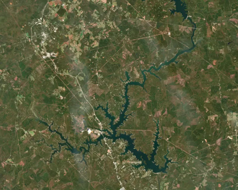
Estimated from Landsat 8/9 (USGS) passes on clear days: the top layer of the water, a few degrees either way. Coves and the shallows can be warmer.
Lake Sinclair water temperature: trend, swimming and the fish →
On or near the shore of Lake Sinclair: 23 boat ramps, 6 marinas, 3 rental outfits, 9 campgrounds, 3 beaches and 2 trails. The lake has about 323 miles of shoreline, counting its islands.
Tap an icon for details; use two fingers (or Ctrl + scroll) to move the map. Tap a dot for details. Map and lake outline © OpenStreetMap contributors. Places from OpenStreetMap, Overture Maps and Recreation.gov. Not for navigation.
What you’ll find on the shore
← AllBoating 29
← AllRentals & tours 3
← AllBeaches 3
← AllCamping 9
← AllLodging 13
← AllTrails 2
← AllParks 1
← AllDining 5
These invasive plants and animals have been recorded in Lake Sinclair: clean, drain and dry everything before you go to another lake.
Georgia: Georgia has no clean-drain-dry law; WRD asks boaters to remove plants, mussels and mud, pull the drain plug and drain all water away from the ramp, never dump bait buckets, and dry gear for five days before using other waters. State rules
Records: USGS Nonindigenous Aquatic Species database. A species not listed may still be present.
Species with open-licensed records inside Lake Sinclair's outline, from GBIF.org (surveys, museum collections and angler reports). A record shows a fish was found here, not how many there are now.
Shallow, protected flats in spring; docks, grass and deep edges in summer heat.
Brush piles, docks and bridge pilings; shallow for a few weeks in spring.
Channel edges and river arms; best after dark in summer, and after a rain.
Run up the river arms in spring; follow shad to cool, deep water near the dam in summer.
Clear water and steep rock; they often suspend deeper than largemouth.
Water temperature sets off each spawn; the bars show the usual months at this latitude and elevation, and move with a warm or cold spring.
Lake Sinclair is a Georgia Power reservoir on the Oconee River in middle Georgia, just north of Milledgeville along U.S. 441. It spreads across Baldwin, Hancock and Putnam counties, and most of it lies in Putnam. Anglers know it for largemouth bass, crappie, catfish and stripers, and for fishing that turns on when the water starts moving at Wallace Dam upstream.
Georgia Power finished the dam at Furman Shoals, about five miles north of Milledgeville, in 1953, damming the Oconee to run a hydroelectric station. The lake takes its name from Benjamin W. Sinclair, a company official. Milledgeville, which sits on the west bank of the Oconee below the dam, was Georgia's capital from 1804 to 1868, and its antebellum Old Governor's Mansion is now part of Georgia College and State University. The lake community became a large part of the town's social and economic life. Building the parks, ramps and marinas was a joint effort of Georgia Power, the U.S. Forest Service, the state game and fish agency, a regional planning commission and local businesses.
Lake Sinclair also serves as the lower reservoir for Wallace Dam and Lake Oconee upstream. At times of peak power demand, Wallace Dam sends water from Oconee through its turbines straight into Sinclair. At night, when power is cheaper, some of that water is pumped back uphill. That daily exchange creates current through much of the lake. In droughts, water from Oconee is released to help keep the Oconee River flowing below Sinclair Dam.
For half a century the lake also served Plant Branch, a large coal-fired power station in Putnam County that began running in 1965 and was retired in 2015.
The Oconee forms the main body of the lake, and the Little River comes in as a major side arm. Creeks such as Beaverdam, Crooked, Rooty, Shoulder Bone, Island and Rocky branch off into long coves. Georgia Power runs several public sites around the shore, among them Rocky Creek Park with a small beach, picnic area and ramp, Little River Park with a campground and swimming, Cosby's Landing and Seabrook Landing ramps, a fishing pier below Sinclair Dam and the T.D. Cheek Public Fishing Area. The fishing piers at the state's Dennis Station site and at U.S. 441 have lights to draw fish at night.
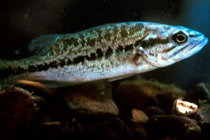
Bass anglers work docks, brush piles, points and weed beds, and biologists say strong reproduction and good growth keep the largemouth fishery in good shape. Bass, like other fish here, tend to feed harder when Wallace Dam is generating or pumping back. Crappie are abundant, with the best spring fishing in the upper ends of coves and night fishing under lighted docks and bridges in summer. Stocked hybrid and striped bass run up the Little River and Murder Creek in spring, and big stripers also gather below Wallace Dam and in the Oconee River below Sinclair Dam. Blue catfish have now passed channel catfish in numbers, and blues in the 40- to 50-pound range are possible.
Written by Lake by Lake from Georgia Department of Natural Resources, Wildlife Resources Division, Georgia Power (East Georgia Lakes, Wallace Dam Project operations brief, Plant Branch), New Georgia Encyclopedia and Wikipedia. Checked November 2026.
Sinclair Dam is a concrete gravity dam 104 feet high and 2,988 feet long on the Oconee, completed in 1953. It belongs to Georgia Power Company and is run for hydropower, recreation and water supply. At its normal level the reservoir holds 333,000 acre-ft, drained from 2,910 square miles of land.
From the National Inventory of Dams (U.S. Army Corps of Engineers), NID ID GA00836. Lake or reservoir: what’s the difference?
Where the level comes from: Oconee River at Lake Sinclair (NOAA National Water Prediction Service).
| Lake | Miles | Level (ft) | vs full | 7 days |
|---|---|---|---|---|
| Lake Oconee At or near full pool | 15 | 433.46 | −1.54 | — |
| Jackson Lake At or near full pool | 39 | 528.28 | −1.72 | — |
| Randy Poynter Lake Live reading | 59 | 730.84 | — | −0.38 |
| Butler Creek Reservoir Live reading | 67 | 27.42 | — | 0.00 |
| Lake Strom Thurmond Below full | 69 | 317.41 | −12.59 | −0.41 |
| Lake Horton Live reading | 71 | 774.10 | — | −0.31 |
Compare Lake Sinclair with Lake Oconee, Jackson Lake, Randy Poynter Lake or Butler Creek Reservoir: size, level, ramps and fish side by side.
Lake Sinclair is about 37 mi from Macon, GA and 57 mi from Athens, GA. See all the lakes near each city.
Lake Sinclair is at 338.15 feet above sea level — 1.85 ft below full pool, as of Nov 17, 2026, 9:00 PM EST. It has dropped 0.24 ft in the past 7 days.
Lake Sinclair's full pool is 340.00 ft, according to Georgia Power. Today the lake is 1.85 ft below that mark.
Lake Sinclair has 23 boat ramps on our map, including Lake Sinclair Recreational Area, Sinclair Marina, Upper Sinclair (SR16), and 6 marinas. Low water can close ramps, so check today's level above and the operator before you go.
Yes. There are 9 campgrounds and RV parks within about a mile of the shore, such as Oconee Springs Park, Temple Bay Resort, Little River Park Campground.
Game fish recorded in Lake Sinclair include largemouth bass, black crappie, channel catfish, bluegill, white catfish, redear sunfish. In all, 24 fish species have open records inside the lake on GBIF.
Anglers 16 and older need a Georgia fishing license, sold online by the Georgia Department of Natural Resources, Wildlife Resources Division. Free fishing days: Two days during National Fishing and Boating Week (June) and National Hunting and Fishing Day (September). Size and bag limits can be set lake by lake: check the current regulations.
NOAA's flood categories for the Lake Sinclair gauge: action stage at 340.0 ft and minor flooding at 340.5 ft. Today the lake is 2.35 ft below the first flooding level.
Lake Sinclair averages about 22 ft deep. Depth changes with the lake level.
In summer a white Secchi disk lowered into Lake Sinclair stays visible to about 4.8 ft (the median of 142 readings, 2016–2026, by Georgia DNR Environmental Protection Division and North American Lake Management Society): somewhat murky water. With the algae measured too (chlorophyll about 13 µg/L), that makes it eutrophic: rich in nutrients, greener water. Clarity drops after storms and during algae blooms.
boating (23 boat ramps and 6 marinas), kayaks, boats & jet skis (3 rental outfits on or near the water), fishing (19 game fish), swimming (3 beaches and swimming areas), hiking & walking (2 trails along the shore, the longest Blue Trail (2.1 mi)) and camping (9 campgrounds), according to our map of the shore.
EPA's CyAN satellite rated cyanobacteria in Lake Sinclair not detected on November 9. The satellite sees open water only; blooms can be patchy, so avoid water that looks like spilled paint or pea soup and keep dogs out of scum. Swimming advisories come from Georgia health and environment agencies.
Yes. 2 trails run along or near the shore, including Twin Bridges Trail (1.4 mi) and Blue Trail (2.1 mi), according to OpenStreetMap.
Lake Sinclair is held back by Sinclair, completed in 1953 and 104 ft high, according to the National Inventory of Dams.
From the NOAA National Water Prediction Service (Oconee River at Lake Sinclair). Lake by Lake checks it every hour; the agency's own figure is always the reference, and provisional readings can be revised.
Lake levels are refreshed every hour. Texas and California reservoirs report once a day; most USGS and NOAA gauges report every 15 to 60 minutes.