Sun
- Sunrise
- 7:17 AM
- Sunset
- 4:41 PM
- First light
- 6:44 AM
- Last light
- 5:13 PM
Lake · Hennepin County, Minnesota
A lake fed by Six Mile Creek in Hennepin County, Minnesota.

Lake Minnetonka is at 928.37 feet above sea level, as of Nov 19, 2026, 12:00 AM CST. The level has held steady over the past week.
A notification from this browser, once, when the level crosses the line (checked every hour). No account and no email. On an iPhone, add Lake by Lake to your home screen first (Share → Add to Home Screen) and open it from there. Or follow the lake in a feed reader: RSS feed.
Lake Minnetonka has held steady over the last 7 days (within 0.05 ft).
Daily values from the NOAA National Water Prediction Service.
Lake Minnetonka is up 0.18 ft over the last 30 days, at 928.37 ft today.
Daily values from the NOAA National Water Prediction Service. Why lake levels rise and fall
Solunar periods for Lake Minnetonka, local time. How they work
High · as of Nov 9, 2026
The satellite sees a likely bloom on part of the lake. Avoid discolored water and scum, and keep dogs out of it. About 445,000 cells/mL at the worst spot, covering 19% of the lake.
Week of Aug 16Week of Nov 1
Each bar is one week, colored by the worst reading of that week.
From the U.S. EPA's Cyanobacteria Assessment Network (CyAN), which reads the color of lakes from the Sentinel-3 satellites; it sees open water only, not coves or the shoreline. Blooms can be patchy: what you see on the water matters more. Swimming closures and health advisories come from Minnesota health and environment agencies. How to read it
The ice usually goes out of Lake Minnetonka around Apr 14 (median of 146 springs on record). In 2023 it went out on Apr 19. The earliest on record was Mar 11, 1878; the latest, May 5, 2018.
Each dot is one of the last 30 springs on record; the dashed line is the median of all of them; the orange dot is 2023.
Source: Minnesota Department of Natural Resources. Ice is never safe everywhere: check local conditions before going out on it. About ice-out
Surface water temperature
48°F on Nov 15, 2026
79°F · Jul 2648°F · Nov 15
31°F cooler than on Jul 26, 2026.
Estimated from Landsat 8/9 (USGS) passes on clear days: the top layer of the water, a few degrees either way. Coves and the shallows can be warmer.
Lake Minnetonka water temperature: trend, swimming and the fish →
On or near the shore of Lake Minnetonka: 21 boat ramps, 30 marinas, 7 rental outfits, 2 campgrounds, 22 beaches, 1 fishing pier, 4 trails and 2 fishing guides. The lake has about 119 miles of shoreline, counting its islands.
Tap an icon for details; use two fingers (or Ctrl + scroll) to move the map. Tap a dot for details. Map and lake outline © OpenStreetMap contributors. Places from OpenStreetMap, Overture Maps and Recreation.gov. Not for navigation.
What you’ll find on the shore
← AllBoating 51
← AllRentals & tours 12
← AllFishing spots 6
← AllBeaches 22
← AllCamping 2
← AllLodging 11
← AllTrails 4
← AllParks 20+
← AllDining 24+
Zebra mussels have been found in Lake Minnetonka. They clog intakes and engines and spread on boats and trailers: clean, drain and dry everything before you go to another lake.
Minnesota: Clean all plants, mud and invasive animals off your boat and trailer, drain all water and pull drain plugs before leaving the access, keep plugs out while transporting, and put unwanted bait in the trash. Inspectors at accesses can require inspection or decontamination and deny launch if plants or invasives are found. State rules
Records: USGS Nonindigenous Aquatic Species database. A species not listed may still be present.
Species with open-licensed records inside Lake Minnetonka's outline, from GBIF.org (surveys, museum collections and angler reports). A record shows a fish was found here, not how many there are now.
Shallow, protected flats in spring; docks, grass and deep edges in summer heat.
Brush piles, docks and bridge pilings; shallow for a few weeks in spring.
Rocky points, gravel and current breaks; deeper rock piles in summer.
Rocky shorelines at night after ice-out; deep weed edges and humps in summer.
Shallow, weedy bays right after ice-out; weed edges the rest of the year.
Water temperature sets off each spawn; the bars show the usual months at this latitude and elevation, and move with a warm or cold spring. The water is about 48°F now.
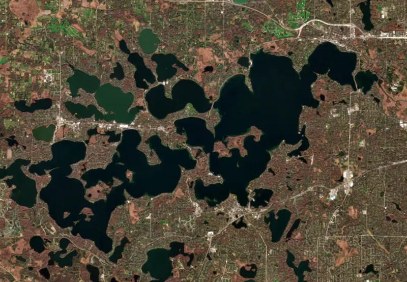
Lake Minnetonka is a sprawling lake of bays, channels and islands about 16 miles west of Minneapolis, shared by 14 cities in Hennepin and Carver counties. In the late 1800s it drew summer visitors from across the country to its grand hotels. Today its shore is mostly suburban, and the lake is busy with boats in summer and ice anglers in winter.
The lake took shape about 10,000 years ago as the last ice sheet melted back to the north. It is really a cluster of kettle lakes joined by channels and marshes, which is why the map looks like a puzzle and why it is divided into an Upper Lake to the west and a Lower Lake to the east. The Mdewakanton Dakota lived around these waters long before settlers arrived and used Big Island as a maple sugar camp, and the name Minnetonka comes from their words for big water, formally adopted by territorial governor Alexander Ramsey in 1852. The Dakota gave up the lake and its woods to the United States in the Treaty of Traverse des Sioux in 1851.
Wayzata and Excelsior were founded in the 1850s, and in 1854 the Harrington Inn opened as the first summer hotel on the lake. Rail service reached Wayzata in 1867, and trains met the steamboats that carried guests to hotels around the shore. The largest was James J. Hill's Hotel Lafayette, which opened on July 2, 1882, with 300 rooms on a ridge facing two bays and counted Presidents Chester A. Arthur and Ulysses S. Grant among its guests. It burned in less than an hour on Oct. 4, 1897. Hard times in the 1890s, the pull of the western national parks and later the automobile ended the resort era.
A second wave came in 1905, when the Twin City Rapid Transit Company opened a streetcar line from Minneapolis to Excelsior. The next year it put a fleet of boats styled like its streetcars on the lake and opened an amusement park on Big Island, which lasted until 1911. As cars and better roads took over, the company ended its steamboat service in 1926 and scuttled three of the boats. One of them, the Minnehaha, was found in 1979, raised in 1980 and, after a volunteer restoration, returned to service in 1996.
Minnehaha Creek is the lake's only outlet, leaving from Gray's Bay at the east end, and Six Mile Creek is the largest stream flowing in. After years of severe flooding in the 1960s, residents petitioned for a watershed district, and the Minnehaha Creek Watershed District was formed in 1967. Its first job was a new outlet structure, and the Gray's Bay Dam was finished in 1979. The district runs it in spring and fall and usually closes it in winter, aiming to end each fall with enough room in the lake to hold the next spring's runoff. When the lake falls below what the state identified as its natural outlet level, the dam releases nothing during the open-water season. The lowest level on record came in 1937 and the highest in 2014. A separate body created in 1967, the Lake Minnetonka Conservation District, sets the rules on the water, from boat density and quiet water areas to docks and invasive species.
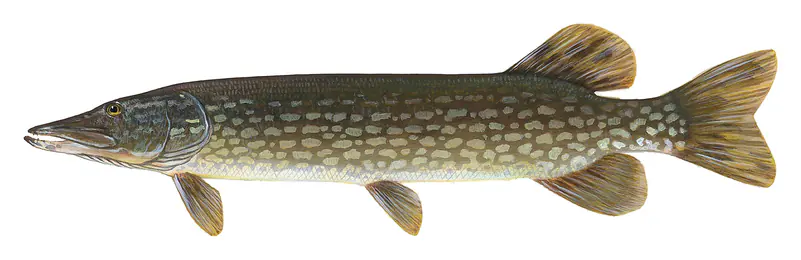
Largemouth and smallmouth bass, muskellunge, northern pike, walleye, yellow perch, bluegill and crappie all live here, and ice fishing is popular once the bays freeze. Several invasive species have arrived over the years, including Eurasian watermilfoil in 1987 and zebra mussels in 2010, and the conservation district works to keep new ones out.
Written by Lake by Lake from Minnesota Historical Society (MNopedia), Minnehaha Creek Watershed District (Gray's Bay Dam, Gray's Bay Dam Operations), Lake Minnetonka Conservation District, Museum of Lake Minnetonka and Wikipedia. Checked November 2026.
Lake Minnetonka Dam is a concrete gravity dam 5 feet high and 32 feet long. It belongs to WD of Minnehaha Creek and is run for recreation. At its normal level the lake holds 23,340 acre-ft, drained from 125 square miles of land.
From the National Inventory of Dams (U.S. Army Corps of Engineers), NID ID MN01307. Lake or reservoir: what’s the difference?
Where the level comes from: Lake Minnetonka above Gray's Dam (NOAA National Water Prediction Service).
| Lake | Miles | Level (ft) | vs full | 7 days |
|---|---|---|---|---|
| Lake Zumbro Live reading | 71 | 914.60 | — | −0.21 |
Compare Lake Minnetonka with Lake Zumbro: size, level, ramps and fish side by side.
Lake Minnetonka is about 82 mi from Rochester, MN. See all the lakes near each city.
Lake Minnetonka is at 928.37 feet above sea level, as of Nov 19, 2026, 12:00 AM CST. The level has held steady over the past week.
Lake Minnetonka has 21 boat ramps on our map, including Boat ramp at Excelsior Bay Marina, Carson's Bay Landing, Grays Bay Public Water Access Site, and 30 marinas. Low water can close ramps, so check today's level above and the operator before you go.
Yes. There are 2 campgrounds and RV parks within about a mile of the shore, such as Camp Teko, Lake Zumbra Group Camp.
Game fish recorded in Lake Minnetonka include largemouth bass, smallmouth bass, bluegill, muskellunge, yellow perch, black crappie. In all, 19 fish species have open records inside the lake on GBIF.
The surface of Lake Minnetonka was about 48°F on November 15, estimated from a satellite pass on a clear day. It is the top layer of the water, a few degrees either way; coves and shallows run warmer in the sun.
Anglers 16 and older need a Minnesota fishing license, sold online by the Minnesota Department of Natural Resources. Free fishing days: Take a Mom Fishing Weekend (Mother’s Day weekend) and Take a Kid Fishing Weekend (early June), for residents. Size and bag limits can be set lake by lake: check the current regulations.
Lake Minnetonka is about 112 ft deep at its deepest point, and about 22 ft deep on average. Depth changes with the lake level.
In summer a white Secchi disk lowered into Lake Minnetonka stays visible to about 11.0 ft (the median of 1,320 readings, 2016–2025, by Minnesota Pollution Control Agency - Ambient Surface Water and North American Lake Management Society): clear water. With the algae measured too (chlorophyll about 5 µg/L), that makes it mesotrophic: moderately rich in nutrients. Clarity drops after storms and during algae blooms.
Yes: lake map with depth contours from the Minnesota Department of Natural Resources. It is linked in the lake facts on this page. Depths on a map are measured at a reference level: subtract how far the lake is below it today.
boating (21 boat ramps and 30 marinas), kayaks, boats & jet skis (7 rental outfits on or near the water), boat tours (5 boat tours and charters), fishing (16 game fish, 1 fishing pier or spot and 2 fishing guides), swimming (22 beaches and swimming areas) and hiking & walking (4 trails along the shore, the longest Lake Minnetonka LRT Regional Trail (12 mi)), according to our map of the shore.
EPA's CyAN satellite rated cyanobacteria in Lake Minnetonka high on November 9. The satellite sees open water only; blooms can be patchy, so avoid water that looks like spilled paint or pea soup and keep dogs out of scum. Swimming advisories come from Minnesota health and environment agencies.
Usually around April 14, the median of 146 springs in the records of Minnesota Department of Natural Resources. In 2023 the ice went out on April 19.
Yes. 4 trails run along or near the shore, including Dakota Rail Regional Trail (9.8 mi), Lake Minnetonka LRT Regional Trail (12 mi) and Northome Trail (0.4 mi), according to OpenStreetMap.
From the NOAA National Water Prediction Service (Lake Minnetonka above Gray's Dam). Lake by Lake checks it every hour; the agency's own figure is always the reference, and provisional readings can be revised.
Lake levels are refreshed every hour. Texas and California reservoirs report once a day; most USGS and NOAA gauges report every 15 to 60 minutes.
Cookies for analytics With your OK we use Google Analytics and Microsoft Clarity to count visits and see how the site is used, so we can make it better. No advertising cookies. Privacy policy