Sun
- Sunrise
- 8:27 AM
- Sunset
- 5:28 PM
- First light
- 7:53 AM
- Last light
- 6:03 PM
Reservoir · Koochiching County, Minnesota
A reservoir on the Rainy River in Koochiching County, Minnesota, held back by International Falls Dam since 1909.

Rainy Lake is at 1,106.33 feet above sea level, as of Nov 18, 2026, 11:30 PM CDT. It has dropped 0.23 ft in the past 7 days.
A notification from this browser, once, when the level crosses the line (checked every hour). No account and no email. On an iPhone, add Lake by Lake to your home screen first (Share → Add to Home Screen) and open it from there. Or follow the lake in a feed reader: RSS feed.
Rainy Lake is down 0.23 ft over the last 7 days, at 1,106.33 ft today.
Daily values from the NOAA National Water Prediction Service.
Rainy Lake is down 0.59 ft over the last 30 days, at 1,106.33 ft today.
Daily values from the NOAA National Water Prediction Service. Why lake levels rise and fall
Solunar periods for Rainy Lake, local time. How they work
High · as of Nov 9, 2026
The satellite sees a likely bloom on part of the lake. Avoid discolored water and scum, and keep dogs out of it. About 555,000 cells/mL at the worst spot, covering 10% of the lake.
Week of Aug 16Week of Nov 1
Each bar is one week, colored by the worst reading of that week.
From the U.S. EPA's Cyanobacteria Assessment Network (CyAN), which reads the color of lakes from the Sentinel-3 satellites; it sees open water only, not coves or the shoreline. Blooms can be patchy: what you see on the water matters more. Swimming closures and health advisories come from Minnesota health and environment agencies. How to read it
The ice usually goes out of Rainy Lake around May 4 (median of 94 springs on record). In 2023 it went out on May 11. The earliest on record was Apr 6, 2012; the latest, May 22, 1950.
Each dot is one of the last 30 springs on record; the dashed line is the median of all of them; the orange dot is 2023.
Source: Minnesota Department of Natural Resources. Ice is never safe everywhere: check local conditions before going out on it. About ice-out
Surface water temperature
42°F on Nov 15, 2026
75°F · Aug 142°F · Nov 15
33°F cooler than on Aug 1, 2026.
Estimated from Landsat 8/9 (USGS) passes on clear days: the top layer of the water, a few degrees either way. Coves and the shallows can be warmer.
Rainy Lake water temperature: trend, swimming and the fish →
On or near the shore of Rainy Lake: 22 boat ramps, 3 marinas, 3 rental outfits, 7 campgrounds, 1 beach, 2 fishing piers, 8 trails and 1 fishing guide. The lake has about 1,543 miles of shoreline, counting its islands.
Tap an icon for details; use two fingers (or Ctrl + scroll) to move the map. Tap a dot for details. Map and lake outline © OpenStreetMap contributors. Places from OpenStreetMap, Overture Maps and Recreation.gov. Not for navigation.
What you’ll find on the shore
← AllBoating 25
← AllRentals & tours 4
← AllFishing spots 8
← AllBeaches 1
← AllCamping 7
← AllLodging 14
← AllTrails 8
← AllParks 7
← AllDining 2
Zebra mussels have been found in Rainy Lake. They clog intakes and engines and spread on boats and trailers: clean, drain and dry everything before you go to another lake.
Minnesota: Clean all plants, mud and invasive animals off your boat and trailer, drain all water and pull drain plugs before leaving the access, keep plugs out while transporting, and put unwanted bait in the trash. Inspectors at accesses can require inspection or decontamination and deny launch if plants or invasives are found. State rules
Records: USGS Nonindigenous Aquatic Species database. A species not listed may still be present.
Species with open-licensed records inside Rainy Lake's outline, from GBIF.org (surveys, museum collections and angler reports). A record shows a fish was found here, not how many there are now.
Brush piles, docks and bridge pilings; shallow for a few weeks in spring.
Rocky points, gravel and current breaks; deeper rock piles in summer.
Rocky shorelines at night after ice-out; deep weed edges and humps in summer.
Shallow, weedy bays right after ice-out; weed edges the rest of the year.
Schools near the bottom; a favorite through the ice.
Water temperature sets off each spawn; the bars show the usual months at this latitude and elevation, and move with a warm or cold spring. The water is about 42°F now.
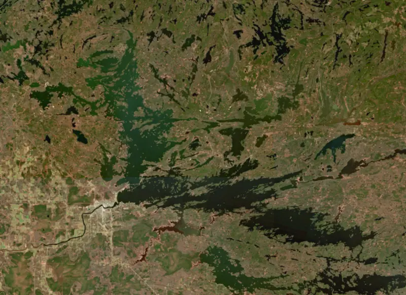
Rainy Lake is a large border lake shared by Minnesota and Ontario, with International Falls and Fort Frances facing each other across its outlet, the Rainy River. Only about a quarter of it lies in Minnesota, and most of that water is inside Voyageurs National Park. It is one of the state's best-known destination fisheries, for walleye, smallmouth bass, big northern pike and crappie.
Rainy is a natural lake, part of a chain of waters that drains north to Hudson Bay. Its shores are rocky and wooded, broken by countless islands, and its low southwestern end was once the bed of glacial Lake Agassiz. Koochiching Falls on the Rainy River used to set the lake's level. In 1909 a dam went up across the river between International Falls and Fort Frances, and it has controlled the lake ever since, raising the water, pushing the spring peak later and holding high water into fall. The International Joint Commission sets its target levels through the year. At the lake's eastern end, the timber baron E.W. Backus built rock dams near Kettle Falls in the 1910s to float logs. They shifted water levels across the border lakes and hurt wild rice beds and fish habitat. When Backus proposed a far larger power scheme in 1925, the writer Ernest Oberholtzer led the fight against it, and the Shipstead-Newton-Nolan Act of 1930 put new dams there under congressional approval. In the spring of 2022, after weeks of snow and then heavy rain on frozen ground, Rainy Lake rose to a new record about 2.75 inches above the old 1950 mark. Every gate at the outlet dam was open by May 5, and the commission concluded no dam operation could have prevented the flood.
The French called it Lac à la Pluie. The explorer La Vérendrye said the name came from a Cree phrase about constant rain, which he tied to the Rainy River. In late July 1893 a prospector camped on a small island near Black Bay Narrows found a gold-bearing quartz vein, the Little American discovery. Rainy Lake City was incorporated in March 1894 and within months had a bank, a newspaper, hotels and several saloons. Output was poor, the boom was over by 1898, and by 1901 the town was empty. Tourism came next. Wealthy businessmen built summer homes on islands reached only by boat, and the Kettle Falls Hotel, built in 1910, was the first seasonal lodging on the steamboat route.
Commercial netting on Rainy Lake goes back more than a century, and together with poor spring water levels it drove walleye down in the 1950s and again in the 1980s. Minnesota's commercial walleye fishermen accepted a buyout in 1985, and Ontario bought out walleye quotas on its side of the South Arm in 1990. Tighter rules, beginning with experimental regulations in 1994 and later protective slot limits, brought the population back, with record catches in state nets in the mid-2000s. The DNR also describes a high-quality pike fishery with real chances at fish over 30 and 40 inches, a destination smallmouth bass fishery, and a crappie population that has grown sharply over the last decade. Spiny water fleas and rusty crayfish are already established, and zebra mussel larvae have been found, so inspectors work the busiest public accesses.
Voyageurs National Park was established in 1975 and covers Minnesota's part of the lake from east Black Bay to Kettle Falls, and shoreline development there is limited. Between Ranier and the park, resorts, campgrounds and houseboat outfitters line the shore. The international line runs through the lake, and boaters who land on the Canadian side must report to Canadian customs. In winter the park plows an ice road onto the lake from the Rainy Lake Visitor Center boat launch, open to cars and light trucks at 30 mph, with routes that change each year with ice and snow.
Written by Lake by Lake from Minnesota Department of Natural Resources, National Park Service, Voyageurs National Park (Historic Themes, Mining, Winter Activities), International Joint Commission and Wikipedia. Checked November 2026.
International Falls Dam is a concrete gravity dam 29 feet high and 505 feet long on the Rainy River, completed in 1909. It belongs to International Falls Power Company and is run for hydropower, recreation, water supply and flood control. Water reaches it from 5,000 square miles of land.
From the National Inventory of Dams (U.S. Army Corps of Engineers), NID ID MN00653. Lake or reservoir: what’s the difference?
Where the level comes from: Rainy Lake Near Fort Frances (NOAA National Water Prediction Service).
| Lake | Miles | Level (ft) | vs full | 7 days |
|---|---|---|---|---|
| Crane Lake Live reading | 47 | 1115.27 | — | −0.49 |
| Upper Red Lake Live reading | 64 | 1174.04 | — | +0.11 |
| Lake Winnibigoshish At or near full pool | 91 | 1298.25 | −0.19 | −0.09 |
| Lake of the Woods Live reading | 93 | 1060.16 | — | +0.04 |
Compare Rainy Lake with Crane Lake, Upper Red Lake, Lake Winnibigoshish or Lake of the Woods: size, level, ramps and fish side by side.
Rainy Lake is at 1,106.33 feet above sea level, as of Nov 18, 2026, 11:30 PM CDT. It has dropped 0.23 ft in the past 7 days.
Rainy Lake has 22 boat ramps on our map, including Black Bay Narrows Rainy Lake Visitor Center Public Access, Boat ramp at Rainy Lake Marine, Boat ramp near Seegert's Marine, and 3 marinas. Low water can close ramps, so check today's level above and the operator before you go.
Yes. There are 7 campgrounds and RV parks within about a mile of the shore, such as Rainy Lake RV, Labelle's Birch Point Camp, Camp Narrows.
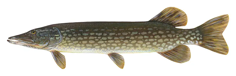
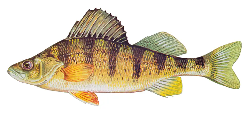
Game fish recorded in Rainy Lake include smallmouth bass, walleye, yellow perch, black crappie, northern pike, sauger. In all, 33 fish species have open records inside the lake on GBIF.
The surface of Rainy Lake was about 42°F on November 15, estimated from a satellite pass on a clear day. It is the top layer of the water, a few degrees either way; coves and shallows run warmer in the sun.
Anglers 16 and older need a Minnesota fishing license, sold online by the Minnesota Department of Natural Resources. Free fishing days: Take a Mom Fishing Weekend (Mother’s Day weekend) and Take a Kid Fishing Weekend (early June), for residents. Size and bag limits can be set lake by lake: check the current regulations.
Rainy Lake is about 164 ft deep at its deepest point, usually near the dam. Depth changes with the lake level.
In summer a white Secchi disk lowered into Rainy Lake stays visible to about 7.9 ft (the median of 95 readings, 2016–2025, by Minnesota Pollution Control Agency - Ambient Surface Water): clear water. Silt after rain lowers the reading as much as algae do. Clarity drops after storms and during algae blooms.
boating (22 boat ramps and 3 marinas), kayaks, boats & jet skis (3 rental outfits on or near the water), boat tours (1 boat tour or charter), fishing (11 game fish, 2 fishing piers and spots and 1 fishing guide), swimming (1 beach or swimming area) and hiking & walking (8 trails along the shore, the longest Cruiser Lake Trail (14 mi)), according to our map of the shore.
EPA's CyAN satellite rated cyanobacteria in Rainy Lake high on November 9. The satellite sees open water only; blooms can be patchy, so avoid water that looks like spilled paint or pea soup and keep dogs out of scum. Swimming advisories come from Minnesota health and environment agencies.
Usually around May 4, the median of 94 springs in the records of Minnesota Department of Natural Resources. In 2023 the ice went out on May 11.
Yes. 8 trails run along or near the shore, including Anderson Bay Overlook Trail (2.1 mi), Beaver Pond Hiking Trail (0.6 mi) and Hagerman Trail (6.1 mi), according to OpenStreetMap.
Rainy Lake is held back by International Falls, completed in 1909 and 29 ft high, according to the National Inventory of Dams.
From the NOAA National Water Prediction Service (Rainy Lake Near Fort Frances). Lake by Lake checks it every hour; the agency's own figure is always the reference, and provisional readings can be revised.
Lake levels are refreshed every hour. Texas and California reservoirs report once a day; most USGS and NOAA gauges report every 15 to 60 minutes.
Cookies for analytics With your OK we use Google Analytics and Microsoft Clarity to count visits and see how the site is used, so we can make it better. No advertising cookies. Privacy policy