Sun
- Sunrise
- 7:28 AM
- Sunset
- 4:52 PM
- First light
- 6:56 AM
- Last light
- 5:24 PM
Reservoir · Gallatin County, Montana
A reservoir on the Madison River in Gallatin County, Montana, held back by Hebgen Dam since 1915.

Hebgen Lake is at 6,529.88 feet above sea level — 5.02 ft below top of conservation pool, as of Nov 19, 2026, 1:45 AM MST. It has dropped 0.05 ft in the past 7 days.
2nd fullest of 13 Montana lakes today against full pool · See the ranking
A notification from this browser, once, when the level crosses the line (checked every hour). No account and no email. On an iPhone, add Lake by Lake to your home screen first (Share → Add to Home Screen) and open it from there. Or follow the lake in a feed reader: RSS feed.
Hebgen Lake is down 0.05 ft over the last 7 days, at 6,529.88 ft today.
Daily values from the U.S. Geological Survey.
Hebgen Lake has held steady over the last 30 days (within 0.05 ft).
Daily values from the U.S. Geological Survey.
Over the past 12 months, Hebgen Lake ranged from 6,528.76 ft (Mar 14, 2026) to 6,534.79 ft (Jun 11, 2026), a swing of 6.0 ft. Today's level is near the bottom of that range. It is 0.48 ft higher than on this date last year.
Daily values from the U.S. Geological Survey. Why lake levels rise and fall
Solunar periods for Hebgen Lake, local time. How they work
Not detected · as of Nov 9, 2026
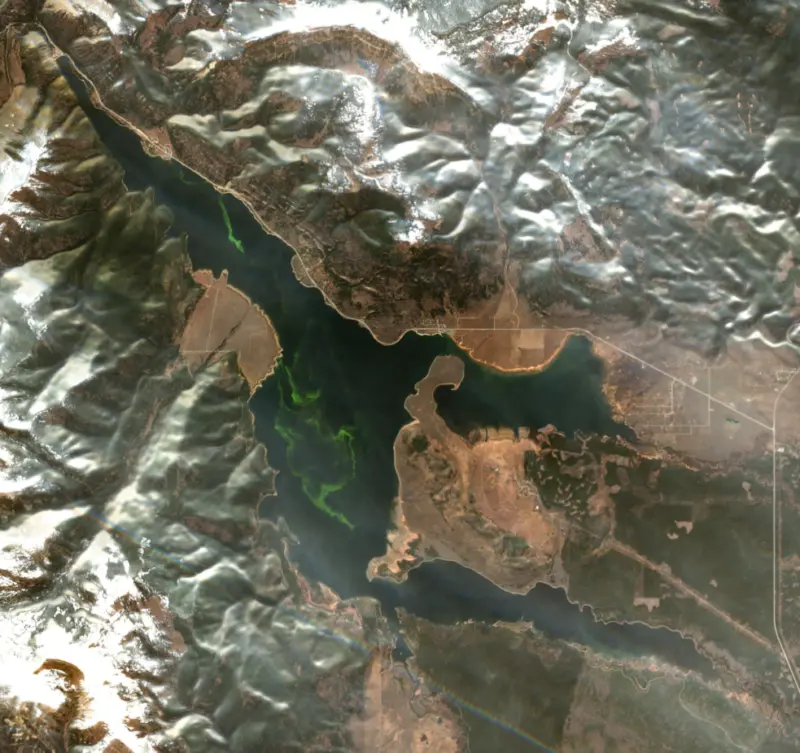
The satellite found no cyanobacteria at the surface.
Week of Aug 16Week of Nov 1
Each bar is one week, colored by the worst reading of that week.
From the U.S. EPA's Cyanobacteria Assessment Network (CyAN), which reads the color of lakes from the Sentinel-3 satellites; it sees open water only, not coves or the shoreline. Blooms can be patchy: what you see on the water matters more. Swimming closures and health advisories come from Montana health and environment agencies. How to read it
Surface water temperature
46°F on Nov 3, 2026
72°F · Jul 2246°F · Nov 3
27°F cooler than on Jul 22, 2026.
Estimated from Landsat 8/9 (USGS) passes on clear days: the top layer of the water, a few degrees either way. Coves and the shallows can be warmer.
Hebgen Lake water temperature: trend, swimming and the fish →
On or near the shore of Hebgen Lake: 5 boat ramps, 1 marina, 8 campgrounds and 1 trail. The lake has about 66 miles of shoreline, counting its islands.
Tap an icon for details; use two fingers (or Ctrl + scroll) to move the map. Tap a dot for details. Map and lake outline © OpenStreetMap contributors. Places from OpenStreetMap, Overture Maps and Recreation.gov. Not for navigation.
What you’ll find on the shore
← AllBoating 6
← AllCamping 8
← AllLodging 5
← AllTrails 1
← AllParks 1
← AllDining 1
These invasive plants and animals have been recorded in Hebgen Lake: clean, drain and dry everything before you go to another lake.
Montana: Stop at every open watercraft inspection station, and have any boat coming from out of state inspected before it touches Montana water (out-of-state wake and ballast boats must also be decontaminated). When you pull out, remove all plants and drain bilges, livewells, ballast tanks, motors and bait buckets before leaving the ramp area. Required: Vessel AIS Prevention Pass (out-of-state boats) ($30 a year for out-of-state motorboats, $10 for nonmotorized). State rules
Records: USGS Nonindigenous Aquatic Species database. A species not listed may still be present.
Species with open-licensed records inside Hebgen Lake's outline, from GBIF.org (surveys, museum collections and angler reports). A record shows a fish was found here, not how many there are now.
Cool water: near the surface in spring and fall, deep in summer.
Low light and cold water; the inflows in fall.
Deep and cold most of the year; shallow reefs in fall and right after ice-out.
Water temperature sets off each spawn; the bars show the usual months at this latitude and elevation, and move with a warm or cold spring. The water is about 46°F now.
Hebgen Lake is the storage reservoir at the head of the Madison River in southwest Montana, a few miles northwest of West Yellowstone and the west entrance to Yellowstone National Park. It is known for big wild trout that rise on calm summer mornings, and for the night in 1959 when the ground broke beneath it.
The dam was the idea of Max Hebgen, who was known nationally in electric development and helped build several of Montana's early hydroelectric dams. He saw a storage reservoir in the Madison Canyon as a way to steady the river for the power plants downstream. Montana Power Company began work in 1910 and finished in 1915. Hebgen had heart disease and died that year at 45, before the dam was done. Hebgen Dam makes no electricity of its own. It catches spring runoff, mostly from mid-May into early June, and lets it out through the year to the Madison and Rainbow dams downstream and to irrigators. NorthWestern Energy has owned it since 2014. Those steady, cool releases are a large part of why the upper Madison has a national reputation as a trout river, even in hot, dry summers.
At 11:37 p.m. on August 17, 1959, a magnitude 7.3 earthquake struck a few miles from the dam. The ground split along the Hebgen Lake and Red Canyon faults, with up to about 18 to 20 feet of offset at the surface, and the whole basin tilted to the north. The lake sloshed from end to end in waves that ran over the top of the dam several times. A stretch of Highway 287 dropped into the water along the fault, and the Hillgard fishing lodge fell into a fissure and sank. Ennis was evacuated in case the dam failed. It held, and repairs were finished in 1960.
Downstream, the side of the canyon collapsed. About 50 million cubic yards of rock and mud slid across the Madison River and partly buried the Rock Creek campground, where many Yellowstone visitors were sleeping. The quake killed 28 people, most of them in the slide. The debris dammed the river and created Earthquake Lake, which now sits about 3 miles below Hebgen Dam. The fault scarps from that night can still be seen today.
The Madison River reaches the lake after crossing a high, forested plateau out of Yellowstone. The South Fork of the Madison feeds the long Madison Arm on the southeast side, while Duck, Grayling and Red Canyon creeks run into the Grayling Arm on the east, and Watkins Creek comes in from the west. Both arms grow thick beds of aquatic weeds, and both are known for their surface-feeding trout. Rainbow Point Campground, on Rainbow Bay about 10 miles north of West Yellowstone, sits in lodgepole pine with its own boat ramp. Bears use the area, so food has to be stored in approved containers.
For decades the rainbow trout here were propped up with at least 100,000 hatchery fish a year. Then Montana Fish, Wildlife & Parks found that most of the rainbows were actually wild, born in the creeks that feed the lake, and stocking ended in 2016. The rainbows have since held their numbers, and the lake is managed as a wild fishery for rainbow and brown trout, with mountain whitefish native. The state has also put Arctic grayling eggs and fry into the South Fork and the lake, hoping to bring back a fish that once lived in the Madison. The lake's signature is the gulper, a trout cruising near the surface and rising again and again to midges early in the season and to Callibaetis mayflies in late summer. The best of it comes early in the day and again in the evening, once the wind lies down.
Written by Lake by Lake from NorthWestern Energy, U.S. Geological Survey, Yellowstone Volcano Observatory, University of Montana, Montana Fish, Wildlife & Parks, Recreation.gov (USDA Forest Service) and KSL. Checked November 2026.
Hebgen Dam is an earthfill dam 88 feet high and 721 feet long on the Madison River, completed in 1915. It belongs to NorthWestern Energy and is run for hydropower, recreation, water supply and flood control. At its normal level the reservoir holds 386,000 acre-ft, drained from 905 square miles of land.
From the National Inventory of Dams (U.S. Army Corps of Engineers), NID ID MT00134. Lake or reservoir: what’s the difference?
Where the level comes from: Hebgen Lake near West Yellowstone, MT (U.S. Geological Survey, used on this page) and Madison River at Hebgen Dam near West Yellowstone (NOAA National Water Prediction Service).
| Lake | Miles | Level (ft) | vs full | 7 days |
|---|---|---|---|---|
| Island Park Reservoir Well below full | 31 | 6287.28 | −15.72 | +1.00 |
| Lima Reservoir Below full | 53 | 6568.53 | −14.27 | +0.28 |
| Grassy Lake Reservoir Well below full | 57 | 7181.04 | −28.96 | +0.25 |
| Clark Canyon Reservoir Well below full | 75 | 5520.80 | −25.30 | +0.80 |
| Jackson Lake Well below full | 79 | 6734.77 | −33.23 | +0.04 |
| Ririe Reservoir Well below full | 91 | 5066.07 | −39.93 | +0.45 |
Compare Hebgen Lake with Island Park Reservoir, Lima Reservoir, Grassy Lake Reservoir or Clark Canyon Reservoir: size, level, ramps and fish side by side.
Hebgen Lake is at 6,529.88 feet above sea level — 5.02 ft below top of conservation pool, as of Nov 19, 2026, 1:45 AM MST. It has dropped 0.05 ft in the past 7 days.
Hebgen Lake's top of conservation pool is 6,534.90 ft, according to U.S. Army Corps of Engineers. Today the lake is 5.02 ft below that mark.
Today's level is 0.02 ft below the median for this date (6,529.90 ft), from the gauge’s long-term daily record.
Hebgen Lake has 5 boat ramps on our map, including Boat ramp at Yellowstone Holiday RV Campground, Lonesomehurst Boat Launch, Rainbow Point Boat Launch, and 1 marina. Low water can close ramps, so check today's level above and the operator before you go.
Yes. There are 8 campgrounds and RV parks within about a mile of the shore, such as Red Canyon Creek, Yellowstone Holiday RV Campground, Spring Creek Campground.
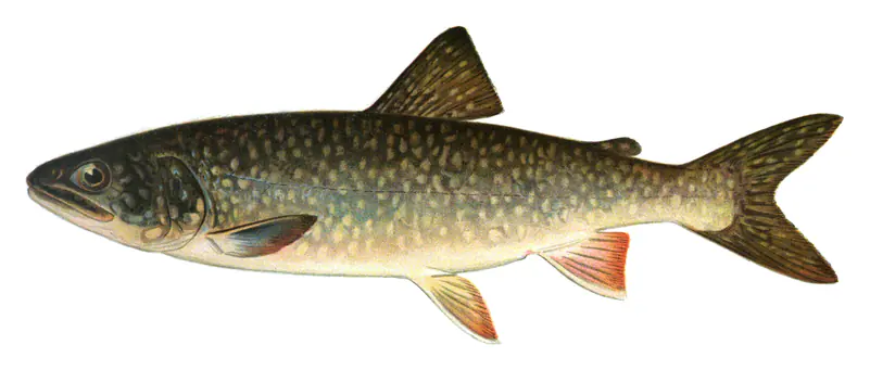
Game fish recorded in Hebgen Lake include rainbow trout, brown trout, lake trout. In all, 7 fish species have open records inside the lake on GBIF.
The surface of Hebgen Lake was about 46°F on November 3, estimated from a satellite pass on a clear day. It is the top layer of the water, a few degrees either way; coves and shallows run warmer in the sun.
Anglers 12 and older need a Montana fishing license, sold online by the Montana Fish, Wildlife & Parks. Free fishing days: Mother's Day weekend and Father's Day weekend. Size and bag limits can be set lake by lake: check the current regulations.
Hebgen Lake averages about 30 ft deep. Depth changes with the lake level.
Yes: bathymetric map from the Montana Fish, Wildlife & Parks (2017). It is linked in the lake facts on this page. Depths on a map are measured at a reference level: subtract how far the lake is below it today.
boating (5 boat ramps and 1 marina), fishing (3 game fish), hiking & walking (1 trail along the shore, the longest Kirkwood Trail (6.8 mi)), camping (8 campgrounds, 3 bookable on Recreation.gov), cabins & lodging (5 places to stay close to the water) and parks & picnics (1 park on the shore), according to our map of the shore.
EPA's CyAN satellite rated cyanobacteria in Hebgen Lake not detected on November 9. The satellite sees open water only; blooms can be patchy, so avoid water that looks like spilled paint or pea soup and keep dogs out of scum. Swimming advisories come from Montana health and environment agencies.
Yes. A trail runs along or near the shore, including Kirkwood Trail (6.8 mi), according to OpenStreetMap.
Hebgen Lake is held back by Hebgen Dam, completed in 1915 and 88 ft high, according to the National Inventory of Dams.
From the U.S. Geological Survey (Hebgen Lake near West Yellowstone, MT). Lake by Lake checks it every hour; the agency's own figure is always the reference, and provisional readings can be revised.
Lake levels are refreshed every hour. Texas and California reservoirs report once a day; most USGS and NOAA gauges report every 15 to 60 minutes.
Cookies for analytics With your OK we use Google Analytics and Microsoft Clarity to count visits and see how the site is used, so we can make it better. No advertising cookies. Privacy policy