Sun
- Sunrise
- 7:19 AM
- Sunset
- 4:54 PM
- First light
- 6:48 AM
- Last light
- 5:25 PM
Lake · Teton County, Wyoming
A lake fed by the Snake River in Teton County, Wyoming, held back by Jackson Lake Dam since 1911.

Jackson Lake is at 6,734.71 feet above sea level — 33.29 ft below normal pool, as of Nov 17, 2026, 7:45 PM MST. The level has held steady over the past week.
5th lowest of 14 Wyoming lakes today against full pool · See the ranking
Record low 6,730.01 ft (1919), record high 6,770.06 ft (1997) · Level history since 1910
Which boat ramps are usable at today’s level →
A notification from this browser, once, when the level crosses the line (checked every hour). No account and no email. On an iPhone, add Lake by Lake to your home screen first (Share → Add to Home Screen) and open it from there. Or follow the lake in a feed reader: RSS feed.
Jackson Lake has held steady over the last 7 days (within 0.05 ft).
Daily values from the U.S. Geological Survey.
Jackson Lake is up 0.53 ft over the last 30 days, at 6,734.71 ft today.
Daily values from the U.S. Geological Survey.
Over the past 12 months, Jackson Lake ranged from 6,733.73 ft (Oct 2, 2026) to 6,767.92 ft (May 20, 2026), a swing of 34.2 ft. Today's level is near the bottom of that range. It is 22.44 ft lower than on this date last year.
Daily values from the U.S. Geological Survey. Why lake levels rise and fall
In the U.S. Army Corps of Engineers record, which starts in 1910, the lowest level was 6,730.01 ft on September 2, 1919 and the highest 6,770.06 ft on June 12, 1997. Today’s 6,734.71 ft is 4.7 ft above the record low and 35.4 ft below the record high.
Jackson Lake level history: every year since 1910, the lowest and highest years →
Solunar periods for Jackson Lake, local time. How they work
Not detected · as of Nov 9, 2026
The satellite found no cyanobacteria at the surface.
Week of Aug 9Week of Nov 1
Each bar is one week, colored by the worst reading of that week.
From the U.S. EPA's Cyanobacteria Assessment Network (CyAN), which reads the color of lakes from the Sentinel-3 satellites; it sees open water only, not coves or the shoreline. Blooms can be patchy: what you see on the water matters more. Swimming closures and health advisories come from Wyoming health and environment agencies. How to read it
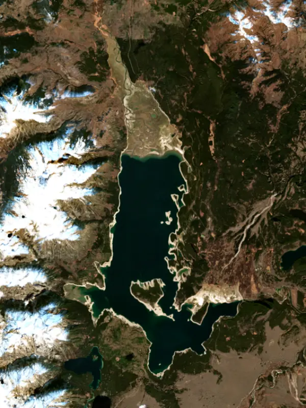
Surface water temperature
43°F on Nov 12, 2026
72°F · Jul 2343°F · Nov 12
29°F cooler than on Jul 23, 2026.
Estimated from Landsat 8/9 (USGS) passes on clear days: the top layer of the water, a few degrees either way. Coves and the shallows can be warmer.
Jackson Lake water temperature: trend, swimming and the fish →
On or near the shore of Jackson Lake: 4 boat ramps, 3 marinas, 8 campgrounds, 1 beach and 9 trails. The lake has about 90 miles of shoreline, counting its islands.
Tap an icon for details; use two fingers (or Ctrl + scroll) to move the map. Tap a dot for details. Map and lake outline © OpenStreetMap contributors. Places from OpenStreetMap, Overture Maps and Recreation.gov. Not for navigation.
What you’ll find on the shore
← AllBoating 7
Which boat ramps are usable at today’s level →
← AllBeaches 1
← AllCamping 8
← AllLodging 2
← AllTrails 9
← AllParks 15
← AllDining 2
No aquatic invasive species are on record for Jackson Lake in the USGS database. Keep it that way: clean, drain and dry your boat between lakes.
Wyoming: Boats arriving by land from March 1 to November 30 (and in winter if recently used on infested or suspect waters) must be inspected before launching. On leaving any water, remove plants and drain all water, keep drain plugs out while trailering, and dry boats from infested waters 30 days or have them decontaminated. Required: Wyoming AIS decal. State rules
Records: USGS Nonindigenous Aquatic Species database. A species not listed may still be present.
Species with open-licensed records inside Jackson Lake's outline, from GBIF.org (surveys, museum collections and angler reports). A record shows a fish was found here, not how many there are now.
Cool water: near the surface in spring and fall, deep in summer.
Low light and cold water; the inflows in fall.
Deep and cold most of the year; shallow reefs in fall and right after ice-out.
Inlets and shorelines in spring; deeper as the lake warms.
Cold, clear water near springs and inlets.
Water temperature sets off each spawn; the bars show the usual months at this latitude and elevation, and move with a warm or cold spring. The water is about 43°F now.
Jackson Lake is the largest lake in Grand Teton National Park, a natural glacial lake at the foot of the Teton Range in northwestern Wyoming whose top layer is held back by a federal dam. Mount Moran and the northern Tetons rise across the water from its eastern shore.
Glaciers off the Tetons and the high country to the north scoured this basin. Native American families spent summers in northern Jackson Hole for thousands of years, and the oldest artifacts found in the valley, the W.C. Lawrence collection, come from the north end of the lake. One of their seasonal camps, the Lawrence Site, lay near Arrowhead Point. A map drawn by William Clark around 1809 shows a lake of the same outline labeled Lake Biddle, though Lewis and Clark never came this way. The name that stuck honors David E. Jackson, a fur trapper who worked alongside Jedediah Smith and William Sublette in the 1820s and whose name also went to the valley and the town.
The Bureau of Reclamation dammed the outlet to store water for its Minidoka Project, which irrigates farmland along the Snake River in Idaho. A temporary crib dam was finished in 1907, part of it failed in 1910, and in 1911 Reclamation replaced it with a concrete gravity dam flanked by earth embankments. The dam was raised in 1916. The higher water flooded the forest along the shore, and during the Great Depression Civilian Conservation Corps crews cleared the dead timber and burned the slash. In the 1980s engineers drained the reservoir and strengthened the dam to withstand a large earthquake, work Reclamation completed in 1989. The Park Service describes the lake as about 400 feet deep on its own, with the top 39 feet used as reservoir storage. Because that storage is drawn for irrigation downstream, the lake can sit far below full in dry years, and Colter Bay can become too shallow for motorboats or dry up altogether.
The Snake River enters the lake from the north and leaves through the dam on the east side, and anglers fish the river just below it. The highway and nearly all the boating are on the eastern shore. Leeks Marina, a few miles north of Colter Bay, began in the late 1800s as a hunting and fishing camp run by Stephen Leek, a rancher and conservationist, and several small islands lie just off it. Colter Bay is named for John Colter, the trapper who left the Lewis and Clark Expedition and crossed this region in the winter of 1807-1808. It has a marina with boat rentals, a swim beach, a visitor center whose back deck looks across to Mount Moran, the easy Lakeshore Trail and a longer walk out to Hermitage Point. Lizard Creek Campground sits near the north end, and the AMK Ranch there houses a university research station. The western shore has no roads, only trails and a few primitive campsites.
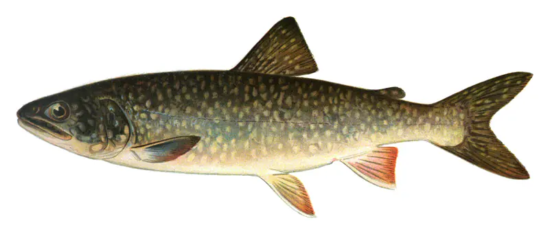
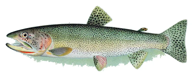
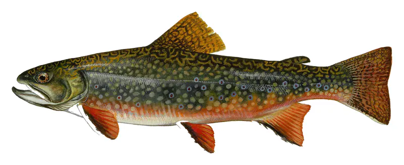
Jackson Lake holds lake trout, brown trout and cutthroat trout, fished from shore and from boats, and a Wyoming fishing license is required inside the park. Lake trout were stocked here to build a population, and for more than 70 years the lake closed to fishing every October. Wyoming Game and Fish judged the lake trout fully established and lifted the closure starting in October 2026. Boats need a park permit, a Wyoming aquatic invasive species decal and an inspection before launching, and in 2025 a check-station technician found quagga mussels on a boat arriving from Utah.
Written by Lake by Lake from Bureau of Reclamation, National Park Service, Grand Teton National Park (Jackson Lake Dam Overlook, Colter Bay, Leeks Marina and the North), National Park Service (via NPS History) and Wyoming Public Media. Checked November 2026.
Jackson Lake Dam is a concrete dam 68 feet high and 222 feet long, completed in 1911. It belongs to the Bureau of Reclamation and is run for flood control, irrigation, fish and wildlife and recreation. At its normal level the lake holds 847,000 acre-ft, drained from 806 square miles of land.
From the National Inventory of Dams (U.S. Army Corps of Engineers), NID ID WY01385. Lake or reservoir: what’s the difference?
Where the level comes from: Jackson Lake near Moran, WY (U.S. Geological Survey, used on this page) and Jackson Lake and Jackson Lake Dam (JCK) (Bureau of Reclamation (RISE)).
| Lake | Miles | Level (ft) | vs full | 7 days |
|---|---|---|---|---|
| Grassy Lake Reservoir Well below full | 22 | 7180.97 | −29.03 | +0.16 |
| Palisades Reservoir Well below full | 48 | 5527.95 | −91.05 | +3.07 |
| Island Park Reservoir Well below full | 56 | 6287.28 | −15.72 | +1.00 |
| Ririe Reservoir Well below full | 61 | 5066.03 | −39.97 | +0.61 |
| Hebgen Lake Slightly below full | 79 | 6529.96 | −4.94 | +0.01 |
| Buffalo Bill Reservoir Well below full | 83 | 5359.62 | −33.88 | — |
Compare Jackson Lake with Grassy Lake Reservoir, Palisades Reservoir, Island Park Reservoir or Ririe Reservoir: size, level, ramps and fish side by side.
Jackson Lake is at 6,734.71 feet above sea level — 33.29 ft below normal pool, as of Nov 17, 2026, 7:45 PM MST. The level has held steady over the past week.
Jackson Lake's normal pool is 6,768.00 ft, according to U.S. Army Corps of Engineers. Today the lake is 33.29 ft below that mark.
Today's level is 23.57 ft below the median for this date (6,758.28 ft), from the gauge’s long-term daily record.
6,730.01 ft, on September 2, 1919, in the U.S. Army Corps of Engineers record, which starts in 1910. Today the lake is 4.7 ft above that.
6,770.06 ft, on June 12, 1997, in the U.S. Army Corps of Engineers record since 1910. That is 2.1 ft above normal pool.
Jackson Lake has 4 boat ramps on our map, including Colter Bay, Leek's Marina, Signal Mountain, and 3 marinas. Low water can close ramps, so check today's level above and the operator before you go.
Yes. There are 8 campgrounds and RV parks within about a mile of the shore, such as Colter Bay Marina End Ties Campground, Signal Mountain Campground, Lizard Creek Campground.
Game fish recorded in Jackson Lake include lake trout, brown trout, cutthroat trout, brook trout, rainbow trout, mountain whitefish. In all, 12 fish species have open records inside the lake on GBIF.
The surface of Jackson Lake was about 43°F on November 12, estimated from a satellite pass on a clear day. It is the top layer of the water, a few degrees either way; coves and shallows run warmer in the sun.
Anglers 14 and older need a Wyoming fishing license, sold online by the Wyoming Game and Fish Department. Free fishing days: First Saturday of National Boating and Fishing Week. Size and bag limits can be set lake by lake: check the current regulations.
Jackson Lake is about 440 ft deep at its deepest point. Depth changes with the lake level.
In summer a white Secchi disk lowered into Jackson Lake stays visible to about 15.9 ft (the median of 18 readings, 2017–2024, by Bureau of Reclamation and EPA National Aquatic Resources Survey (NARS)): very clear water. Silt after rain lowers the reading as much as algae do. Clarity drops after storms and during algae blooms.
boating (4 boat ramps and 3 marinas, with the ramps usable at today’s level), fishing (6 game fish), swimming (1 beach or swimming area), hiking & walking (9 trails along the shore, the longest Hermitage Point Trail (11 mi)), camping (8 campgrounds, 6 bookable on Recreation.gov) and cabins & lodging (2 places to stay close to the water), according to our map of the shore.
EPA's CyAN satellite rated cyanobacteria in Jackson Lake not detected on November 9. The satellite sees open water only; blooms can be patchy, so avoid water that looks like spilled paint or pea soup and keep dogs out of scum. Swimming advisories come from Wyoming health and environment agencies.
Yes. 9 trails run along or near the shore, including Lakeshore Trail (2.7 mi), South Landing Trail (1.9 mi) and Hermitage Point Trail (11 mi), according to OpenStreetMap.
Jackson Lake is held back by Jackson Lake Dam, completed in 1911 and 68 ft high, according to the National Inventory of Dams.
From the U.S. Geological Survey (Jackson Lake near Moran, WY). Lake by Lake checks it every hour; the agency's own figure is always the reference, and provisional readings can be revised.
Lake levels are refreshed every hour. Texas and California reservoirs report once a day; most USGS and NOAA gauges report every 15 to 60 minutes.