Sun
- Sunrise
- 6:45 AM
- Sunset
- 4:17 PM
- First light
- 6:13 AM
- Last light
- 4:48 PM
Lake · Belknap County, New Hampshire
A lake fed by the Gunstock River in Belknap County, New Hampshire.

Lake Winnipesaukee is at 502.19 feet above sea level — 2.13 ft below full lake, as of Nov 18, 2026, 4:00 PM EST. It has dropped 0.12 ft in the past 7 days.
A notification from this browser, once, when the level crosses the line (checked every hour). No account and no email. On an iPhone, add Lake by Lake to your home screen first (Share → Add to Home Screen) and open it from there. Or follow the lake in a feed reader: RSS feed.
Lake Winnipesaukee is down 0.31 ft over the last 30 days, at 502.19 ft today.
Daily values from the New Hampshire Department of Environmental Services.
Over the past 12 months, Lake Winnipesaukee ranged from 502.07 ft (Nov 24, 2025) to 504.96 ft (May 18, 2026), a swing of 2.9 ft. Today's level is near the bottom of that range. It is 0.07 ft higher than on this date last year.
Daily values from the New Hampshire Department of Environmental Services. Why lake levels rise and fall
Solunar periods for Lake Winnipesaukee, local time. How they work
Not detected · as of Nov 9, 2026
The satellite found no cyanobacteria at the surface.
Week of Aug 16Week of Nov 1
Each bar is one week, colored by the worst reading of that week.
From the U.S. EPA's Cyanobacteria Assessment Network (CyAN), which reads the color of lakes from the Sentinel-3 satellites; it sees open water only, not coves or the shoreline. Blooms can be patchy: what you see on the water matters more. Swimming closures and health advisories come from New Hampshire health and environment agencies. How to read it
The ice usually goes out of Lake Winnipesaukee around Apr 20 (median of 133 springs on record). The record we have ends in 2019, when the ice went out on Apr 24. The earliest on record was Mar 18, 2016; the latest, May 12, 1888.
Each dot is one of the last 30 springs on record; the dashed line is the median of all of them; the orange dot is 2019.
Source: Sharma et al. (2022), lake ice phenology records for 78 lakes. Ice is never safe everywhere: check local conditions before going out on it. About ice-out
Surface water temperature
50°F on Nov 16, 2026
74°F · Jul 2550°F · Nov 16
25°F cooler than on Jul 25, 2026.
Estimated from MODIS Aqua (NASA) passes on clear days: the top layer of the water, a few degrees either way. Coves and the shallows can be warmer.
Lake Winnipesaukee water temperature: trend, swimming and the fish →
On or near the shore of Lake Winnipesaukee: 13 boat ramps, 25 marinas, 10 rental outfits, 29 campgrounds, 29 beaches and 19 trails. The lake has about 269 miles of shoreline, counting its islands.
Tap an icon for details; use two fingers (or Ctrl + scroll) to move the map. Tap a dot for details. Map and lake outline © OpenStreetMap contributors. Places from OpenStreetMap, Overture Maps and Recreation.gov. Not for navigation.
What you’ll find on the shore
← AllBoating 38
← AllRentals & tours 13
← AllFishing spots 3
← AllBeaches 29
← AllCamping 29
← AllLodging 24+
← AllTrails 19
← AllParks 14
← AllDining 24+
These invasive plants and animals have been recorded in Lake Winnipesaukee: clean, drain and dry everything before you go to another lake.
New Hampshire: It is illegal to carry aquatic plants on a boat, trailer or gear; drain all water before leaving a lake and keep drain plugs out or open while trailering (fines $50 to $200). State rules
Records: USGS Nonindigenous Aquatic Species database. A species not listed may still be present.
Species with open-licensed records inside Lake Winnipesaukee's outline, from GBIF.org (surveys, museum collections and angler reports). A record shows a fish was found here, not how many there are now.
Shallow, protected flats in spring; docks, grass and deep edges in summer heat.
Rocky points, gravel and current breaks; deeper rock piles in summer.
Cool water: near the surface in spring and fall, deep in summer.
Deep and cold most of the year; shallow reefs in fall and right after ice-out.
Schools near the bottom; a favorite through the ice.
Water temperature sets off each spawn; the bars show the usual months at this latitude and elevation, and move with a warm or cold spring. The water is about 50°F now.
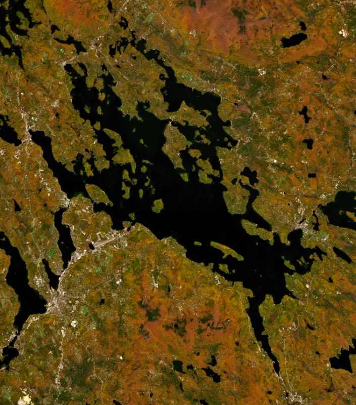
Lake Winnipesaukee is the largest lake in New Hampshire and the third largest in New England, a glacial lake scattered with more than 250 islands at the heart of the state's Lakes Region. It has drawn summer visitors from Boston and New York for well over a century.
The name comes from the Abenaki word Wiwninbesoki, usually read as the land around the lake. Older, more poetic translations such as smile of the Great Spirit also turn up. The Winnipesaukee people, a band of the Pennacook, lived and fished at a village called Acquadocton where the lake drains out, and the fish weirs that English settlers saw there gave the spot its name, The Weirs.
In 1652 surveyors for the Massachusetts Bay Colony went looking for the head of the Merrimack River, because the colony's charter set its northern line 3 miles north of the river. At the Weirs channel they carved Governor John Endecott's name and their own initials into a boulder, believing they had found the head of the river. They had not, since the Pemigewasset rises much farther north. Endicott Rock was later lost, turned up again when the channel was dredged in the 19th century, and is now a small state historic site.
Winnipesaukee is a glacial lake. It once drained southeast through Alton Bay, until glacial debris blocked that route and turned the outflow west through Paugus Bay. The Gunstock, Merrymeeting, Melvin and Red Hill rivers feed it. Going clockwise from the south, the shore towns are Alton, Gilford, Laconia, Meredith, Center Harbor, Moultonborough, Tuftonboro and Wolfeboro, which calls itself the oldest summer resort in America. Long Island is the largest island, followed by Bear and Rattlesnake, and six islands are linked to the mainland by bridges.
Two boats are part of lake life. The MS Mount Washington took over in 1940 from an 1872 paddle steamer of the same name that burned in 1939. The Sophie C. is one of only two floating post offices in the country and carries mail to island residents in summer, keeping up a service that started in 1892. Each spring the lake's ice-out is declared on the day the Mount Washington could reach all of its ports. Most years that falls in April, and the earliest on record came on March 17, 2024.
Winnipesaukee is natural, but its level is set at the Lakeport Dam in Laconia, which the Dam Bureau of the New Hampshire Department of Environmental Services operates. The aim is to have the lake full by about June 1 and to keep the seasonal highs and lows within about two feet. Unlike most big New Hampshire lakes, it is not drawn down in the fall. Around Columbus Day the outflow is cut sharply for up to two weeks so dams and power plants downstream can be maintained. Five hydroelectric plants on the Winnipesaukee River hold 19th-century rights to a minimum flow, and the river runs on through downtown Laconia and Lake Winnisquam to Franklin, where it joins the Pemigewasset to form the Merrimack. A lake this size reacts slowly. Opening the gates takes days to show at Wolfeboro, and summer heat alone can drop the level by up to a foot by early fall.
The state manages Winnipesaukee for landlocked salmon and lake trout. Ice fishing season on the lake closes at the end of March, open-water season begins on April 1, and landlocked salmon may never be taken through the ice. Weirs Beach in Laconia is the largest and busiest public beach. Ellacoya State Park in Gilford has a 600-foot sand beach on the southwest shore with views across the water to the Sandwich and Ossipee mountains.
Written by Lake by Lake from New Hampshire Public Radio (Maintaining Level of Winnipesaukee a Delicate Balance for Boaters, Environment, The Lakeport Dam, Standing at New Hampshire's Water Crossroads), New Hampshire Fish and Game Department, New Hampshire State Parks and Wikipedia (Lake Winnipesaukee, Endicott Rock). Checked November 2026.
Where the level comes from: Lake Winnipesaukee (New Hampshire Department of Environmental Services).
| Lake | Miles | Level (ft) | vs full | 7 days |
|---|---|---|---|---|
| Lake Winnisquam Live reading | 8 | 480.88 | — | +0.61 |
| Squam Lake Live reading | 11 | 560.56 | — | −0.16 |
| Newfound Lake Live reading | 14 | 585.70 | — | −0.09 |
| Ossipee Lake Live reading | 20 | 404.22 | — | 0.00 |
| Great East Lake Live reading | 24 | 571.15 | — | −0.26 |
| Lake Sunapee Live reading | 35 | 1091.95 | — | −0.01 |
Compare Lake Winnipesaukee with Lake Winnisquam, Squam Lake, Newfound Lake or Ossipee Lake: size, level, ramps and fish side by side.
Lake Winnipesaukee is about 43 mi from Manchester, NH. See all the lakes near each city.
Lake Winnipesaukee is at 502.19 feet above sea level — 2.13 ft below full lake, as of Nov 18, 2026, 4:00 PM EST. It has dropped 0.12 ft in the past 7 days.
Lake Winnipesaukee's full lake is 504.32 ft, according to New Hampshire Department of Environmental Services. Today the lake is 2.13 ft below that mark.
Lake Winnipesaukee has 13 boat ramps on our map, including Boat ramp at Alton Town Beach, Boat ramp at Center Harbor Town Beach, Boat ramp at Gilford Yacht Club, and 25 marinas. Low water can close ramps, so check today's level above and the operator before you go.
Yes. There are 29 campgrounds and RV parks within about a mile of the shore, such as Long Island Bridge Campground, North Woods YMCA Camp for Boys, Village Beach Club.
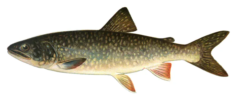
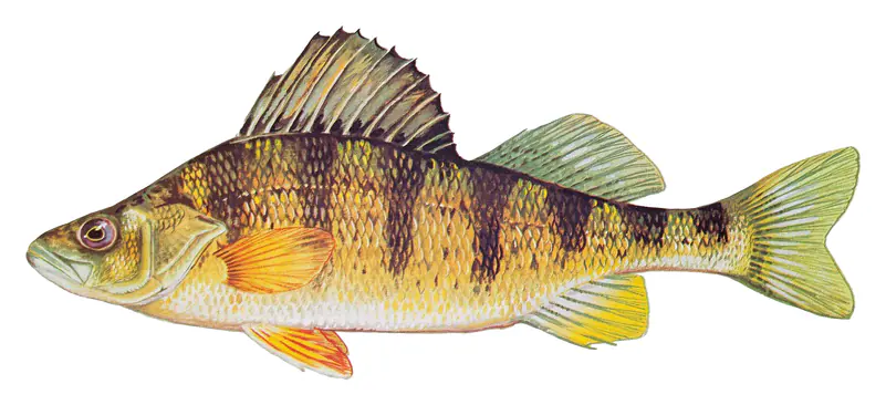
Game fish recorded in Lake Winnipesaukee include rainbow trout, yellow perch, smallmouth bass, largemouth bass, lake trout, bluegill. In all, 13 fish species have open records inside the lake on GBIF.
The surface of Lake Winnipesaukee was about 50°F on November 16, estimated from a satellite pass on a clear day. It is the top layer of the water, a few degrees either way; coves and shallows run warmer in the sun.
Anglers 16 and older need a New Hampshire fishing license, sold online by the New Hampshire Fish and Game Department. Free fishing days: First Saturday in June and third Saturday in January. Size and bag limits can be set lake by lake: check the current regulations.
Lake Winnipesaukee is about 180 ft deep at its deepest point. Depth changes with the lake level.
boating (13 boat ramps and 25 marinas), kayaks, boats & jet skis (10 rental outfits on or near the water), boat tours (3 boat tours and charters), fishing (10 game fish), swimming (29 beaches and swimming areas) and hiking & walking (19 trails along the shore, the longest Belknap Range Trail (10 mi)), according to our map of the shore.
EPA's CyAN satellite rated cyanobacteria in Lake Winnipesaukee not detected on November 9. The satellite sees open water only; blooms can be patchy, so avoid water that looks like spilled paint or pea soup and keep dogs out of scum. Swimming advisories come from New Hampshire health and environment agencies.
Usually around April 20, the median of 133 springs in the records of Sharma et al. (2022), lake ice phenology records for 78 lakes.
Yes. 19 trails run along or near the shore, including Island Loop Trail (0.5 mi), Nature Trail (0.7 mi) and Main Loop Trail (yellow) (0.6 mi), according to OpenStreetMap.
From the New Hampshire Department of Environmental Services (Lake Winnipesaukee). Lake by Lake checks it every hour; the agency's own figure is always the reference, and provisional readings can be revised.
Lake levels are refreshed every hour. Texas and California reservoirs report once a day; most USGS and NOAA gauges report every 15 to 60 minutes.
Cookies for analytics With your OK we use Google Analytics and Microsoft Clarity to count visits and see how the site is used, so we can make it better. No advertising cookies. Privacy policy