Sun
- Sunrise
- 6:46 AM
- Sunset
- 4:18 PM
- First light
- 6:14 AM
- Last light
- 4:49 PM
Lake · Grafton County, New Hampshire
A lake fed by the Fowler River in Grafton County, New Hampshire, held back by Newfound Lake Dam since 1771.

Newfound Lake is at 585.70 feet above sea level, as of Nov 18, 2026, 4:00 PM EST. It has dropped 0.09 ft in the past 7 days.
A notification from this browser, once, when the level crosses the line (checked every hour). No account and no email. On an iPhone, add Lake by Lake to your home screen first (Share → Add to Home Screen) and open it from there. Or follow the lake in a feed reader: RSS feed.
Newfound Lake is down 0.77 ft over the last 30 days, at 585.70 ft today.
Daily values from the New Hampshire Department of Environmental Services.
Over the past 12 months, Newfound Lake ranged from 585.30 ft (Mar 2, 2026) to 588.83 ft (May 16, 2026), a swing of 3.5 ft. Today's level is near the bottom of that range. It is 0.82 ft lower than on this date last year.
Daily values from the New Hampshire Department of Environmental Services. Why lake levels rise and fall
Solunar periods for Newfound Lake, local time. How they work
Not detected · as of Nov 9, 2026
The satellite found no cyanobacteria at the surface.
Week of Aug 16Week of Nov 1
Each bar is one week, colored by the worst reading of that week.
From the U.S. EPA's Cyanobacteria Assessment Network (CyAN), which reads the color of lakes from the Sentinel-3 satellites; it sees open water only, not coves or the shoreline. Blooms can be patchy: what you see on the water matters more. Swimming closures and health advisories come from New Hampshire health and environment agencies. How to read it
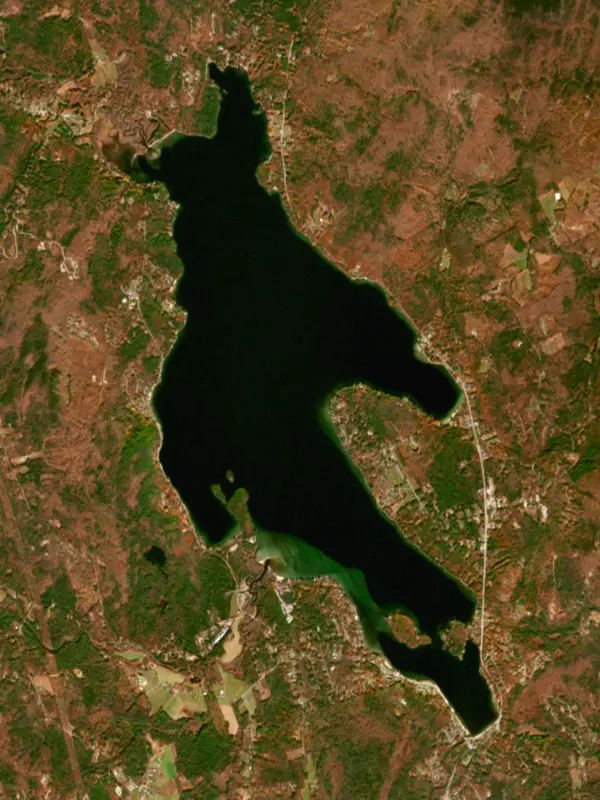
Surface water temperature
53°F on Oct 29, 2026
75°F · Jul 2553°F · Oct 29
22°F cooler than on Jul 25, 2026.
Estimated from Landsat 8/9 (USGS) passes on clear days: the top layer of the water, a few degrees either way. Coves and the shallows can be warmer.
Newfound Lake water temperature: trend, swimming and the fish →
On or near the shore of Newfound Lake: 3 boat ramps, 7 campgrounds, 6 beaches and 4 trails. The lake has about 26 miles of shoreline, counting its islands.
Tap an icon for details; use two fingers (or Ctrl + scroll) to move the map. Tap a dot for details. Map and lake outline © OpenStreetMap contributors. Places from OpenStreetMap, Overture Maps and Recreation.gov. Not for navigation.
What you’ll find on the shore
← AllBoating 3
← AllBeaches 6
← AllCamping 7
← AllLodging 12
← AllTrails 4
← AllParks 4
← AllDining 3
These invasive plants and animals have been recorded in Newfound Lake: clean, drain and dry everything before you go to another lake.
New Hampshire: It is illegal to carry aquatic plants on a boat, trailer or gear; drain all water before leaving a lake and keep drain plugs out or open while trailering (fines $50 to $200). State rules
Records: USGS Nonindigenous Aquatic Species database. A species not listed may still be present.
Species with open-licensed records inside Newfound Lake's outline, from GBIF.org (surveys, museum collections and angler reports). A record shows a fish was found here, not how many there are now.
Shallow, protected flats in spring; docks, grass and deep edges in summer heat.
Rocky points, gravel and current breaks; deeper rock piles in summer.
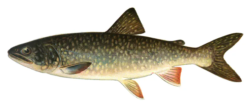
Cool water: near the surface in spring and fall, deep in summer.
Deep and cold most of the year; shallow reefs in fall and right after ice-out.
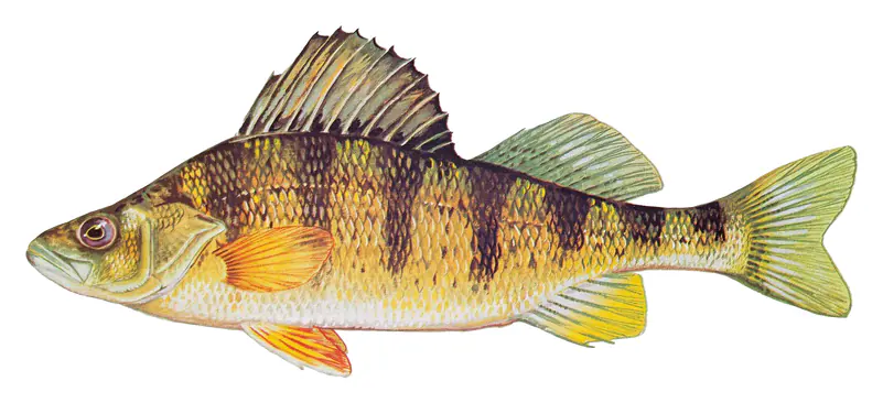
Schools near the bottom; a favorite through the ice.
Water temperature sets off each spawn; the bars show the usual months at this latitude and elevation, and move with a warm or cold spring.
Newfound Lake lies in Grafton County, New Hampshire, shared by the towns of Bristol, Bridgewater, Hebron and Alexandria at the western edge of the Lakes Region. Of the lakes that sit wholly inside the state, only Winnipesaukee and Squam are bigger. It is known for deep, clean water, a big state park beach, and lake trout and landlocked salmon.
A local tradition holds that Native people called the lake Pasquaney, a name Bristol writer Fred Lewis Pattee used for a poem, though there is no firm record of it. Surveyors in 1751 wrote it down as Newfound Lake or Baker's Pond, and later it went by New Chester Pond and Newfound Pond. Title to the surrounding land was tied up in a dispute between claimants John Mason and Peter Wheelwright that dragged on for more than a century. From 1865 to 1915 several steamboats worked the lake, and the Stella-Marion, which carried mail and passengers, burned in 1915. Summer camps came too, and in 1942 Camp Mowglis gave Belle Island to the state.
The Fowler River and the Cockermouth River are the main streams feeding the lake. The water leaves by the Newfound River, which flows through the town of Bristol to join the Pemigewasset River, and a state-owned dam at the outlet holds the level. Mayhew, Belle, Cliff and Loon are the main islands. The Reed Lighthouse, built in 1932, stands on West Shore Road, and the Newfound Lighthouse stands at the Paradise Point Lodge in Bridgewater.
In 1931 Elizabeth R. Wellington turned the Wellington Reservation on the southwest shore over to the state for one dollar, and the Civilian Conservation Corps built the park during the 1930s. It has the largest freshwater swimming beach in the New Hampshire state park system. The Peninsula Nature Trail looks out to Cliff and Belle islands, and a marked trail climbs from the park toward Goose Pond, the Sugarloafs, Bear Mountain, Welton Falls and Mount Cardigan. A Fish and Game boat launch next to the park stays open year-round. On the north shore in Hebron, New Hampshire Audubon keeps the Paradise Point sanctuary, 43 acres with about 3,500 feet of rocky shore, short trails out to a viewpoint called The Point, century-old pines and outcrops of garnet-bearing rock. Loons and mergansers use the lake in the warm months.
Newfound is counted among the cleanest lakes in New Hampshire, but it has had to work for it. The Newfound Lake Region Association, founded in 1971, has led water testing on the lake for 37 years, mostly through volunteers who sample seven sites each week from mid-May to the end of September. Their records show summer clarity at the deep central site fell by about 13 feet between the mid-1980s and the late 1990s, and Tropical Storm Irene in 2011 cut clarity by 80 percent. Polluted stormwater from developed land is still the biggest threat. Lake Hosts offer free boat inspections for invasive species at the public launches, and volunteer Weed Watchers scout the shallows. In 2025 the association opened its Grey Rocks Conservation Center, with labs for water testing. Below the surface, 22 species of fish live in the watershed, lake trout and landlocked salmon among them, and the state has stocked the lake since the late 1800s.
Written by Lake by Lake from New Hampshire State Parks, Newfound Lake Region Association, New Hampshire Public Radio, Trail Finder (Upper Valley Trails Alliance) and Wikipedia (Newfound Lake, Wellington State Park). Checked November 2026.
Newfound Lake Dam is a rockfill dam 13 feet high and 170 feet long, completed in 1771. It belongs to NH DES Water Division. At its normal level the lake holds 501 acre-ft, drained from 5 square miles of land.
From the National Inventory of Dams (U.S. Army Corps of Engineers), NID ID NH00137. Lake or reservoir: what’s the difference?
Where the level comes from: Newfound Lake (New Hampshire Department of Environmental Services).
| Lake | Miles | Level (ft) | vs full | 7 days |
|---|---|---|---|---|
| Squam Lake Live reading | 11 | 560.56 | — | −0.16 |
| Lake Winnisquam Live reading | 14 | 480.88 | — | +0.61 |
| Lake Winnipesaukee Slightly below full | 14 | 502.19 | −2.13 | −0.12 |
| Mascoma Lake Live reading | 22 | 748.05 | — | −0.12 |
| Lake Sunapee Live reading | 23 | 1091.95 | — | −0.01 |
| Ossipee Lake Live reading | 32 | 404.22 | — | 0.00 |
Compare Newfound Lake with Squam Lake, Lake Winnisquam, Lake Winnipesaukee or Mascoma Lake: size, level, ramps and fish side by side.
Newfound Lake is about 46 mi from Manchester, NH. See all the lakes near each city.
Newfound Lake is at 585.70 feet above sea level, as of Nov 18, 2026, 4:00 PM EST. It has dropped 0.09 ft in the past 7 days.
Newfound Lake has 3 boat ramps on our map. Low water can close ramps, so check today's level above and the operator before you go.
Yes. There are 7 campgrounds and RV parks within about a mile of the shore, such as Camp Wulamat, Masquebec Hill, Camp Onaway.
Game fish recorded in Newfound Lake include rainbow trout, smallmouth bass, largemouth bass, lake trout, yellow perch, chain pickerel. In all, 12 fish species have open records inside the lake on GBIF.
Anglers 16 and older need a New Hampshire fishing license, sold online by the New Hampshire Fish and Game Department. Free fishing days: First Saturday in June and third Saturday in January. Size and bag limits can be set lake by lake: check the current regulations.
boating (3 boat ramps), fishing (9 game fish), swimming (6 beaches and swimming areas), hiking & walking (4 trails along the shore, the longest Elwell Trail (Yellow) (1.8 mi)), camping (7 campgrounds) and cabins & lodging (12 places to stay close to the water), according to our map of the shore.
EPA's CyAN satellite rated cyanobacteria in Newfound Lake not detected on November 9. The satellite sees open water only; blooms can be patchy, so avoid water that looks like spilled paint or pea soup and keep dogs out of scum. Swimming advisories come from New Hampshire health and environment agencies.
Yes. 4 trails run along or near the shore, including Ridge/Lakeside Trail (0.9 mi), Sandy Point Trail (0.3 mi) and Goose Pond Trail (Orange) (0.9 mi), according to OpenStreetMap.
Newfound Lake is held back by Newfound Lake Dam, completed in 1771 and 13 ft high, according to the National Inventory of Dams.
From the New Hampshire Department of Environmental Services (Newfound Lake). Lake by Lake checks it every hour; the agency's own figure is always the reference, and provisional readings can be revised.
Lake levels are refreshed every hour. Texas and California reservoirs report once a day; most USGS and NOAA gauges report every 15 to 60 minutes.
Cookies for analytics With your OK we use Google Analytics and Microsoft Clarity to count visits and see how the site is used, so we can make it better. No advertising cookies. Privacy policy