Sun
- Sunrise
- 7:12 AM
- Sunset
- 4:52 PM
- First light
- 6:42 AM
- Last light
- 5:23 PM
Lake · Chautauqua County, New York
A lake in Chautauqua County, New York.

Chautauqua Lake is at 1,306.93 feet above sea level, as of Nov 19, 2026, 4:30 AM EST. It has dropped 0.31 ft in the past 7 days.
2nd lowest of 8 New York lakes today against normal for the date · See the ranking
Record low 1,306.22 ft (1998), record high 1,311.16 ft (1976) · Level history since 1972
A notification from this browser, once, when the level crosses the line (checked every hour). No account and no email. On an iPhone, add Lake by Lake to your home screen first (Share → Add to Home Screen) and open it from there. Or follow the lake in a feed reader: RSS feed.
Chautauqua Lake is down 0.31 ft over the last 7 days, at 1,306.93 ft today.
Daily values from the U.S. Geological Survey.
Chautauqua Lake is down 1.06 ft over the last 30 days, at 1,306.93 ft today.
Daily values from the U.S. Geological Survey.
Over the past 12 months, Chautauqua Lake ranged from 1,306.85 ft (Feb 16, 2026) to 1,309.01 ft (Jan 11, 2026), a swing of 2.2 ft. Today's level is near the bottom of that range. It is 0.34 ft lower than on this date last year.
Daily values from the U.S. Geological Survey. Why lake levels rise and fall
In the U.S. Geological Survey record, which starts in 1972, the lowest level was 1,306.22 ft on December 15, 1998 and the highest 1,311.16 ft on March 5, 1976. Today’s 1,306.93 ft is 0.7 ft above the record low and 4.2 ft below the record high.
Chautauqua Lake level history: every year since 1972, the lowest and highest years →
Solunar periods for Chautauqua Lake, local time. How they work
Avoid scum and discolored water, and keep dogs out of it.
From the New York State Department of Environmental Conservation, checked Nov 19. Advisories change with the weather: check the agency's page and the signs at the water before you go.
Not detected · as of Nov 9, 2026
The satellite found no cyanobacteria at the surface.
Week of Aug 16Week of Nov 1
Each bar is one week, colored by the worst reading of that week.
From the U.S. EPA's Cyanobacteria Assessment Network (CyAN), which reads the color of lakes from the Sentinel-3 satellites; it sees open water only, not coves or the shoreline. Blooms can be patchy: what you see on the water matters more. Swimming closures and health advisories come from New York health and environment agencies. How to read it
Surface water temperature
54°F on Nov 10, 2026
76°F · Jul 3154°F · Nov 10
22°F cooler than on Jul 31, 2026.
Estimated from MODIS Aqua (NASA) passes on clear days: the top layer of the water, a few degrees either way. Coves and the shallows can be warmer.
Chautauqua Lake water temperature: trend, swimming and the fish →
On or near the shore of Chautauqua Lake: 10 boat ramps, 13 marinas, 2 rental outfits, 11 campgrounds, 4 beaches, 1 fishing pier, 13 trails and 1 fishing guide. The lake has about 46 miles of shoreline, counting its islands.
Tap an icon for details; use two fingers (or Ctrl + scroll) to move the map. Tap a dot for details. Map and lake outline © OpenStreetMap contributors. Places from OpenStreetMap, Overture Maps and Recreation.gov. Not for navigation.
What you’ll find on the shore
← AllBoating 23
← AllRentals & tours 2
← AllFishing spots 6
← AllBeaches 4
← AllCamping 11
← AllLodging 24+
← AllTrails 13
← AllParks 10
← AllDining 18
Zebra mussels have been found in Chautauqua Lake. They clog intakes and engines and spread on boats and trailers: clean, drain and dry everything before you go to another lake.
New York: Before launching into public water, drain all water and remove any plants or animals from the boat, trailer and gear. In and within 10 miles of the Adirondack Park, motorboats must carry a clean-drain-dry certificate (free from a launch steward or self-issued), and trailered boats must pass an inspection before launching on Lake George. State rules
Records: USGS Nonindigenous Aquatic Species database. A species not listed may still be present.
The last stocking on record was in October 2025 (muskellunge).
Source: New York State Department of Environmental Conservation stocking records.
Species with open-licensed records inside Chautauqua Lake's outline, from GBIF.org (surveys, museum collections and angler reports). A record shows a fish was found here, not how many there are now. marks fish the state stocks here.
Shallow, protected flats in spring; docks, grass and deep edges in summer heat.
Brush piles, docks and bridge pilings; shallow for a few weeks in spring.
Rocky points, gravel and current breaks; deeper rock piles in summer.
Rocky shorelines at night after ice-out; deep weed edges and humps in summer.
Low light and cold water; the inflows in fall.
Water temperature sets off each spawn; the bars show the usual months at this latitude and elevation, and move with a warm or cold spring. The water is about 54°F now.
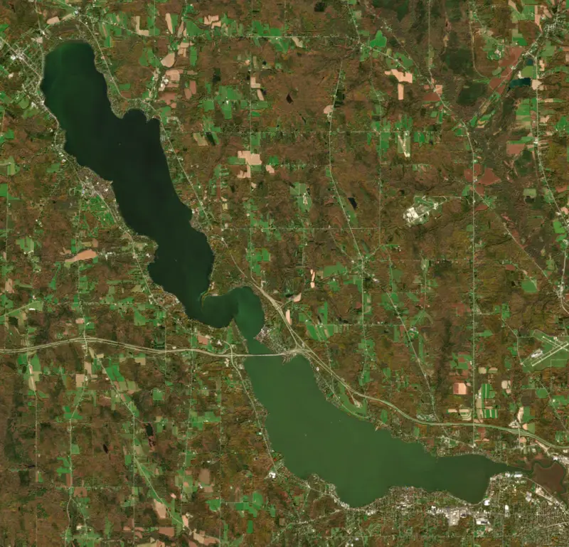
Chautauqua Lake lies in southwestern New York, with Mayville, the Chautauqua County seat, at its north end and Jamestown at its south end. It is the largest inland lake in western New York. It gave its name to the county and to a national adult-education movement, and anglers know it for muskellunge and walleye.
The name comes from the Erie language, and its meaning is lost. Popular translations, such as a bag tied in the middle, are folk stories. The Seneca name is Dza'dáhgwëh. Creeks that start near the lake run north to Lake Erie, but the lake itself drains south through the Chadakoin River at Jamestown, bound for the Allegheny and the Ohio.
That made it a gateway. In 1739 French explorers landed on the Lake Erie shore looking for a way south to the Ohio and Mississippi rivers, and the path from Barcelona Harbor to the lake, later called the Portage Trail, gave them one. The rivalry between England and France over that trail helped bring on the French and Indian War. Pierre-Joseph Celoron de Blainville crossed the divide in 1749, and Celoron, the hometown of Lucille Ball, carries his name. Settlers later used the lake's water power to saw planks for flatboats and shipped salt from Mayville down to Pittsburgh and on to New Orleans.
The lake has two distinctly different basins. Bemus Point and Stow face each other across the water, and a ferry has crossed there since 1811, when the county licensed Thomas Bemus to run one. The early boats were rafts, poled or rowed and later pulled by hand along a rope. In 1902 a new owner laid a steel cable across the lake bottom and added a steam engine, and the ferry could carry up to nine cars. The Veterans Memorial Bridge, finished in 1982, now carries Interstate 86 between the two shores, but the cable ferry still runs in summer.
Warner Dam on the outlet raises the lake in summer for boating and lowers it in winter. Communities such as Bemus Point, Maple Springs, Lakewood, Chautauqua, Dewittville and Stow line the shore, and almost all of it is privately owned.
In 1874 Lewis Miller and John Heyl Vincent, both Methodists, opened the Chautauqua Lake Sunday School Assembly on the shore as a summer school for Sunday school teachers. Courses in academic subjects, music, art and physical education soon followed. In 1878 the Chautauqua Literary and Scientific Circle began offering a four-year reading course by mail to people who could not attend college. Daughter Chautauquas sprang up elsewhere, and touring tent shows later carried the name to small towns across the United States and Canada. Chautauqua Institution is now a 750-acre community that fills up for a nine-week summer season of educational and cultural programs.
The state manages the lake for muskellunge, walleye and black bass, and stocks pure-strain muskellunge fingerlings every year to keep the trophy fishery going. Walleye fell sharply in the mid-2000s. The state stocked them from 2004 to 2015 under a special limit, then stopped after two of the strongest year classes on record hatched in 2014 and 2015. By 2019 survey catches were almost double the long-term average, and anglers reported walleyes up to 10 pounds.
The lake is rich in nutrients, and harmful algal blooms are frequent. Invasive weeds are kept in check with harvesters and herbicides. The lake is also a source of drinking water. Scientists from Rensselaer Polytechnic Institute and IBM Research began studying it in 2020 with Chautauqua Institution to find where the extra nutrients come from and how to cut them.
Written by Lake by Lake from Chautauqua County, Chautauqua Institution, New York State Department of Environmental Conservation, The Post-Journal, Rensselaer Polytechnic Institute, The Jefferson Project (Chautauqua County) and Wikipedia. Checked November 2026.
Where the level comes from: CHAUTAUQUA LAKE AT BEMUS POINT NY (U.S. Geological Survey, used on this page) and Chautauqua Lake at Bemus Point (NOAA National Water Prediction Service).
| Lake | Miles | Level (ft) | vs full | 7 days |
|---|---|---|---|---|
| Allegheny Reservoir Well below full | 30 | 1306.93 | −20.60 | −2.71 |
| Union City Reservoir Live reading | 31 | 1216.97 | — | −0.87 |
| Tionesta Creek Reservoir Live reading | 47 | 1087.88 | — | −0.27 |
| Woodcock Creek Lake Below full | 48 | 1166.46 | −13.89 | +0.72 |
| East Branch Clarion River Lake Well below full | 58 | 1644.77 | −25.01 | −0.51 |
| Shenango River Reservoir Slightly below full | 83 | 892.60 | −2.07 | −0.96 |
Compare Chautauqua Lake with Allegheny Reservoir, Union City Reservoir, Tionesta Creek Reservoir or Woodcock Creek Lake: size, level, ramps and fish side by side.
Chautauqua Lake is about 58 mi from Buffalo, NY. See all the lakes near each city.
Chautauqua Lake is at 1,306.93 feet above sea level, as of Nov 19, 2026, 4:30 AM EST. It has dropped 0.31 ft in the past 7 days.
Today's level is 0.77 ft below the median for this date (1,307.70 ft), from the gauge’s long-term daily record.
1,306.22 ft, on December 15, 1998, in the U.S. Geological Survey record, which starts in 1972. Today the lake is 0.7 ft above that.
1,311.16 ft, on March 5, 1976, in the U.S. Geological Survey record since 1972.
Chautauqua Lake has 10 boat ramps on our map, including Bemus Point Boat Launch, Lakeside Park Boat Launch, Lakewood Community Park Boat Launch, and 13 marinas. Low water can close ramps, so check today's level above and the operator before you go.
Yes. There are 11 campgrounds and RV parks within about a mile of the shore, such as Lakeside Camping, Peachy's Lakefront Camping, James Lake Front Camping.
Game fish recorded in Chautauqua Lake include yellow perch, walleye, muskellunge, black crappie, white crappie, largemouth bass. In all, 40 fish species have open records inside the lake on GBIF.
The surface of Chautauqua Lake was about 54°F on November 10, estimated from a satellite pass on a clear day. It is the top layer of the water, a few degrees either way; coves and shallows run warmer in the sun.
Anglers 16 and older need a New York fishing license, sold online by the New York State Department of Environmental Conservation. Free fishing days: Presidents’ Day weekend, a weekend in late June, National Hunting and Fishing Day (September) and Veterans Day. Size and bag limits can be set lake by lake: check the current regulations.
In summer a white Secchi disk lowered into Chautauqua Lake stays visible to about 4.6 ft (the median of 90 readings, 2016–2020, by North American Lake Management Society and Rensselaer Polytechnic Institute): somewhat murky water. With the algae measured too (chlorophyll about 17 µg/L), that makes it eutrophic: rich in nutrients, greener water. Clarity drops after storms and during algae blooms.
Yes: fishing map with depth contours (north basin) from the New York State Department of Environmental Conservation and fishing map with depth contours (south basin) from the New York State Department of Environmental Conservation. It is linked in the lake facts on this page. Depths on a map are measured at a reference level: subtract how far the lake is below it today.
boating (10 boat ramps and 13 marinas), kayaks, boats & jet skis (2 rental outfits on or near the water), fishing (19 game fish, 1 fishing pier or spot and 1 fishing guide; stocked by the state), swimming (4 beaches and swimming areas), hiking & walking (13 trails along the shore, the longest Greater Jamestown Riverwalk (8.5 mi)) and camping (11 campgrounds), according to our map of the shore.
EPA's CyAN satellite rated cyanobacteria in Chautauqua Lake not detected on November 9. The satellite sees open water only; blooms can be patchy, so avoid water that looks like spilled paint or pea soup and keep dogs out of scum. Swimming advisories come from New York health and environment agencies.
Yes. New York State Department of Environmental Conservation stocked muskellunge and walleye in Chautauqua Lake; the latest stocking on record was in October 2025.
Yes. 13 trails run along or near the shore, including Chautauqua Nadine and Paul Webb Trail (1.1 mi), Tom's Point Trail (0.7 mi) and Greater Jamestown Riverwalk (8.5 mi), according to OpenStreetMap.
From the U.S. Geological Survey (CHAUTAUQUA LAKE AT BEMUS POINT NY). Lake by Lake checks it every hour; the agency's own figure is always the reference, and provisional readings can be revised.
Lake levels are refreshed every hour. Texas and California reservoirs report once a day; most USGS and NOAA gauges report every 15 to 60 minutes.
Cookies for analytics With your OK we use Google Analytics and Microsoft Clarity to count visits and see how the site is used, so we can make it better. No advertising cookies. Privacy policy




