Sun
- Sunrise
- 7:10 AM
- Sunset
- 4:52 PM
- First light
- 6:40 AM
- Last light
- 5:22 PM
Reservoir · Warren County, Pennsylvania
A reservoir on the Allegheny River in Warren County, Pennsylvania, held back by Kinzua Dam since 1965.

Allegheny Reservoir is at 1,306.93 feet above sea level — 20.60 ft below full summer pool, as of Nov 19, 2026, 5:00 AM EST. It has dropped 2.71 ft in the past 7 days.
2nd lowest of 21 Pennsylvania lakes today against full pool · See the ranking
Record low 1,296.42 ft (2025), record high 1,340.49 ft (2024) · Level history since 2015
A notification from this browser, once, when the level crosses the line (checked every hour). No account and no email. On an iPhone, add Lake by Lake to your home screen first (Share → Add to Home Screen) and open it from there. Or follow the lake in a feed reader: RSS feed.
Allegheny Reservoir is down 2.71 ft over the last 7 days, at 1,306.93 ft today.
Daily values from the U.S. Geological Survey.
Allegheny Reservoir is down 12.46 ft over the last 30 days, at 1,306.93 ft today.
Daily values from the U.S. Geological Survey.
Over the past 12 months, Allegheny Reservoir ranged from 1,301.09 ft (Feb 17, 2026) to 1,339.05 ft (Apr 7, 2026), a swing of 38.0 ft. Today's level is near the bottom of that range. It is 4.50 ft higher than on this date last year.
Daily values from the U.S. Geological Survey. Why lake levels rise and fall
In the U.S. Geological Survey record, which starts in 2015, the lowest level was 1,296.42 ft on October 30, 2025 and the highest 1,340.49 ft on April 16, 2024. Today’s 1,306.93 ft is 10.5 ft above the record low and 33.6 ft below the record high.
Allegheny Reservoir level history: every year since 2015, the lowest and highest years →
Solunar periods for Allegheny Reservoir, local time. How they work
Not detected · as of Nov 9, 2026
The satellite found no cyanobacteria at the surface.
Week of Aug 16Week of Nov 1
Each bar is one week, colored by the worst reading of that week.
From the U.S. EPA's Cyanobacteria Assessment Network (CyAN), which reads the color of lakes from the Sentinel-3 satellites; it sees open water only, not coves or the shoreline. Blooms can be patchy: what you see on the water matters more. Swimming closures and health advisories come from Pennsylvania health and environment agencies. How to read it
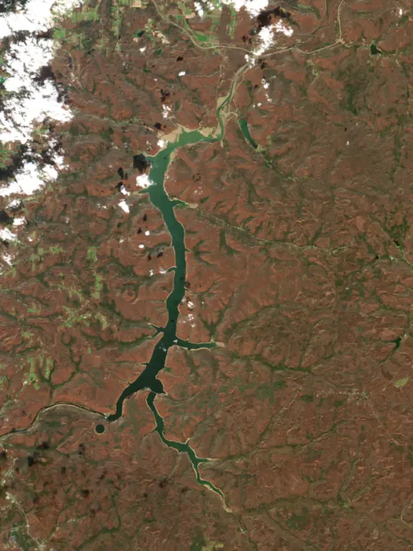
Surface water temperature
51°F on Nov 1, 2026
77°F · Aug 551°F · Nov 1
26°F cooler than on Aug 5, 2026.
Estimated from Landsat 8/9 (USGS) passes on clear days: the top layer of the water, a few degrees either way. Coves and the shallows can be warmer.
Allegheny Reservoir water temperature: trend, swimming and the fish →
On or near the shore of Allegheny Reservoir: 11 boat ramps, 2 marinas, 13 campgrounds, 2 beaches, 1 fishing pier and 13 trails. The lake has about 108 miles of shoreline, counting its islands.
Tap an icon for details; use two fingers (or Ctrl + scroll) to move the map. Tap a dot for details. Map and lake outline © OpenStreetMap contributors. Places from OpenStreetMap, Overture Maps and Recreation.gov. Not for navigation.
What you’ll find on the shore
← AllBoating 13
← AllFishing spots 1
← AllBeaches 2
← AllCamping 13
← AllLodging 1
← AllTrails 13
← AllParks 1
← AllDining 1
These invasive plants and animals have been recorded in Allegheny Reservoir: clean, drain and dry everything before you go to another lake.
Pennsylvania: Your boat, trailer, motor and gear must be free of plants and other aquatic organisms; when leaving any water, drain the boat, livewells and bilges by pulling the drain plug and keep plugs out or open while trailering. Officers can keep a boat off the water or order it decontaminated. State rules
Records: USGS Nonindigenous Aquatic Species database. A species not listed may still be present.
Species with open-licensed records inside Allegheny Reservoir's outline, from GBIF.org (surveys, museum collections and angler reports). A record shows a fish was found here, not how many there are now.
Brush piles, docks and bridge pilings; shallow for a few weeks in spring.
Rocky points, gravel and current breaks; deeper rock piles in summer.
Rocky shorelines at night after ice-out; deep weed edges and humps in summer.
Cool water: near the surface in spring and fall, deep in summer.
Shallow, weedy bays right after ice-out; weed edges the rest of the year.
Water temperature sets off each spawn; the bars show the usual months at this latitude and elevation, and move with a warm or cold spring.
The Allegheny Reservoir, also called Kinzua Lake, backs up the Allegheny River for about 24 miles from Kinzua Dam, a few miles east of Warren, Pennsylvania, nearly to Salamanca, New York. The Allegheny National Forest wraps its Pennsylvania shores, and the upper end lies on the Seneca Nation's Allegany Reservation. It was built to protect Pittsburgh from floods, and the Seneca, who lost much of their land to it, call it the Lake of Perfidy.
Pittsburgh had flooded again and again, and the St. Patrick's Day flood of 1936 killed 47 people and did about $50 million in damage in the metropolitan area. Congress answered with the Flood Control Act of 1936, which listed nine reservoirs for the upper Allegheny, one of them near Warren. The Army Corps of Engineers began the dam in 1960 and finished it in 1965, and the reservoir filled over the next two years. Besides flood control, it keeps the river from running too low in dry spells and supports hydroelectric power. The Seneca Pumped Storage station below the dam pumps water up to an upper reservoir when demand is low and runs it back through turbines when demand peaks. The dam proved itself in 1972, when Tropical Storm Agnes brought the reservoir within 3 feet of its maximum and the Corps estimated that it prevented about $247 million in downstream damage that year alone.
The price fell on the Seneca. The Treaty of Canandaigua, signed in November 1794 by Timothy Pickering for George Washington's government, had guaranteed their lands along the river. The reservoir flooded more than 9,000 acres of the reservation's habitable land, with homes, farms, community buildings, burial grounds and hunting and fishing grounds. With help from Quakers and other allies, the Seneca fought the dam for years in Congress and the courts. Critics backed an alternative from the engineer Arthur Morgan that would have sent floodwater to Lake Erie instead. The Seneca lost their key court case in 1958, and in 1961 President John F. Kennedy declined to halt construction. More than 600 people were moved to two new communities, Steamburg and Jimerson Town, and a 1964 law signed by President Lyndon Johnson paid the nation about $15 million. On the Pennsylvania side the water covered most of the Cornplanter Tract, 1,500 acres granted in 1796 to the Seneca leader Cornplanter and for generations the only Native land in the state, and most graves in its cemetery were moved to higher ground. Kinzua Township in Pennsylvania and Elko in New York dissolved, and Corydon and Onoville lost most of their people. In 1964 Johnny Cash recorded a song about the loss, As Long as the Grass Shall Grow.
Because the forest and reservation hold most of the shore, very little private development lines the water. The Pennsylvania Fish and Boat Commission stocks walleye, muskellunge and channel catfish, and walleye are the main target for many anglers. In its 2014 survey the walleye catch in gill nets was among the highest on record, with fish from 9 to 29 inches. Anglers also catch bass and musky. Willow Bay, just south of the New York line and about 16 miles west of Bradford on Route 346, has a campground, rustic cabins and a launch, and the North Country National Scenic Trail passes nearby. On the east side, Kinzua Bay branches off the main lake. Several rustic campgrounds on the shore have no road access at all, among them Hooks Brook on the west bank, reached only by boat, and Morrison on a branch of Kinzua Bay, reached by boat or a hike of 6 to 7 miles on the Morrison Run Trail.
Written by Lake by Lake from The Pennsylvania Magazine of History and Biography (via Rivers of Steel), Wikipedia (Kinzua Dam, Cornplanter Tract), Warren Times Observer and USDA Forest Service (Recreation.gov) (Willow Bay, Allegheny National Forest, Morrison Boat Access Campground). Checked November 2026.
Activities listed by the U.S. Army Corps of Engineers: Boating · Camping · Fishing · Hiking · Picnicking · Visitor center · Water sports · Wildlife viewing
Kinzua Dam is a rockfill dam 177 feet high and 1,916 feet long on the Allegheny River, completed in 1965. It belongs to the U.S. Army Corps of Engineers (Pittsburgh District) and is run for flood control, fish and wildlife, recreation and hydropower. At its normal level the reservoir holds 573,000 acre-ft, drained from 2,180 square miles of land.
From the National Inventory of Dams (U.S. Army Corps of Engineers), NID ID PA00105. Lake or reservoir: what’s the difference?
Where the level comes from: Allegheny Reservoir near Warren, PA (U.S. Geological Survey, used on this page) and Central PA Dams Kinzua Dam on Allegheny River (NOAA National Water Prediction Service).
| Lake | Miles | Level (ft) | vs full | 7 days |
|---|---|---|---|---|
| East Branch Clarion River Lake Well below full | 29 | 1644.77 | −25.01 | −0.51 |
| Chautauqua Lake Live reading | 30 | 1306.93 | — | −0.31 |
| Tionesta Creek Reservoir Live reading | 34 | 1087.88 | — | −0.27 |
| Union City Reservoir Live reading | 46 | 1216.97 | — | −0.87 |
| Woodcock Creek Lake Below full | 57 | 1166.46 | −13.89 | +0.72 |
| George B. Stevenson Reservoir At or near full pool | 59 | 922.00 | +1.00 | −0.42 |
Compare Allegheny Reservoir with East Branch Clarion River Lake, Chautauqua Lake, Tionesta Creek Reservoir or Union City Reservoir: size, level, ramps and fish side by side.
Allegheny Reservoir is about 73 mi from Buffalo, NY. See all the lakes near each city.
Allegheny Reservoir is at 1,306.93 feet above sea level — 20.60 ft below full summer pool, as of Nov 19, 2026, 5:00 AM EST. It has dropped 2.71 ft in the past 7 days.
Allegheny Reservoir's full summer pool is 1,327.53 ft, according to U.S. Army Corps of Engineers. Today the lake is 20.60 ft below that mark.
Today's level is 0.60 ft below the median for this date (1,307.53 ft), from the gauge’s long-term daily record.
1,296.42 ft, on October 30, 2025, in the U.S. Geological Survey record, which starts in 2015. Today the lake is 10.5 ft above that.
1,340.49 ft, on April 16, 2024, in the U.S. Geological Survey record since 2015. That is 13.0 ft above full summer pool.
Allegheny Reservoir has 11 boat ramps on our map, including Allegany State Park Boat Launch, Boat ramp at Wolf Run Marina, Boat ramp near Red Bridge Campground, and 2 marinas. Low water can close ramps, so check today's level above and the operator before you go.
Yes. There are 13 campgrounds and RV parks within about a mile of the shore, such as Hooks Brook Boat Access Campground, Pine Grove Boat Access Campground, Handsome Lake Boat Access Campground.
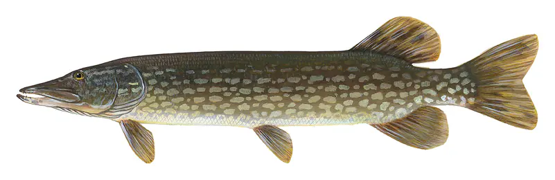
Game fish recorded in Allegheny Reservoir include walleye, northern pike, smallmouth bass, yellow perch, white crappie, white bass. In all, 40 fish species have open records inside the lake on GBIF.
Anglers 16 and older need a Pennsylvania fishing license, sold online by the Pennsylvania Fish and Boat Commission. Free fishing days: Two Fish-for-Free Days (2026: May 24 and July 4). Size and bag limits can be set lake by lake: check the current regulations.
Allegheny Reservoir averages about 47 ft deep. Depth changes with the lake level.
U.S. Army Corps of Engineers lists boating, camping, fishing, hiking, picnicking, visitor center, water sports and wildlife viewing at Allegheny Reservoir. 9 campgrounds can be booked on Recreation.gov.
EPA's CyAN satellite rated cyanobacteria in Allegheny Reservoir not detected on November 9. The satellite sees open water only; blooms can be patchy, so avoid water that looks like spilled paint or pea soup and keep dogs out of scum. Swimming advisories come from Pennsylvania health and environment agencies.
Yes. 13 trails run along or near the shore, including North Country National Scenic Trail (PA), North Country Trail and Tracy Ridge Loop (16 mi), according to OpenStreetMap.
Allegheny Reservoir is held back by Kinzua Dam, completed in 1965 and 177 ft high, according to the National Inventory of Dams.
From the U.S. Geological Survey (Allegheny Reservoir near Warren, PA). Lake by Lake checks it every hour; the agency's own figure is always the reference, and provisional readings can be revised.
Lake levels are refreshed every hour. Texas and California reservoirs report once a day; most USGS and NOAA gauges report every 15 to 60 minutes.
Cookies for analytics With your OK we use Google Analytics and Microsoft Clarity to count visits and see how the site is used, so we can make it better. No advertising cookies. Privacy policy