Sun
- Sunrise
- 7:09 AM
- Sunset
- 4:42 PM
- First light
- 6:38 AM
- Last light
- 5:14 PM
Lake · Monroe County, New York
A lake fed by the Niagara River in Monroe County, New York.

Lake Ontario is at 244.91 feet above sea level, as of Nov 19, 2026, 4:24 AM EST. It has dropped 0.53 ft in the past 7 days.
A notification from this browser, once, when the level crosses the line (checked every hour). No account and no email. On an iPhone, add Lake by Lake to your home screen first (Share → Add to Home Screen) and open it from there. Or follow the lake in a feed reader: RSS feed.
Lake Ontario is down 0.53 ft over the last 7 days, at 244.91 ft today.
Daily values from the NOAA National Water Prediction Service.
Lake Ontario is down 0.62 ft over the last 30 days, at 244.91 ft today.
Daily values from the NOAA National Water Prediction Service. Why lake levels rise and fall
Solunar periods for Lake Ontario, local time. How they work
High · as of Nov 8, 2026
The satellite sees a likely bloom on part of the lake. Avoid discolored water and scum, and keep dogs out of it. About 377,000 cells/mL at the worst spot, covering less than 1% of the lake.
Week of Aug 16Week of Nov 1
Each bar is one week, colored by the worst reading of that week.
From the U.S. EPA's Cyanobacteria Assessment Network (CyAN), which reads the color of lakes from the Sentinel-3 satellites; it sees open water only, not coves or the shoreline. Blooms can be patchy: what you see on the water matters more. Swimming closures and health advisories come from New York health and environment agencies. How to read it
Surface water temperature
52°F on Nov 17, 2026
67°F · Jul 2452°F · Nov 17
15°F cooler than on Jul 24, 2026.
Estimated from NOAA’s Great Lakes analysis passes on clear days: the top layer of the water, a few degrees either way. Coves and the shallows can be warmer.
Lake Ontario water temperature: trend, swimming and the fish →
The map loads when you scroll to it.
Zebra mussels and Quagga mussels have been found in Lake Ontario. They clog intakes and engines and spread on boats and trailers: clean, drain and dry everything before you go to another lake.
New York: Before launching into public water, drain all water and remove any plants or animals from the boat, trailer and gear. In and within 10 miles of the Adirondack Park, motorboats must carry a clean-drain-dry certificate (free from a launch steward or self-issued), and trailered boats must pass an inspection before launching on Lake George. State rules
Records: USGS Nonindigenous Aquatic Species database. A species not listed may still be present.
The last stocking on record was in June 2025 (brown trout).
Source: New York State Department of Environmental Conservation stocking records.
Species with open-licensed records inside Lake Ontario's outline, from GBIF.org (surveys, museum collections and angler reports). A record shows a fish was found here, not how many there are now. marks fish the state stocks here.
Low light and cold water; the inflows in fall.
Deep and cold most of the year; shallow reefs in fall and right after ice-out.
Water temperature sets off each spawn; the bars show the usual months at this latitude and elevation, and move with a warm or cold spring. The water is about 52°F now.
Lake Ontario is the easternmost of the Great Lakes and the smallest by surface area, though it holds more water than Lake Erie. New York owns its south and east shores, from the Niagara River past Rochester and Oswego to the head of the St. Lawrence, while Canada holds the north and west. On the American side it is known for its salmon rivers, its harbors and the heavy lake-effect snow that piles up downwind in winter.
The name likely comes from an Iroquoian word meaning roughly lake of shining waters. Glaciers carved the basin, and the land around it is still slowly rebounding from the weight of the ice. The Wendat and the Haudenosaunee lived around it before Europeans came, and forts and shipping followed. In the War of 1812 the lake was a naval front. At Sackets Harbor in Jefferson County, some 3,000 men worked in a shipyard building warships, and two battles were fought nearby. The Welland Canal carries ships around Niagara Falls to Lake Erie, and the Oswego Canal connects the lake to the waterways of upstate New York.
About 85 percent of the water entering Lake Ontario comes from Lake Erie, mostly by way of the Niagara River, and that flow is not controlled. Rain, runoff and evaporation make up the rest. The lake drains to the Atlantic through the St. Lawrence. Since 1960 its outflow has been regulated mainly at the Moses-Saunders power dam between Massena, New York, and Cornwall, Ontario, which the New York Power Authority and Ontario Power Generation run together. An international board sets the releases under Plan 2014, issued in December 2016 to replace a plan in use since 1963, with the aims of protecting shoreline property, restoring coastal wetlands, lengthening the fall boating season and keeping water deep enough for shipping. In normal years, regulation moves the lake only by inches. The level climbs with snowmelt and spring rain, usually peaks in early summer and falls to its lowest in late fall and early winter. High water in 2017 and again in 2019 did heavy damage to homes, docks and shoreline businesses on the lake and the river. The board estimates that regulation kept the 2017 peak about 7 inches lower than it would otherwise have been.
Atlantic salmon were native here but had vanished from the Salmon River by 1872. New York began stocking coho in 1968, Chinook in 1970 and steelhead in 1974, and the Salmon River Fish Hatchery near Altmar, opened in 1980, raises nearly three million young fish a year. The Salmon River runs through Pulaski to Port Ontario and is the most heavily fished of the state's Lake Ontario tributaries, with fall and spring runs of Chinook and coho salmon, steelhead, brown trout and Atlantic salmon. Snagging has been illegal there since 1995. The river produced a world-record coho in 1989.
In 2024 NOAA designated the Lake Ontario National Marine Sanctuary, 1,722 square miles of New York waters that protect shipwrecks and other remains of the old water route between the Great Lakes and the Atlantic. Winter is the lake's other big story. Lake-effect snow falls heavily along the southern shore, and the lake itself rarely freezes over completely.
Written by Lake by Lake from International Joint Commission, International Lake Ontario-St. Lawrence River Board (FAQ: Influences on Water Levels and Flows, FAQ: Effects of Regulation on Levels and Flows, Regulation), NOAA Office of National Marine Sanctuaries and Wikipedia (Lake Ontario, Salmon River (New York)). Checked November 2026.
Where the level comes from: Lake America at Braddock Heights (NOAA National Water Prediction Service, used on this page), Lake America at Hamlin Beach State Park (NOAA National Water Prediction Service), Lake America at Ninemile Point (NOAA National Water Prediction Service), Lake America at Golden Hill State Park (NOAA National Water Prediction Service), Lake America at Sackets Harbor (NOAA National Water Prediction Service) and Lake America at Sodus Point (NOAA National Water Prediction Service).
| Lake | Miles | Level (ft) | vs full | 7 days |
|---|---|---|---|---|
| Conesus Lake Live reading | 36 | 816.75 | — | −0.22 |
| Canandaigua Lake Live reading | 38 | 687.11 | — | −0.02 |
| Mount Morris Lake Live reading | 41 | 586.82 | — | +0.28 |
| Seneca Lake Live reading | 50 | 443.93 | — | +0.34 |
| Cayuga Lake Live reading | 56 | 382.40 | — | — |
| Keuka Lake Live reading | 57 | 713.09 | — | −0.10 |
Compare Lake Ontario with Conesus Lake, Canandaigua Lake, Mount Morris Lake or Seneca Lake: size, level, ramps and fish side by side.
Lake Ontario is about 12 mi from Rochester, NY and 64 mi from Buffalo, NY. See all the lakes near each city.
Lake Ontario is at 244.91 feet above sea level, as of Nov 19, 2026, 4:24 AM EST. It has dropped 0.53 ft in the past 7 days.
The surface of Lake Ontario was about 52°F on November 17, estimated from a satellite pass on a clear day. It is the top layer of the water, a few degrees either way; coves and shallows run warmer in the sun.
Anglers 16 and older need a New York fishing license, sold online by the New York State Department of Environmental Conservation. Free fishing days: Presidents’ Day weekend, a weekend in late June, National Hunting and Fishing Day (September) and Veterans Day. Size and bag limits can be set lake by lake: check the current regulations.
Lake Ontario is about 801 ft deep at its deepest point. Depth changes with the lake level.
Yes: bathymetry poster with depth contours from the NOAA National Centers for Environmental Information. It is linked in the lake facts on this page. Depths on a map are measured at a reference level: subtract how far the lake is below it today.
EPA's CyAN satellite rated cyanobacteria in Lake Ontario high on November 8. The satellite sees open water only; blooms can be patchy, so avoid water that looks like spilled paint or pea soup and keep dogs out of scum. Swimming advisories come from New York health and environment agencies.
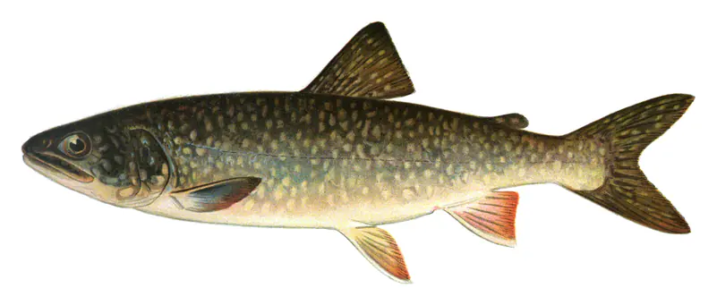
Yes. New York State Department of Environmental Conservation stocked brown trout, lake trout and landlocked salmon in Lake Ontario; the latest stocking on record was in June 2025.
From the NOAA National Water Prediction Service (Lake America at Braddock Heights). Lake by Lake checks it every hour; the agency's own figure is always the reference, and provisional readings can be revised.
Lake levels are refreshed every hour. Texas and California reservoirs report once a day; most USGS and NOAA gauges report every 15 to 60 minutes.
Cookies for analytics With your OK we use Google Analytics and Microsoft Clarity to count visits and see how the site is used, so we can make it better. No advertising cookies. Privacy policy