Sun
- Sunrise
- 7:01 AM
- Sunset
- 5:16 PM
- First light
- 6:34 AM
- Last light
- 5:43 PM
Reservoir · Lincoln County, North Carolina
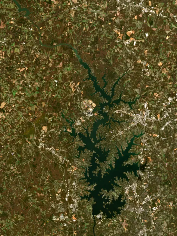
A reservoir on the Catawba River in Lincoln County, North Carolina, held back by Cowans Ford Dam since 1963.

Lake Norman is at 96.56 ft on its local gauge — 3.44 ft below full pond (local datum), as of Nov 17, 2026, 8:00 PM EST. It has dropped 0.18 ft in the past 7 days.
Lake Norman is down 1.72 ft over the last 30 days, at 96.56 ft today.
Daily values from the NOAA National Water Prediction Service. Why lake levels rise and fall
Solunar periods for Lake Norman, local time. How they work
Not detected · as of Nov 9, 2026
The satellite found no cyanobacteria at the surface.
Week of Aug 16Week of Nov 1
Each bar is one week, colored by the worst reading of that week.
From the U.S. EPA's Cyanobacteria Assessment Network (CyAN), which reads the color of lakes from the Sentinel-3 satellites; it sees open water only, not coves or the shoreline. Blooms can be patchy: what you see on the water matters more. Swimming closures and health advisories come from North Carolina health and environment agencies. How to read it
Surface water temperature
68°F on Nov 9, 2026
92°F · Jul 2068°F · Nov 9
24°F cooler than on Jul 20, 2026.
Estimated from Landsat 8/9 (USGS) passes on clear days: the top layer of the water, a few degrees either way. Coves and the shallows can be warmer.
Lake Norman water temperature: trend, swimming and the fish →
On or near the shore of Lake Norman: 18 boat ramps, 35 marinas, 23 rental outfits, 8 campgrounds, 5 beaches and 15 trails. The lake has about 554 miles of shoreline, counting its islands.
Tap an icon for details; use two fingers (or Ctrl + scroll) to move the map. Tap a dot for details. Map and lake outline © OpenStreetMap contributors. Places from OpenStreetMap, Overture Maps and Recreation.gov. Not for navigation.
What you’ll find on the shore
← AllBoating 53
← AllRentals & tours 23
← AllFishing spots 5
← AllBeaches 5
← AllCamping 8
← AllLodging 24+
← AllTrails 15
← AllParks 20+
← AllDining 24+
Zebra mussels have been found in Lake Norman. They clog intakes and engines and spread on boats and trailers: clean, drain and dry everything before you go to another lake.
North Carolina: North Carolina has no clean-drain-dry law for boaters. The Wildlife Resources Commission urges you to clean off plants, animals and mud, drain all water, dry your gear, and never move fish or plants from one water to another. State rules
Records: USGS Nonindigenous Aquatic Species database. A species not listed may still be present.
Species with open-licensed records inside Lake Norman's outline, from GBIF.org (surveys, museum collections and angler reports). A record shows a fish was found here, not how many there are now.
Shallow, protected flats in spring; docks, grass and deep edges in summer heat.
Brush piles, docks and bridge pilings; shallow for a few weeks in spring.
Channel edges and river arms; best after dark in summer, and after a rain.
Run up the river arms in spring; follow shad to cool, deep water near the dam in summer.
Schools near the bottom; best in the cool months.
Water temperature sets off each spawn; the bars show the usual months at this latitude and elevation, and move with a warm or cold spring. The water is about 68°F now.
Lake Norman is the largest man-made lake in North Carolina, a Duke Energy reservoir on the Catawba River just north of Charlotte, shared by Mecklenburg, Iredell, Lincoln and Catawba counties. It is often called the inland sea of North Carolina. It makes electricity, cools two power plants and supplies drinking water to Charlotte and the towns around it.
Duke Power, as the company was then called, had been buying land along the Catawba for decades before it broke ground on Cowans Ford Dam on September 28, 1959. The river's flow was weak and the dam was still being finished, so the lake took more than a year to fill, rising over the old farmland in 1963. Duke named it for Norman Atwater Cocke, a former president of the company.
The dam takes its name from Cowan's Ford, a river crossing that now lies under the water. In 1781 General William Lee Davidson, the namesake of Davidson College, was killed there fighting Lord Cornwallis's army in the Revolutionary War. The lake also covered plantations, Native trading routes, bridges and the mill village of Long Island, whose ruins rest on the bottom. Families could sell and move, sell and lease their land back, or sell only the part that would flood. More than a dozen churches, graveyards and family plots were affected, and remains were moved with the consent of next of kin.
Only about 2,000 people lived in the area in the 1950s, and growth was slow at first because the area lacked roads and water and sewer service. That changed with Interstate 77, finished in 1975. Cornelius, Davidson, Huntersville and Mooresville grew into lake towns, and much of the shoreline is now lined with homes, piers and seawalls. Interstate 77 and Highway 150 both cross the water.
The lake is one link in Duke's chain of hydroelectric and nuclear plants in the Catawba-Wateree basin. Its water cools both the McGuire Nuclear Station and the Marshall Steam Station.
The state park on the northern shore near Troutman began in 1962 as Duke Power State Park, on land the company gave to the state. Its Itusi Trail has nearly 31 miles of single-track for mountain bikes, and there are hiking trails, a swim beach, a campground and a boat ramp. A small dammed Park Lake inside the park is good for quiet paddling, and great blue herons nest on two of the islands nearby.
For years Lake Norman was a striped bass lake, stocked by the state. After alewife were introduced in the early 2000s, and with little suitable habitat for them in summer, striper die-offs became more frequent and more severe. In 2013 the North Carolina Wildlife Resources Commission switched to stocking Bodie bass, the hybrid of striped bass and white bass, which handle warm water better. There have been no major Bodie bass kills since, and the fishery became popular enough that the state raised stocking rates and the size limit to protect it.
Anglers crowd the warm discharge from Marshall Steam Station in winter and the water below Lookout Shoals Dam in spring. Besides Bodie bass, the lake holds largemouth bass, Alabama bass, crappie and blue, channel and flathead catfish. Natural cover such as fallen trees and weed beds is scarce.
Written by Lake by Lake from North Carolina Department of Natural and Cultural Resources, Levine Museum of the New South, Davidson College Library, North Carolina Wildlife Resources Commission, North Carolina State Parks and Wikipedia. Checked November 2026.
Cowans Ford Dam is a concrete dam 134 feet high and 8,738 feet long on the Catawba River, completed in 1963. It belongs to Duke Energy and is run for hydropower, recreation and water supply. At its normal level the reservoir holds 414,100 acre-ft, drained from 1,790 square miles of land.
From the National Inventory of Dams (U.S. Army Corps of Engineers), NID ID NC05064. Lake or reservoir: what’s the difference?
Where the level comes from: Catawba River at Lake Norman/Cowans Ford Dam (NOAA National Water Prediction Service).
| Lake | Miles | Level (ft) | vs full | 7 days |
|---|---|---|---|---|
| Mountain Island Lake Slightly below full | 7 | 96.85* | −3.15 | — |
| Lookout Shoals Lake Slightly below full | 23 | 97.66* | −2.34 | — |
| Lake Wylie Slightly below full | 29 | 97.31* | −2.69 | — |
| Lake Hickory At or near full pool | 30 | 98.53* | −1.47 | — |
| Lake Rhodhiss Slightly below full | 36 | 97.01* | −2.99 | — |
| Ninety Nine Islands Reservoir Live reading | 41 | 510.78 | — | −0.17 |
* Local gauge datum: 100 ft = full pond (Duke Energy lakes).
Compare Lake Norman with Mountain Island Lake, Lookout Shoals Lake, Lake Wylie or Lake Hickory: size, level, ramps and fish side by side.
Lake Norman is about 17 mi from Charlotte, NC, 18 mi from Concord, NC and 66 mi from High Point, NC. See all the lakes near each city.
Lake Norman is at 96.56 ft on its local gauge — 3.44 ft below full pond (local datum), as of Nov 17, 2026, 8:00 PM EST. It has dropped 0.18 ft in the past 7 days.
Lake Norman's full pond (local datum) is 100 ft (local datum), according to Duke Energy local datum: 100 ft = full pond. Today the lake is 3.44 ft below that mark.
Lake Norman has 18 boat ramps on our map, including Boat ramp at Beach Ramsey Creek Park Lake Norman Nc, Boat ramp at Lake Norman Yacht Club, Boat ramp near Lake Norman Yacht Club, and 35 marinas. Low water can close ramps, so check today's level above and the operator before you go.
Yes. There are 8 campgrounds and RV parks within about a mile of the shore, such as Camp Dogwood for the Blind and Visually Impaired, Fellowship Point, Little's Campground and Boat Slips.
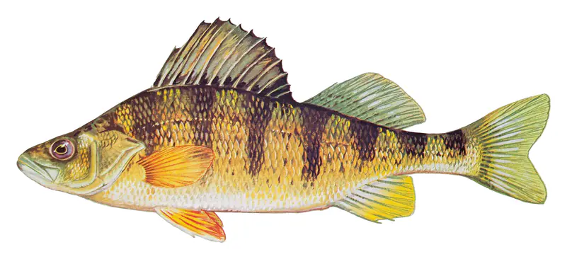
Game fish recorded in Lake Norman include bluegill, striped bass, yellow perch, largemouth bass, black crappie, white catfish. In all, 20 fish species have open records inside the lake on GBIF.
The surface of Lake Norman was about 68°F on November 9, estimated from a satellite pass on a clear day. It is the top layer of the water, a few degrees either way; coves and shallows run warmer in the sun.
Anglers 16 and older need a North Carolina fishing license, sold online by the North Carolina Wildlife Resources Commission. Free fishing days: July 4. Size and bag limits can be set lake by lake: check the current regulations.
NOAA's flood categories for the Lake Norman gauge: action stage at 100.0 ft, minor flooding at 102.0 ft, moderate flooding at 105.0 ft and major flooding at 110.0 ft. Today the lake is 5.44 ft below the first flooding level.
Lake Norman averages about 13 ft deep. Depth changes with the lake level.
boating (18 boat ramps and 35 marinas), kayaks, boats & jet skis (23 rental outfits on or near the water), fishing (9 game fish), swimming (5 beaches and swimming areas), hiking & walking (15 trails along the shore, the longest Laurel Loop (8.3 mi)) and camping (8 campgrounds), according to our map of the shore.
EPA's CyAN satellite rated cyanobacteria in Lake Norman not detected on November 9. The satellite sees open water only; blooms can be patchy, so avoid water that looks like spilled paint or pea soup and keep dogs out of scum. Swimming advisories come from North Carolina health and environment agencies.
Yes. 15 trails run along or near the shore, including Alder Trail (0.7 mi), Lake Shore Trail (5.9 mi) and Laurel Loop (8.3 mi), according to OpenStreetMap.
Lake Norman is held back by Cowans Ford, completed in 1963 and 134 ft high, according to the National Inventory of Dams.
From the NOAA National Water Prediction Service (Catawba River at Lake Norman/Cowans Ford Dam). Lake by Lake checks it every hour; the agency's own figure is always the reference, and provisional readings can be revised.
Lake levels are refreshed every hour. Texas and California reservoirs report once a day; most USGS and NOAA gauges report every 15 to 60 minutes.