Sun
- Sunrise
- 7:45 AM
- Sunset
- 4:55 PM
- First light
- 7:11 AM
- Last light
- 5:29 PM
Lake · Ramsey County, North Dakota
A lake in Ramsey County, North Dakota, held back by Spirit Lake Jetty 2 Dam since 1997. Also called Devils Lake, Lake of Spirits.

Devils Lake is at 1,449.82 feet above sea level, as of Nov 17, 2026, 8:00 PM CST. The level has held steady over the past week.
A notification from this browser, once, when the level crosses the line (checked every hour). No account and no email. On an iPhone, add Lake by Lake to your home screen first (Share → Add to Home Screen) and open it from there. Or follow the lake in a feed reader: RSS feed.
Devils Lake is down 0.14 ft over the last 30 days, at 1,449.82 ft today.
Daily values from the U.S. Geological Survey.
Over the past 122 days, Devils Lake ranged from 1,449.82 ft (Nov 17, 2026) to 1,450.48 ft (Jul 20, 2026), a swing of 0.7 ft. Today's level is the lowest of the past 122 days.
Daily values from the U.S. Geological Survey. Why lake levels rise and fall
Solunar periods for Devils Lake, local time. How they work
Avoid scum and discolored water, and keep dogs out of it.
From the North Dakota Department of Environmental Quality, checked Nov 16. Advisories change with the weather: check the agency's page and the signs at the water before you go.
High · as of Nov 9, 2026
The satellite sees a likely bloom on part of the lake. Avoid discolored water and scum, and keep dogs out of it. About 302,000 cells/mL at the worst spot, covering less than 1% of the lake.
Week of Aug 9Week of Nov 1
Each bar is one week, colored by the worst reading of that week.
From the U.S. EPA's Cyanobacteria Assessment Network (CyAN), which reads the color of lakes from the Sentinel-3 satellites; it sees open water only, not coves or the shoreline. Blooms can be patchy: what you see on the water matters more. Swimming closures and health advisories come from North Dakota health and environment agencies. How to read it
Surface water temperature
47°F on Nov 9, 2026
75°F · Jul 1947°F · Nov 9
28°F cooler than on Jul 19, 2026.
Estimated from MODIS Aqua (NASA) passes on clear days: the top layer of the water, a few degrees either way. Coves and the shallows can be warmer.
Devils Lake water temperature: trend, swimming and the fish →
On or near the shore of Devils Lake: 13 boat ramps, 2 marinas, 15 campgrounds and 1 trail. The lake has about 314 miles of shoreline, counting its islands.
Tap an icon for details; use two fingers (or Ctrl + scroll) to move the map. Tap a dot for details. Map and lake outline © OpenStreetMap contributors. Places from OpenStreetMap, Overture Maps and Recreation.gov. Not for navigation.
What you’ll find on the shore
← AllBoating 15
← AllFishing spots 2
← AllCamping 15
← AllLodging 14
← AllTrails 1
← AllParks 3
← AllDining 5
No aquatic invasive species are on record for Devils Lake in the USGS database. Keep it that way: clean, drain and dry your boat between lakes.
North Dakota: Leave every lake with no plants on boat, trailer or gear, drain all water (bilge, livewells, baitwells, motor) and pull all drain plugs, keeping them out while trailering. Don't bring live bait or aquatic plants into North Dakota, and don't haul bait in water from infested lakes. Required: ANS fee sticker (out-of-state motorboats) ($15 a year for out-of-state motorboats; $15 in North Dakota 3-year registration). State rules
Records: USGS Nonindigenous Aquatic Species database. A species not listed may still be present.
Species with open-licensed records inside Devils Lake's outline, from GBIF.org (surveys, museum collections and angler reports). A record shows a fish was found here, not how many there are now.
Run up the river arms in spring; follow shad to cool, deep water near the dam in summer.
Weed beds and rock bars; fall is trophy season.
Spring runs up the tributaries; schools busting shad in late summer.
Water temperature sets off each spawn; the bars show the usual months at this latitude and elevation, and move with a warm or cold spring. The water is about 47°F now.
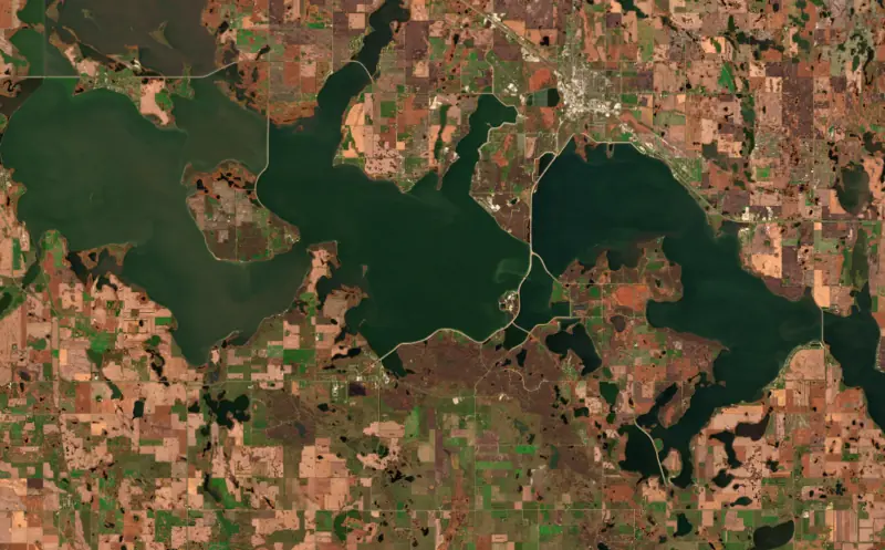
Devils Lake is a big prairie lake in northeastern North Dakota, in Ramsey and Benson counties beside the city of Devils Lake and the Spirit Lake Reservation. It has no natural outlet at its usual levels, and it is known for two things: walleye and perch fishing, and a rise of nearly 32 feet between 1993 and 2011 that swallowed farms, roads and homes.
The Dakota call the lake Mni Wakan, spirit water, and English speakers turned that name into Devils Lake. A treaty in 1867 set aside a reservation south of the lake for the Sisseton and Wahpeton Dakota and the Cut Head band of the Yanktonai. It was centered on Fort Totten, the Army post where the agency had its headquarters. The Army left in 1890 and turned the buildings over for schooling. The reservation, long named for the lake, is known today as the Spirit Lake Reservation.
The retreating glaciers left North Dakota dotted with closed basins, and Devils Lake sits in one of them. With no outlet, the lake follows the climate, rising in wet decades and shrinking in dry ones. Since the ice age it has swung between overflowing and drying up. When high enough it first spills east into Stump Lake, and higher still the combined lakes would pour through Tolna Coulee into the Sheyenne River and on to the Red River of the North. That has happened at least twice in the past 4,000 years, the last time less than 2,000 years ago. The lowest level on record came in 1940.
In 1993 the lake was low enough that people worried about it. Then a long wet cycle set in. By June 2011 the lake had risen 31.68 feet, its volume had grown more than sevenfold, and it covered roughly 167,000 more acres than in 1993. Hundreds of homes and businesses were lost, along with tens of thousands of acres of farmland. The state and federal governments spent more than $450 million raising and moving roads, rail lines, bridges and power lines and building dikes.
North Dakota built its own outlets to the Sheyenne River: a west-end outlet finished in 2005 and enlarged in 2010, and an east-end outlet in 2012. They pump only in ice-free months and only as river capacity and water quality downstream allow. By 2025 they had moved more than 1.6 million acre-feet, and state engineers estimated in 2020 that without them the lake would stand about 6 feet higher. In 2012 the Army Corps of Engineers finished a control structure at Tolna Coulee to prevent a sudden, uncontrolled spill, and in 2014 the levee protecting the city of Devils Lake was completed.
The rising water flooded new structure and habitat, and local guides credit it with better fishing. Walleye, yellow perch, northern pike, crappie and white bass are the main catches. The state stocks walleye every year to add to natural reproduction, and perch, white bass and freshwater shrimp feed them. The largest walleye year-class ever recorded on the lake hatched in 2009.
The seasons set the pattern. Pike are the first fish to turn active after ice-out, usually around mid-April, and move shallow to spawn. In spring, walleye gather in the coulees that feed Lake Irvine and Lake Alice in the upper basin, giving shore anglers their best chance of the year at a big fish, though the run lasts only a few weeks. From mid-May to the end of June many species mix in the warmer shallows. In winter the lake is best known for yellow perch caught through the ice.
Written by Lake by Lake from North Dakota Department of Water Resources (Devils Lake: Flood History and Response (fact sheet, December 2025), Outlets and Tolna Structure), U.S. Geological Survey, Dakota Water Science Center, North Dakota Studies, State Historical Society of North Dakota, North Dakota Game and Fish Department and North Dakota Tourism. Checked November 2026.
Activities listed by the Bureau of Reclamation: Biking · Boating · Camping · Fishing · Hiking · Hunting · Picnicking · Winter sports · Water sports
Spirit Lake Jetty 2 Dam is an earthfill dam 15 feet high and 2,740 feet long, completed in 1997. It belongs to BIA and is run for flood control, fish and wildlife and recreation. At its normal level the lake holds 2.61 million acre-ft, drained from 3,322 square miles of land.
From the National Inventory of Dams (U.S. Army Corps of Engineers), NID ID ND01091. Lake or reservoir: what’s the difference?
Where the level comes from: DEVILS LAKE NEAR DEVILS LAKE, ND (U.S. Geological Survey).
| Lake | Miles | Level (ft) | vs full | 7 days |
|---|---|---|---|---|
| Dry Lake Live reading | 10 | 1451.32 | — | −0.01 |
| Morrison Lake Live reading | 11 | 1459.27 | — | −0.02 |
| Eastern Stump Lake Live reading | 30 | 1450.92 | — | −0.15 |
| Homme Lake Slightly below full | 55 | 1077.09 | −3.11 | −0.99 |
| Pipestem Lake Live reading | 79 | — | — | — |
| Jamestown Reservoir Above full pool | 81 | 1429.75 | +1.75 | −0.15 |
Compare Devils Lake with Dry Lake, Morrison Lake, Eastern Stump Lake or Homme Lake: size, level, ramps and fish side by side.
Devils Lake is also known as Devils Lake, Lake of Spirits.
Devils Lake is at 1,449.82 feet above sea level, as of Nov 17, 2026, 8:00 PM CST. The level has held steady over the past week.
Devils Lake has 13 boat ramps on our map, including Boat ramp at Bayview Resort, Boat ramp near South End R & R, Boat ramp near Stoneridge Campground Devils Lake, and 2 marinas. Low water can close ramps, so check today's level above and the operator before you go.
Yes. There are 15 campgrounds and RV parks within about a mile of the shore, such as Lakeside Haven Campground, South End R & R, Bayview Resort.
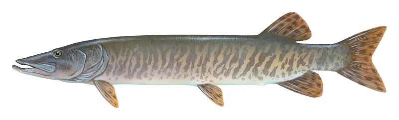
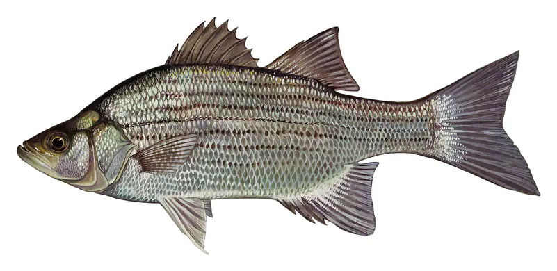
Game fish recorded in Devils Lake include striped bass, muskellunge, white bass. In all, 5 fish species have open records inside the lake on GBIF.
The surface of Devils Lake was about 47°F on November 9, estimated from a satellite pass on a clear day. It is the top layer of the water, a few degrees either way; coves and shallows run warmer in the sun.
Anglers 16 and older need a North Dakota fishing license, sold online by the North Dakota Game and Fish Department. Free fishing days: Residents only: first weekend in June and December 26-27. Size and bag limits can be set lake by lake: check the current regulations.
Devils Lake averages about 27 ft deep. Depth changes with the lake level.
In summer a white Secchi disk lowered into Devils Lake stays visible to about 5.6 ft (the median of 37 readings, 2016–2025, by North Dakota Department Of Environmental Quality): somewhat murky water. With the algae measured too (chlorophyll about 14 µg/L), that makes it eutrophic: rich in nutrients, greener water. Clarity drops after storms and during algae blooms.
Yes: lake contour map (overview) from the North Dakota Game and Fish Department (2012). It is linked in the lake facts on this page. Depths on a map are measured at a reference level: subtract how far the lake is below it today.
Bureau of Reclamation lists biking, boating, camping, fishing, hiking, hunting, picnicking and winter sports at Devils Lake State Park - Grahams Island State Park.
EPA's CyAN satellite rated cyanobacteria in Devils Lake high on November 9. The satellite sees open water only; blooms can be patchy, so avoid water that looks like spilled paint or pea soup and keep dogs out of scum. Swimming advisories come from North Dakota health and environment agencies.
Yes. A trail runs along or near the shore, including Sivert Thompson Loop (1.3 mi), according to OpenStreetMap.
Devils Lake is held back by Spirit Lake Jetty 2, completed in 1997 and 15 ft high, according to the National Inventory of Dams.
From the U.S. Geological Survey (DEVILS LAKE NEAR DEVILS LAKE, ND). Lake by Lake checks it every hour; the agency's own figure is always the reference, and provisional readings can be revised.
Lake levels are refreshed every hour. Texas and California reservoirs report once a day; most USGS and NOAA gauges report every 15 to 60 minutes.