Sun
- Sunrise
- 7:24 AM
- Sunset
- 5:16 PM
- First light
- 6:54 AM
- Last light
- 5:45 PM
Reservoir · Logan County, Ohio
A reservoir on the Great Miami River in Logan County, Ohio, held back by Indian Lake Dam since 1852.

Indian Lake is at 996.04 feet above sea level, as of Nov 17, 2026, 9:00 PM EST. It has dropped 0.06 ft in the past 7 days.
A notification from this browser, once, when the level crosses the line (checked every hour). No account and no email. On an iPhone, add Lake by Lake to your home screen first (Share → Add to Home Screen) and open it from there. Or follow the lake in a feed reader: RSS feed.
Indian Lake is down 0.05 ft over the last 30 days, at 996.04 ft today.
Daily values from the U.S. Geological Survey.
Over the past 12 months, Indian Lake ranged from 995.49 ft (Nov 18, 2025) to 996.75 ft (Aug 15, 2026), a swing of 1.3 ft. Today's level is in the lower half of that range. It is 0.54 ft higher than on this date last year.
Daily values from the U.S. Geological Survey. Why lake levels rise and fall
Solunar periods for Indian Lake, local time. How they work
High · as of Nov 9, 2026
The satellite sees a likely bloom on part of the lake. Avoid discolored water and scum, and keep dogs out of it. About 752,000 cells/mL at the worst spot, covering 67% of the lake.
Week of Aug 9Week of Nov 1
Each bar is one week, colored by the worst reading of that week.
From the U.S. EPA's Cyanobacteria Assessment Network (CyAN), which reads the color of lakes from the Sentinel-3 satellites; it sees open water only, not coves or the shoreline. Blooms can be patchy: what you see on the water matters more. Swimming closures and health advisories come from Ohio health and environment agencies. How to read it
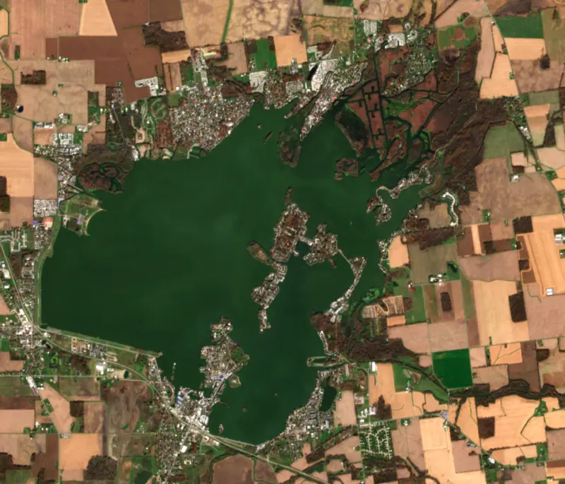
The last 7 satellite passes
76°F · Jul 2561°F · Oct 21
15°F cooler than on Jul 25, 2026.
Estimated from Landsat 8/9 (USGS) passes on clear days: the top layer of the water, a few degrees either way. Coves and the shallows can be warmer.
Indian Lake water temperature: trend, swimming and the fish →
On or near the shore of Indian Lake: 6 boat ramps, 6 marinas, 2 rental outfits, 27 campgrounds, 2 beaches and 1 trail. The lake has about 96 miles of shoreline, counting its islands.
Tap an icon for details; use two fingers (or Ctrl + scroll) to move the map. Tap a dot for details. Map and lake outline © OpenStreetMap contributors. Places from OpenStreetMap, Overture Maps and Recreation.gov. Not for navigation.
What you’ll find on the shore
← AllBoating 12
← AllRentals & tours 2
← AllFishing spots 3
← AllBeaches 2
← AllCamping 27
← AllLodging 21
← AllTrails 1
← AllParks 7
← AllDining 21
These invasive plants and animals have been recorded in Indian Lake: clean, drain and dry everything before you go to another lake.
Ohio: Ohio has no clean-drain-dry law for boaters; ODNR asks you to clean, drain and dry your boat before leaving every lake and to put unused bait in the trash. Possessing, selling or releasing listed injurious invasive species such as round goby is illegal. State rules
Records: USGS Nonindigenous Aquatic Species database. A species not listed may still be present.
Species with open-licensed records inside Indian Lake's outline, from GBIF.org (surveys, museum collections and angler reports). A record shows a fish was found here, not how many there are now.
Shallow, protected flats in spring; docks, grass and deep edges in summer heat.
Brush piles, docks and bridge pilings; shallow for a few weeks in spring.
Channel edges and river arms; best after dark in summer, and after a rain.
Spring runs up the tributaries; schools busting shad in late summer.
Schools near the bottom; a favorite through the ice.
Water temperature sets off each spawn; the bars show the usual months at this latitude and elevation, and move with a warm or cold spring. The water is about 47°F now.
Indian Lake is a shallow state park lake in Logan County, in west-central Ohio, and one of the largest reservoirs in the state. The Great Miami River begins at its outlet. It started as a canal reservoir, grew into one of the Midwest's busiest summer resorts, and today is best known among anglers as the top saugeye lake in Ohio.
Melting glacial ice left a cluster of shallow kettle lakes and marshes here, about 640 acres in all, with names such as Old Indian Lake, Otter Lake, Black Lake and Sheep Pen Lake. Native peoples lived and hunted in the area, and the nearness of the Great Miami made it part of a trade route between the Ohio River and Lake Erie. Daniel Boone and Simon Kenton are both known to have passed through.
In 1850 the Ohio General Assembly voted to use the lakes as a water supply for the Miami and Erie Canal. From 1851 to 1860 Irish laborers built a bulkhead in Washington Township, where the river begins, working by hand with picks, shovels and carts. The higher water could be let down the Great Miami to keep the canal at its required 4 feet of depth. The work cost $340,000, and by the time it was done the canal was already in decline. The flooded basin was named Lewistown Reservoir, and by 1893 it covered 6,334 acres. On April 9, 1898, the legislature dedicated the reservoir as a public recreation area called Indian Lake, and it came under the Ohio Department of Natural Resources' parks division in 1949.
Steam and electric railways, among them the Toledo and Ohio Central and the Ohio Electric Railway, brought crowds around the turn of the 20th century, and the lake came to be called the Midwest's Million Dollar Playground. At Russells Point on the south shore, Sandy Beach Amusement Park opened in 1924 with a wooden roller coaster and a big-band dance hall. It closed in 1975 and was torn down in 1982.
On the evening of March 14, 2024, an EF3 tornado with winds estimated at 155 mph crossed parts of the lake. It destroyed many manufactured homes on Orchard Island and did its worst damage in Lakeview, killing three people and injuring 27 along its 32-mile path.
In the northeast corner of the lake, a wetland known as the Game Preserve has been cut through with dredged channels, and it shelters fish, small mammals, turtles and waterfowl. The lake lies on a major migration route, and Canada geese, ducks, grebes, swans, egrets and herons rest here, with many staying to nest. Bald eagles have nested nearby in recent years.
The state park has two swimming beaches, Old Field and Fox Island, and five launch ramps, at Lakeview Harbor, Blackhawk, Moundwood, Chippewa and Cranetown Island. There is no horsepower limit, water skiers use the open zone, and boaters may stop to swim at marked spots near the Walnut Islands. Boat campsites near the ramp each come with their own dock. A paved 3.5-mile bikeway on the west bank links Old Field Beach and Lakeview Harbor, and a causeway leads to a short loop trail on Pew Island. In winter people ice fish and sail ice boats, and the park reminds them that no ice is ever certain to be safe.
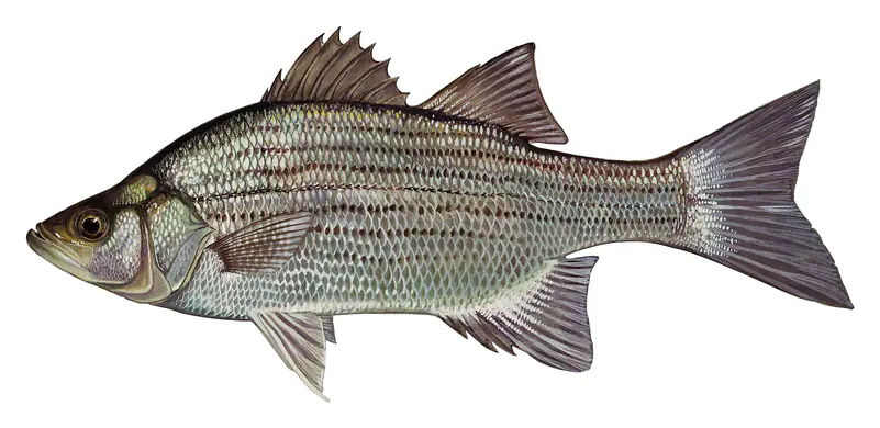
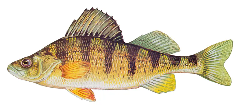
Saugeye, a walleye and sauger cross, are the fish that put the lake on the map. The Division of Wildlife stocks them by the million, and in 2024 anglers reported 170 saugeye over 21 inches from Indian Lake, more than from any other place in Ohio. The shallow water also holds good numbers of bluegill, crappie, yellow perch, largemouth bass and white bass, along with walleye and catfish.
Written by Lake by Lake from Miami Conservancy District, America's State Parks (Ohio DNR listing), Office of the Governor of Ohio (release archived by politicalemails.org), National Weather Service, Wilmington and Wikipedia. Checked November 2026.
Indian Lake Dam is an earthfill dam 16 feet high and 19,860 feet long on the Great Miami River, completed in 1852. It belongs to ODNR, Division of Parks & Watercraft and is run for recreation. At its normal level the reservoir holds 18,414 acre-ft, drained from 98 square miles of land.
From the National Inventory of Dams (U.S. Army Corps of Engineers), NID ID OH00596. Lake or reservoir: what’s the difference?
Where the level comes from: Indian Lake at Russells Point OH (U.S. Geological Survey).
| Lake | Miles | Level (ft) | vs full | 7 days |
|---|---|---|---|---|
| Lake Loramie Live reading | 26 | 953.80 | — | 0.00 |
| Clarence J Brown Reservoir Slightly below full | 36 | 1009.54 | −2.46 | −0.30 |
| Grand Lake St. Marys Live reading | 37 | 870.79 | — | −0.02 |
| Delaware Lake At or near full pool | 43 | 913.16 | −1.84 | +0.29 |
| O'Shaughnessy Reservoir At or near full pool | 45 | 848.53 | +0.03 | +0.06 |
| Griggs Reservoir At or near full pool | 52 | 755.98 | +0.38 | +0.18 |
Compare Indian Lake with Lake Loramie, Clarence J Brown Reservoir, Grand Lake St. Marys or Delaware Lake: size, level, ramps and fish side by side.
Indian Lake is about 50 mi from Dayton, OH, 58 mi from Columbus, OH and 84 mi from Toledo, OH. See all the lakes near each city.
Indian Lake is at 996.04 feet above sea level, as of Nov 17, 2026, 9:00 PM EST. It has dropped 0.06 ft in the past 7 days.
Indian Lake has 6 boat ramps on our map, including Boat ramp near Indian Lake State Park Chippewa Marina, Boat ramp at Flip Flop Cove Campground, Boat ramp near Indian Lake State Park Chippewa Marina (2), and 6 marinas. Low water can close ramps, so check today's level above and the operator before you go.
Yes. There are 27 campgrounds and RV parks within about a mile of the shore, such as Acheson's Resort, Geronimo Camp, Cherokee Landing RV Resort.
Game fish recorded in Indian Lake include largemouth bass, black crappie, white crappie, channel catfish, blue catfish, white bass. In all, 20 fish species have open records inside the lake on GBIF.
The water at Indian Lake is 47°F, measured 2 hr ago by the USGS sensor in the lake. Surface temperature changes through the day and with depth.
Anglers 16 and older need an Ohio fishing license, sold online by the Ohio Department of Natural Resources Division of Wildlife. Free fishing days: Father's Day weekend. Size and bag limits can be set lake by lake: check the current regulations.
Indian Lake averages about 4 ft deep. Depth changes with the lake level.
In summer a white Secchi disk lowered into Indian Lake stays visible to about 1.0 ft (the median of 17 readings, 2016–2017, by Ohio Lake Management Society): murky water. Silt after rain lowers the reading as much as algae do. Clarity drops after storms and during algae blooms.
Yes: fishing map with depth contours from the Ohio Department of Natural Resources, Division of Wildlife. It is linked in the lake facts on this page. Depths on a map are measured at a reference level: subtract how far the lake is below it today.
boating (6 boat ramps and 6 marinas), kayaks, boats & jet skis (2 rental outfits on or near the water), fishing (12 game fish), swimming (2 beaches and swimming areas), hiking & walking (1 trail along the shore, the longest Pew Island Trail (0.7 mi)) and camping (27 campgrounds), according to our map of the shore.
EPA's CyAN satellite rated cyanobacteria in Indian Lake high on November 9. The satellite sees open water only; blooms can be patchy, so avoid water that looks like spilled paint or pea soup and keep dogs out of scum. Swimming advisories come from Ohio health and environment agencies.
Yes. A trail runs along or near the shore, including Pew Island Trail (0.7 mi), according to OpenStreetMap.
Indian Lake is held back by Indian Lake Dam, completed in 1852 and 16 ft high, according to the National Inventory of Dams.
From the U.S. Geological Survey (Indian Lake at Russells Point OH). Lake by Lake checks it every hour; the agency's own figure is always the reference, and provisional readings can be revised.
Lake levels are refreshed every hour. Texas and California reservoirs report once a day; most USGS and NOAA gauges report every 15 to 60 minutes.