Sun
- Sunrise
- 7:08 AM
- Sunset
- 5:24 PM
- First light
- 6:41 AM
- Last light
- 5:51 PM
Reservoir · Anderson County, South Carolina
A reservoir on the Savannah River in Georgia and South Carolina, held back by Hartwell Dam since 1962. Also called Hartwell Lake.

Lake Hartwell is at 647.30 feet above sea level — 12.70 ft below full summer pool, as of Nov 19, 2026, 6:00 AM EST. It has dropped 0.29 ft in the past 7 days.
Lowest of 4 South Carolina lakes today against full pool · See the ranking
Record low 637.61 ft (2008), record high 664.85 ft (2016) · Level history since 2005
Which boat ramps are usable at today’s level →
A notification from this browser, once, when the level crosses the line (checked every hour). No account and no email. On an iPhone, add Lake by Lake to your home screen first (Share → Add to Home Screen) and open it from there. Or follow the lake in a feed reader: RSS feed.
Lake Hartwell is down 0.29 ft over the last 7 days, at 647.30 ft today.
Daily values from the U.S. Geological Survey.
Lake Hartwell is down 1.47 ft over the last 30 days, at 647.30 ft today.
Daily values from the U.S. Geological Survey.
Over the past 12 months, Lake Hartwell ranged from 647.26 ft (Nov 19, 2026) to 654.97 ft (Nov 23, 2025), a swing of 7.7 ft. Today's level is near the bottom of that range. It is 7.64 ft lower than on this date last year.
Daily values from the U.S. Geological Survey. Why lake levels rise and fall
In the U.S. Geological Survey record, which starts in 2005, the lowest level was 637.61 ft on December 9, 2008 and the highest 664.85 ft on January 5, 2016. Today’s 647.30 ft is 9.7 ft above the record low and 17.6 ft below the record high.
Lake Hartwell level history: every year since 2005, the lowest and highest years →
Solunar periods for Lake Hartwell, local time. How they work
Not detected · as of Nov 9, 2026
The satellite found no cyanobacteria at the surface.
Week of Aug 9Week of Nov 1
Each bar is one week, colored by the worst reading of that week.
From the U.S. EPA's Cyanobacteria Assessment Network (CyAN), which reads the color of lakes from the Sentinel-3 satellites; it sees open water only, not coves or the shoreline. Blooms can be patchy: what you see on the water matters more. Swimming closures and health advisories come from South Carolina health and environment agencies. How to read it
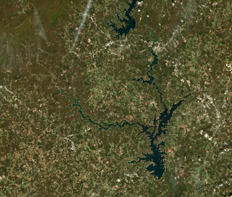
Surface water temperature
62°F on Nov 16, 2026
81°F · Aug 1262°F · Nov 16
19°F cooler than on Aug 12, 2026.
Estimated from Landsat 8/9 (USGS) passes on clear days: the top layer of the water, a few degrees either way. Coves and the shallows can be warmer.
Lake Hartwell water temperature: trend, swimming and the fish →
On or near the shore of Lake Hartwell: 92 boat ramps, 12 marinas, 4 rental outfits, 43 campgrounds, 8 beaches and 13 trails. The lake has about 908 miles of shoreline, counting its islands.
Tap an icon for details; use two fingers (or Ctrl + scroll) to move the map. Tap a dot for details. Map and lake outline © OpenStreetMap contributors. Places from OpenStreetMap, Overture Maps and Recreation.gov. Not for navigation.
What you’ll find on the shore
← AllBoating 104
Which boat ramps are usable at today’s level →
← AllRentals & tours 5
← AllFishing spots 5
← AllBeaches 8
← AllCamping 43
← AllLodging 24+
← AllTrails 13
← AllParks 19
← AllDining 24+
These invasive plants and animals have been recorded in Lake Hartwell: clean, drain and dry everything before you go to another lake.
Georgia: Georgia has no clean-drain-dry law; WRD asks boaters to remove plants, mussels and mud, pull the drain plug and drain all water away from the ramp, never dump bait buckets, and dry gear for five days before using other waters. State rules
South Carolina: South Carolina has no clean-drain-dry law for boats, but it is illegal to possess hydrilla, water hyacinth and other listed aquatic plants or put them in state waters, so strip off all plant fragments. Officials urge boaters to clean, drain and dry before moving to another lake. State rules
Records: USGS Nonindigenous Aquatic Species database. A species not listed may still be present.
Species with open-licensed records inside Lake Hartwell's outline, from GBIF.org (surveys, museum collections and angler reports). A record shows a fish was found here, not how many there are now.
Shallow, protected flats in spring; docks, grass and deep edges in summer heat.
Brush piles, docks and bridge pilings; shallow for a few weeks in spring.
Channel edges and river arms; best after dark in summer, and after a rain.
Rocky shorelines and riprap at night in late winter; deep weed edges and humps in summer.
Run up the river arms in spring; follow shad to cool, deep water near the dam in summer.
Water temperature sets off each spawn; the bars show the usual months at this latitude and elevation, and move with a warm or cold spring. The water is about 62°F now.
Lake Hartwell is a U.S. Army Corps of Engineers reservoir on the upper Savannah River, with the South Carolina and Georgia state line running down its length. Interstate 85 crosses it near the border, Clemson University sits on its Seneca River arm, and it is one of the most popular lakes in the Southeast, known above all for striped and hybrid bass.
The Tugaloo and Seneca rivers meet to form the Savannah, and Hartwell Dam stands about 7 miles below that meeting point. Their flooded valleys make up the lake's two long arms, and the water reaches into Anderson, Oconee and Pickens counties in South Carolina and Hart, Franklin and Stephens counties in Georgia. The Flood Control Act of 1950 authorized the project as the second step in developing the Savannah River basin, and the Corps built it between 1955 and 1963 for flood control and hydropower. The lake is named for Nancy Hart, a Georgia heroine of the Revolutionary War. Below the dam, the Savannah flows on into Lake Russell.
The original plan would have flooded at least 7,000 acres of Clemson land, including part of the old Fort Hill estate and the college football stadium up to its 26th row. In 1956 the trustees pressed the Corps to look for another way, and work paused early in 1957 while engineers restudied the project. Lowering the lake was ruled too costly, so the Corps built two diversion dams on the Seneca, known on campus as the Dikes, with a pump station that lifts creek water over the lower dike into the lake. Graves in the Woodland Cemetery area, including those of enslaved people and convict laborers, were moved about 300 feet to make room. Not every landowner went quietly. In 1956, 78-year-old Eliza Brock held off the government at her 103-acre farm for more than a month before accepting $6,850. Andersonville, once a river port with barge service to Savannah, now survives as the lake's largest island.
Striped bass are the most popular catch, and South Carolina stocks both stripers and hybrid bass. Over three weeks in 2016 the state stocked about 780,000 striped bass and 480,000 hybrids, raised at its hatchery in Bonneau. All Hartwell stripers belong to the Savannah River strain, native to this drainage. Largemouth bass, crappie, bream and catfish round out the catch.
Anglers should also know the lake's pollution history. From 1955 to 1977, the Sangamo Weston plant in the town of Pickens discharged more than 400,000 pounds of PCBs into Town Creek, which drains through Twelve Mile Creek into the lake. The contamination was discovered in 1976, the year the first fish advisory was issued. Fish consumption advisories have covered parts of the lake ever since, strictest in the Twelve Mile Creek and Seneca River arms, so check the current South Carolina and Georgia advisories before keeping fish.
Drought can pull the lake far down. In December 2008 it fell more than 22 feet below normal, uncovering old highways and new islands. The Corps keeps loaner life jacket stands at every designated swimming area, stocked in sizes for children and adults. Rangers point out that most people who drown were not wearing one, that distances over water are hard to judge, and that buoys are not swimming targets. On the South Carolina side, Lake Hartwell State Park at Fair Play, just off I-85, has campsites, camper cabins, boat ramps and a 140-foot fishing pier.
Written by Lake by Lake from Wikipedia, Clemson University News, South Carolina Department of Natural Resources, South Carolina DHEC and Agency for Toxic Substances and Disease Registry, U.S. Army and South Carolina State Parks. Checked November 2026.
Activities listed by the U.S. Army Corps of Engineers: Boating · Camping · Fishing · Hiking · Picnicking · Water sports · Wildlife viewing
Hartwell Dam is a concrete dam 155 feet high and 17,852 feet long on the Savannah River, completed in 1962. It belongs to the U.S. Army Corps of Engineers (Savannah District) and is run for hydropower, fish and wildlife, recreation, water supply and flood control. At its normal level the reservoir holds 2.55 million acre-ft, drained from 2,088 square miles of land.
From the National Inventory of Dams (U.S. Army Corps of Engineers), NID ID GA01702. Lake or reservoir: what’s the difference?
Where the level comes from: HARTWELL LAKE NEAR ANDERSON, SC (U.S. Geological Survey, used on this page) and Savannah River at Lake Hartwell (NOAA National Water Prediction Service).
| Lake | Miles | Level (ft) | vs full | 7 days |
|---|---|---|---|---|
| Lake Keowee Slightly below full | 20 | 95.66* | −4.34 | −1.01 |
| Lake Yonah At or near full pool | 29 | 743.45 | −0.75 | +0.22 |
| Richard B. Russell Lake At or near full pool | 31 | 473.13 | −1.87 | −0.26 |
| Lake Jocassee Well below full | 31 | 83.43* | −16.57 | +0.31 |
| Lake Tugalo At or near full pool | 32 | 889.94 | −1.56 | −0.22 |
| Tallulah Falls Lake At or near full pool | 35 | 1499.22 | −0.78 | +0.91 |
* Local gauge datum: 100 ft = full pond (Duke Energy lakes).
Compare Lake Hartwell with Lake Keowee, Lake Yonah, Richard B. Russell Lake or Lake Jocassee: size, level, ramps and fish side by side.
Lake Hartwell is about 49 mi from Athens, GA. See all the lakes near each city.
Lake Hartwell is also known as Hartwell Lake.
Lake Hartwell is at 647.30 feet above sea level — 12.70 ft below full summer pool, as of Nov 19, 2026, 6:00 AM EST. It has dropped 0.29 ft in the past 7 days.
Lake Hartwell's full summer pool is 660.00 ft, according to U.S. Army Corps of Engineers. Today the lake is 12.70 ft below that mark.
Today's level is 7.19 ft below the median for this date (654.49 ft), from the gauge’s long-term daily record.
637.61 ft, on December 9, 2008, in the U.S. Geological Survey record, which starts in 2005. Today the lake is 9.7 ft above that.
664.85 ft, on January 5, 2016, in the U.S. Geological Survey record since 2005. That is 4.9 ft above full summer pool.
Lake Hartwell has 92 boat ramps on our map, including Apple Island, Asbury, Big Oaks (left lane), and 12 marinas. Low water can close ramps, so check today's level above and the operator before you go.
Yes. There are 43 campgrounds and RV parks within about a mile of the shore, such as Hartwell Lakeside KOA Holiday, Twin Lakes Campground, Oconee Point - Site 28.
Game fish recorded in Lake Hartwell include largemouth bass, channel catfish, black crappie, striped bass, bluegill, white bass. In all, 40 fish species have open records inside the lake on GBIF.
The surface of Lake Hartwell was about 62°F on November 16, estimated from a satellite pass on a clear day. It is the top layer of the water, a few degrees either way; coves and shallows run warmer in the sun.
Lake Hartwell lies in Georgia and South Carolina: the license of the state where you fish applies. Anglers 16 and older need a Georgia fishing license, sold online by the Georgia Department of Natural Resources, Wildlife Resources Division. Free fishing days: Two days during National Fishing and Boating Week (June) and National Hunting and Fishing Day (September). Anglers 16 and older need a South Carolina fishing license, sold online by the South Carolina Department of Natural Resources. Free fishing days: Memorial Day and July 4 (residents, freshwater only). Size and bag limits can be set lake by lake: check the current regulations.
Lake Hartwell averages about 46 ft deep. Depth changes with the lake level.
In summer a white Secchi disk lowered into Lake Hartwell stays visible to about 9.2 ft (the median of 275 readings, 2016–2026, by South Carolina Department of Environmental Services and Georgia DNR Environmental Protection Division): clear water. With the algae measured too (chlorophyll about 5 µg/L), that makes it mesotrophic: moderately rich in nutrients. Clarity drops after storms and during algae blooms.
U.S. Army Corps of Engineers lists boating, camping, fishing, hiking, picnicking, water sports and wildlife viewing at Hartwell Lake. 9 campgrounds can be booked on Recreation.gov.
EPA's CyAN satellite rated cyanobacteria in Lake Hartwell not detected on November 9. The satellite sees open water only; blooms can be patchy, so avoid water that looks like spilled paint or pea soup and keep dogs out of scum. Swimming advisories come from South Carolina health and environment agencies.
Yes. 13 trails run along or near the shore, including Double Fork Tree Trail (2.9 mi), Double Logging Road Trail (2.2 mi) and Hunting Arrow Trail (4.9 mi), according to OpenStreetMap.
Lake Hartwell is held back by Hartwell Dam, completed in 1962 and 155 ft high, according to the National Inventory of Dams.
From the U.S. Geological Survey (HARTWELL LAKE NEAR ANDERSON, SC). Lake by Lake checks it every hour; the agency's own figure is always the reference, and provisional readings can be revised.
Lake levels are refreshed every hour. Texas and California reservoirs report once a day; most USGS and NOAA gauges report every 15 to 60 minutes.
Cookies for analytics With your OK we use Google Analytics and Microsoft Clarity to count visits and see how the site is used, so we can make it better. No advertising cookies. Privacy policy




