Sun
- Sunrise
- 6:23 AM
- Sunset
- 4:30 PM
- First light
- 5:55 AM
- Last light
- 4:58 PM
Reservoir · Clay County, Tennessee
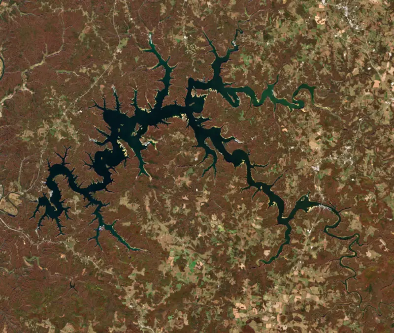
A reservoir on the Obey River in Kentucky and Tennessee, held back by Dale Hollow Dam since 1943. Also called Dale Hollow Reservoir.

Dale Hollow Lake is at 637.77 feet above sea level — 13.23 ft below normal summer pool, as of Nov 19, 2026, 5:00 AM CST. It has dropped 0.31 ft in the past 7 days.
8th lowest of 23 Tennessee lakes today against full pool · See the ranking
Record low 636.01 ft (2024), record high 660.11 ft (2019) · Level history since 2012
A notification from this browser, once, when the level crosses the line (checked every hour). No account and no email. On an iPhone, add Lake by Lake to your home screen first (Share → Add to Home Screen) and open it from there. Or follow the lake in a feed reader: RSS feed.
Dale Hollow Lake is down 0.31 ft over the last 7 days, at 637.77 ft today.
Daily values from the U.S. Army Corps of Engineers.
Dale Hollow Lake is down 1.43 ft over the last 30 days, at 637.77 ft today.
Daily values from the U.S. Army Corps of Engineers.
Over the past 12 months, Dale Hollow Lake ranged from 636.21 ft (Dec 18, 2025) to 647.35 ft (Jun 30, 2026), a swing of 11.1 ft. Today's level is near the bottom of that range. It is 0.45 ft lower than on this date last year.
Daily values from the U.S. Army Corps of Engineers. Why lake levels rise and fall
In the U.S. Army Corps of Engineers record, which starts in 2012, the lowest level was 636.01 ft on January 5, 2024 and the highest 660.11 ft on February 25, 2019. Today’s 637.77 ft is 1.8 ft above the record low and 22.3 ft below the record high.
Dale Hollow Lake level history: every year since 2012, the lowest and highest years →
Solunar periods for Dale Hollow Lake, local time. How they work
Moderate · as of Nov 9, 2026
A bloom may be forming somewhere on the lake. Avoid water that looks like spilled paint or pea soup. About 229,000 cells/mL at the worst spot, covering 5% of the lake.
Week of Aug 16Week of Nov 1
Each bar is one week, colored by the worst reading of that week.
From the U.S. EPA's Cyanobacteria Assessment Network (CyAN), which reads the color of lakes from the Sentinel-3 satellites; it sees open water only, not coves or the shoreline. Blooms can be patchy: what you see on the water matters more. Swimming closures and health advisories come from Tennessee health and environment agencies. How to read it
Surface water temperature
61°F on Nov 14, 2026
87°F · Aug 1861°F · Nov 14
26°F cooler than on Aug 18, 2026.
Estimated from Landsat 8/9 (USGS) passes on clear days: the top layer of the water, a few degrees either way. Coves and the shallows can be warmer.
Dale Hollow Lake water temperature: trend, swimming and the fish →
On or near the shore of Dale Hollow Lake: 20 boat ramps, 24 marinas and 15 campgrounds. The lake has about 407 miles of shoreline, counting its islands.
Tap an icon for details; use two fingers (or Ctrl + scroll) to move the map. Tap a dot for details. Map and lake outline © OpenStreetMap contributors. Places from OpenStreetMap, Overture Maps and Recreation.gov. Not for navigation.
What you’ll find on the shore
← AllBoating 44
← AllFishing spots 2
← AllCamping 15
← AllLodging 24+
← AllParks 4
← AllDining 7
These invasive plants and animals have been recorded in Dale Hollow Lake: clean, drain and dry everything before you go to another lake.
Kentucky: Kentucky has no clean-drain-dry law; KDFWR asks boaters to remove plants, mud and mussels, drain motors, bilges and livewells before leaving the access, trash unused bait, and dry gear for five days. Possessing, importing or releasing prohibited non-native aquatic species such as zebra mussels is illegal. State rules
Tennessee: Tennessee has no statewide clean-drain-dry law; TWRA urges you to remove plants, animals and mud, drain all water, and dry the boat for five days (or hot-wash it) before moving to another lake. Moving live invasive carp is illegal. State rules
Records: USGS Nonindigenous Aquatic Species database. A species not listed may still be present.
Species with open-licensed records inside Dale Hollow Lake's outline, from GBIF.org (surveys, museum collections and angler reports). A record shows a fish was found here, not how many there are now.
Channel edges and river arms; best after dark in summer, and after a rain.
Rocky points, gravel and current breaks; deeper rock piles in summer.
Cool water: near the surface in spring and fall, deep in summer.
Clear water and steep rock; they often suspend deeper than largemouth.
Low light and cold water; the inflows in fall.
Water temperature sets off each spawn; the bars show the usual months at this latitude and elevation, and move with a warm or cold spring. The water is about 61°F now.
Dale Hollow Lake is a Corps of Engineers reservoir on the Obey River along the Tennessee and Kentucky line, lying mostly in Clay, Pickett and Overton counties in Tennessee with arms reaching into Cumberland and Clinton counties in Kentucky. It is famous for clear water and for smallmouth bass, including the fish that has stood as the world record since 1955.
Before the dam, the Obey and the Cumberland flooded the Upper Cumberland country again and again. Celina, where the Obey meets the Cumberland, was a river town. Each spring lumbermen floated rafts of logs from there to Nashville, a trip of about a week, and steamboats brought in mail and goods and carried out chickens, lumber and farm produce until highways took over in the 1920s and 1930s.
Congress authorized the project in the Flood Control Act of 1938, and the Army Corps of Engineers finished the dam in 1943, 7.3 miles above the river's mouth near Celina. It was the first dam on the Obey. Generators were added in 1948, 1949 and 1953, and the lake is one of four major flood control reservoirs in the Cumberland basin, along with Lake Cumberland, Center Hill and Percy Priest.
The price was paid in farmland and towns. The government bought the community of Willow Grove in 1942, and the water covered it completely. Pickett County lost most of its best farmland and about a fourth of its people. The lake also cut off the east end of Clay County, so residents there must drive through Overton County to reach the rest of their own county. In Pickett County, cheap power from the dam later helped bring in clothing factories.
The dam backs water up nearly the whole length of the Obey and well up its East and West forks. Because the dam is tall and the river ran through deep gorges, the lake is deep for its size. On the Kentucky side the water fills the Wolf River, Sulphur Creek and Illwill Creek embayments. Below the dam the river makes two sharp bends before it reaches the Cumberland.
Two islands have their own uses. Geiger Island is a primitive camping site run by the Corps, and Trooper Island, on the state line, is leased to the Kentucky State Police for a children's camp and is generally closed to the public in summer. Dale Hollow Lake State Resort Park sits on the Kentucky shore.
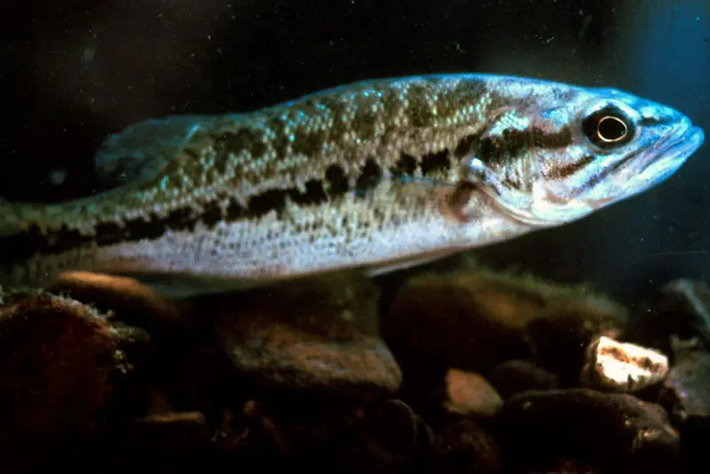
In 1955 David Hayes caught a smallmouth bass weighing 11 pounds 15 ounces here, and it remains the all-tackle world record. Smallmouth are still the fish the lake is known for, and largemouth bass, crappie, muskellunge, walleye, catfish and trout are also caught. The Tennessee and Kentucky wildlife agencies share jurisdiction over the lake under a reciprocal fishing agreement. The water is clear enough that scuba divers come to the lake as well.
At the dam site, the Dale Hollow National Fish Hatchery in Celina has raised trout since 1965. It was built to make up for fisheries lost to federal dams in the Southeast, and it grows rainbow, brown, lake and brook trout for public waters in Tennessee and neighboring states. Its visitor center, aquarium and raceways are open to the public.
Written by Lake by Lake from Tennessee Historical Society, Tennessee Encyclopedia (Clay County, Pickett County), U.S. Fish and Wildlife Service and Wikipedia (Dale Hollow Lake, Obey River, Smallmouth bass). Checked November 2026.
Activities listed by the U.S. Army Corps of Engineers: Scenic drives · Biking · Boating · Historic sites · Camping · Fishing · Hiking · Horseback riding · Picnicking · Water sports · Wildlife viewing
Dale Hollow Dam is a concrete gravity dam 200 feet high and 1,717 feet long on the Obey River, completed in 1943. It belongs to the U.S. Army Corps of Engineers (Nashville District) and is run for flood control, recreation, hydropower and water supply. At its normal level the reservoir holds 857,000 acre-ft, drained from 935 square miles of land.
From the National Inventory of Dams (U.S. Army Corps of Engineers), NID ID TN02702. Lake or reservoir: what’s the difference?
Where the level comes from: Dale Hollow Lake (U.S. Army Corps of Engineers).
| Lake | Miles | Level (ft) | vs full | 7 days |
|---|---|---|---|---|
| Lake Cumberland Well below full | 29 | 688.74 | −34.26 | −1.28 |
| Cordell Hull Lake Slightly below full | 32 | 500.97 | −3.53 | +0.14 |
| Center Hill Lake Well below full | 37 | 629.34 | −18.66 | −0.63 |
| Barren River Lake Well below full | 44 | 531.53 | −20.47 | −6.04 |
| Green River Lake At or near full pool | 50 | 673.35 | −1.65 | −0.37 |
| Great Falls Lake Well below full | 51 | 787.02 | −17.98 | −0.34 |
Compare Dale Hollow Lake with Lake Cumberland, Cordell Hull Lake, Center Hill Lake or Barren River Lake: size, level, ramps and fish side by side.
Dale Hollow Lake is also known as Dale Hollow Reservoir.
Dale Hollow Lake is at 637.77 feet above sea level — 13.23 ft below normal summer pool, as of Nov 19, 2026, 5:00 AM CST. It has dropped 0.31 ft in the past 7 days.
Dale Hollow Lake's normal summer pool is 651.00 ft, according to U.S. Army Corps of Engineers. Today the lake is 13.23 ft below that mark.
Today's level is 0.45 ft below the median for this date (638.22 ft), from the gauge’s long-term daily record.
636.01 ft, on January 5, 2024, in the U.S. Army Corps of Engineers record, which starts in 2012. Today the lake is 1.8 ft above that.
660.11 ft, on February 25, 2019, in the U.S. Army Corps of Engineers record since 2012. That is 9.1 ft above normal summer pool.
Dale Hollow Lake has 20 boat ramps on our map, including Holly Creek Dock, Pleasant Grove Boat Ramp, Lilydale, and 24 marinas. Low water can close ramps, so check today's level above and the operator before you go.
Yes. There are 15 campgrounds and RV parks within about a mile of the shore, such as Gunnels Camp, Cove Creek Campground, Pleasant Grove Recreation Area Campground.
Game fish recorded in Dale Hollow Lake include spotted bass, smallmouth bass, channel catfish, brown trout, flathead catfish, lake trout. In all, 40 fish species have open records inside the lake on GBIF.
The surface of Dale Hollow Lake was about 61°F on November 14, estimated from a satellite pass on a clear day. It is the top layer of the water, a few degrees either way; coves and shallows run warmer in the sun.
Dale Hollow Lake lies in Kentucky and Tennessee: the license of the state where you fish applies. Anglers 16 and older need a Kentucky fishing license, sold online by the Kentucky Department of Fish and Wildlife Resources. Free fishing days: First full weekend in June. Anglers 13 and older need a Tennessee fishing license, sold online by the Tennessee Wildlife Resources Agency. Free fishing days: Free Fishing Day, one Saturday in June; children 15 and under fish free that whole week. Size and bag limits can be set lake by lake: check the current regulations.
Dale Hollow Lake averages about 31 ft deep. Depth changes with the lake level.
U.S. Army Corps of Engineers lists scenic drives, biking, boating, historic sites, camping, fishing, hiking and horseback riding at Dale Hollow Lake. 4 campgrounds can be booked on Recreation.gov.
EPA's CyAN satellite rated cyanobacteria in Dale Hollow Lake moderate on November 9. The satellite sees open water only; blooms can be patchy, so avoid water that looks like spilled paint or pea soup and keep dogs out of scum. Swimming advisories come from Tennessee health and environment agencies.
Dale Hollow Lake is held back by Dale Hollow Dam, completed in 1943 and 200 ft high, according to the National Inventory of Dams.
From the U.S. Army Corps of Engineers (Dale Hollow Lake). Lake by Lake checks it every hour; the agency's own figure is always the reference, and provisional readings can be revised.
Lake levels are refreshed every hour. Texas and California reservoirs report once a day; most USGS and NOAA gauges report every 15 to 60 minutes.
Cookies for analytics With your OK we use Google Analytics and Microsoft Clarity to count visits and see how the site is used, so we can make it better. No advertising cookies. Privacy policy