Sun
- Sunrise
- 6:27 AM
- Sunset
- 4:35 PM
- First light
- 6:00 AM
- Last light
- 5:03 PM
Reservoir · Davidson County, Tennessee
A reservoir on the Cumberland River in Davidson County, Tennessee, held back by Old Hickory Lock and Dam since 1954.

Old Hickory Lake is at 443.03 feet above sea level — 1.97 ft below normal pool, as of Nov 19, 2026, 3:00 AM CST. It has dropped 0.16 ft in the past 7 days.
6th fullest of 23 Tennessee lakes today against full pool · See the ranking
Record low 442.62 ft (2026), record high 450.70 ft (2010) · Level history since 1987
A notification from this browser, once, when the level crosses the line (checked every hour). No account and no email. On an iPhone, add Lake by Lake to your home screen first (Share → Add to Home Screen) and open it from there. Or follow the lake in a feed reader: RSS feed.
Old Hickory Lake is down 0.16 ft over the last 7 days, at 443.03 ft today.
Daily values from the U.S. Army Corps of Engineers.
Old Hickory Lake is down 1.79 ft over the last 30 days, at 443.03 ft today.
Daily values from the U.S. Army Corps of Engineers.
Over the past 12 months, Old Hickory Lake ranged from 442.62 ft (Nov 17, 2026) to 446.78 ft (Jan 26, 2026), a swing of 4.2 ft. Today's level is near the bottom of that range. It is 2.03 ft lower than on this date last year.
Daily values from the U.S. Army Corps of Engineers. Why lake levels rise and fall
In the U.S. Army Corps of Engineers record, which starts in 1987, the lowest level was 442.62 ft on November 17, 2026 and the highest 450.70 ft on May 4, 2010. Today’s 443.03 ft is 0.4 ft above the record low and 7.7 ft below the record high.
Old Hickory Lake level history: every year since 1987, the lowest and highest years →
Solunar periods for Old Hickory Lake, local time. How they work
Surface water temperature
57°F on Nov 14, 2026
82°F · Aug 1057°F · Nov 14
24°F cooler than on Aug 10, 2026.
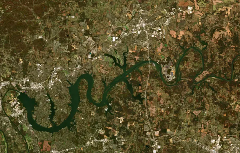
Estimated from Landsat 8/9 (USGS) passes on clear days: the top layer of the water, a few degrees either way. Coves and the shallows can be warmer.
Old Hickory Lake water temperature: trend, swimming and the fish →
On or near the shore of Old Hickory Lake: 35 boat ramps, 13 marinas, 4 rental outfits, 14 campgrounds, 2 beaches, 1 fishing pier, 6 trails and 1 fishing guide. The lake has about 244 miles of shoreline, counting its islands.
Tap an icon for details; use two fingers (or Ctrl + scroll) to move the map. Tap a dot for details. Map and lake outline © OpenStreetMap contributors. Places from OpenStreetMap, Overture Maps and Recreation.gov. Not for navigation.
What you’ll find on the shore
← AllBoating 48
← AllRentals & tours 4
← AllFishing spots 4
← AllBeaches 2
← AllCamping 14
← AllLodging 15
← AllTrails 6
← AllParks 20+
← AllDining 20
Zebra mussels have been found in Old Hickory Lake. They clog intakes and engines and spread on boats and trailers: clean, drain and dry everything before you go to another lake.
Tennessee: Tennessee has no statewide clean-drain-dry law; TWRA urges you to remove plants, animals and mud, drain all water, and dry the boat for five days (or hot-wash it) before moving to another lake. Moving live invasive carp is illegal. State rules
Records: USGS Nonindigenous Aquatic Species database. A species not listed may still be present.
Species with open-licensed records inside Old Hickory Lake's outline, from GBIF.org (surveys, museum collections and angler reports). A record shows a fish was found here, not how many there are now.
Channel edges and river arms; best after dark in summer, and after a rain.
Rocky points, gravel and current breaks; deeper rock piles in summer.
Spring runs up the rivers on rising water; snagging seasons are set by the state.
Stumps, brush and weedbeds over soft bottoms; fish tight to cover.
Clear water over gravel near weeds; creek arms and coves, nests in colonies in summer.
Water temperature sets off each spawn; the bars show the usual months at this latitude and elevation, and move with a warm or cold spring. The water is about 57°F now.
Old Hickory Lake is an Army Corps of Engineers reservoir on the Cumberland River, about 25 river miles upstream of Nashville, Tennessee, in Sumner and Davidson counties. Hendersonville spreads along its north shore, and the lake winds about 97 river miles upstream to Cordell Hull Lock and Dam near Carthage. Close to a big city, it ranks third in visitation among all the lakes the Corps manages.
The great Cumberland floods of December 1926 and January 1927 gave urgency to plans for dams on the river. The Rivers and Harbors Act of 1946 authorized Old Hickory as one part of a plan for the whole basin, and by the 1970s eight dams controlled the river from Burnside, Kentucky, to its mouth on the Ohio. Work at Old Hickory began in January 1952. The lock opened to boats in June 1954, the same month the dam closed off the river, and the project came into full use in December 1957, when its last generator went on line. The lock lifts barges and pleasure boats about 60 feet between the river and the lake. The lake's level changes very little through the year.
The lake and dam are named for Andrew Jackson, known as Old Hickory, whose plantation, The Hermitage, lies about 6 miles from the lock. The community of Old Hickory, part of metro Nashville, faces Hendersonville from the south shore.
In early May 2010, as much as 17 to 20 inches of rain fell over two days in parts of the basin. Old Hickory has no storage set aside for floods. Operators widened the floodgates every 15 minutes, and releases peaked at more than 212,000 cubic feet per second, nearly 10 times the normal May flow, to keep the lake from pouring over the top of the dam. The water crested about a foot below the top. The timing of the releases later drew a U.S. Senate inquiry into whether the public had been properly warned.
On August 2, 1960, Mabry Harper, a plumber catfishing from the bank at night near Hartsville, landed a walleye recorded at about 25 pounds. Critics later argued from photos that the fish could not have weighed that much, and the Freshwater Fishing Hall of Fame dropped it in favor of a smaller walleye caught in Arkansas in 1982. The International Game Fish Association never stopped recognizing it, and in 2019 the Hall of Fame restored it after new photographs and photo analysis supported Harper's claim. It stands again as the all-tackle world record.
Today the Corps calls the fishing world class and names largemouth bass as the lake's premier game fish. Smallmouth and spotted bass, striped bass, white crappie and sauger are also caught. Sauger bite best from January through April in the upper half of the lake toward Cordell Hull Dam, and accessible fishing piers at Rockland, Sanders Ferry and Shutes Branch serve anglers on foot.
The Corps lists campgrounds around the lake at Cages Bend, Cedar Creek, Laguardo, Lone Branch, Old Hickory Beach, Shutes Branch and other sites, along with dozens of boat access sites and day-use parks. Lakefront homes are in high demand, and many country music stars have lived on the lake.
Rockland Recreation Area in Hendersonville holds the lake's resource office and visitor center, with picnic shelters and nature trails through wooded wetlands where migratory birds spend the winter. A tornado on December 9, 2023, did heavy damage there and along Power Plant Road.
Written by Lake by Lake from U.S. Army Corps of Engineers, Nashville District (Old Hickory Lake history, Old Hickory Lock, Old Hickory Lake fishing), Recreation.gov (U.S. Army Corps of Engineers), Tennessee Encyclopedia and Game & Fish. Checked November 2026.
Activities listed by the U.S. Army Corps of Engineers: Biking · Boating · Historic sites · Camping · Fishing · Hiking · Picnicking · Visitor center · Water sports · Wildlife viewing
Old Hickory Lock and Dam is a concrete dam 98 feet high and 3,750 feet long on the Cumberland River, completed in 1954. It belongs to the U.S. Army Corps of Engineers (Nashville District) and is run for navigation, recreation, hydropower and water supply. At its normal level the reservoir holds 420,000 acre-ft, drained from 11,674 square miles of land.
From the National Inventory of Dams (U.S. Army Corps of Engineers), NID ID TN03702. Lake or reservoir: what’s the difference?
Where the level comes from: Old Hickory Lake (U.S. Army Corps of Engineers).
| Lake | Miles | Level (ft) | vs full | 7 days |
|---|---|---|---|---|
| Percy Priest Lake At or near full pool | 10 | 490.40 | +0.40 | −0.12 |
| Cordell Hull Lake Slightly below full | 40 | 501.03 | −3.47 | +0.20 |
| Center Hill Lake Well below full | 49 | 629.37 | −18.63 | −0.60 |
| Barren River Lake Well below full | 51 | 531.60 | −20.40 | −5.97 |
| Normandy Lake Below full | 62 | 866.54 | −8.46 | −0.64 |
| Great Falls Lake Well below full | 66 | 787.02 | −17.98 | −0.34 |
Compare Old Hickory Lake with Percy Priest Lake, Cordell Hull Lake, Center Hill Lake or Barren River Lake: size, level, ramps and fish side by side.
Old Hickory Lake is about 11 mi from Nashville, TN, 33 mi from Murfreesboro, TN and 43 mi from Clarksville, TN. See all the lakes near each city.
Old Hickory Lake is at 443.03 feet above sea level — 1.97 ft below normal pool, as of Nov 19, 2026, 3:00 AM CST. It has dropped 0.16 ft in the past 7 days.
Old Hickory Lake's normal pool is 445.00 ft, according to U.S. Army Corps of Engineers. Today the lake is 1.97 ft below that mark.
Today's level is 1.72 ft below the median for this date (444.75 ft), from the gauge’s long-term daily record.
442.62 ft, on November 17, 2026, in the U.S. Army Corps of Engineers record, which starts in 1987. Today the lake is 0.4 ft above that.
450.70 ft, on May 4, 2010, in the U.S. Army Corps of Engineers record since 1987. That is 5.7 ft above normal pool.
Old Hickory Lake has 35 boat ramps on our map, including Boat ramp at Blue Turtle Bay Marina, Coles Ferry, Cripple Children Ramp, and 13 marinas. Low water can close ramps, so check today's level above and the operator before you go.
Yes. There are 14 campgrounds and RV parks within about a mile of the shore, such as Avondale Campground, Shutes Branch Campground, Driftwood Mobile Home Park.
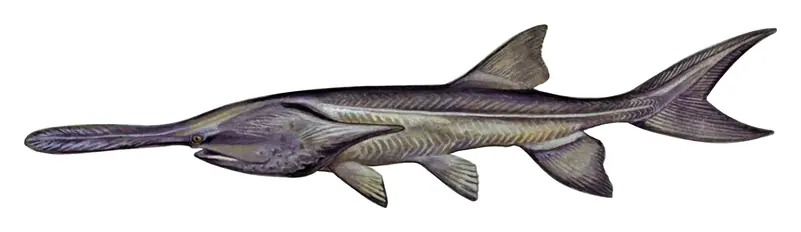
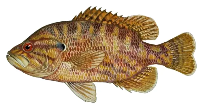
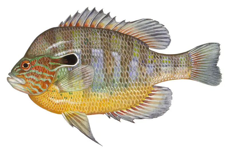
Game fish recorded in Old Hickory Lake include flathead catfish, smallmouth bass, paddlefish, warmouth, longear sunfish, common carp. In all, 28 fish species have open records inside the lake on GBIF.
The surface of Old Hickory Lake was about 57°F on November 14, estimated from a satellite pass on a clear day. It is the top layer of the water, a few degrees either way; coves and shallows run warmer in the sun.
Anglers 13 and older need a Tennessee fishing license, sold online by the Tennessee Wildlife Resources Agency. Free fishing days: Free Fishing Day, one Saturday in June; children 15 and under fish free that whole week. Size and bag limits can be set lake by lake: check the current regulations.
Old Hickory Lake averages about 19 ft deep. Depth changes with the lake level.
U.S. Army Corps of Engineers lists biking, boating, historic sites, camping, fishing, hiking, picnicking and visitor center at Old Hickory Lake. 9 campgrounds can be booked on Recreation.gov.
Yes. 6 trails run along or near the shore, including Shoreline Trail (1.5 mi), High Ridge Trail (1.3 mi) and Nature trail (0.6 mi), according to OpenStreetMap.
Old Hickory Lake is held back by Old Hickory Lock and Dam, completed in 1954 and 98 ft high, according to the National Inventory of Dams.
From the U.S. Army Corps of Engineers (Old Hickory Lake). Lake by Lake checks it every hour; the agency's own figure is always the reference, and provisional readings can be revised.
Lake levels are refreshed every hour. Texas and California reservoirs report once a day; most USGS and NOAA gauges report every 15 to 60 minutes.
Cookies for analytics With your OK we use Google Analytics and Microsoft Clarity to count visits and see how the site is used, so we can make it better. No advertising cookies. Privacy policy