Sun
- Sunrise
- 6:27 AM
- Sunset
- 4:36 PM
- First light
- 5:59 AM
- Last light
- 5:03 PM
Reservoir · Davidson County, Tennessee
A reservoir on the Stones River in Davidson County, Tennessee, held back by J. Percy Priest Dam since 1967. Also called J. Percy Priest Lake and J Percy Priest Lake.

Percy Priest Lake is at 490.40 feet above sea level — 0.40 ft above summer pool, as of Nov 19, 2026, 2:00 AM CST. It has dropped 0.12 ft in the past 7 days.
Fullest of 23 Tennessee lakes today against full pool · See the ranking
Record low 481.78 ft (2014), record high 504.68 ft (2010) · Level history since 1987
A notification from this browser, once, when the level crosses the line (checked every hour). No account and no email. On an iPhone, add Lake by Lake to your home screen first (Share → Add to Home Screen) and open it from there. Or follow the lake in a feed reader: RSS feed.
Percy Priest Lake is down 0.12 ft over the last 7 days, at 490.40 ft today.
Daily values from the U.S. Army Corps of Engineers.
Percy Priest Lake is up 1.19 ft over the last 30 days, at 490.40 ft today.
Daily values from the U.S. Army Corps of Engineers.
Over the past 12 months, Percy Priest Lake ranged from 483.00 ft (Dec 17, 2025) to 491.69 ft (Aug 9, 2026), a swing of 8.7 ft. Today's level is near the top of that range. It is 3.18 ft higher than on this date last year.
Daily values from the U.S. Army Corps of Engineers. Why lake levels rise and fall
In the U.S. Army Corps of Engineers record, which starts in 1987, the lowest level was 481.78 ft on January 30, 2014 and the highest 504.68 ft on May 4, 2010. Today’s 490.40 ft is 8.6 ft above the record low and 14.3 ft below the record high.
Percy Priest Lake level history: every year since 1987, the lowest and highest years →
Solunar periods for Percy Priest Lake, local time. How they work
Not detected · as of Nov 9, 2026
The satellite found no cyanobacteria at the surface.
Week of Aug 16Week of Nov 1
Each bar is one week, colored by the worst reading of that week.
From the U.S. EPA's Cyanobacteria Assessment Network (CyAN), which reads the color of lakes from the Sentinel-3 satellites; it sees open water only, not coves or the shoreline. Blooms can be patchy: what you see on the water matters more. Swimming closures and health advisories come from Tennessee health and environment agencies. How to read it
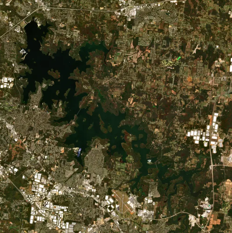
Surface water temperature
56°F on Nov 14, 2026
87°F · Aug 256°F · Nov 14
31°F cooler than on Aug 2, 2026.
Estimated from Landsat 8/9 (USGS) passes on clear days: the top layer of the water, a few degrees either way. Coves and the shallows can be warmer.
Percy Priest Lake water temperature: trend, swimming and the fish →
On or near the shore of Percy Priest Lake: 27 boat ramps, 10 marinas, 6 rental outfits, 16 campgrounds, 4 beaches and 13 trails. The lake has about 156 miles of shoreline, counting its islands.
Tap an icon for details; use two fingers (or Ctrl + scroll) to move the map. Tap a dot for details. Map and lake outline © OpenStreetMap contributors. Places from OpenStreetMap, Overture Maps and Recreation.gov. Not for navigation.
What you’ll find on the shore
← AllBoating 37
← AllRentals & tours 8
← AllFishing spots 2
← AllBeaches 4
← AllCamping 16
← AllLodging 17
← AllTrails 13
← AllParks 17
← AllDining 5
No aquatic invasive species are on record for Percy Priest Lake in the USGS database. Keep it that way: clean, drain and dry your boat between lakes.
Tennessee: Tennessee has no statewide clean-drain-dry law; TWRA urges you to remove plants, animals and mud, drain all water, and dry the boat for five days (or hot-wash it) before moving to another lake. Moving live invasive carp is illegal. State rules
Records: USGS Nonindigenous Aquatic Species database. A species not listed may still be present.
Species with open-licensed records inside Percy Priest Lake's outline, from GBIF.org (surveys, museum collections and angler reports). A record shows a fish was found here, not how many there are now.
Channel edges and river arms; best after dark in summer, and after a rain.
Rocky points, gravel and current breaks; deeper rock piles in summer.
Run up the river arms in spring; follow shad to cool, deep water near the dam in summer.
Near the surface over weedy shallows and backwaters on calm, warm days.
Stumps, brush and weedbeds over soft bottoms; fish tight to cover.
Water temperature sets off each spawn; the bars show the usual months at this latitude and elevation, and move with a warm or cold spring. The water is about 56°F now.
Percy Priest Lake is the Army Corps of Engineers reservoir on the Stones River on the east side of Nashville. The dam stands within sight of Interstate 40, and the lake reaches upstream through Davidson, Wilson and Rutherford counties toward Smyrna. Built for flood control, water supply and power, it puts open water within 10 miles of downtown, and it has long ranked among the 10 most visited Corps lakes in the country.
Congress first authorized the project in 1946 as Stewarts Ferry Reservoir. In 1958 it was renamed for J. Percy Priest, a former high school teacher and coach and a reporter and editor at the Nashville Tennessean, who represented Nashville and Davidson County in Congress from 1940 until his death in 1956. In Congress he was a strong backer of TVA and of dams on the Cumberland River. Ground was broken on June 29, 1963, and President Lyndon B. Johnson dedicated the project five years later to the day, speaking to a crowd of more than 4,000.
The lake came at a cost to the families along the Stones River, who were moved off their homes and farms when the Corps bought the land in the 1960s. The home site on one of those farms, which belonged to the family of a later La Vergne mayor, now lies about 30 feet under water. The plans also called for flooding most of the town of Old Jefferson, and its people moved away. In the end the water never rose that high, and the old town site was left dry and abandoned.
In 1972 the state leased 2,400 acres from the Corps, with two boat ramps and two day-use areas now known as Bryant Grove and Couchville, and Long Hunter State Park opened officially in 1978. Before the lake, the land was a mix of cedar glades, barrens and forest along the river, a hunting ground for Native peoples and later for the long hunters of European descent who arrived in the late 1700s. Old house foundations, fence rows and stone walls from the farms that followed can still be found in the park. The Corps runs campgrounds at Anderson Road, Seven Points and Poole Knobs, and there are primitive island campsites in the lower lake. Several sailing and rowing clubs, among them Vanderbilt's, are based on the lake.
Black bass draw more anglers than anything else, and crappie come second. Largemouth are the most common bass, and April is a prime month on the gently sloping banks, while summer fish move to the steep bluff walls. TWRA keeps about 132 fish attractor sites in the lake, some marked with buoys, and they hold crappie best from October through May. The lake is also known for hybrid striped bass, called Cherokee bass, raised in TWRA hatcheries and stocked as small fingerlings each June. They reach 15 inches within a year, 6 to 8 pound fish are common, and in July and August they gather in the lower lake between the Hobson Pike bridge and the dam. White bass and yellow bass run up the East and West Forks of the Stones River and Stewart Creek in March and April. Fishing piers at Stewart Creek in Smyrna and Vivrette Creek give shore anglers good access.
The Corps holds the lake about 7 feet lower in winter than at summer full pool. The lake also has a long drowning record. By 2021 the Nashville District counted 181 drownings since the lake was filled, and only four of those people were wearing life jackets. Rangers ask everyone on or near the water to wear one and remind parents that a child can drown in under a minute.
Written by Lake by Lake from U.S. Army Corps of Engineers, Nashville District (Region recognizes J. Percy Priest project on its 50th birthday, Park rangers teaming up with Nashville Shores on water safety), Tennessee Wildlife Resources Agency, Tennessee State Parks and Wikipedia. Checked November 2026.
Activities listed by the U.S. Army Corps of Engineers: Biking · Boating · Camping · Fishing · Hiking · Horseback riding · Picnicking · Visitor center · Water sports · Wildlife viewing · Swimming
J. Percy Priest Dam is a concrete dam 147 feet high and 2,716 feet long on the Stones River, completed in 1967. It belongs to the U.S. Army Corps of Engineers (Nashville District) and is run for flood control, recreation, hydropower and water supply. At its normal level the reservoir holds 202,000 acre-ft, drained from 892 square miles of land.
From the National Inventory of Dams (U.S. Army Corps of Engineers), NID ID TN03701. Lake or reservoir: what’s the difference?
Where the level comes from: Percy Priest Lake (U.S. Army Corps of Engineers).
| Lake | Miles | Level (ft) | vs full | 7 days |
|---|---|---|---|---|
| Old Hickory Lake At or near full pool | 10 | 443.03 | −1.97 | −0.16 |
| Cordell Hull Lake Slightly below full | 39 | 501.03 | −3.47 | +0.20 |
| Center Hill Lake Well below full | 45 | 629.37 | −18.63 | −0.60 |
| Normandy Lake Below full | 52 | 866.54 | −8.46 | −0.64 |
| Barren River Lake Well below full | 58 | 531.60 | −20.40 | −5.97 |
| Great Falls Lake Well below full | 60 | 787.02 | −17.98 | −0.34 |
Compare Percy Priest Lake with Old Hickory Lake, Cordell Hull Lake, Center Hill Lake or Normandy Lake: size, level, ramps and fish side by side.
Percy Priest Lake is about 9 mi from Nashville, TN, 23 mi from Murfreesboro, TN and 50 mi from Clarksville, TN. See all the lakes near each city.
Percy Priest Lake is also known as J. Percy Priest Lake and J Percy Priest Lake.
Percy Priest Lake is at 490.40 feet above sea level — 0.40 ft above summer pool, as of Nov 19, 2026, 2:00 AM CST. It has dropped 0.12 ft in the past 7 days.
Percy Priest Lake's summer pool is 490.00 ft, according to U.S. Army Corps of Engineers. Today the lake is 0.40 ft above that mark.
Today's level is 3.64 ft above the median for this date (486.76 ft), from the gauge’s long-term daily record.
481.78 ft, on January 30, 2014, in the U.S. Army Corps of Engineers record, which starts in 1987. Today the lake is 8.6 ft above that.
504.68 ft, on May 4, 2010, in the U.S. Army Corps of Engineers record since 1987. That is 14.7 ft above summer pool.
Percy Priest Lake has 27 boat ramps on our map, including Anderson Boat Ramp, Boat ramp at Cook Beach :D, Boat ramp at Hamilton Creek Sailboat Marina, and 10 marinas. Low water can close ramps, so check today's level above and the operator before you go.
Yes. There are 16 campgrounds and RV parks within about a mile of the shore, such as Anderson Beach, Camp YI, Nashville Shores Campground.
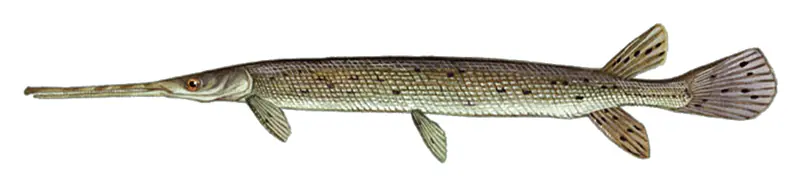
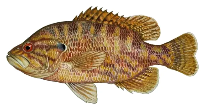
Game fish recorded in Percy Priest Lake include channel catfish, flathead catfish, smallmouth bass, striped bass, longnose gar, warmouth. In all, 36 fish species have open records inside the lake on GBIF.
The surface of Percy Priest Lake was about 56°F on November 14, estimated from a satellite pass on a clear day. It is the top layer of the water, a few degrees either way; coves and shallows run warmer in the sun.
Anglers 13 and older need a Tennessee fishing license, sold online by the Tennessee Wildlife Resources Agency. Free fishing days: Free Fishing Day, one Saturday in June; children 15 and under fish free that whole week. Size and bag limits can be set lake by lake: check the current regulations.
Percy Priest Lake averages about 14 ft deep. Depth changes with the lake level.
U.S. Army Corps of Engineers lists biking, boating, camping, fishing, hiking, horseback riding, picnicking and visitor center at J Percy Priest Lake. 5 campgrounds can be booked on Recreation.gov.
EPA's CyAN satellite rated cyanobacteria in Percy Priest Lake not detected on November 9. The satellite sees open water only; blooms can be patchy, so avoid water that looks like spilled paint or pea soup and keep dogs out of scum. Swimming advisories come from Tennessee health and environment agencies.
Yes. 13 trails run along or near the shore, including Bryant Grove Trail (4.0 mi), Day Loop Trail (3.3 mi) and Volunteer Trail (4.2 mi), according to OpenStreetMap.
Percy Priest Lake is held back by J. Percy Priest Dam, completed in 1967 and 147 ft high, according to the National Inventory of Dams.
From the U.S. Army Corps of Engineers (Percy Priest Lake). Lake by Lake checks it every hour; the agency's own figure is always the reference, and provisional readings can be revised.
Lake levels are refreshed every hour. Texas and California reservoirs report once a day; most USGS and NOAA gauges report every 15 to 60 minutes.
Cookies for analytics With your OK we use Google Analytics and Microsoft Clarity to count visits and see how the site is used, so we can make it better. No advertising cookies. Privacy policy