Sun
- Sunrise
- 6:58 AM
- Sunset
- 5:33 PM
- First light
- 6:33 AM
- Last light
- 5:58 PM
Reservoir · Travis County, Texas
A reservoir on the Colorado River in Travis County, Texas, held back by Tom Miller Dam since 1939.

Lake Austin is at 492.06 feet above sea level — 0.74 ft below top of conservation pool, 95.2% full, as of Nov 17, 2026. It has dropped 0.28 ft in the past 7 days.
19th fullest of 118 Texas lakes today by percent full · See the ranking
Record low 476.02 ft (1986), record high 494.92 ft (1981) · Level history since 1966
Which boat ramps are usable at today’s level →
A notification from this browser, once, when the level crosses the line (checked every hour). No account and no email. On an iPhone, add Lake by Lake to your home screen first (Share → Add to Home Screen) and open it from there. Or follow the lake in a feed reader: RSS feed.
Lake Austin is down 0.19 ft over the last 30 days, at 492.06 ft today.
Daily values from the Texas Water Development Board.
Over the past 12 months, Lake Austin ranged from 491.74 ft (Nov 12, 2026) to 492.60 ft (Jan 2, 2026), a swing of 0.9 ft. Today's level is in the lower half of that range. It is 0.18 ft lower than on this date last year.
Daily values from the Texas Water Development Board. Why lake levels rise and fall
In the Texas Water Development Board record, which starts in 1966, the lowest level was 476.02 ft on January 23, 1986 and the highest 494.92 ft on May 25, 1981. Today’s 492.06 ft is 16.0 ft above the record low and 2.9 ft below the record high.
Lake Austin level history: every year since 1966, the lowest and highest years →
Solunar periods for Lake Austin, local time. How they work
Not detected · as of Nov 9, 2026
The satellite found no cyanobacteria at the surface.
Week of Aug 16Week of Nov 1
Each bar is one week, colored by the worst reading of that week.
From the U.S. EPA's Cyanobacteria Assessment Network (CyAN), which reads the color of lakes from the Sentinel-3 satellites; it sees open water only, not coves or the shoreline. Blooms can be patchy: what you see on the water matters more. Swimming closures and health advisories come from Texas health and environment agencies. How to read it
Surface water temperature
75°F on Oct 22, 2026
78°F · Jul 2675°F · Oct 22
3°F cooler than on Jul 26, 2026.
Estimated from Landsat 8/9 (USGS) passes on clear days: the top layer of the water, a few degrees either way. Coves and the shallows can be warmer.
Lake Austin water temperature: trend, swimming and the fish →
On or near the shore of Lake Austin: 9 boat ramps, 7 marinas, 21 rental outfits, 2 campgrounds, 2 beaches and 9 trails. The lake has about 55 miles of shoreline, counting its islands.
Tap an icon for details; use two fingers (or Ctrl + scroll) to move the map. Tap a dot for details. Map and lake outline © OpenStreetMap contributors. Places from OpenStreetMap, Overture Maps and Recreation.gov. Not for navigation.
What you’ll find on the shore
← AllBoating 16
Which boat ramps are usable at today’s level →
← AllRentals & tours 24
← AllFishing spots 2
← AllBeaches 2
← AllCamping 2
← AllLodging 11
← AllTrails 9
← AllParks 20+
← AllDining 7
Zebra mussels have been found in Lake Austin. They clog intakes and engines and spread on boats and trailers: clean, drain and dry everything before you go to another lake.
Texas: Before leaving or arriving at any public fresh water, drain all water from the boat and gear, including bilge, livewells, motor and bait buckets; live bait bought from a dealer may stay in water if you carry the receipt. Remove any invasive plants clinging to the boat or trailer right away, and never move invasive species such as zebra mussels. State rules
Records: USGS Nonindigenous Aquatic Species database. A species not listed may still be present.
In the last 12 months, Texas Parks and Wildlife Department stocked 97,369 fish in Lake Austin: Florida largemouth bass (97,369).
All 5 stockings · Source: Texas Parks and Wildlife Department stocking records.
Species with open-licensed records inside Lake Austin's outline, from GBIF.org (surveys, museum collections and angler reports). A record shows a fish was found here, not how many there are now. marks fish the state stocks here.
Shallow, protected flats in spring; docks, grass and deep edges in summer heat.
Brush piles, docks and bridge pilings; shallow for a few weeks in spring.
Channel edges and river arms; best after dark in summer, and after a rain.
Rocky points, gravel and current breaks; deeper rock piles in summer.
Rocky shorelines and riprap at night in late winter; deep weed edges and humps in summer.
Water temperature sets off each spawn; the bars show the usual months at this latitude and elevation, and move with a warm or cold spring.
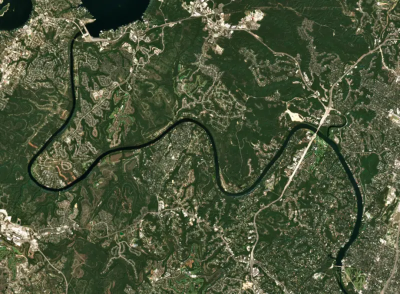
Lake Austin is the long, narrow reservoir on the Colorado River that winds through Austin, from Mansfield Dam at Lake Travis down to Tom Miller Dam. It is one of the seven Highland Lakes and a pass-through lake, held at a nearly constant level by releases from Lake Travis. Its steady water draws water skiers, wakesurfers and bass anglers, and it is also a major source of Austin's drinking water.
In May 1890 Austin voters approved $1.4 million in debt for a dam that would power a public utility, by a vote of 1,354 to 50. Built of Texas red granite and finished in 1893, it formed Lake McDonald, named for Mayor John McDonald, and the new lake soon drew steamboat rides and a rowing regatta. Its first chief engineer had quit, warning that the site was unsound and the materials poor, and the dam never delivered all the power it promised. After a night of heavy storms, floodwater pouring over the crest pushed the dam off its foundation late in the morning of April 7, 1900. The flood killed dozens of people and left the city without its dam, its power or its water, and still in debt. City leaders turned down an offer from the private utility and kept water and power in public hands, the start of today's Austin Water and Austin Energy. Chunks of the old granite dam now line the parking lot at Red Bud Isle.
A second dam, built from 1912 to 1915, was also badly damaged by floods. The Lower Colorado River Authority began a third dam on top of the remains in 1938, on land leased from the City of Austin, and the lake filled again in 1939. Tom Miller Dam is named for an Austin mayor.
The lake is about 20 miles long and only 1,300 feet across at its widest. Bull Creek comes in from the north near the Pennybacker Bridge, where Loop 360 crosses the water, and Bee Creek enters from the west just above Tom Miller Dam. Below the dam the river becomes Lady Bird Lake. Lake Austin itself has no extra room to store floodwater. It feeds two of Austin's major water treatment plants, and the city does not allow herbicides in it.
Emma Long Metropolitan Park, known for years simply as City Park, sits on the shore with campsites, boat ramps and a beach-entry swimming area. It was renamed for Emma Long, who was first elected to the Austin City Council in 1948 and became the city's first woman mayor pro tem in 1967.
Texas Parks and Wildlife rates the largemouth bass fishing as excellent, and the lake has real trophy potential, with many 8 to 10 pound bass caught each year. The water is clear, and fish hold along weed lines, boulders, rock slides off the bluffs and the many boat docks. The spawn usually runs February through April, later on the upper lake because Lake Travis releases cold water. Summer weekends bring heavy boat traffic, so early mornings and nights fish best. Bluegill, redbreast and redear sunfish are good, and catfish are scarce.
Hydrilla, a non-native water plant, covered about an eighth of the lake from 1999 to 2003. The lake was lowered in January and February so that freezing weather would kill much of it. The city then stocked grass carp, and around 2014 they ate nearly all the plants in the lake, a loss that took about a decade to recover from. Hydrilla spread again in 2025, and the city resumed stocking carp that year. Any grass carp caught must be released unharmed. Zebra mussels are also in the lake, and Texas law requires boaters to drain their boats and gear before leaving.
Written by Lake by Lake from Lower Colorado River Authority, KUT 90.5, City of Austin, Texas Parks and Wildlife Department, City of Austin Parks and Recreation and Wikipedia. Checked November 2026.
Tom Miller Dam is a concrete dam 85 feet high and 1,395 feet long on the Colorado River, completed in 1939. It belongs to the City of Austin and is run for irrigation, recreation, hydropower and water supply. At its normal level the reservoir holds 25,200 acre-ft, drained from 26,124 square miles of land.
From the National Inventory of Dams (U.S. Army Corps of Engineers), NID ID TX01086. Lake or reservoir: what’s the difference?
Where the level comes from: Lake Austin (Texas Water Development Board, used on this page), LCRA Lk Austin at Austin, TX (U.S. Geological Survey) and Colorado River (TX) at Lake Austin (NOAA National Water Prediction Service).
| Lake | Miles | Level (ft) | vs full | 7 days |
|---|---|---|---|---|
| Lake Travis At or near full pool | 9 | 681.67 | +0.67 | +3.72 |
| Mills Pond Live reading | 11 | 832.03 | — | +1.14 |
| Lake Georgetown Slightly below full | 25 | 784.97 | −6.03 | +0.42 |
| Lake Marble Falls At or near full pool | 33 | 736.41 | −0.59 | +0.69 |
| Lake LBJ At or near full pool | 37 | 824.64 | −0.36 | +0.61 |
| Granger Lake At or near full pool | 38 | 504.35 | +0.35 | +0.34 |
Compare Lake Austin with Lake Travis, Mills Pond, Lake Georgetown or Lake Marble Falls: size, level, ramps and fish side by side.
Lake Austin is about 2 mi from Austin, TX, 16 mi from Round Rock, TX and 25 mi from Georgetown, TX. See all the lakes near each city.
Lake Austin is at 492.06 feet above sea level — 0.74 ft below top of conservation pool, 95.2% full, as of Nov 17, 2026. It has dropped 0.28 ft in the past 7 days.
Lake Austin's top of conservation pool is 492.80 ft, according to Texas Water Development Board. Today the lake is 0.74 ft below that mark.
Today's level is 0.04 ft below the median for this date (492.10 ft), from the gauge’s long-term daily record.
476.02 ft, on January 23, 1986, in the Texas Water Development Board record, which starts in 1966. Today the lake is 16.0 ft above that.
494.92 ft, on May 25, 1981, in the Texas Water Development Board record since 1966. That is 2.1 ft above top of conservation pool.
Lake Austin has 9 boat ramps on our map, including 360 Bridge Boat Landing, Boat ramp at Quinlan Park, Boat ramp near Lake Austin- Emma Long Park, and 7 marinas. Low water can close ramps, so check today's level above and the operator before you go.
Yes. There are 2 campgrounds and RV parks within about a mile of the shore, such as Emma long RV park, Riverbend RV Park.
Game fish recorded in Lake Austin include largemouth bass, channel catfish, bluegill, Florida bass, white bass, striped bass. In all, 40 fish species have open records inside the lake on GBIF.
Anglers 17 and older need a Texas fishing license, sold online by the Texas Parks and Wildlife Department. Free fishing days: First Saturday in June. Size and bag limits can be set lake by lake: check the current regulations.
Lake Austin is about 76 ft deep at its deepest point, usually near the dam, and about 14 ft deep on average. Depth changes with the lake level.
In summer a white Secchi disk lowered into Lake Austin stays visible to about 6.7 ft (the median of 28 readings, 2016–2024, by Texas Commission on Environmental Quality): clear water. Silt after rain lowers the reading as much as algae do. Clarity drops after storms and during algae blooms.
Yes: hydrographic survey contour map from the Texas Water Development Board (2008). It is linked in the lake facts on this page. Depths on a map are measured at a reference level: subtract how far the lake is below it today.
boating (9 boat ramps and 7 marinas, with the ramps usable at today’s level), kayaks, boats & jet skis (21 rental outfits on or near the water), boat tours (3 boat tours and charters), fishing (29 game fish; stocked by the state), swimming (2 beaches and swimming areas) and hiking & walking (9 trails along the shore, the longest Trail #3 (2.5 mi)), according to our map of the shore.
EPA's CyAN satellite rated cyanobacteria in Lake Austin not detected on November 9. The satellite sees open water only; blooms can be patchy, so avoid water that looks like spilled paint or pea soup and keep dogs out of scum. Swimming advisories come from Texas health and environment agencies.
Yes. Texas Parks and Wildlife Department stocked Florida largemouth bass in Lake Austin; the latest stocking on record was in 2026.
Yes. 9 trails run along or near the shore, including Bright Sky Overlook Trail (1.6 mi), Cliff Loop Trail (1.9 mi) and Summer Vista Trail (1.3 mi), according to OpenStreetMap.
Lake Austin is held back by Tom Miller Dam, completed in 1939 and 85 ft high, according to the National Inventory of Dams.
From the Texas Water Development Board (Lake Austin). Lake by Lake checks it every hour; the agency's own figure is always the reference, and provisional readings can be revised.
Lake levels are refreshed every hour. Texas and California reservoirs report once a day; most USGS and NOAA gauges report every 15 to 60 minutes.




