Sun
- Sunrise
- 7:09 AM
- Sunset
- 4:56 PM
- First light
- 6:40 AM
- Last light
- 5:25 PM
Reservoir · Daggett County, Utah
A reservoir on the Green River in Daggett County, Utah, held back by Flaming Gorge Dam since 1964.

Flaming Gorge Reservoir is at 6,003.42 feet above sea level — 36.58 ft below full pool, as of Nov 17, 2026. It has dropped 0.54 ft in the past 7 days. That is the lowest level since 1980.
10th lowest of 24 Utah lakes today against full pool · See the ranking
Record low 5,966.89 ft (1970), record high 6,043.80 ft (1983) · Level history since 1968
Which boat ramps are usable at today’s level →
A notification from this browser, once, when the level crosses the line (checked every hour). No account and no email. On an iPhone, add Lake by Lake to your home screen first (Share → Add to Home Screen) and open it from there. Or follow the lake in a feed reader: RSS feed.
Flaming Gorge Reservoir is down 2.30 ft over the last 30 days, at 6,003.42 ft today.
Daily values from the Bureau of Reclamation.
Over the past 12 months, Flaming Gorge Reservoir ranged from 6,003.44 ft (Nov 16, 2026) to 6,022.83 ft (Apr 2, 2026), a swing of 19.4 ft. Today's level is the lowest of the past 12 months. It is 19.06 ft lower than on this date last year.
Daily values from the Bureau of Reclamation. Why lake levels rise and fall
In the Bureau of Reclamation record, which starts in 1968, the lowest level was 5,966.89 ft on March 22, 1970 and the highest 6,043.80 ft on July 13, 1983. Today’s 6,003.42 ft is 36.5 ft above the record low and 40.4 ft below the record high. That is the lowest level since 1980.
Flaming Gorge Reservoir level history: every year since 1968, the lowest and highest years →
Solunar periods for Flaming Gorge Reservoir, local time. How they work
Moderate · as of Nov 9, 2026
A bloom may be forming somewhere on the lake. Avoid water that looks like spilled paint or pea soup. About 217,000 cells/mL at the worst spot, covering 3% of the lake.
Week of Aug 9Week of Nov 1
Each bar is one week, colored by the worst reading of that week.
From the U.S. EPA's Cyanobacteria Assessment Network (CyAN), which reads the color of lakes from the Sentinel-3 satellites; it sees open water only, not coves or the shoreline. Blooms can be patchy: what you see on the water matters more. Swimming closures and health advisories come from Utah health and environment agencies. How to read it
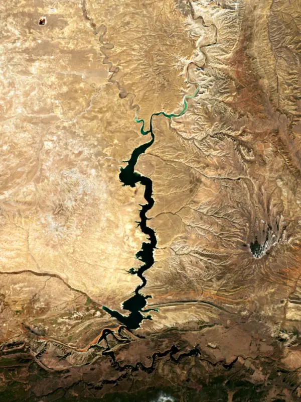
Surface water temperature
53°F on Nov 12, 2026
81°F · Jul 2453°F · Nov 12
27°F cooler than on Jul 24, 2026.
Estimated from MODIS Aqua (NASA) passes on clear days: the top layer of the water, a few degrees either way. Coves and the shallows can be warmer.
Flaming Gorge Reservoir water temperature: trend, swimming and the fish →
On or near the shore of Flaming Gorge Reservoir: 11 boat ramps, 3 marinas, 17 campgrounds, 2 beaches and 1 trail. The lake has about 413 miles of shoreline, counting its islands.
Tap an icon for details; use two fingers (or Ctrl + scroll) to move the map. Tap a dot for details. Map and lake outline © OpenStreetMap contributors. Places from OpenStreetMap, Overture Maps and Recreation.gov. Not for navigation.
What you’ll find on the shore
← AllBoating 14
Which boat ramps are usable at today’s level →
← AllFishing spots 3
← AllBeaches 2
← AllCamping 17
← AllLodging 1
← AllTrails 1
← AllParks 2
← AllDining 1
No aquatic invasive species are on record for Flaming Gorge Reservoir in the USGS database. Keep it that way: clean, drain and dry your boat between lakes.
Utah: Every boater, paddlers included, must take the Mussel-Aware Boater course each year, and motorboats need an annual AIS decal; pull drain plugs and sea strainers when leaving any water and while trailering. Boats leaving Lake Powell must be inspected, then professionally decontaminated or dried 7 to 30 days before launching elsewhere. Required: Mussel-Aware Boater course certificate; AIS decal (motorboats) (Course free; AIS decal $20 a year for Utah motorboats, $25 for nonresident motorboats). State rules
Records: USGS Nonindigenous Aquatic Species database. A species not listed may still be present.
Species with open-licensed records inside Flaming Gorge Reservoir's outline, from GBIF.org (surveys, museum collections and angler reports). A record shows a fish was found here, not how many there are now.
Shallow, protected flats in spring; docks, grass and deep edges in summer heat.
Channel edges and river arms; best after dark in summer, and after a rain.
Rocky points, gravel and current breaks; deeper rock piles in summer.
Cool water: near the surface in spring and fall, deep in summer.
Low light and cold water; the inflows in fall.
Water temperature sets off each spawn; the bars show the usual months at this latitude and elevation, and move with a warm or cold spring. The water is about 53°F now.
Flaming Gorge Reservoir is the Green River held back by Flaming Gorge Dam in the northeastern corner of Utah. From the dam it reaches about 91 miles north into the high desert of southwestern Wyoming, so although the dam is in Utah, most of the water is in Wyoming. Anglers know it for trophy lake trout and for kokanee and rainbows, and the Green River below the dam is a noted blue-ribbon trout stream.
John Wesley Powell named Flaming Gorge in May 1869, on his expedition down the Green and Colorado rivers, for the bright red rock of the canyon walls. Congress authorized the dam on April 11, 1956, as part of the Colorado River Storage Project, which stores water in the upper basin and releases it to meet commitments downstream. The main contract was let in June 1958, the river was diverted around the site in August 1959, and the last bucket of concrete went in on November 15, 1962. President Kennedy started the first generator in September 1963, and Lady Bird Johnson dedicated the dam on August 17, 1964. Dutch John, about 2 miles from the dam, was founded in 1958 to house the workers and was handed over to local government in 1998. Construction briefly tripled the population of Daggett County. Upstream, the rising water covered the settlement of Linwood near the state line, and houses there were moved or torn down. One rancher, Minnie Rasmussen, is said to have burned her own home rather than accept help to relocate.
The southern end of the lake runs through steep, narrow canyons of hard quartzite and sandstone layered with softer shale. To the north the country opens up, and the lake's upper tip lies about 10 miles southeast of the town of Green River, Wyoming. The Blacks Fork and Henrys Fork join the Green along the way. Manila and Dutch John are the Utah towns closest to the water. The Flaming Gorge National Recreation Area was created on October 1, 1968. Its land is split almost evenly between the two states, and the Ashley National Forest runs it. Campgrounds sit at Buckboard and Lucerne marinas on the west side. At the dam, Reclamation keeps a seasonal visitor center and a walkway with a view of the face that drops toward the river.
Wyoming and Utah manage the fishery together. Most anglers come for kokanee and rainbow trout, which the two states and the U.S. Fish and Wildlife Service stock in large numbers every year. Lake trout are the trophy fish. Anglers regularly catch them over 30 pounds, and Utah's state-record lake trout, a fish over 50 pounds, came from here. The trouble is the many smaller lake trout, which eat kokanee and rainbows faster than they can grow up. In 1992 a lake trout took about 7 years to reach 28 inches. By 2016 it took 14 to 16, so the agencies urge anglers to keep the small ones. Burbot also prey on kokanee, and any burbot caught here must be killed. Smallmouth bass, cutthroat and brown trout round out the catch.
Early on, the dam's releases made the river below it a trout fishery while native fish declined. Reclamation added a structure in 1977 and 1978 to draw warmer water for the trout, and since 2006 it has shaped releases to help four endangered fish, the Colorado pikeminnow, humpback chub, razorback sucker and bonytail. The tailwater draws fly anglers and rafters, with boat ramps and a national trail at Little Hole. In the drought of 2022, Reclamation began sending about 500,000 extra acre-feet from Flaming Gorge to prop up Lake Powell over the following year, a drawdown of roughly 9 feet that it warned could affect some recreation facilities.
Written by Lake by Lake from U.S. Bureau of Reclamation (Flaming Gorge Unit, Reclamation's drought response actions will boost Lake Powell), WyoHistory.org (Wyoming State Historical Society), Wyoming Game and Fish Department and Wikipedia. Checked November 2026.
Activities listed by the Bureau of Reclamation: Scenic drives · Biking · Boating · Historic sites · Camping · Ranger programs · Fishing · Hiking · Horseback riding · Hunting · Picnicking · Winter sports · Visitor center · Water sports · Wildlife viewing
Flaming Gorge Dam is a concrete dam 502 feet high and 1,285 feet long on the Green River, completed in 1964. It belongs to the Bureau of Reclamation and is run for flood control, recreation, hydropower and water supply. At its normal level the reservoir holds 3.79 million acre-ft, drained from 16 square miles of land.
From the National Inventory of Dams (U.S. Army Corps of Engineers), NID ID UT10121. Lake or reservoir: what’s the difference?
Where the level comes from: Flaming Gorge Reservoir (Bureau of Reclamation, used on this page) and Flaming Gorge Reservoir Dam and Powerplant (Bureau of Reclamation (RISE)).
| Lake | Miles | Level (ft) | vs full | 7 days |
|---|---|---|---|---|
| Red Fleet Reservoir Well below full | 23 | 5577.78 | −30.42 | +1.96 |
| Steinaker Reservoir Slightly below full | 28 | 5512.92 | −4.88 | +4.06 |
| Stateline Reservoir Well below full | 51 | 9133.26 | −29.94 | +1.76 |
| Meeks Cabin Reservoir Well below full | 61 | 8633.07 | −52.63 | +3.27 |
| Moon Lake Below full | 61 | 8128.82 | −8.18 | +1.14 |
| Upper Stillwater Reservoir Well below full | 71 | 8150.40 | −21.60 | +10.00 |
Compare Flaming Gorge Reservoir with Red Fleet Reservoir, Steinaker Reservoir, Stateline Reservoir or Meeks Cabin Reservoir: size, level, ramps and fish side by side.
Flaming Gorge Reservoir is at 6,003.42 feet above sea level — 36.58 ft below full pool, as of Nov 17, 2026. It has dropped 0.54 ft in the past 7 days. That is the lowest level since 1980.
Flaming Gorge Reservoir's full pool is 6,040.00 ft, according to Bureau of Reclamation. Today the lake is 36.58 ft below that mark.
Today's level is 21.51 ft below the median for this date (6,024.93 ft), from the gauge’s long-term daily record.
5,966.89 ft, on March 22, 1970, in the Bureau of Reclamation record, which starts in 1968. Today the lake is 36.5 ft above that.
6,043.80 ft, on July 13, 1983, in the Bureau of Reclamation record since 1968. That is 3.8 ft above full pool.
Flaming Gorge Reservoir has 11 boat ramps on our map, including Anvil Draw, Brinegar Crossing, Buckboard, and 3 marinas. Low water can close ramps, so check today's level above and the operator before you go.
Yes. There are 17 campgrounds and RV parks within about a mile of the shore, such as Hideout Canyon Boat-in Campground, Jarvies Boat In Group Campground, Jarvies Family Boat In Campground.
Game fish recorded in Flaming Gorge Reservoir include lake trout, rainbow trout, brown trout, smallmouth bass, kokanee salmon, channel catfish. In all, 29 fish species have open records inside the lake on GBIF.
The surface of Flaming Gorge Reservoir was about 53°F on November 12, estimated from a satellite pass on a clear day. It is the top layer of the water, a few degrees either way; coves and shallows run warmer in the sun.
Anglers 12 and older need a Utah fishing license, sold online by the Utah Division of Wildlife Resources. Free fishing days: Free Fishing Day, one Saturday in June (2026: June 6). Size and bag limits can be set lake by lake: check the current regulations.
Flaming Gorge Reservoir averages about 90 ft deep. Depth changes with the lake level.
In summer a white Secchi disk lowered into Flaming Gorge Reservoir stays visible to about 21.0 ft (the median of 77 readings, 2016–2025, by Utah Department Of Environmental Quality and UC Region of USBOR): very clear water. With the algae measured too (chlorophyll about 1 µg/L), that makes it oligotrophic: clear, low in nutrients. Clarity drops after storms and during algae blooms.
Yes: reservoir survey report with contour maps from the U.S. Bureau of Reclamation (2019). It is linked in the lake facts on this page. Depths on a map are measured at a reference level: subtract how far the lake is below it today.
Bureau of Reclamation lists scenic drives, biking, boating, historic sites, camping, ranger programs, fishing and hiking at Flaming Gorge Dam. 14 campgrounds can be booked on Recreation.gov.
EPA's CyAN satellite rated cyanobacteria in Flaming Gorge Reservoir moderate on November 9. The satellite sees open water only; blooms can be patchy, so avoid water that looks like spilled paint or pea soup and keep dogs out of scum. Swimming advisories come from Utah health and environment agencies.
Yes. A trail runs along or near the shore, including Lowline Trail (6.2 mi), according to OpenStreetMap.
Flaming Gorge Reservoir is held back by Flaming Gorge Dam, completed in 1964 and 502 ft high, according to the National Inventory of Dams.
From the Bureau of Reclamation (Flaming Gorge Reservoir). Lake by Lake checks it every hour; the agency's own figure is always the reference, and provisional readings can be revised.
Lake levels are refreshed every hour. Texas and California reservoirs report once a day; most USGS and NOAA gauges report every 15 to 60 minutes.
Cookies for analytics With your OK we use Google Analytics and Microsoft Clarity to count visits and see how the site is used, so we can make it better. No advertising cookies. Privacy policy




