Sun
- Sunrise
- 7:14 AM
- Sunset
- 5:04 PM
- First light
- 6:44 AM
- Last light
- 5:33 PM
Reservoir · Wasatch County, Utah
A reservoir on the Strawberry River in Wasatch County, Utah, held back by Soldier Creek Dam since 1974.
Strawberry Reservoir is at 7,585.74 feet above sea level — 16.66 ft below top of active conservation pool, as of Nov 17, 2026. The level has held steady over the past week.
7th fullest of 24 Utah lakes today against full pool · See the ranking
Record low 7,549.98 ft (1993), record high 7,602.63 ft (2011) · Level history since 1986
A notification from this browser, once, when the level crosses the line (checked every hour). No account and no email. On an iPhone, add Lake by Lake to your home screen first (Share → Add to Home Screen) and open it from there. Or follow the lake in a feed reader: RSS feed.
Strawberry Reservoir is down 0.18 ft over the last 30 days, at 7,585.74 ft today.
Daily values from the Bureau of Reclamation (Upper Colorado).
Over the past 12 months, Strawberry Reservoir ranged from 7,585.72 ft (Nov 16, 2026) to 7,592.99 ft (Apr 2, 2026), a swing of 7.3 ft. Today's level is near the bottom of that range. It is 6.36 ft lower than on this date last year.
Daily values from the Bureau of Reclamation (Upper Colorado). Why lake levels rise and fall
In the Bureau of Reclamation (Upper Colorado) record, which starts in 1986, the lowest level was 7,549.98 ft on March 24, 1993 and the highest 7,602.63 ft on July 6, 2011. Today’s 7,585.74 ft is 35.8 ft above the record low and 16.9 ft below the record high.
Strawberry Reservoir level history: every year since 1986, the lowest and highest years →
Solunar periods for Strawberry Reservoir, local time. How they work
A bloom may be developing: look at the water before you go in and keep dogs away from scum.
From the Utah Department of Environmental Quality, checked Nov 18. Advisories change with the weather: check the agency's page and the signs at the water before you go.
Very high · as of Nov 9, 2026
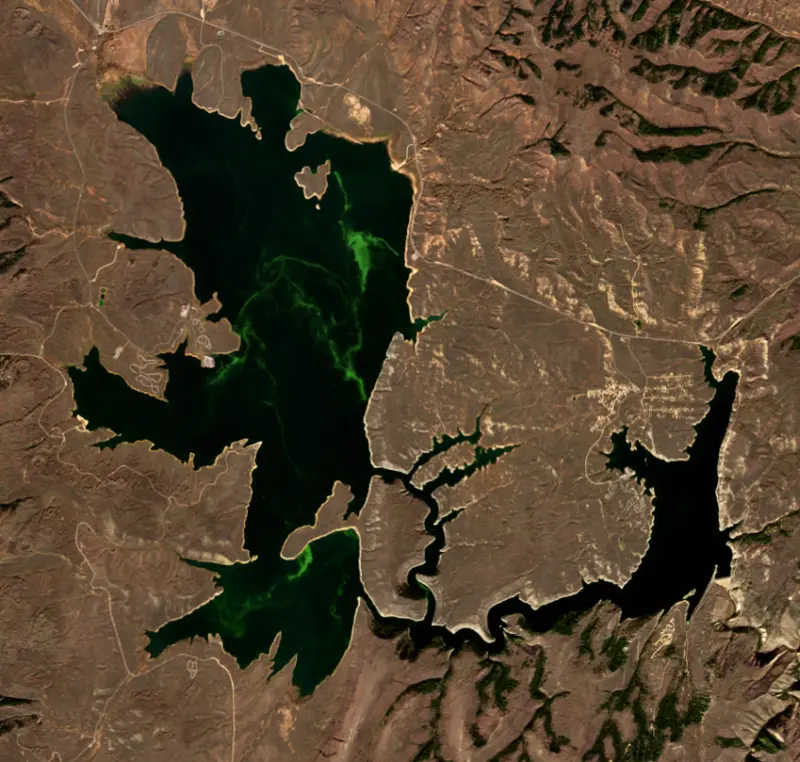
The satellite sees a strong bloom on part of the lake. Stay out of discolored water, keep pets away and check for state advisories. About 2,400,000 cells/mL at the worst spot, covering 34% of the lake.
Week of Aug 9Week of Nov 1
Each bar is one week, colored by the worst reading of that week.
From the U.S. EPA's Cyanobacteria Assessment Network (CyAN), which reads the color of lakes from the Sentinel-3 satellites; it sees open water only, not coves or the shoreline. Blooms can be patchy: what you see on the water matters more. Swimming closures and health advisories come from Utah health and environment agencies. How to read it
Surface water temperature
48°F on Nov 12, 2026
75°F · Jul 3148°F · Nov 12
27°F cooler than on Jul 31, 2026.
Estimated from Landsat 8/9 (USGS) passes on clear days: the top layer of the water, a few degrees either way. Coves and the shallows can be warmer.
Strawberry Reservoir water temperature: trend, swimming and the fish →
On or near the shore of Strawberry Reservoir: 8 boat ramps, 3 marinas, 10 campgrounds, 1 beach and 2 trails. The lake has about 106 miles of shoreline, counting its islands.
Tap an icon for details; use two fingers (or Ctrl + scroll) to move the map. Tap a dot for details. Map and lake outline © OpenStreetMap contributors. Places from OpenStreetMap, Overture Maps and Recreation.gov. Not for navigation.
What you’ll find on the shore
← AllBoating 11
← AllBeaches 1
← AllCamping 10
← AllLodging 3
← AllTrails 2
← AllDining 1
No aquatic invasive species are on record for Strawberry Reservoir in the USGS database. Keep it that way: clean, drain and dry your boat between lakes.
Utah: Every boater, paddlers included, must take the Mussel-Aware Boater course each year, and motorboats need an annual AIS decal; pull drain plugs and sea strainers when leaving any water and while trailering. Boats leaving Lake Powell must be inspected, then professionally decontaminated or dried 7 to 30 days before launching elsewhere. Required: Mussel-Aware Boater course certificate; AIS decal (motorboats) (Course free; AIS decal $20 a year for Utah motorboats, $25 for nonresident motorboats). State rules
Records: USGS Nonindigenous Aquatic Species database. A species not listed may still be present.
Species with open-licensed records inside Strawberry Reservoir's outline, from GBIF.org (surveys, museum collections and angler reports). A record shows a fish was found here, not how many there are now.
Cool water: near the surface in spring and fall, deep in summer.
Schools at a set depth in summer: trolling at the right depth is everything.
Water temperature sets off each spawn; the bars show the usual months at this latitude and elevation, and move with a warm or cold spring. The water is about 48°F now.
Strawberry Reservoir lies high in the Wasatch Mountains of Wasatch County, Utah, along U.S. Route 40 southeast of Heber City. Its water belongs by nature to the Colorado River system, but much of it is sent west through the mountains to farms and towns in Utah Valley. Anglers know it as one of the most heavily fished trout and kokanee waters in the state.
Farmers around Spanish Fork had irrigated since before 1860, but their river ran low by midsummer. In 1902 a local irrigation company filed for a reservoir in Strawberry Valley, on the far side of the divide, and the new federal Reclamation Service took up the plan. Crews started the Strawberry Tunnel in 1906, stopped for lack of money in 1907, and broke through the 3.8-mile bore in June 1912. Strawberry Dam began storing water in July 1912, and the Indian Creek Dike and its feeder canal were done that September. Water left the reservoir through the tunnel into Sixth Water Canyon, then ran down Diamond Fork and the Spanish Fork River to canals and three small powerplants. It was the first large diversion from the Colorado River Basin into the Bonneville Basin, and the whole project was complete by 1922. Part of the reservoir site came out of the Uintah Indian Reservation, land Congress handed to the project at the urging of Senator Reed Smoot.
The reservoir took its present form under the Central Utah Project. In the early 1970s Reclamation built Soldier Creek Dam, a 272-foot earthfill dam farther down the Strawberry River, as part of the Bonneville Unit. The new lake roughly doubled the water surface and took in the old Soldier Creek Reservoir, and the original Strawberry Dam was breached in 1985. Of its four parts, Strawberry Basin is the largest and holds the original reservoir. The Narrows link it to the Soldier Creek Basin, the deepest water, and the Meadows lie south of the Indian Creek Dike.
Over the decades Utah chub and suckers became the main problem for the trout fishery. In August 1990 the Utah Division of Wildlife Resources treated the reservoir and its tributaries with rotenone, a fish toxin made from a plant root, working from barges and small boats. The job cost $3.5 million and drew help from eight states and Norway. Restocking used Bear Lake cutthroat, sterile rainbow trout and kokanee salmon, a fish first brought to Strawberry in 1937 with eggs from Idaho. The chub came back, so the state now leans on the cutthroat as a predator and requires anglers to release cutthroat in the middle size range, the fish that eat the most chub. A new threat appeared in 2023, when an angler caught a walleye that someone had put in illegally, and the agency asks anyone who catches one to report it.
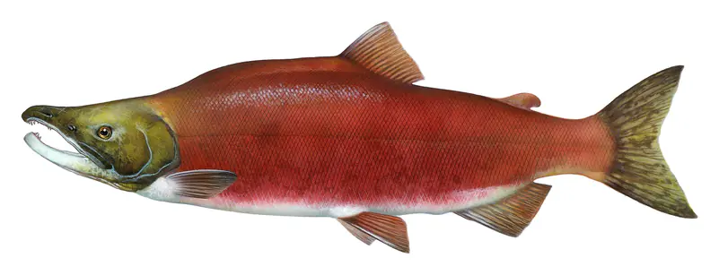
The Strawberry Visitor Center has exhibits, a nature trail and a working fish trap and egg station run by the state. In September, kokanee turn bright red and run up the Strawberry River to spawn. A boardwalk leads from the visitor center to the trap, where biologists take eggs for state hatcheries, and the state's viewing day there can draw up to 3,000 people. The main developed sites are Strawberry Bay, with a campground, beach access and a marina with a ramp and boat rentals, and Soldier Creek. The surrounding hills carry about 75 miles of off-highway vehicle trails also used by hikers and mountain bikers.
Written by Lake by Lake from U.S. Bureau of Reclamation, Deseret News, KUER, USDA Forest Service (Recreation.gov), KPCW and Wikipedia. Checked November 2026.
Soldier Creek Dam is an earthfill dam 272 feet high and 1,290 feet long on the Strawberry River, completed in 1974. It belongs to the Department of the Interior and is run for irrigation. At its normal level the reservoir holds 1.11 million acre-ft, drained from 213 square miles of land.
From the National Inventory of Dams (U.S. Army Corps of Engineers), NID ID UT10135. Lake or reservoir: what’s the difference?
Where the level comes from: Strawberry Reservoir (Bureau of Reclamation (Upper Colorado), used on this page) and Strawberry Reservoir and Soldier Creek Dam (Bureau of Reclamation (RISE)).
| Lake | Miles | Level (ft) | vs full | 7 days |
|---|---|---|---|---|
| Currant Creek Reservoir At or near full pool | 14 | 7676.70 | −1.30 | −0.21 |
| Scofield Reservoir Well below full | 25 | 7600.14 | −17.36 | +0.05 |
| Starvation Reservoir Well below full | 31 | 5692.77 | −19.23 | +1.14 |
| Deer Creek Reservoir Live reading | 33 | 5383.52 | — | — |
| Upper Stillwater Reservoir Well below full | 34 | 8150.40 | −21.60 | +10.00 |
| Lost Lake Live reading | 37 | 9896.19 | — | +0.36 |
Compare Strawberry Reservoir with Currant Creek Reservoir, Scofield Reservoir, Starvation Reservoir or Deer Creek Reservoir: size, level, ramps and fish side by side.
Strawberry Reservoir is about 34 mi from Provo, UT. See all the lakes near each city.
Strawberry Reservoir is at 7,585.74 feet above sea level — 16.66 ft below top of active conservation pool, as of Nov 17, 2026. The level has held steady over the past week.
Strawberry Reservoir's top of active conservation pool is 7,602.40 ft, according to Bureau of Reclamation. Today the lake is 16.66 ft below that mark.
Today's level is 4.82 ft below the median for this date (7,590.56 ft), from the gauge’s long-term daily record.
7,549.98 ft, on March 24, 1993, in the Bureau of Reclamation (Upper Colorado) record, which starts in 1986. Today the lake is 35.8 ft above that.
7,602.63 ft, on July 6, 2011, in the Bureau of Reclamation (Upper Colorado) record since 1986. That is 0.2 ft above top of active conservation pool.
Strawberry Reservoir has 8 boat ramps on our map, including Boat ramp at Soldier Creek Marian, Boat ramp at Strawberry Bay Marina, Renegade Point, and 3 marinas. Low water can close ramps, so check today's level above and the operator before you go.
Yes. There are 10 campgrounds and RV parks within about a mile of the shore, such as Soldier Creek Vacation Cabin Campground, Renegade Campground, Renegade Long Term Campground.
Game fish recorded in Strawberry Reservoir include rainbow trout, kokanee salmon. In all, 8 fish species have open records inside the lake on GBIF.
The surface of Strawberry Reservoir was about 48°F on November 12, estimated from a satellite pass on a clear day. It is the top layer of the water, a few degrees either way; coves and shallows run warmer in the sun.
Anglers 12 and older need a Utah fishing license, sold online by the Utah Division of Wildlife Resources. Free fishing days: Free Fishing Day, one Saturday in June (2026: June 6). Size and bag limits can be set lake by lake: check the current regulations.
Strawberry Reservoir averages about 64 ft deep. Depth changes with the lake level.
In summer a white Secchi disk lowered into Strawberry Reservoir stays visible to about 17.1 ft (the median of 78 readings, 2016–2025, by Utah Department Of Environmental Quality and UC Region of USBOR): very clear water. With the algae measured too (chlorophyll about 2 µg/L), that makes it oligotrophic: clear, low in nutrients. Clarity drops after storms and during algae blooms.
boating (8 boat ramps and 3 marinas), fishing (2 game fish), swimming (1 beach or swimming area), hiking & walking (2 trails along the shore, the longest Strawberry Narrows Trail (11 mi)), camping (10 campgrounds, 8 bookable on Recreation.gov) and cabins & lodging (3 places to stay close to the water), according to our map of the shore.
EPA's CyAN satellite rated cyanobacteria in Strawberry Reservoir very high on November 9. The satellite sees open water only; blooms can be patchy, so avoid water that looks like spilled paint or pea soup and keep dogs out of scum. Swimming advisories come from Utah health and environment agencies.
Yes. 2 trails run along or near the shore, including Strawberry Bay Shoreline Trail (2.5 mi) and Strawberry Narrows Trail (11 mi), according to OpenStreetMap.
Strawberry Reservoir is held back by Soldier Creek Dam, completed in 1974 and 272 ft high, according to the National Inventory of Dams.
From the Bureau of Reclamation (Upper Colorado) (Strawberry Reservoir). Lake by Lake checks it every hour; the agency's own figure is always the reference, and provisional readings can be revised.
Lake levels are refreshed every hour. Texas and California reservoirs report once a day; most USGS and NOAA gauges report every 15 to 60 minutes.
Cookies for analytics With your OK we use Google Analytics and Microsoft Clarity to count visits and see how the site is used, so we can make it better. No advertising cookies. Privacy policy