Sun
- Sunrise
- 7:13 AM
- Sunset
- 4:21 PM
- First light
- 6:38 AM
- Last light
- 4:55 PM
Lake · Chelan County, Washington
A lake fed by the Stehekin River in Chelan County, Washington, held back by Chelan Dam since 1927.

Lake Chelan is at 1,090.99 feet above sea level — 9.01 ft below full pool, as of Nov 17, 2026, 6:00 PM PST. It has dropped 0.87 ft in the past 7 days.
9th fullest of 20 Washington lakes today against full pool · See the ranking
Record low 1,084.45 ft (2019), record high 1,099.56 ft (2020) · Level history since 2018
A notification from this browser, once, when the level crosses the line (checked every hour). No account and no email. On an iPhone, add Lake by Lake to your home screen first (Share → Add to Home Screen) and open it from there. Or follow the lake in a feed reader: RSS feed.
Lake Chelan is down 3.92 ft over the last 30 days, at 1,090.99 ft today.
Daily values from the U.S. Geological Survey.
Over the past 12 months, Lake Chelan ranged from 1,089.13 ft (Mar 17, 2026) to 1,099.29 ft (Jul 20, 2026), a swing of 10.2 ft. Today's level is near the bottom of that range. It is 1.91 ft lower than on this date last year.
Daily values from the U.S. Geological Survey. Why lake levels rise and fall
In the U.S. Geological Survey record, which starts in 2018, the lowest level was 1,084.45 ft on March 21, 2019 and the highest 1,099.56 ft on July 21, 2020. Today’s 1,090.99 ft is 6.5 ft above the record low and 8.6 ft below the record high.
Lake Chelan level history: every year since 2018, the lowest and highest years →
Solunar periods for Lake Chelan, local time. How they work
Not detected · as of Nov 9, 2026
The satellite found no cyanobacteria at the surface.
Week of Aug 16Week of Nov 1
Each bar is one week, colored by the worst reading of that week.
From the U.S. EPA's Cyanobacteria Assessment Network (CyAN), which reads the color of lakes from the Sentinel-3 satellites; it sees open water only, not coves or the shoreline. Blooms can be patchy: what you see on the water matters more. Swimming closures and health advisories come from Washington health and environment agencies. How to read it
Surface water temperature
53°F on Nov 8, 2026
68°F · Jul 2453°F · Nov 8
15°F cooler than on Jul 24, 2026.
Estimated from MODIS Aqua (NASA) passes on clear days: the top layer of the water, a few degrees either way. Coves and the shallows can be warmer.
Lake Chelan water temperature: trend, swimming and the fish →
On or near the shore of Lake Chelan: 6 boat ramps, 14 marinas, 9 rental outfits, 9 campgrounds, 10 beaches and 14 trails. The lake has about 123 miles of shoreline, counting its islands.
Tap an icon for details; use two fingers (or Ctrl + scroll) to move the map. Tap a dot for details. Map and lake outline © OpenStreetMap contributors. Places from OpenStreetMap, Overture Maps and Recreation.gov. Not for navigation.
What you’ll find on the shore
← AllBoating 20
← AllRentals & tours 9
← AllBeaches 10
← AllCamping 9
← AllLodging 24+
← AllTrails 14
← AllParks 16
← AllDining 24+
These invasive plants and animals have been recorded in Lake Chelan: clean, drain and dry everything before you go to another lake.
Washington: Stop at every open watercraft check station (required for motorized and nonmotorized boats), and clean and drain your boat after each use, removing plants, animals and water. Required: Aquatic Invasive Species Prevention Permit (out-of-state boats) ($24 a year for out-of-state boats). State rules
Records: USGS Nonindigenous Aquatic Species database. A species not listed may still be present.
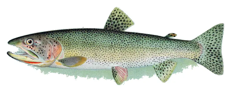
In the last 12 months, Washington Department of Fish and Wildlife stocked 96,885 fish in Lake Chelan: cutthroat trout (67,625) and rainbow trout (29,260).
Source: Washington Department of Fish and Wildlife stocking records.
Species with open-licensed records inside Lake Chelan's outline, from GBIF.org (surveys, museum collections and angler reports). A record shows a fish was found here, not how many there are now. marks fish the state stocks here.
Rocky points, gravel and current breaks; deeper rock piles in summer.
Cool water: near the surface in spring and fall, deep in summer.
Low light and cold water; the inflows in fall.
Deep and cold most of the year; shallow reefs in fall and right after ice-out.
Inlets and shorelines in spring; deeper as the lake warms.
Water temperature sets off each spawn; the bars show the usual months at this latitude and elevation, and move with a warm or cold spring. The water is about 53°F now.
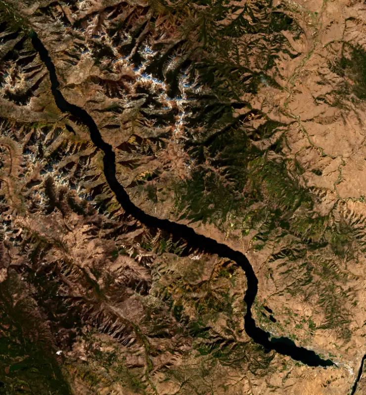
Lake Chelan is a long, narrow glacial lake in north-central Washington, reaching more than 50 miles from the town of Chelan, a few miles above the Columbia River, northwest into the North Cascades to the roadless village of Stehekin. It is the largest natural lake in the state and the third deepest in the country, after Crater Lake and Lake Tahoe.
The Chelan people, thought to be an offshoot of the Wenatchi and speakers of an Interior Salish dialect, lived here for thousands of years. Their year-round village, whose name means rainbow robe, stood where the town is now. Between 1811 and 1813 the fur trader Alexander Ross wrote down their name for the river as Tsill-ane, deep water. In 1880 the Moses Reservation was extended to take in the whole lake, but Congress rescinded it in 1886, the year Ignatius Navarre filed a homestead claim on the lake. The town was platted in 1889, and tourists were already a mainstay of its economy before 1900.
The valley was scoured by ice again and again. In the last glacial maximum, about 21,000 years ago, a lobe of the Cordilleran ice sheet crossed Rainy and Fisher passes and came down Bridge Creek into the head of the valley, while another lobe pushed up from the Columbia and met it near Manson. The result is a fjord-like trough. A sill at the narrows splits a short lower basin, the Wapato, from the long Lucerne basin above it, which holds about 92 percent of the water and reaches below sea level. Near the upper end, peaks less than 3 miles from shore rise more than 6,600 feet above the surface. The Stehekin River brings in about 65 percent of the inflow, and the Chelan River drains the lake in barely four miles to the Columbia.
Early dams at the outlet washed out in the 1890s. In 1926 Washington Water Power won a 50-year federal license, and up to 1,250 men built the present dam, which raised the lake 21 feet. Its first generator started in September 1927, fed by a tunnel more than 2 miles long that drops to a powerhouse at Chelan Falls. For decades the Chelan River gorge ran dry most of the year. The Chelan County PUD bought the project in 1955, and under its current license water now flows down the gorge year-round. Each spring the PUD lowers the lake to make room for snowmelt, sizing the drawdown from snow samples taken in the mountains, so a big snow year means a lower lake in spring before it refills.
No outside roads reach Stehekin. Visitors come by passenger ferry from Chelan or Fields Point, by floatplane, or on foot or horseback over the mountains, and the Lake Chelan National Recreation Area around the village bans personal watercraft. Lucerne, at the mouth of Railroad Creek, is the landing for Holden Village. Down lake, Lake Chelan State Park and Twenty-Five Mile Creek State Park sit near the town, and the Lake Chelan wine region covers the southernmost 12 miles. Kokanee fishing is best from mid-April through June, and in summer anglers find them offshore near the thermocline. The lake has produced the state-record lake trout several times, and those big fish draw trophy hunters. Westslope cutthroat are planted in early summer, and smallmouth bass are good in the lower lake near Chelan and Manson.
Written by Lake by Lake from HistoryLink.org, National Park Service, Washington Department of Fish and Wildlife, Lake Chelan Mirror and Wikipedia (Lake Chelan, Lake Chelan Dam). Checked November 2026.
Chelan Dam is a concrete gravity dam 33 feet high and 490 feet long, completed in 1927. It belongs to PUD #1 of Chelan County, WA and is run for hydropower and flood control. At its normal level the lake holds 676,100 acre-ft, drained from 952 square miles of land.
From the National Inventory of Dams (U.S. Army Corps of Engineers), NID ID WA00004. Lake or reservoir: what’s the difference?
Where the level comes from: LAKE CHELAN AT PURPLE POINT AT STEHEKIN, WA (U.S. Geological Survey, used on this page), Lake Chelan at Purple Point near Stehekin (NOAA National Water Prediction Service), LAKE CHELAN AT CHELAN, WA (U.S. Geological Survey) and Lake Chelan at Chelan (NOAA National Water Prediction Service).
| Lake | Miles | Level (ft) | vs full | 7 days |
|---|---|---|---|---|
| Lake Pateros Slightly below full | 44 | 775.66 | −5.34 | — |
| Conconully Reservoir Live reading | 45 | 2252.52 | — | +0.51 |
| Conconully Lake Live reading | 45 | 2298.10 | — | −0.01 |
| Rufus Woods Lake Slightly below full | 52 | 953.00 | −3.00 | +0.20 |
| Lake Shannon Live reading | 53 | 425.68 | — | +13.98 |
| Spada Lake Live reading | 53 | 1407.35 | — | +5.75 |
Compare Lake Chelan with Lake Pateros, Conconully Reservoir, Conconully Lake or Rufus Woods Lake: size, level, ramps and fish side by side.
Lake Chelan is at 1,090.99 feet above sea level — 9.01 ft below full pool, as of Nov 17, 2026, 6:00 PM PST. It has dropped 0.87 ft in the past 7 days.
Lake Chelan's full pool is 1,100.00 ft, according to Chelan County PUD. Today the lake is 9.01 ft below that mark.
Today's level is 1.71 ft below the median for this date (1,092.70 ft), from the gauge’s long-term daily record.
1,084.45 ft, on March 21, 2019, in the U.S. Geological Survey record, which starts in 2018. Today the lake is 6.5 ft above that.
1,099.56 ft, on July 21, 2020, in the U.S. Geological Survey record since 2018.
Lake Chelan has 6 boat ramps on our map, including Boat ramp at Old Mill Park, Boat ramp near Chelan Falls Park, Boat ramp at Lakeshore Marina, and 14 marinas. Low water can close ramps, so check today's level above and the operator before you go.
Yes. There are 9 campgrounds and RV parks within about a mile of the shore, such as Lucerne Campground, Graham Harbor Creek Campground, Graham Harbor Campground.
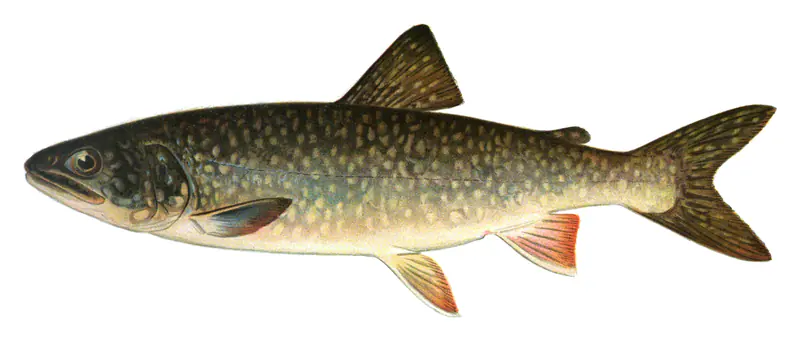
Game fish recorded in Lake Chelan include smallmouth bass, brown trout, lake trout, cutthroat trout. In all, 6 fish species have open records inside the lake on GBIF.
The surface of Lake Chelan was about 53°F on November 8, estimated from a satellite pass on a clear day. It is the top layer of the water, a few degrees either way; coves and shallows run warmer in the sun.
Anglers 16 and older need a Washington fishing license, sold online by the Washington Department of Fish and Wildlife. Free fishing days: First weekend after the first Monday in June. Size and bag limits can be set lake by lake: check the current regulations.
Lake Chelan is about 1,486 ft deep at its deepest point, and about 472 ft deep on average. Depth changes with the lake level.
Yes: morphometry report with bathymetric contour maps from the Washington State Department of Ecology (1987). It is linked in the lake facts on this page. Depths on a map are measured at a reference level: subtract how far the lake is below it today.
boating (6 boat ramps and 14 marinas), kayaks, boats & jet skis (9 rental outfits on or near the water), fishing (5 game fish; stocked by the state), swimming (10 beaches and swimming areas), hiking & walking (14 trails along the shore, the longest Lakeshore Trail (17 mi)) and camping (9 campgrounds), according to our map of the shore.
EPA's CyAN satellite rated cyanobacteria in Lake Chelan not detected on November 9. The satellite sees open water only; blooms can be patchy, so avoid water that looks like spilled paint or pea soup and keep dogs out of scum. Swimming advisories come from Washington health and environment agencies.
Yes. Washington Department of Fish and Wildlife stocked rainbow trout and cutthroat trout in Lake Chelan; the latest stocking on record was on October 6, 2026.
Yes. 14 trails run along or near the shore, including Box Canyon Trail (6.4 mi), Chelan Riverwalk Loop (0.9 mi) and Lakeshore (Chelan) Trail (14 mi), according to OpenStreetMap.
Lake Chelan is held back by Chelan, completed in 1927 and 33 ft high, according to the National Inventory of Dams.
From the U.S. Geological Survey (LAKE CHELAN AT PURPLE POINT AT STEHEKIN, WA). Lake by Lake checks it every hour; the agency's own figure is always the reference, and provisional readings can be revised.
Lake levels are refreshed every hour. Texas and California reservoirs report once a day; most USGS and NOAA gauges report every 15 to 60 minutes.