Sun
- Sunrise
- 7:05 AM
- Sunset
- 4:19 PM
- First light
- 6:32 AM
- Last light
- 4:53 PM
Lake · Grant County, Washington
A lake in Grant County, Washington.

Soap Lake is at 1,068.45 feet above sea level, as of Nov 17, 2026, 6:15 PM PST. It has risen 0.06 ft in the past 7 days.
4th lowest of 13 Washington lakes today against normal for the date · See the ranking
Record low 1,068.33 ft (2026), record high 1,077.00 ft (1985) · Level history since 1969
A notification from this browser, once, when the level crosses the line (checked every hour). No account and no email. On an iPhone, add Lake by Lake to your home screen first (Share → Add to Home Screen) and open it from there. Or follow the lake in a feed reader: RSS feed.
Soap Lake is up 0.11 ft over the last 30 days, at 1,068.45 ft today.
Daily values from the U.S. Geological Survey.
Over the past 12 months, Soap Lake ranged from 1,068.33 ft (Oct 24, 2026) to 1,069.99 ft (Apr 22, 2026), a swing of 1.7 ft. Today's level is near the bottom of that range. It is 0.31 ft lower than on this date last year.
Daily values from the U.S. Geological Survey. Why lake levels rise and fall
In the U.S. Geological Survey record, which starts in 1969, the lowest level was 1,068.33 ft on October 24, 2026 and the highest 1,077.00 ft on April 3, 1985. Today’s 1,068.45 ft is 0.1 ft above the record low and 8.5 ft below the record high.
Soap Lake level history: every year since 1969, the lowest and highest years →
Solunar periods for Soap Lake, local time. How they work
Not detected · as of Nov 9, 2026
The satellite found no cyanobacteria at the surface.
Week of Aug 16Week of Nov 1
Each bar is one week, colored by the worst reading of that week.
From the U.S. EPA's Cyanobacteria Assessment Network (CyAN), which reads the color of lakes from the Sentinel-3 satellites; it sees open water only, not coves or the shoreline. Blooms can be patchy: what you see on the water matters more. Swimming closures and health advisories come from Washington health and environment agencies. How to read it
Surface water temperature
53°F on Oct 21, 2026
82°F · Jul 2553°F · Oct 21
29°F cooler than on Jul 25, 2026.
Estimated from Landsat 8/9 (USGS) passes on clear days: the top layer of the water, a few degrees either way. Coves and the shallows can be warmer.
On or near the shore of Soap Lake: 2 boat ramps, 1 campground and 1 beach. The lake has about 6 miles of shoreline, counting its islands.
Tap an icon for details; use two fingers (or Ctrl + scroll) to move the map. Tap a dot for details. Map and lake outline © OpenStreetMap contributors. Places from OpenStreetMap, Overture Maps and Recreation.gov. Not for navigation.
No aquatic invasive species are on record for Soap Lake in the USGS database. Keep it that way: clean, drain and dry your boat between lakes.
Washington: Stop at every open watercraft check station (required for motorized and nonmotorized boats), and clean and drain your boat after each use, removing plants, animals and water. Required: Aquatic Invasive Species Prevention Permit (out-of-state boats) ($24 a year for out-of-state boats). State rules
Records: USGS Nonindigenous Aquatic Species database. A species not listed may still be present.
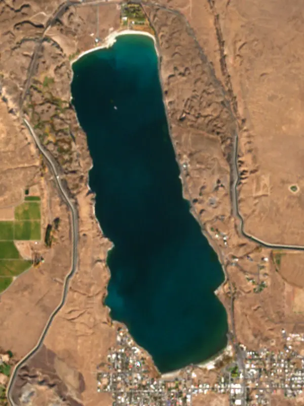
Soap Lake is a mineral lake at the foot of the Grand Coulee in Grant County, Washington, with the small town of the same name on its southern shore, about 7 miles north of Ephrata and 23 miles northwest of Moses Lake. Its water is strongly alkaline, slick to the touch and so loaded with salts that swimmers float easily. For more than a century people have come to soak in it and coat themselves in its mud.
The lake was shaped by the Ice Age floods. During the last Ice Age an ice dam held back glacial Lake Missoula far to the northeast, and each time it failed, enormous floods tore across eastern Washington toward the Pacific, carving features such as the cliffs of Dry Falls. Geologist J Harlen Bretz laid out that catastrophic flood idea in 1927, and it took his colleagues about half a century to accept it. In the basin the floods left behind, water leached sodium carbonate, sodium sulfate and other salts out of the old lava flows. The lake is meromictic, meaning it has two layers that do not mix. The deep layer, roughly five times saltier than seawater, has probably not mixed with the water above it for about 2,000 years. Tribes of the region knew the place as Smokiam, often translated as healing waters, and came for centuries to bathe, dig roots and build steam huts on the shore, calling truces so that people and horses could share the water.
Settlers arrived around 1900, the first store opened in 1904, and the town was platted in 1908 and incorporated on June 9, 1919. The lake has also been called Cottage Lake, Siloam and Sanitarium Lake. The Soap Lake Sanitarium was founded officially in 1905 and sold bottled water, salts, soap, mud packs and massages, and the 100-room Siloam Sanitarium overlooked the lake from 1909 until it burned in 1921. Notaras Lodge, built of river rock in 1911, piped lake water into its rooms. At the 1920 Washington State Fair the local commercial club billed the lake as the greatest healing spot on earth. In the 1920s World War I veterans with Buerger's disease, a circulatory illness that can lead to gangrene, came to bathe and reported relief. The Veterans Administration sent nine veterans for treatment in 1933, and in 1938 the federal government authorized a veterans hospital in Soap Lake to study the disease. Sulfa drugs in the late 1930s and penicillin in the early 1940s slowly took the shine off natural cures, and the town has since shrunk by about three quarters from its peak.
The name comes from the natural foam that used to whip up along the shore. Foam has become rare since canals tied the lake to the lakes upstream and the Grand Coulee Dam was built, and it now shows up mostly on windy days. Testing going back to 1910 shows the mineral content falling as fresher water seeps in from other sources. An oily film on the water is probably left by red brine shrimp, which thrive from late spring to midsummer. The lake's chemistry also draws scientists. Researchers funded by the National Science Foundation have studied its hardy microbes for clues to environmental cleanup, new medicines and possible life on Mars.
On December 19, 2023, the Washington Department of Ecology named Soap Lake an Outstanding Resource Water, the highest level of protection under the state's antidegradation rules and the first time it had been given to any waterbody. The Confederated Tribes of the Colville Reservation and the Soap Lake Conservancy applied for it together. An earlier effort, in 2012, to rename the lake Smokiam failed in the face of opposition from residents and the city council. The town is also known for its Fourth of July fireworks. Pow wows held at the lake from 1953 to 1972 returned in 2023.
Written by Lake by Lake from HistoryLink.org, Soap Lake Conservancy and Wikipedia. Checked November 2026.
Where the level comes from: SOAP LK NEAR SOAP LK, WA (U.S. Geological Survey).
| Lake | Miles | Level (ft) | vs full | 7 days |
|---|---|---|---|---|
| Lake Lenore Live reading | 8 | 1076.68 | — | +0.03 |
| Billy Clapp Lake Well below full | 11 | 1316.73 | −18.27 | −0.39 |
| Banks Lake At or near full pool | 17 | 1568.28 | −1.72 | 0.00 |
| Moses Lake Live reading | 22 | 1042.33 | — | −0.84 |
| Potholes Reservoir Below full | 31 | 1038.80 | −7.70 | +0.97 |
| Lake Entiat At or near full pool | 39 | 705.34 | −1.66 | −0.68 |
Compare Soap Lake with Lake Lenore, Billy Clapp Lake, Banks Lake or Moses Lake: size, level, ramps and fish side by side.
Soap Lake is about 98 mi from Spokane, WA. See all the lakes near each city.
Soap Lake is at 1,068.45 feet above sea level, as of Nov 17, 2026, 6:15 PM PST. It has risen 0.06 ft in the past 7 days.
Today's level is 4.37 ft below the median for this date (1,072.82 ft), from the gauge’s long-term daily record.
1,068.33 ft, on October 24, 2026, in the U.S. Geological Survey record, which starts in 1969. Today the lake is 0.1 ft above that.
1,077.00 ft, on April 3, 1985, in the U.S. Geological Survey record since 1969.
Soap Lake has 2 boat ramps on our map, including Boat ramp at Smokiam RV Resort. Low water can close ramps, so check today's level above and the operator before you go.
Yes. There is 1 campground within about a mile of the shore, such as Smokiam RV Resort.
Anglers 16 and older need a Washington fishing license, sold online by the Washington Department of Fish and Wildlife. Free fishing days: First weekend after the first Monday in June. Size and bag limits can be set lake by lake: check the current regulations.
Soap Lake is about 70 ft deep at its deepest point, and about 44 ft deep on average. Depth changes with the lake level.
boating (2 boat ramps), swimming (1 beach or swimming area), camping (1 campground), cabins & lodging (5 places to stay close to the water), parks & picnics (3 parks on the shore) and waterfront dining (1 waterfront restaurant), according to our map of the shore.
EPA's CyAN satellite rated cyanobacteria in Soap Lake not detected on November 9. The satellite sees open water only; blooms can be patchy, so avoid water that looks like spilled paint or pea soup and keep dogs out of scum. Swimming advisories come from Washington health and environment agencies.
From the U.S. Geological Survey (SOAP LK NEAR SOAP LK, WA). Lake by Lake checks it every hour; the agency's own figure is always the reference, and provisional readings can be revised.
Lake levels are refreshed every hour. Texas and California reservoirs report once a day; most USGS and NOAA gauges report every 15 to 60 minutes.