Sun
- Sunrise
- 6:52 AM
- Sunset
- 4:29 PM
- First light
- 6:22 AM
- Last light
- 4:59 PM
Reservoir · Jefferson County, Wisconsin
A reservoir fed by the Rock River in Jefferson County, Wisconsin.
Lake Koshkonong is at 776.05 feet above sea level, as of Nov 19, 2026, 3:00 AM CST. The level has held steady over the past week.
2nd lowest of 4 Wisconsin lakes today against normal for the date · See the ranking
Record low 775.28 ft (2021), record high 781.15 ft (2026) · Level history since 2019
A notification from this browser, once, when the level crosses the line (checked every hour). No account and no email. On an iPhone, add Lake by Lake to your home screen first (Share → Add to Home Screen) and open it from there. Or follow the lake in a feed reader: RSS feed.
Lake Koshkonong has held steady over the last 7 days (within 0.05 ft).
Daily values from the U.S. Geological Survey.
Lake Koshkonong is down 0.12 ft over the last 30 days, at 776.05 ft today.
Daily values from the U.S. Geological Survey.
Over the past 12 months, Lake Koshkonong ranged from 775.66 ft (Feb 2, 2026) to 781.15 ft (Apr 24, 2026), a swing of 5.5 ft. Today's level is near the bottom of that range. It is 0.19 ft higher than on this date last year.
Daily values from the U.S. Geological Survey. Why lake levels rise and fall
In the U.S. Geological Survey record, which starts in 2019, the lowest level was 775.28 ft on February 26, 2021 and the highest 781.15 ft on April 24, 2026. Today’s 776.05 ft is 0.8 ft above the record low and 5.1 ft below the record high.
Lake Koshkonong level history: every year since 2019, the lowest and highest years →
Solunar periods for Lake Koshkonong, local time. How they work
Not detected · as of Nov 9, 2026
The satellite found no cyanobacteria at the surface.
Week of Aug 16Week of Nov 1
Each bar is one week, colored by the worst reading of that week.
From the U.S. EPA's Cyanobacteria Assessment Network (CyAN), which reads the color of lakes from the Sentinel-3 satellites; it sees open water only, not coves or the shoreline. Blooms can be patchy: what you see on the water matters more. Swimming closures and health advisories come from Wisconsin health and environment agencies. How to read it
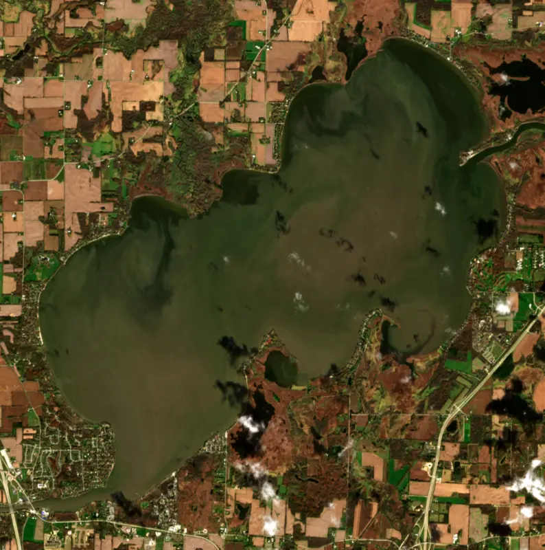
Surface water temperature
50°F on Nov 10, 2026
80°F · Jul 2850°F · Nov 10
30°F cooler than on Jul 28, 2026.
Estimated from Landsat 8/9 (USGS) passes on clear days: the top layer of the water, a few degrees either way. Coves and the shallows can be warmer.
Lake Koshkonong water temperature: trend, swimming and the fish →
On or near the shore of Lake Koshkonong: 5 boat ramps, 1 marina, 2 rental outfits, 7 campgrounds and 1 beach. The lake has about 28 miles of shoreline, counting its islands.
Tap an icon for details; use two fingers (or Ctrl + scroll) to move the map. Tap a dot for details. Map and lake outline © OpenStreetMap contributors. Places from OpenStreetMap, Overture Maps and Recreation.gov. Not for navigation.
What you’ll find on the shore
← AllBoating 6
← AllRentals & tours 2
← AllFishing spots 1
← AllBeaches 1
← AllCamping 7
← AllLodging 2
← AllParks 2
← AllDining 8
Zebra mussels have been found in Lake Koshkonong. They clog intakes and engines and spread on boats and trailers: clean, drain and dry everything before you go to another lake.
Wisconsin: Before leaving, remove all plants and animals from the boat, trailer and gear and drain all water, including livewells and buckets; launching, or driving on a highway, with plants or animals attached is illegal. Never move live fish away from the water; leftover minnows can go to another lake only if no lake water or fish were added. State rules
Records: USGS Nonindigenous Aquatic Species database. A species not listed may still be present.
Species with open-licensed records inside Lake Koshkonong's outline, from GBIF.org (surveys, museum collections and angler reports). A record shows a fish was found here, not how many there are now.
Shallow, protected flats in spring; docks, grass and deep edges in summer heat.
Brush piles, docks and bridge pilings; shallow for a few weeks in spring.
Rocky shorelines at night after ice-out; deep weed edges and humps in summer.
Shallow, weedy bays right after ice-out; weed edges the rest of the year.
Spring runs up the tributaries; schools busting shad in late summer.
Water temperature sets off each spawn; the bars show the usual months at this latitude and elevation, and move with a warm or cold spring. The water is about 50°F now.
Lake Koshkonong is a broad, shallow widening of the Rock River in southern Wisconsin, lying mostly in Jefferson County with its edges in Rock and Dane counties, just downstream from Fort Atkinson. It ranks as the sixth-largest inland lake in the state, yet it averages only about 5 feet deep. Its story runs from Ho-Chunk villages and the Black Hawk War to a dam, a duck-hunting tradition and a long legal fight over a few inches of water.
Before settlers arrived the shores were home to Ho-Chunk, or Winnebago, villages, and archaeologists have mapped mound groups and village sites around the lake, including Carcajou Point and the point now called Taylor Point, whose Ho-Chunk name meant the lake point. An 1834 surveyor wrote the lake down as Kuskawenong. The meaning of the name is debated. The familiar translation, the lake we live on, has been questioned, and a more likely reading is a place of heavy fog. In the summer of 1832 the Army came through this country in pursuit of Black Hawk and his band. On July 6 General Atkinson reached the Ho-Chunk town known as Burnt Village, about 2.5 miles southeast of today's Fort Atkinson, and found it deserted, and pioneers later placed Black Hawk's own camp of that summer near the south end of the lake in the Town of Milton.
Koshkonong was once a mix of shallow and deep marsh, with reeds and wild rice. The territorial legislature authorized a dam downstream at Indianford in 1843, and the Stoughtons built it after the state approved it again in 1851, which turned the marsh into a shallow lake. Rebuilding around 1917 raised the water about two more feet. Rock County owned the dam until 2004, when the Rock-Koshkonong Lake District, formed in 1999, took it over. The dam had fallen into disrepair in the 1960s and was rehabilitated in 2002.
In 2003 the lake district asked the Department of Natural Resources to raise the lake, arguing that low water hurt boating and forced owners to build longer piers. In 2005 the department refused to raise the summer level, citing erosion of wetland shoreline, water quality, wildlife habitat and the riprap that protects the banks, though it did allow a higher winter level. The case went all the way to the Wisconsin Supreme Court, which ruled on July 16, 2013, that the department had wrongly shut out evidence of economic harm to property values, businesses and local tax bases and could not use the public trust doctrine to regulate dry land above the high water mark. Erosion is a real problem here. In 2002 and 2003 about 5 miles of shoreline were armored with riprap. In the 1970s the lake was also the primary site considered for a large nuclear power plant, a plan dropped in 1977 after opposition and doubts about having enough water in a drought.
The lake drains a basin of about 2,640 square miles of farms and towns, and the sediment and phosphorus that wash in feed frequent algae blooms and the occasional fish kill. The state lists Koshkonong as impaired for low oxygen, poor habitat, algae and murky water, and common carp, despite a long-running commercial carp fishery, make it worse by stirring the bottom. Health officials advise staying out of water that looks like green scum or pea soup. Even so, the Rock River and the lake hold about 60 kinds of fish, including walleye, muskellunge and bass, and anglers fish it through the year, on the ice in winter. Koshkonong has long been a stopover for migrating ducks and geese and has a long history of waterfowl hunting. Summer brings boat races and a Venetian boat parade.
Written by Lake by Lake from Wisconsin Department of Natural Resources, Wisconsin Supreme Court (via FindLaw), Hotcâk Encyclopedia and Wikipedia. Checked November 2026.
Where the level comes from: LAKE KOSHKONONG NEAR NEWVILLE, WI (U.S. Geological Survey).
| Lake | Miles | Level (ft) | vs full | 7 days |
|---|---|---|---|---|
| Lake Kegonsa Live reading | 18 | 842.64 | — | −0.27 |
| Lake Waubesa Live reading | 21 | 843.68 | — | −0.31 |
| Lake Monona Live reading | 27 | 844.03 | — | −0.31 |
| Lake Mendota Live reading | 27 | 849.52 | — | −0.18 |
| Geneva Lake Live reading | 32 | 864.29 | — | −0.01 |
| Hustisford-Sinissippi Lake Live reading | 38 | 855.51 | — | — |
Compare Lake Koshkonong with Lake Kegonsa, Lake Waubesa, Lake Monona or Lake Mendota: size, level, ramps and fish side by side.
Lake Koshkonong is about 29 mi from Madison, WI, 42 mi from Rockford, IL and 51 mi from Milwaukee, WI. See all the lakes near each city.
Lake Koshkonong is at 776.05 feet above sea level, as of Nov 19, 2026, 3:00 AM CST. The level has held steady over the past week.
Today's level is 1.04 ft below the median for this date (777.09 ft), from the gauge’s long-term daily record.
775.28 ft, on February 26, 2021, in the U.S. Geological Survey record, which starts in 2019. Today the lake is 0.8 ft above that.
781.15 ft, on April 24, 2026, in the U.S. Geological Survey record since 2019.
Lake Koshkonong has 5 boat ramps on our map, including Bingham Road Boat Ramp, Royce-Dallman County Park Boat Ramp, Vinne HaHa Landing, and 1 marina. Low water can close ramps, so check today's level above and the operator before you go.
Yes. There are 7 campgrounds and RV parks within about a mile of the shore, such as Pettit's Lakeview Campground and Bar, Jellystone Park, Wishing Well RV Resort.
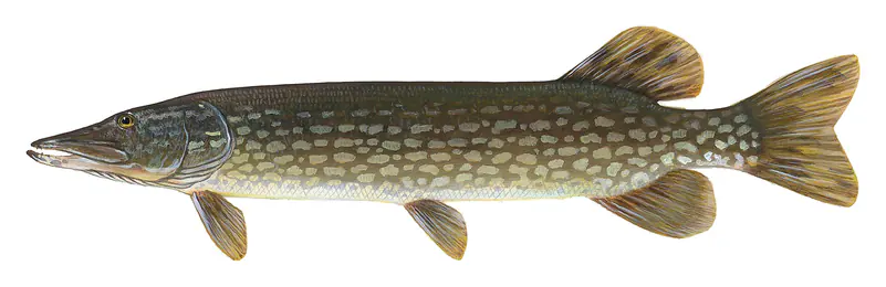
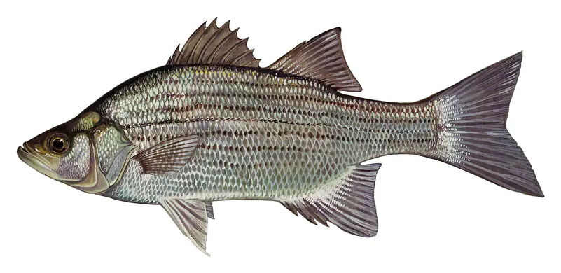
Game fish recorded in Lake Koshkonong include largemouth bass, white crappie, walleye, northern pike, white bass, yellow perch. In all, 11 fish species have open records inside the lake on GBIF.
The surface of Lake Koshkonong was about 50°F on November 10, estimated from a satellite pass on a clear day. It is the top layer of the water, a few degrees either way; coves and shallows run warmer in the sun.
Anglers 16 and older need a Wisconsin fishing license, sold online by the Wisconsin Department of Natural Resources. Free fishing days: Third full weekend in January and first full weekend in June. Size and bag limits can be set lake by lake: check the current regulations.
Lake Koshkonong averages about 25 ft deep. Depth changes with the lake level.
In summer a white Secchi disk lowered into Lake Koshkonong stays visible to about 1.7 ft (the median of 88 readings, 2016–2026, by Wisconsin Department of Natural Resources): murky water. Silt after rain lowers the reading as much as algae do. Clarity drops after storms and during algae blooms.
Yes: contour (bathymetric) lake map from the Wisconsin Department of Natural Resources. It is linked in the lake facts on this page. Depths on a map are measured at a reference level: subtract how far the lake is below it today.
boating (5 boat ramps and 1 marina), kayaks, boats & jet skis (2 rental outfits on or near the water), fishing (10 game fish), swimming (1 beach or swimming area), camping (7 campgrounds) and cabins & lodging (2 places to stay close to the water), according to our map of the shore.
EPA's CyAN satellite rated cyanobacteria in Lake Koshkonong not detected on November 9. The satellite sees open water only; blooms can be patchy, so avoid water that looks like spilled paint or pea soup and keep dogs out of scum. Swimming advisories come from Wisconsin health and environment agencies.
From the U.S. Geological Survey (LAKE KOSHKONONG NEAR NEWVILLE, WI). Lake by Lake checks it every hour; the agency's own figure is always the reference, and provisional readings can be revised.
Lake levels are refreshed every hour. Texas and California reservoirs report once a day; most USGS and NOAA gauges report every 15 to 60 minutes.
Cookies for analytics With your OK we use Google Analytics and Microsoft Clarity to count visits and see how the site is used, so we can make it better. No advertising cookies. Privacy policy