Sun
- Sunrise
- 6:55 AM
- Sunset
- 4:30 PM
- First light
- 6:24 AM
- Last light
- 5:01 PM
Lake · Dane County, Wisconsin
A lake fed by the Yahara River in Dane County, Wisconsin.

Lake Monona is at 844.03 feet above sea level, as of Nov 19, 2026, 2:00 AM CST. It has dropped 0.31 ft in the past 7 days.
A notification from this browser, once, when the level crosses the line (checked every hour). No account and no email. On an iPhone, add Lake by Lake to your home screen first (Share → Add to Home Screen) and open it from there. Or follow the lake in a feed reader: RSS feed.
Lake Monona is down 0.31 ft over the last 7 days, at 844.03 ft today.
Daily values from the U.S. Geological Survey.
Lake Monona is down 0.90 ft over the last 30 days, at 844.03 ft today.
Daily values from the U.S. Geological Survey.
Over the past 12 months, Lake Monona ranged from 843.42 ft (Mar 4, 2026) to 845.45 ft (Sep 22, 2026), a swing of 2.0 ft. Today's level is in the lower half of that range. It is 0.29 ft lower than on this date last year.
Daily values from the U.S. Geological Survey. Why lake levels rise and fall
Solunar periods for Lake Monona, local time. How they work
Moderate · as of Nov 9, 2026
A bloom may be forming somewhere on the lake. Avoid water that looks like spilled paint or pea soup. About 286,000 cells/mL at the worst spot, covering 60% of the lake.
Week of Aug 16Week of Nov 1
Each bar is one week, colored by the worst reading of that week.
From the U.S. EPA's Cyanobacteria Assessment Network (CyAN), which reads the color of lakes from the Sentinel-3 satellites; it sees open water only, not coves or the shoreline. Blooms can be patchy: what you see on the water matters more. Swimming closures and health advisories come from Wisconsin health and environment agencies. How to read it
The ice usually goes out of Lake Monona around Mar 29 (median of 172 springs on record). In 2026 it went out on Mar 11. The earliest on record was Feb 26, 2002; the latest, May 4, 1857.
Each dot is one of the last 30 springs on record; the dashed line is the median of all of them; the orange dot is 2026.
Source: Wisconsin State Climatology Office. Ice is never safe everywhere: check local conditions before going out on it. About ice-out
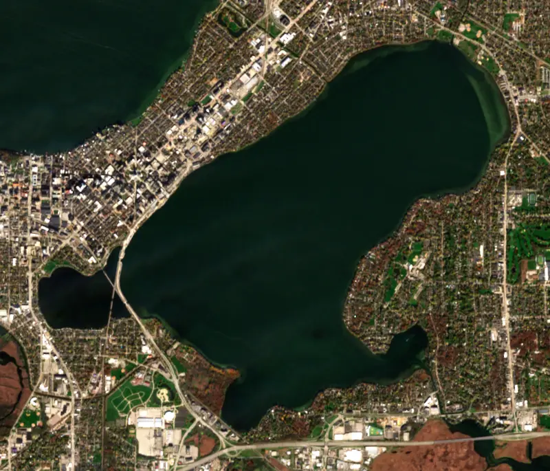
The last 7 satellite passes
79°F · Jul 2156°F · Nov 10
24°F cooler than on Jul 21, 2026.
Estimated from Landsat 8/9 (USGS) passes on clear days: the top layer of the water, a few degrees either way. Coves and the shallows can be warmer.
Lake Monona water temperature: trend, swimming and the fish →
On or near the shore of Lake Monona: 9 boat ramps, 2 marinas, 3 rental outfits, 11 beaches and 7 trails. The lake has about 17 miles of shoreline, counting its islands.
Tap an icon for details; use two fingers (or Ctrl + scroll) to move the map. Tap a dot for details. Map and lake outline © OpenStreetMap contributors. Places from OpenStreetMap, Overture Maps and Recreation.gov. Not for navigation.
What you’ll find on the shore
← AllBoating 11
← AllRentals & tours 5
← AllFishing spots 3
← AllBeaches 11
← AllLodging 24+
← AllTrails 7
← AllParks 20+
← AllDining 24+
Zebra mussels have been found in Lake Monona. They clog intakes and engines and spread on boats and trailers: clean, drain and dry everything before you go to another lake.
Wisconsin: Before leaving, remove all plants and animals from the boat, trailer and gear and drain all water, including livewells and buckets; launching, or driving on a highway, with plants or animals attached is illegal. Never move live fish away from the water; leftover minnows can go to another lake only if no lake water or fish were added. State rules
Records: USGS Nonindigenous Aquatic Species database. A species not listed may still be present.
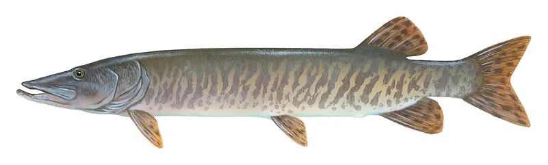
The last stocking on record was in 2025 (muskellunge).
Source: Wisconsin Department of Natural Resources stocking records.
Species with open-licensed records inside Lake Monona's outline, from GBIF.org (surveys, museum collections and angler reports). A record shows a fish was found here, not how many there are now. marks fish the state stocks here.
Brush piles, docks and bridge pilings; shallow for a few weeks in spring.
Weed beds and rock bars; fall is trophy season.
Beds in shallow, firm bottoms; around docks and weeds all summer.
Shallow, muddy bays and flooded grass in spring; mud flats and inflows in summer.
Water temperature sets off each spawn; the bars show the usual months at this latitude and elevation, and move with a warm or cold spring. The water is about 47°F now.
Lake Monona is the lake on the south side of downtown Madison, Wisconsin, the second in the chain of lakes on the Yahara River. Madison wraps around three sides of it, the city of Monona sits on the southeast shore, and Frank Lloyd Wright's Monona Terrace stands at the water's edge two blocks from the State Capitol.
The lakes sit in the Yahara River valley in a chain held back by glacial moraines. The Yahara carries water in from Lake Mendota across the Madison isthmus, and Starkweather and Wingra creeks also drain into Monona. The Ho-Chunk called the Four Lakes Taychoperah and knew this one by a name that translates as Teepee Lake. The present name was suggested in 1849 by Frank Hudson of Philadelphia, who had been hired to lay out an addition to the young town. It is often said to mean beautiful, but its origin is uncertain.
Monona forms the south shore of the isthmus that downtown Madison is built on. Frank Lloyd Wright proposed a civic center on that shore in 1938, lost by a single vote on a county board, and kept reworking the design until he died in 1959. Voters approved the project in a 1992 referendum, and Monona Terrace opened on July 18, 1997. Its roof looks out over the lake and back toward the Capitol.
The lake has eight city parks and numerous boat launches, and the railroad and road fills across Monona Bay make easy places to fish from shore. Swimmers use beaches at Olbrich, Olin, Brittingham, B.B. Clarke and other parks. On December 10, 1967, the plane carrying soul singer Otis Redding to a Madison concert went down in the lake in bad weather. Everyone aboard died except Ben Cauley, a trumpeter in Redding's band, the Bar-Kays.
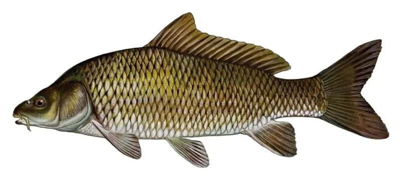
State biologists count 36 fish species here. Perch and other panfish, largemouth bass, northern pike, walleye and muskellunge are the main sport fish, and stocked hybrid muskies have done well enough that legal fish are caught regularly. The lake also has a long history of carp problems.
The lake drains a heavily urban watershed, and its water has been a concern for well over a century. Algae blooms were reported as early as 1888, and copper sulfate treatments started in 1918. Over the decades, more than 1.5 million pounds of copper and arsenic compounds went into the lake to control weeds. The water improved after Madison stopped sending its wastewater into the lake and diverted it to Badfish Creek, but Monona is still listed as impaired for phosphorus. Beaches close at times for E. coli, and the state advises limits on eating some fish because of mercury and, since 2020, PFOS.
Ice records for Monona go back to the mid-1800s. The Wisconsin State Climatology Office calls the lake frozen when about half of it is covered, watching from the foot of South Few Street, the causeway and other points, and the lake is usually iced over for around three and a half months.
Monona has no dam at its own outlet. Its level depends heavily on how much water comes down the Yahara from Lake Mendota, which the Tenney Lock and Dam holds about 5 feet above its natural level. In August 2018, heavy rain fell on a lake chain that was already close to record highs. Monona came near an unprecedented flood, lakefront homes and low ground flooded, and slow-no-wake rules and beach closures spread across the chain.
Written by Lake by Lake from Wisconsin Department of Natural Resources, Historic Madison, Inc., Wisconsin State Climatology Office, UW-Madison Center for Limnology and Wikipedia (Lake Monona, Monona Terrace). Checked November 2026.
Where the level comes from: LAKE MONONA AT MADISON, WI (U.S. Geological Survey).
| Lake | Miles | Level (ft) | vs full | 7 days |
|---|---|---|---|---|
| Lake Mendota Live reading | 3 | 849.57 | — | −0.13 |
| Lake Waubesa Live reading | 6 | 843.68 | — | −0.31 |
| Lake Kegonsa Live reading | 10 | 842.64 | — | −0.27 |
| Lake Koshkonong Live reading | 27 | 776.07 | — | 0.00 |
| Hustisford-Sinissippi Lake Live reading | 45 | 855.51 | — | — |
| Green Lake Live reading | 55 | 796.46 | — | −0.09 |
Compare Lake Monona with Lake Mendota, Lake Waubesa, Lake Kegonsa or Lake Koshkonong: size, level, ramps and fish side by side.
Lake Monona is about 2 mi from Madison, WI, 58 mi from Rockford, IL and 89 mi from Elgin, IL. See all the lakes near each city.
Lake Monona is at 844.03 feet above sea level, as of Nov 19, 2026, 2:00 AM CST. It has dropped 0.31 ft in the past 7 days.
Lake Monona has 9 boat ramps on our map, including Boat ramp at Brittingham Beach, Law Park Boat Launch, Olin-Turville Park Boat Ramp, and 2 marinas. Low water can close ramps, so check today's level above and the operator before you go.
Game fish recorded in Lake Monona include black crappie, muskellunge, bluegill, common carp. In all, 5 fish species have open records inside the lake on GBIF.
The water at Lake Monona is 47°F, measured 2 hr ago by the USGS sensor in the lake. Surface temperature changes through the day and with depth.
Anglers 16 and older need a Wisconsin fishing license, sold online by the Wisconsin Department of Natural Resources. Free fishing days: Third full weekend in January and first full weekend in June. Size and bag limits can be set lake by lake: check the current regulations.
Lake Monona is about 69 ft deep at its deepest point, and about 22 ft deep on average. Depth changes with the lake level.
In summer a white Secchi disk lowered into Lake Monona stays visible to about 6.7 ft (the median of 66 readings, 2016–2026, by Wisconsin Department of Natural Resources): clear water. Silt after rain lowers the reading as much as algae do. Clarity drops after storms and during algae blooms.
Yes: contour (bathymetric) lake map from the Wisconsin Department of Natural Resources. It is linked in the lake facts on this page. Depths on a map are measured at a reference level: subtract how far the lake is below it today.
boating (9 boat ramps and 2 marinas), kayaks, boats & jet skis (3 rental outfits on or near the water), boat tours (2 boat tours and charters), fishing (4 game fish; stocked by the state), swimming (11 beaches and swimming areas) and hiking & walking (7 trails along the shore, the longest Capital City State Trail (12 mi)), according to our map of the shore.
EPA's CyAN satellite rated cyanobacteria in Lake Monona moderate on November 9. The satellite sees open water only; blooms can be patchy, so avoid water that looks like spilled paint or pea soup and keep dogs out of scum. Swimming advisories come from Wisconsin health and environment agencies.
Usually around March 29, the median of 172 springs in the records of Wisconsin State Climatology Office. In 2026 the ice went out on March 11.
Yes. Wisconsin Department of Natural Resources stocked muskellunge in Lake Monona; the latest stocking on record was in 2025.
Yes. 7 trails run along or near the shore, including Capital City State Trail (12 mi), Lake Loop (1.5 mi) and Brittingham Park Path (0.8 mi), according to OpenStreetMap.
From the U.S. Geological Survey (LAKE MONONA AT MADISON, WI). Lake by Lake checks it every hour; the agency's own figure is always the reference, and provisional readings can be revised.
Lake levels are refreshed every hour. Texas and California reservoirs report once a day; most USGS and NOAA gauges report every 15 to 60 minutes.
Cookies for analytics With your OK we use Google Analytics and Microsoft Clarity to count visits and see how the site is used, so we can make it better. No advertising cookies. Privacy policy