Sun
- Sunrise
- 6:50 AM
- Sunset
- 4:27 PM
- First light
- 6:19 AM
- Last light
- 4:58 PM
Lake · Walworth County, Wisconsin
A lake in Walworth County, Wisconsin, held back by Lake Geneva Dam since 1836.

Geneva Lake is at 864.26 feet above sea level, as of Nov 19, 2026, 2:00 AM CST. The level has held steady over the past week.
A notification from this browser, once, when the level crosses the line (checked every hour). No account and no email. On an iPhone, add Lake by Lake to your home screen first (Share → Add to Home Screen) and open it from there. Or follow the lake in a feed reader: RSS feed.
Geneva Lake has held steady over the last 7 days (within 0.05 ft).
Daily values from the U.S. Geological Survey.
Geneva Lake is down 0.09 ft over the last 30 days, at 864.26 ft today.
Daily values from the U.S. Geological Survey.
Over the past 12 months, Geneva Lake ranged from 863.64 ft (Nov 28, 2025) to 865.13 ft (Apr 18, 2026), a swing of 1.5 ft. Today's level is in the lower half of that range. It is 0.56 ft higher than on this date last year.
Daily values from the U.S. Geological Survey. Why lake levels rise and fall
Solunar periods for Geneva Lake, local time. How they work
Low · as of Nov 9, 2026
Some cyanobacteria at the surface, under 100,000 cells/mL. About 89,500 cells/mL at the worst spot, covering 14% of the lake.
Week of Aug 9Week of Nov 1
Each bar is one week, colored by the worst reading of that week.
From the U.S. EPA's Cyanobacteria Assessment Network (CyAN), which reads the color of lakes from the Sentinel-3 satellites; it sees open water only, not coves or the shoreline. Blooms can be patchy: what you see on the water matters more. Swimming closures and health advisories come from Wisconsin health and environment agencies. How to read it
The ice usually goes out of Geneva Lake around Apr 1 (median of 153 springs on record). The record we have ends in 2019, when the ice went out on Apr 1. The earliest on record was Jan 3, 1886; the latest, May 4, 1881.
Each dot is one of the last 30 springs on record; the dashed line is the median of all of them; the orange dot is 2019.
Source: Sharma et al. (2022), lake ice phenology records for 78 lakes. Ice is never safe everywhere: check local conditions before going out on it. About ice-out
Surface water temperature
57°F on Nov 10, 2026
77°F · Jul 2257°F · Nov 10
20°F cooler than on Jul 22, 2026.
Estimated from Landsat 8/9 (USGS) passes on clear days: the top layer of the water, a few degrees either way. Coves and the shallows can be warmer.
Geneva Lake water temperature: trend, swimming and the fish →
On or near the shore of Geneva Lake: 10 boat ramps, 10 marinas, 11 rental outfits, 4 campgrounds, 9 beaches and 8 trails. The lake has about 21 miles of shoreline, counting its islands.
Tap an icon for details; use two fingers (or Ctrl + scroll) to move the map. Tap a dot for details. Map and lake outline © OpenStreetMap contributors. Places from OpenStreetMap, Overture Maps and Recreation.gov. Not for navigation.
What you’ll find on the shore
← AllBoating 20
← AllRentals & tours 12
← AllFishing spots 4
← AllBeaches 9
← AllCamping 4
← AllLodging 24+
← AllTrails 8
← AllParks 14
← AllDining 24+
Zebra mussels and Quagga mussels have been found in Geneva Lake. They clog intakes and engines and spread on boats and trailers: clean, drain and dry everything before you go to another lake.
Wisconsin: Before leaving, remove all plants and animals from the boat, trailer and gear and drain all water, including livewells and buckets; launching, or driving on a highway, with plants or animals attached is illegal. Never move live fish away from the water; leftover minnows can go to another lake only if no lake water or fish were added. State rules
Records: USGS Nonindigenous Aquatic Species database. A species not listed may still be present.
The last stocking on record was in 2025 (lake trout).
All 7 stockings · Source: Wisconsin Department of Natural Resources stocking records.
Species with open-licensed records inside Geneva Lake's outline, from GBIF.org (surveys, museum collections and angler reports). A record shows a fish was found here, not how many there are now. marks fish the state stocks here.
Shallow, protected flats in spring; docks, grass and deep edges in summer heat.
Brush piles, docks and bridge pilings; shallow for a few weeks in spring.
Rocky points, gravel and current breaks; deeper rock piles in summer.
Rocky shorelines at night after ice-out; deep weed edges and humps in summer.
Shallow, weedy bays right after ice-out; weed edges the rest of the year.
Water temperature sets off each spawn; the bars show the usual months at this latitude and elevation, and move with a warm or cold spring. The water is about 57°F now.
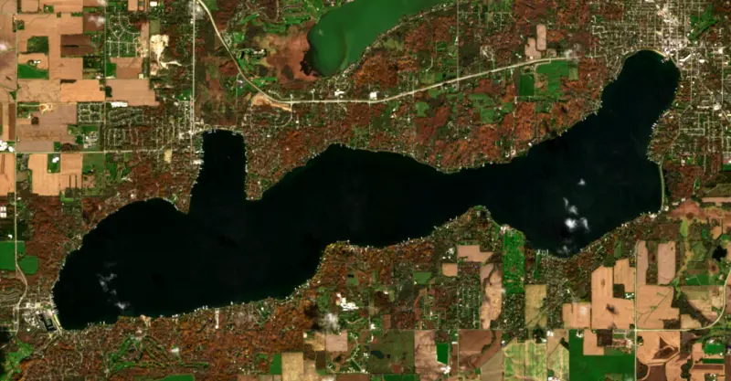
Geneva Lake is a deep, clear glacial lake in Walworth County, in southeastern Wisconsin, shared by the city of Lake Geneva and the villages of Williams Bay and Fontana-on-Geneva Lake. It is the largest and deepest lake in that corner of the state, set between Chicago, Milwaukee and Madison, and it has drawn summer residents from Chicago since the 1800s.
The lake is a product of the last ice age. A tongue of the glacier known as the Delavan Lobe stood for a long time just south of today's shore and dumped a curving ridge of rock and soil, the Darien Moraine. As the ice pulled back it left a second ridge to the north, the Elkhorn Moraine, which Highway 67 climbs going north out of Williams Bay. Geneva Lake formed between the two, about 10,000 years ago, in an old valley partly filled with glacial debris. Its water drains east into the White River.
The Potawatomi called the lake Kishwauketoe, roughly clear water. The Prairie Band leader Maungeezik, known as Big Foot, lived here with his people, and early settlers called it Big Foot Lake. Big Foot signed the 1833 Treaty of Chicago, which gave up much of southeastern Wisconsin and northeastern Illinois, and his band was then forced out to the Platte River country in Missouri and later to Kansas. Surveyor John Brink renamed the lake in the 1830s after Geneva, New York. A bronze marker on the south shore path east of Fontana marks where a party traveling the trails from Fort Dearborn in Chicago to Fort Winnebago first saw the lake in 1831.
The lake was natural until 1836, when settler Christopher Payne put a simple dam across the White River outlet at the east end, in what became the city of Lake Geneva. A stronger dam in the 1840s raised the water about 6 feet. Floods and droughts kept the level unsettled until 1894, when H. H. Porter, a Chicago railroad man with a summer home on the lake, bought the dam. He and other shore owners formed a company that built control gates to hold the level within narrow limits.
Early settlers also decided that a 20-foot strip of land along the water should stay in the public domain, and a footpath now circles the whole lake, more than 20 miles, along a route once used by the Potawatomi. It passes estates once owned by families such as the Wrigleys, Swifts, Wackers and Schwinns. The lake also keeps a tradition found nowhere else, mail jumping, in which mail reaches lakefront piers from a passing boat. At Williams Bay stands Yerkes Observatory, opened by the University of Chicago in 1897 and home to the largest refracting telescope ever built. The university closed it in 2018 and handed it to the nonprofit Yerkes Future Foundation in 2020. Big Foot Beach State Park, on the shore, has a swimming beach, a campground and about 5 miles of trails.
Geneva is a two-story lake, deep enough to keep a cold, well-oxygenated layer through summer that supports lake trout and cisco, a schooling forage fish that state biologists consider the base of the lake's sport fishery. It ranks among the most popular fishing lakes in southeastern Wisconsin. The shallows have suffered, though. Surveys show the nearshore fishery declining over the past 50 years as plant beds and fallen wood disappeared and waves battered the shallows. Eurasian water milfoil and zebra mussels have been in the lake for decades, and starry stonewort and quagga mussels arrived more recently, so staff at the municipal launches check boats and remove hitchhiking plants and mussels. A large algal bloom in August 2024 was a warning sign, and regional planners suggest keeping wake sports at least 500 feet from shore in water 30 feet deep or more.
Written by Lake by Lake from Williams Bay Historical Society, Southeastern Wisconsin Regional Planning Commission, Wikipedia (Geneva Lake, Big Foot (Potawatomi leader)), Wisconsin Public Radio and Wisconsin Department of Natural Resources. Checked November 2026.
Lake Geneva Dam is a concrete gravity dam 14 feet high and 300 feet long, completed in 1836. It belongs to Lake Level Board and is run for recreation. At its normal level the lake holds 30,000 acre-ft, drained from 36 square miles of land.
From the National Inventory of Dams (U.S. Army Corps of Engineers), NID ID WI00084. Lake or reservoir: what’s the difference?
Where the level comes from: GENEVA LAKE AT LAKE GENEVA, WI (U.S. Geological Survey).
| Lake | Miles | Level (ft) | vs full | 7 days |
|---|---|---|---|---|
| Wind Lake Live reading | 21 | 767.79 | — | +1.33 |
| Lake Koshkonong Live reading | 32 | 776.07 | — | 0.00 |
| Lake Kegonsa Live reading | 50 | 842.64 | — | −0.27 |
| Lake Waubesa Live reading | 53 | 843.68 | — | −0.31 |
| Hustisford-Sinissippi Lake Live reading | 53 | 855.51 | — | — |
| Lake Monona Live reading | 59 | 844.03 | — | −0.31 |
Compare Geneva Lake with Wind Lake, Lake Koshkonong, Lake Kegonsa or Lake Waubesa: size, level, ramps and fish side by side.
Geneva Lake is about 39 mi from Elgin, IL, 39 mi from Rockford, IL and 40 mi from Milwaukee, WI. See all the lakes near each city.
Geneva Lake is at 864.26 feet above sea level, as of Nov 19, 2026, 2:00 AM CST. The level has held steady over the past week.
Geneva Lake has 10 boat ramps on our map, including Fontana Boat Ramp, Lake Geneva - Hillside Road, Lake Geneva Boat Launch, and 10 marinas. Low water can close ramps, so check today's level above and the operator before you go.
Yes. There are 4 campgrounds and RV parks within about a mile of the shore, such as Deepwood - Reed's Camp Runamuk, Wesley Woods Conference Center, Outdoor & Retreat Ministries.
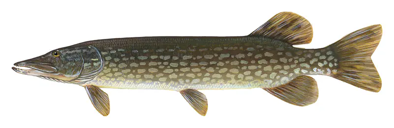
Game fish recorded in Geneva Lake include brown trout, walleye, largemouth bass, smallmouth bass, northern pike, bluegill. In all, 25 fish species have open records inside the lake on GBIF.
The surface of Geneva Lake was about 57°F on November 10, estimated from a satellite pass on a clear day. It is the top layer of the water, a few degrees either way; coves and shallows run warmer in the sun.
Anglers 16 and older need a Wisconsin fishing license, sold online by the Wisconsin Department of Natural Resources. Free fishing days: Third full weekend in January and first full weekend in June. Size and bag limits can be set lake by lake: check the current regulations.
In summer a white Secchi disk lowered into Geneva Lake stays visible to about 22.1 ft (the median of 22 readings, 2021–2026, by Wisconsin Department of Natural Resources): very clear water. Silt after rain lowers the reading as much as algae do. Clarity drops after storms and during algae blooms.
Yes: contour (bathymetric) lake map from the Wisconsin Department of Natural Resources. It is linked in the lake facts on this page. Depths on a map are measured at a reference level: subtract how far the lake is below it today.
boating (10 boat ramps and 10 marinas), kayaks, boats & jet skis (11 rental outfits on or near the water), boat tours (1 boat tour or charter), fishing (20 game fish; stocked by the state), swimming (9 beaches and swimming areas) and hiking & walking (8 trails along the shore, the longest Lake Geneva Shore Path (21 mi)), according to our map of the shore.
EPA's CyAN satellite rated cyanobacteria in Geneva Lake low on November 9. The satellite sees open water only; blooms can be patchy, so avoid water that looks like spilled paint or pea soup and keep dogs out of scum. Swimming advisories come from Wisconsin health and environment agencies.
Usually around April 1, the median of 153 springs in the records of Sharma et al. (2022), lake ice phenology records for 78 lakes.
Yes. Wisconsin Department of Natural Resources stocked lake trout, muskellunge, walleye and brown trout in Geneva Lake; the latest stocking on record was in 2025.
Yes. 8 trails run along or near the shore, including Geneva Lake Shore Path (1.2 mi), Lake Geneva Shore Path (21 mi) and South Lake Shore Lakefront Path (6.4 mi), according to OpenStreetMap.
Geneva Lake is held back by Lake Geneva, completed in 1836 and 14 ft high, according to the National Inventory of Dams.
From the U.S. Geological Survey (GENEVA LAKE AT LAKE GENEVA, WI). Lake by Lake checks it every hour; the agency's own figure is always the reference, and provisional readings can be revised.
Lake levels are refreshed every hour. Texas and California reservoirs report once a day; most USGS and NOAA gauges report every 15 to 60 minutes.
Cookies for analytics With your OK we use Google Analytics and Microsoft Clarity to count visits and see how the site is used, so we can make it better. No advertising cookies. Privacy policy