Sun
- Sunrise
- 6:41 AM
- Sunset
- 4:12 PM
- First light
- 6:10 AM
- Last light
- 4:44 PM
Reservoir · Cumberland County, Maine
A reservoir on the Presumpscot River in Cumberland County, Maine, held back by Eel Weir Dam since 1879.

Sebago Lake is at 262.67 feet above sea level, as of Nov 19, 2026, 1:15 AM EST. It has dropped 0.05 ft in the past 7 days.
Highest of 3 Maine lakes today against normal for the date · See the ranking
Record low 260.58 ft (2002), record high 267.45 ft (2012) · Level history since 2000
A notification from this browser, once, when the level crosses the line (checked every hour). No account and no email. On an iPhone, add Lake by Lake to your home screen first (Share → Add to Home Screen) and open it from there. Or follow the lake in a feed reader: RSS feed.
Sebago Lake is down 0.05 ft over the last 7 days, at 262.67 ft today.
Daily values from the U.S. Geological Survey.
Sebago Lake is down 0.09 ft over the last 30 days, at 262.67 ft today.
Daily values from the U.S. Geological Survey.
Over the past 12 months, Sebago Lake ranged from 262.48 ft (Nov 1, 2026) to 266.21 ft (Jun 28, 2026), a swing of 3.7 ft. Today's level is near the bottom of that range. It is 0.77 ft lower than on this date last year.
Daily values from the U.S. Geological Survey. Why lake levels rise and fall
In the U.S. Geological Survey record, which starts in 2000, the lowest level was 260.58 ft on February 19, 2002 and the highest 267.45 ft on June 9, 2012. Today’s 262.67 ft is 2.1 ft above the record low and 4.8 ft below the record high.
Sebago Lake level history: every year since 2000, the lowest and highest years →
Solunar periods for Sebago Lake, local time. How they work
Moderate · as of Nov 9, 2026
A bloom may be forming somewhere on the lake. Avoid water that looks like spilled paint or pea soup. About 139,000 cells/mL at the worst spot, covering 5% of the lake.
Week of Aug 16Week of Nov 1
Each bar is one week, colored by the worst reading of that week.
From the U.S. EPA's Cyanobacteria Assessment Network (CyAN), which reads the color of lakes from the Sentinel-3 satellites; it sees open water only, not coves or the shoreline. Blooms can be patchy: what you see on the water matters more. Swimming closures and health advisories come from Maine health and environment agencies. How to read it
The ice usually goes out of Sebago Lake around Apr 17 (median of 165 springs on record). The record we have ends in 2019, when the ice went out on Apr 18. The earliest on record was Mar 13, 1932; the latest, May 8, 1888.
Each dot is one of the last 30 springs on record; the dashed line is the median of all of them; the orange dot is 2019.
Source: Sharma et al. (2022), lake ice phenology records for 78 lakes. Ice is never safe everywhere: check local conditions before going out on it. About ice-out
Surface water temperature
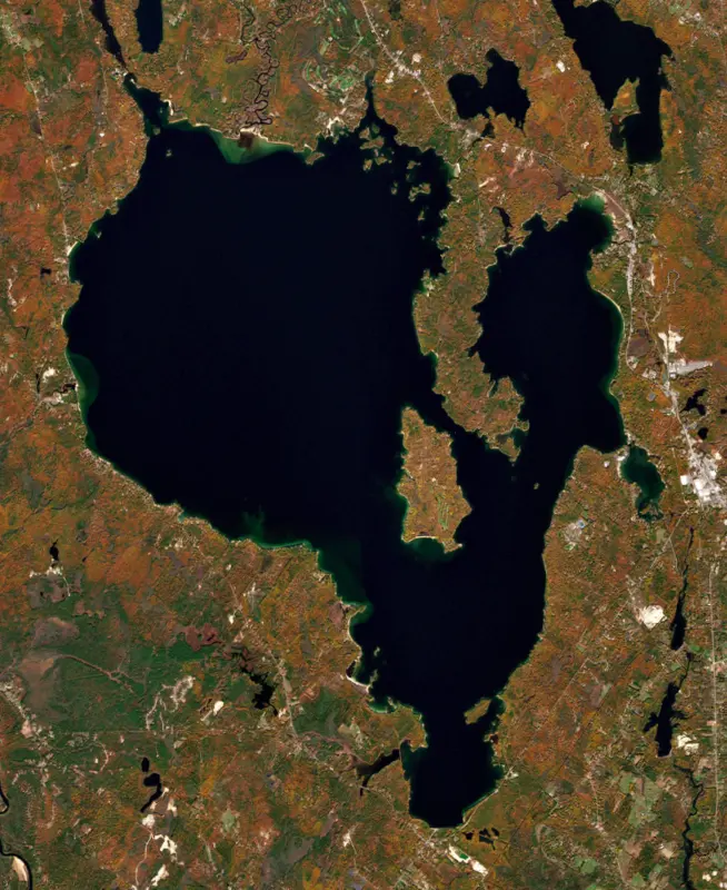
49°F on Nov 16, 2026
73°F · Jul 2749°F · Nov 16
24°F cooler than on Jul 27, 2026.
Estimated from MODIS Aqua (NASA) passes on clear days: the top layer of the water, a few degrees either way. Coves and the shallows can be warmer.
Sebago Lake water temperature: trend, swimming and the fish →
On or near the shore of Sebago Lake: 5 boat ramps, 5 marinas, 1 rental outfit, 16 campgrounds, 20 beaches, 11 trails and 1 fishing guide. The lake has about 97 miles of shoreline, counting its islands.
Tap an icon for details; use two fingers (or Ctrl + scroll) to move the map. Tap a dot for details. Map and lake outline © OpenStreetMap contributors. Places from OpenStreetMap, Overture Maps and Recreation.gov. Not for navigation.
What you’ll find on the shore
← AllBoating 10
← AllRentals & tours 1
← AllFishing spots 5
← AllBeaches 20
← AllCamping 16
← AllLodging 19
← AllTrails 11
← AllParks 5
← AllDining 2
No aquatic invasive species are on record for Sebago Lake in the USGS database. Keep it that way: clean, drain and dry your boat between lakes.
Maine: Motorized boats on Maine inland waters must display a Lake and River Protection sticker. It's illegal to carry any aquatic plant on a boat, trailer or gear, and you must remove or open drain plugs right before launching and when you leave the water, before driving off. Required: Lake and River Protection sticker. State rules
Records: USGS Nonindigenous Aquatic Species database. A species not listed may still be present.
Species with open-licensed records inside Sebago Lake's outline, from GBIF.org (surveys, museum collections and angler reports). A record shows a fish was found here, not how many there are now.
Shallow, protected flats in spring; docks, grass and deep edges in summer heat.
Brush piles, docks and bridge pilings; shallow for a few weeks in spring.
Rocky points, gravel and current breaks; deeper rock piles in summer.
Low light and cold water; the inflows in fall.
Schools near the bottom; a favorite through the ice.
Water temperature sets off each spawn; the bars show the usual months at this latitude and elevation, and move with a warm or cold spring. The water is about 49°F now.
Sebago Lake is the deepest lake in Maine and the second largest, a broad lake in Cumberland County ringed by the towns of Standish, Windham, Raymond, Casco, Naples and Sebago. It supplies drinking water to nearly 200,000 people in 11 Greater Portland communities, and it gave its name to the landlocked salmon, Salmo salar sebago.
The name comes from the Abenaki word sobagoo, which means roughly that it is the sea, or that it looks like the sea. The lake is so deep that the lowest part of its bottom lies below sea level. Its three main basins are Lower Bay at the south end, Big Bay and Jordan Bay. Out on the water sits Frye Island, a town of its own whose residents live there only part of the year. The weather can turn quickly, likely because the ocean and Mount Washington are both near, and the lake does not reliably freeze. It is fully iced over only briefly, and only every few winters.
In June 1830 the Cumberland and Oxford Canal opened, linking the lake to Portland Harbor along the Presumpscot River through Standish, Windham, Gorham and Westbrook. Boats climbed 27 locks to reach Sebago, and one more lock on the Songo River lifted them to Long Lake, so freight could travel from Portland all the way to Harrison. Railroads began taking the business in the 1850s, and when the Portland and Ogdensburg reached Sebago Lake Station in 1870 the river section fell out of use. Steamboats kept running through Songo Lock until 1932, when the last of them, the Goodrich, burned at its dock in Naples. The lock still works for pleasure boats.
The lake drains into the Presumpscot River through the Eel Weir Dam, which the S. D. Warren paper mill controlled from 1878. The water district does not set the lake level. The dam's owner does, following a compromise plan worked out in the 1990s.
The landlocked salmon, Maine's state fish, was native to only four watersheds in the state, Sebago among them, and Sebago fish were used to start salmon populations elsewhere. The Crooked River is the main spawning stream for the wild fish. The lake has been stocked with salmon every year since 1938, and the Casco hatchery raises them from eggs taken from salmon that return from Sebago up the Jordan River. Lake trout were introduced in 1972, and more than 315,000 were stocked over the next decade. They now reproduce on their own and compete with the salmon. Smallmouth bass have been in the lake since the 1930s and largemouth since the early 1960s. Northern pike, brought in illegally, were confirmed in 2003, and the state asks anglers to kill and report any pike they catch. Ice fishing derbies are held on Jordan Bay.
Lake water first flowed to Portland in 1869 from an intake in Lower Bay, and the Portland Water District was chartered in 1908. In 1993 the district won a waiver from federal filtration rules, based in part on the purity of the water and on its work protecting the watershed. Swimming is not allowed near the intakes, because people can bring bacteria and viruses into the supply, and state law keeps cars and trucks off the ice within 2 miles of them. Boating is allowed, since motor fuel floats and evaporates while the intakes draw water from near the bottom.
At the other end of the lake, Sebago Lake State Park opened in 1938 as one of Maine's first five state parks. It covers the north shore in Naples and Casco, split in two by the Songo River, with campgrounds at Naples Beach and Witch Cove that each have a beach and boat ramp.
Written by Lake by Lake from Portland Water District (2025 Sebago Lake Assessment, Frequently Asked Questions), Bangor Daily News and Wikipedia (Sebago Lake, Cumberland and Oxford Canal, Sebago Lake State Park). Checked November 2026.
Eel Weir Dam is a masonry dam 22 feet high and 1,310 feet long on the Presumpscot River, completed in 1879. It belongs to Dichotomy Power Maine, LLC and Presumpcot Hydro, LLC and is run for hydropower, fish and wildlife, recreation, water supply and flood control. At its normal level the reservoir holds 330,000 acre-ft, drained from 441 square miles of land.
From the National Inventory of Dams (U.S. Army Corps of Engineers), NID ID ME00070. Lake or reservoir: what’s the difference?
Where the level comes from: Sebago Lake near North Windham, Maine (U.S. Geological Survey).
| Lake | Miles | Level (ft) | vs full | 7 days |
|---|---|---|---|---|
| Great East Lake Live reading | 27 | 571.15 | — | −0.26 |
| Ossipee Lake Live reading | 33 | 404.22 | — | 0.00 |
| Lake Winnipesaukee Slightly below full | 49 | 502.19 | −2.13 | −0.12 |
| Lake Winnisquam Live reading | 54 | 480.88 | — | +0.61 |
| Squam Lake Live reading | 54 | 560.56 | — | −0.16 |
| Pawtuckaway Lake Live reading | 59 | 245.65 | — | −0.85 |
Compare Sebago Lake with Great East Lake, Ossipee Lake, Lake Winnipesaukee or Lake Winnisquam: size, level, ramps and fish side by side.
Sebago Lake is at 262.67 feet above sea level, as of Nov 19, 2026, 1:15 AM EST. It has dropped 0.05 ft in the past 7 days.
Today's level is 0.40 ft below the median for this date (263.07 ft), from the gauge’s long-term daily record.
260.58 ft, on February 19, 2002, in the U.S. Geological Survey record, which starts in 2000. Today the lake is 2.1 ft above that.
267.45 ft, on June 9, 2012, in the U.S. Geological Survey record since 2000.
Sebago Lake has 5 boat ramps on our map, including Boat ramp at Nason's Beach and Campground, Boat ramp at Raymond Beach, Sebago Lake Station Landing, and 5 marinas. Low water can close ramps, so check today's level above and the operator before you go.
Yes. There are 16 campgrounds and RV parks within about a mile of the shore, such as Point Sebago Marina, Wohelo Camps, Nason's Beach & Campground.
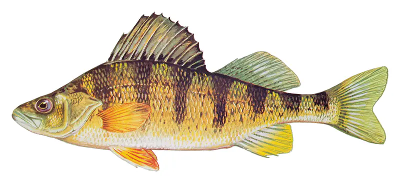
Game fish recorded in Sebago Lake include smallmouth bass, brown trout, yellow perch, largemouth bass, black crappie, chain pickerel. In all, 14 fish species have open records inside the lake on GBIF.
The surface of Sebago Lake was about 49°F on November 16, estimated from a satellite pass on a clear day. It is the top layer of the water, a few degrees either way; coves and shallows run warmer in the sun.
Anglers 16 and older need a Maine fishing license, sold online by the Maine Department of Inland Fisheries and Wildlife. Size and bag limits can be set lake by lake: check the current regulations.
Sebago Lake is about 315 ft deep at its deepest point, usually near the dam. Depth changes with the lake level.
boating (5 boat ramps and 5 marinas), kayaks, boats & jet skis (1 rental outfit on or near the water), fishing (9 game fish and 1 fishing guide), swimming (20 beaches and swimming areas), hiking & walking (11 trails along the shore, the longest Mountain Division Trail (4.7 mi)) and camping (16 campgrounds), according to our map of the shore.
EPA's CyAN satellite rated cyanobacteria in Sebago Lake moderate on November 9. The satellite sees open water only; blooms can be patchy, so avoid water that looks like spilled paint or pea soup and keep dogs out of scum. Swimming advisories come from Maine health and environment agencies.
Usually around April 17, the median of 165 springs in the records of Sharma et al. (2022), lake ice phenology records for 78 lakes.
Yes. 11 trails run along or near the shore, including Sebago to the Sea Trail, High Bank Trail (0.8 mi) and White Pine Trail (0.7 mi), according to OpenStreetMap.
Sebago Lake is held back by Eel Weir, completed in 1879 and 22 ft high, according to the National Inventory of Dams.
From the U.S. Geological Survey (Sebago Lake near North Windham, Maine). Lake by Lake checks it every hour; the agency's own figure is always the reference, and provisional readings can be revised.
Lake levels are refreshed every hour. Texas and California reservoirs report once a day; most USGS and NOAA gauges report every 15 to 60 minutes.
Cookies for analytics With your OK we use Google Analytics and Microsoft Clarity to count visits and see how the site is used, so we can make it better. No advertising cookies. Privacy policy