Sun
- Sunrise
- 7:24 AM
- Sunset
- 4:39 PM
- First light
- 6:50 AM
- Last light
- 5:13 PM
Lake · Cass County, Minnesota
A lake in Cass County, Minnesota, held back by Leech Dam since 1885.

Leech Lake is at 1,294.59 feet above sea level — 0.31 ft below normal pool, as of Nov 17, 2026, 7:30 PM CST. The level has held steady over the past week.
4th lowest of 9 Minnesota lakes today against full pool · See the ranking
Record low 1,291.55 ft (1935), record high 1,297.90 ft (1916) · Level history since 1900
A notification from this browser, once, when the level crosses the line (checked every hour). No account and no email. On an iPhone, add Lake by Lake to your home screen first (Share → Add to Home Screen) and open it from there. Or follow the lake in a feed reader: RSS feed.
Leech Lake has held steady over the last 7 days (within 0.05 ft).
Daily values from the NOAA National Water Prediction Service.
Leech Lake is up 0.28 ft over the last 30 days, at 1,294.59 ft today.
Daily values from the NOAA National Water Prediction Service.
Over the past 12 months, Leech Lake ranged from 1,293.97 ft (Nov 25, 2025) to 1,294.79 ft (Jul 12, 2026), a swing of 0.8 ft. Today's level is in the upper half of that range. It is 0.60 ft higher than on this date last year.
Daily values from the NOAA National Water Prediction Service. Why lake levels rise and fall
In the U.S. Army Corps of Engineers record, which starts in 1900, the lowest level was 1,291.55 ft on January 8, 1935 and the highest 1,297.90 ft on June 30, 1916. Today’s 1,294.59 ft is 3.0 ft above the record low and 3.3 ft below the record high.
Leech Lake level history: every year since 1900, the lowest and highest years →
Solunar periods for Leech Lake, local time. How they work
High · as of Nov 9, 2026
The satellite sees a likely bloom on part of the lake. Avoid discolored water and scum, and keep dogs out of it. About 409,000 cells/mL at the worst spot, covering 5% of the lake.
Week of Aug 16Week of Nov 1
Each bar is one week, colored by the worst reading of that week.
From the U.S. EPA's Cyanobacteria Assessment Network (CyAN), which reads the color of lakes from the Sentinel-3 satellites; it sees open water only, not coves or the shoreline. Blooms can be patchy: what you see on the water matters more. Swimming closures and health advisories come from Minnesota health and environment agencies. How to read it
The ice usually goes out of Leech Lake around Apr 28 (median of 88 springs on record). In 2023 it went out on May 9. The earliest on record was Apr 2, 2012; the latest, May 23, 1950.
Each dot is one of the last 30 springs on record; the dashed line is the median of all of them; the orange dot is 2023.
Source: Minnesota Department of Natural Resources. Ice is never safe everywhere: check local conditions before going out on it. About ice-out
Surface water temperature
43°F on Nov 13, 2026
78°F · Jul 1943°F · Nov 13
35°F cooler than on Jul 19, 2026.
Estimated from Landsat 8/9 (USGS) passes on clear days: the top layer of the water, a few degrees either way. Coves and the shallows can be warmer.
Leech Lake water temperature: trend, swimming and the fish →
On or near the shore of Leech Lake: 26 boat ramps, 6 marinas, 15 campgrounds, 2 beaches, 3 trails and 2 fishing guides. The lake has about 216 miles of shoreline, counting its islands.
Tap an icon for details; use two fingers (or Ctrl + scroll) to move the map. Tap a dot for details. Map and lake outline © OpenStreetMap contributors. Places from OpenStreetMap, Overture Maps and Recreation.gov. Not for navigation.
What you’ll find on the shore
← AllBoating 32
← AllFishing spots 4
← AllBeaches 2
← AllCamping 15
← AllLodging 24+
← AllTrails 3
← AllParks 4
← AllDining 7
Zebra mussels have been found in Leech Lake. They clog intakes and engines and spread on boats and trailers: clean, drain and dry everything before you go to another lake.
Minnesota: Clean all plants, mud and invasive animals off your boat and trailer, drain all water and pull drain plugs before leaving the access, keep plugs out while transporting, and put unwanted bait in the trash. Inspectors at accesses can require inspection or decontamination and deny launch if plants or invasives are found. State rules
Records: USGS Nonindigenous Aquatic Species database. A species not listed may still be present.
Species with open-licensed records inside Leech Lake's outline, from GBIF.org (surveys, museum collections and angler reports). A record shows a fish was found here, not how many there are now.
Shallow, protected flats in spring; docks, grass and deep edges in summer heat.
Brush piles, docks and bridge pilings; shallow for a few weeks in spring.
Rocky points, gravel and current breaks; deeper rock piles in summer.
Rocky shorelines at night after ice-out; deep weed edges and humps in summer.
Shallow, weedy bays right after ice-out; weed edges the rest of the year.
Water temperature sets off each spawn; the bars show the usual months at this latitude and elevation, and move with a warm or cold spring. The water is about 43°F now.
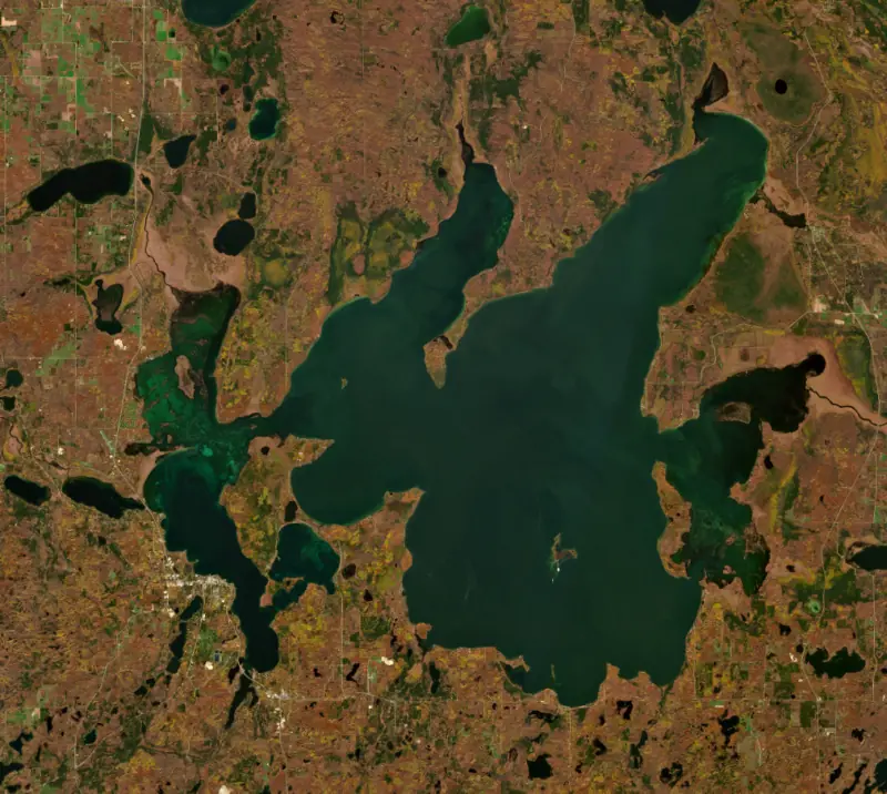
Leech Lake is a large, many-armed lake in Cass County in north-central Minnesota, southeast of Bemidji. It lies mostly within the Leech Lake Reservation and entirely inside the Chippewa National Forest. It is the third-largest lake in the state and one of its best-known fishing lakes, prized for walleye, yellow perch and a native strain of muskellunge.
People fished and gathered wild rice here for thousands of years. By the 1700s the Ojibwe had built permanent villages along the lake and its rivers, and their name for it, Gaa-zagaskwaajimekaag, refers to leeches, as did the lac Sangsue of early French maps. Walleye, whitefish and cisco fed the villages, and the surrounding wetlands held one of the largest natural wild rice beds in Minnesota. The Treaty of Washington in 1855 set aside the Leech Lake Reservation for the Pillager and Lake Winnibigoshish bands.
Between 1882 and 1884 a dam went in at the outlet, at the place now called Federal Dam. It raised the lake and spread it over several thousand more acres, drowning wild rice beds and burial sites while making it easier to float logs downstream. Logging of the white pine and arrests of band members on minor charges fed a growing anger. On October 5, 1898, soldiers of the 3rd Infantry went to Sugar Point, a small peninsula in the northeast part of the lake, to arrest the Pillager leader Bugonaygeshig. Six soldiers were killed, the army withdrew, and he was never taken. The fight is often called the last armed clash between the Army and Native Americans in the continental United States. In 2020 a federal law returned about 11,760 acres of federally managed land on the reservation to tribal trust.
Leech Lake spreads across three glacial zones in an irregular shape, with large bays reaching out from a broad, windswept main lake. Walker Bay and Kabekona Bay on the west side hold clear, lean water, while Steamboat and Boy bays are richer in nutrients. Nearly 80 percent of it is under 35 feet deep. Eleven islands, among them Bear Island and Minnesota Island, rise from it. The town of Walker, on Walker Bay, grew up after the railroad arrived in 1896 and took its name from lumberman Thomas B. Walker.
The lake drains through the Leech Lake River to the Mississippi. The dam is one of six Mississippi headwaters reservoirs run by the Army Corps of Engineers, St. Paul District. Each winter the Corps draws the reservoirs down to make room for snowmelt, then aims to hold them within a summer band from before the fishing opener until after Labor Day.
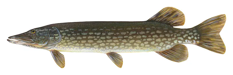
Walleye are the most popular fish here, and their fortunes are tied to yellow perch. In the early 2000s, heavy harvest and a boom in double-crested cormorants, which ate young perch, produced five of the seven weakest walleye year classes recorded since 1983. From 2005 the DNR tightened limits and stocked walleye fry, and cormorant control cut predation on perch. Both species recovered. The lake is managed jointly by the DNR and the Leech Lake Band of Ojibwe, and its fishery is the most varied of the large lakes the state monitors, with northern pike, bass, bluegill, crappie, cisco, whitefish and burbot alongside the headline species.
Muskellunge have been part of the lake's fame since a celebrated run of big catches in 1955. In 1989 the native fish were identified as a distinct genetic strain, and Leech Lake is now the main source of eggs for the brood lakes in Minnesota's muskie stocking program, with crews netting spawning fish in Miller's Bay every four years. Zebra mussels were first detected in 2016 and had spread lakewide by 2021, clearing the water and reshaping the food web.
Written by Lake by Lake from Minnesota Department of Natural Resources, U.S. Army and Wikipedia (Battle of Sugar Point, Leech Lake). Checked November 2026.
Activities listed by the U.S. Army Corps of Engineers: Boating · Camping · Fishing · Hiking · Picnicking · Water sports
Leech Dam is a concrete dam 13 feet high and 3,314 feet long, completed in 1885. It belongs to the U.S. Army Corps of Engineers (St. Paul District) and is run for recreation, navigation, fish and wildlife, water supply and flood control. At its normal level the lake holds 490,000 acre-ft, drained from 1,163 square miles of land.
From the National Inventory of Dams (U.S. Army Corps of Engineers), NID ID MN00585. Lake or reservoir: what’s the difference?
Where the level comes from: Leech Lake (NOAA National Water Prediction Service, used on this page) and LEECH LAKE AT SUGAR POINT NEAR FEDERAL DAM, MN (U.S. Geological Survey).
| Lake | Miles | Level (ft) | vs full | 7 days |
|---|---|---|---|---|
| Lake Winnibigoshish At or near full pool | 21 | 1298.29 | −0.15 | −0.08 |
| Cass Lake Live reading | 21 | 1301.90 | — | −0.08 |
| Pokegama Lake At or near full pool | 32 | 1272.80 | −0.87 | −0.38 |
| Cross Lake At or near full pool | 36 | 1228.90 | −0.67 | −0.29 |
| Gull Lake At or near full pool | 53 | 1193.90 | −0.10 | −0.13 |
| Mille Lacs Lake Live reading | 64 | 1251.01 | — | −0.04 |
Compare Leech Lake with Lake Winnibigoshish, Cass Lake, Pokegama Lake or Cross Lake: size, level, ramps and fish side by side.
Leech Lake is at 1,294.59 feet above sea level — 0.31 ft below normal pool, as of Nov 17, 2026, 7:30 PM CST. The level has held steady over the past week.
Leech Lake's normal pool is 1,294.90 ft, according to U.S. Army Corps of Engineers. Today the lake is 0.31 ft below that mark.
Today's level is 0.22 ft above the median for this date (1,294.37 ft), from the gauge’s long-term daily record.
1,291.55 ft, on January 8, 1935, in the U.S. Army Corps of Engineers record, which starts in 1900. Today the lake is 3.0 ft above that.
1,297.90 ft, on June 30, 1916, in the U.S. Army Corps of Engineers record since 1900. That is 3.0 ft above normal pool.
Leech Lake has 26 boat ramps on our map, including Boat ramp at Shores of Leech Lake, Federal Dam Public Access, Hwy 8 Public Access, and 6 marinas. Low water can close ramps, so check today's level above and the operator before you go.
Yes. There are 15 campgrounds and RV parks within about a mile of the shore, such as North Star Resort of Leech Lake, Bayside Resort, Federal Dam Campground - Leech Lake.
Game fish recorded in Leech Lake include walleye, yellow perch, northern pike, bluegill, largemouth bass, muskellunge. In all, 36 fish species have open records inside the lake on GBIF.
The surface of Leech Lake was about 43°F on November 13, estimated from a satellite pass on a clear day. It is the top layer of the water, a few degrees either way; coves and shallows run warmer in the sun.
Anglers 16 and older need a Minnesota fishing license, sold online by the Minnesota Department of Natural Resources. Free fishing days: Take a Mom Fishing Weekend (Mother’s Day weekend) and Take a Kid Fishing Weekend (early June), for residents. Size and bag limits can be set lake by lake: check the current regulations.
Leech Lake is about 151 ft deep at its deepest point. Depth changes with the lake level.
In summer a white Secchi disk lowered into Leech Lake stays visible to about 11.2 ft (the median of 586 readings, 2016–2025, by Minnesota Pollution Control Agency - Ambient Surface Water and Leech Lake Band of Ojibwe): clear water. With the algae measured too (chlorophyll about 3 µg/L), that makes it mesotrophic: moderately rich in nutrients. Clarity drops after storms and during algae blooms.
Yes: lake map with depth contours (key sheet) from the Minnesota Department of Natural Resources. It is linked in the lake facts on this page. Depths on a map are measured at a reference level: subtract how far the lake is below it today.
U.S. Army Corps of Engineers lists boating, camping, fishing, hiking, picnicking and water sports at Mississippi River Headwaters - Leech Lake. 2 campgrounds can be booked on Recreation.gov.
EPA's CyAN satellite rated cyanobacteria in Leech Lake high on November 9. The satellite sees open water only; blooms can be patchy, so avoid water that looks like spilled paint or pea soup and keep dogs out of scum. Swimming advisories come from Minnesota health and environment agencies.
Usually around April 28, the median of 88 springs in the records of Minnesota Department of Natural Resources. In 2023 the ice went out on May 9.
Yes. 3 trails run along or near the shore, including Shingobee Trail (4.3 mi), Heartland Trail (26 mi) and Paul Bunyan State Trail (12 mi), according to OpenStreetMap.
Leech Lake is held back by Leech Dam, completed in 1885 and 13 ft high, according to the National Inventory of Dams.
From the NOAA National Water Prediction Service (Leech Lake). Lake by Lake checks it every hour; the agency's own figure is always the reference, and provisional readings can be revised.
Lake levels are refreshed every hour. Texas and California reservoirs report once a day; most USGS and NOAA gauges report every 15 to 60 minutes.