Sun
- Sunrise
- 7:22 AM
- Sunset
- 4:38 PM
- First light
- 6:49 AM
- Last light
- 5:11 PM
Lake · Crow Wing County, Minnesota
A lake in Crow Wing County, Minnesota, held back by Mille Lacs Dam since 2015.

Mille Lacs Lake is at 1,250.95 feet above sea level, as of Nov 19, 2026, 3:15 AM CST. The level has held steady over the past week.
A notification from this browser, once, when the level crosses the line (checked every hour). No account and no email. On an iPhone, add Lake by Lake to your home screen first (Share → Add to Home Screen) and open it from there. Or follow the lake in a feed reader: RSS feed.
Mille Lacs Lake has held steady over the last 7 days (within 0.05 ft).
Daily values from the U.S. Geological Survey.
Mille Lacs Lake is up 0.07 ft over the last 30 days, at 1,250.95 ft today.
Daily values from the U.S. Geological Survey.
Over the past 12 months, Mille Lacs Lake ranged from 1,250.72 ft (Nov 26, 2025) to 1,251.76 ft (Jul 9, 2026), a swing of 1.0 ft. Today's level is in the lower half of that range. It is 0.09 ft higher than on this date last year.
Daily values from the U.S. Geological Survey. Why lake levels rise and fall
Solunar periods for Mille Lacs Lake, local time. How they work
Moderate · as of Nov 8, 2026
A bloom may be forming somewhere on the lake. Avoid water that looks like spilled paint or pea soup. About 100,000 cells/mL at the worst spot, covering 1% of the lake.
Week of Aug 16Week of Nov 1
Each bar is one week, colored by the worst reading of that week.
From the U.S. EPA's Cyanobacteria Assessment Network (CyAN), which reads the color of lakes from the Sentinel-3 satellites; it sees open water only, not coves or the shoreline. Blooms can be patchy: what you see on the water matters more. Swimming closures and health advisories come from Minnesota health and environment agencies. How to read it
The ice usually goes out of Mille Lacs Lake around Apr 25 (median of 68 springs on record). In 2023 it went out on May 5. The earliest on record was Mar 26, 2012; the latest, May 16, 2013.
Each dot is one of the last 30 springs on record; the dashed line is the median of all of them; the orange dot is 2023.
Source: Minnesota Department of Natural Resources. Ice is never safe everywhere: check local conditions before going out on it. About ice-out
Surface water temperature
44°F on Nov 16, 2026
76°F · Aug 144°F · Nov 16
31°F cooler than on Aug 1, 2026.
Estimated from MODIS Aqua (NASA) passes on clear days: the top layer of the water, a few degrees either way. Coves and the shallows can be warmer.
Mille Lacs Lake water temperature: trend, swimming and the fish →
On or near the shore of Mille Lacs Lake: 13 boat ramps, 3 marinas, 1 rental outfit, 27 campgrounds, 2 beaches, 2 trails and 5 fishing guides. The lake has about 92 miles of shoreline, counting its islands.
Tap an icon for details; use two fingers (or Ctrl + scroll) to move the map. Tap a dot for details. Map and lake outline © OpenStreetMap contributors. Places from OpenStreetMap, Overture Maps and Recreation.gov. Not for navigation.
What you’ll find on the shore
← AllBoating 16
← AllRentals & tours 1
← AllFishing spots 9
← AllBeaches 2
← AllCamping 27
← AllLodging 24+
← AllTrails 2
← AllParks 4
← AllDining 18
Zebra mussels have been found in Mille Lacs Lake. They clog intakes and engines and spread on boats and trailers: clean, drain and dry everything before you go to another lake.
Minnesota: Clean all plants, mud and invasive animals off your boat and trailer, drain all water and pull drain plugs before leaving the access, keep plugs out while transporting, and put unwanted bait in the trash. Inspectors at accesses can require inspection or decontamination and deny launch if plants or invasives are found. State rules
Records: USGS Nonindigenous Aquatic Species database. A species not listed may still be present.
Species with open-licensed records inside Mille Lacs Lake's outline, from GBIF.org (surveys, museum collections and angler reports). A record shows a fish was found here, not how many there are now.
Shallow, protected flats in spring; docks, grass and deep edges in summer heat.
Brush piles, docks and bridge pilings; shallow for a few weeks in spring.
Rocky points, gravel and current breaks; deeper rock piles in summer.
Rocky shorelines at night after ice-out; deep weed edges and humps in summer.
Shallow, weedy bays right after ice-out; weed edges the rest of the year.
Water temperature sets off each spawn; the bars show the usual months at this latitude and elevation, and move with a warm or cold spring. The water is about 44°F now.
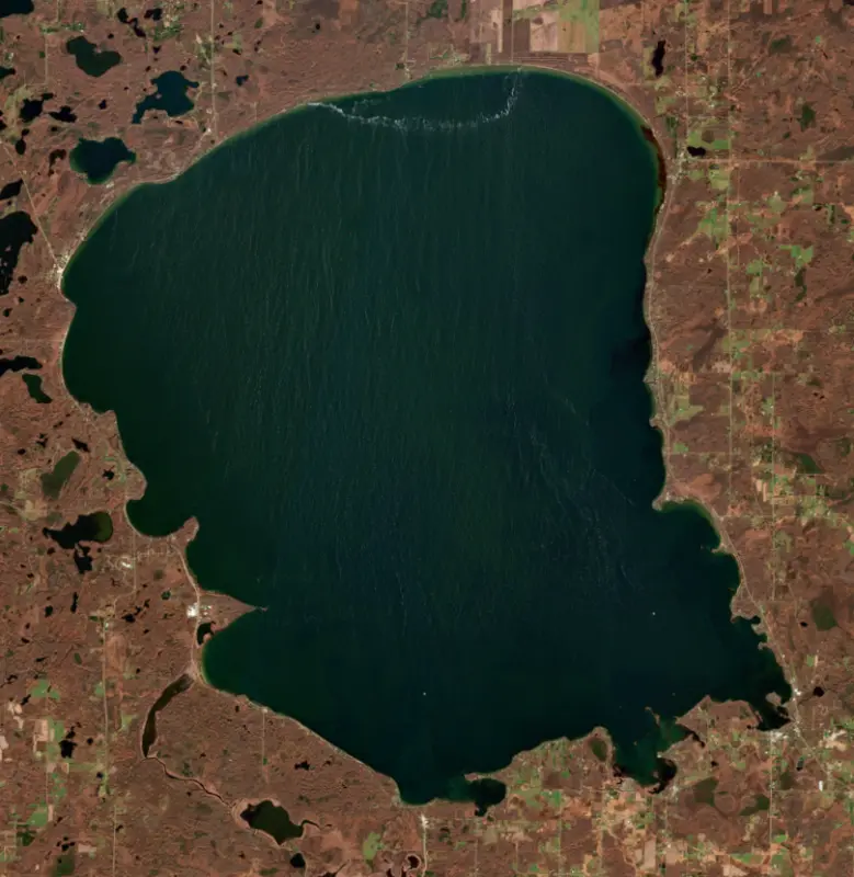
Mille Lacs Lake is a broad, shallow lake in east-central Minnesota, shared by Mille Lacs, Aitkin and Crow Wing counties about two hours north of the Twin Cities. It is one of the most popular fishing lakes in the state, known above all for walleye, and each winter thousands of fish houses spread across its ice.
The lake fills a basin shaped by the last glaciers and is held in by a moraine, a ridge of debris the ice left behind. Its water once stood higher. Today it drains through the Rum River to the Mississippi. The French name means a thousand lakes. The Ojibwe call it Misi-zaaga'igan, the grand lake, and the Dakota name, Bdé Wakháŋ, means roughly spirit lake. The towns around it include Garrison, Isle, Wahkon, Onamia and Vineland, and a giant walleye statue stands beside U.S. 169 in Garrison.
Long before Europeans arrived, villages lined these shores, living on fish, game and wild rice, and the chain of small lakes along the Rum River outlet was a favored place to settle. Archaeological sites at what is now Mille Lacs Kathio State Park, near Vineland, date from about 3000 BC to 1750 AD. The French explorer Daniel Greysolon, Sieur du Lhut, met the Dakota here in 1679 and recorded the name Izatys for the area. A misreading of his handwriting gave the park its name, Kathio. In the spring of 1680 Dakota people captured the priest Louis Hennepin about 15 miles from today's Father Hennepin State Park on the southeast shore, and du Lhut negotiated his release months later. By the middle of the 1700s Ojibwe bands had moved into the region. An 1855 treaty created the Mille Lacs Reservation, and the Ojibwe still have a strong presence on the southwest shore. In 1999 the U.S. Supreme Court ruled 5 to 4 that the Chippewa kept the rights to hunt, fish and gather on lands ceded in an 1837 treaty, and the Mille Lacs Band fishes the lake under those rights and its own conservation code.
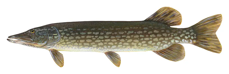
In 1992 anglers took 1.2 million pounds of walleye from Mille Lacs. By 2015 the population had fallen to a 40-year low, and anglers that year could keep just one walleye. Biologists pointed to several causes at once. The lake is shallow, so a warming climate hits it hard and favors predators such as bass. Zebra mussels, established around 2005, and spiny water fleas have also thinned the food web that young walleye depend on. Walleye hit their low point in 2016 and rebounded in 2023 and 2024, which eased the rules. Smallmouth bass have grown into a fishery of their own, and Bassmaster held its Angler of the Year championship finale here in 2017. Northern pike, muskellunge and yellow perch round out the catch. Winter brings fish houses by the thousands, but the ice can also be dangerous on shore. In 2013 wind drove a wall of ice onto the lakeshore and damaged homes.
Two tiny rock islands in the lake, Hennepin Island and Spirit Island, make up Mille Lacs National Wildlife Refuge. Set aside in 1915, it covers just over half an acre and is the smallest refuge in the national system. Common terns, a threatened species in Minnesota, nest there along with gulls, cormorants and white pelicans. The islands are closed to the public, and the Fish and Wildlife Service asks boaters to stay at least 100 yards away.
Written by Lake by Lake from National Park Service, U.S. Fish and Wildlife Service, Legal Information Institute, Cornell Law School, MPR News and Wikipedia (Mille Lacs Lake, Father Hennepin State Park). Checked November 2026.
Mille Lacs Dam is a dam 8 feet high, completed in 2015. It belongs to Mndnr and is run for recreation. At its normal level the lake holds 133,000 acre-ft, drained from 415 square miles of land.
From the National Inventory of Dams (U.S. Army Corps of Engineers), NID ID MN01645. Lake or reservoir: what’s the difference?
Where the level comes from: MILLE LACS LAKE NR GARRISON, MN (U.S. Geological Survey).
| Lake | Miles | Level (ft) | vs full | 7 days |
|---|---|---|---|---|
| Gull Lake At or near full pool | 27 | 1193.88 | −0.12 | −0.14 |
| Cross Lake At or near full pool | 29 | 1228.84 | −0.73 | −0.33 |
| Leech Lake At or near full pool | 64 | 1294.68 | −0.22 | +0.08 |
| Pokegama Lake At or near full pool | 65 | 1272.75 | −0.92 | −0.40 |
| Lake Winnibigoshish At or near full pool | 78 | 1298.35 | −0.09 | +0.01 |
| Cass Lake Live reading | 85 | 1301.87 | — | −0.10 |
Compare Mille Lacs Lake with Gull Lake, Cross Lake, Leech Lake or Pokegama Lake: size, level, ramps and fish side by side.
Mille Lacs Lake is at 1,250.95 feet above sea level, as of Nov 19, 2026, 3:15 AM CST. The level has held steady over the past week.
Mille Lacs Lake has 13 boat ramps on our map, including Father Hennepin SPK (E) Public Access, Malmo Public Access, Wahkon Public Access, and 3 marinas. Low water can close ramps, so check today's level above and the operator before you go.
Yes. There are 27 campgrounds and RV parks within about a mile of the shore, such as Doc's Harbor RV, Fisher's Resort, Rocky Reef Resort.
Game fish recorded in Mille Lacs Lake include northern pike, walleye, yellow perch, smallmouth bass, largemouth bass, muskellunge. In all, 30 fish species have open records inside the lake on GBIF.
The surface of Mille Lacs Lake was about 44°F on November 16, estimated from a satellite pass on a clear day. It is the top layer of the water, a few degrees either way; coves and shallows run warmer in the sun.
Anglers 16 and older need a Minnesota fishing license, sold online by the Minnesota Department of Natural Resources. Free fishing days: Take a Mom Fishing Weekend (Mother’s Day weekend) and Take a Kid Fishing Weekend (early June), for residents. Size and bag limits can be set lake by lake: check the current regulations.
Mille Lacs Lake averages about 26 ft deep. Depth changes with the lake level.
In summer a white Secchi disk lowered into Mille Lacs Lake stays visible to about 9.0 ft (the median of 250 readings, 2016–2025, by Mille Lacs Band of Ojibwe DNR/Environment and Minnesota Pollution Control Agency - Ambient Surface Water): clear water. With the algae measured too (chlorophyll about 5 µg/L), that makes it mesotrophic: moderately rich in nutrients. Clarity drops after storms and during algae blooms.
Yes: lake map with depth contours from the Minnesota Department of Natural Resources. It is linked in the lake facts on this page. Depths on a map are measured at a reference level: subtract how far the lake is below it today.
boating (13 boat ramps and 3 marinas), kayaks, boats & jet skis (1 rental outfit on or near the water), fishing (15 game fish and 5 fishing guides), swimming (2 beaches and swimming areas), hiking & walking (2 trails along the shore, the longest Soo Line Trail (13 mi)) and camping (27 campgrounds), according to our map of the shore.
EPA's CyAN satellite rated cyanobacteria in Mille Lacs Lake moderate on November 8. The satellite sees open water only; blooms can be patchy, so avoid water that looks like spilled paint or pea soup and keep dogs out of scum. Swimming advisories come from Minnesota health and environment agencies.
Usually around April 25, the median of 68 springs in the records of Minnesota Department of Natural Resources. In 2023 the ice went out on May 5.
Yes. 2 trails run along or near the shore, including Pope Point Trail (0.5 mi) and Soo Line Trail (13 mi), according to OpenStreetMap.
Mille Lacs Lake is held back by Mille Lacs, completed in 2015 and 8 ft high, according to the National Inventory of Dams.
From the U.S. Geological Survey (MILLE LACS LAKE NR GARRISON, MN). Lake by Lake checks it every hour; the agency's own figure is always the reference, and provisional readings can be revised.
Lake levels are refreshed every hour. Texas and California reservoirs report once a day; most USGS and NOAA gauges report every 15 to 60 minutes.
Cookies for analytics With your OK we use Google Analytics and Microsoft Clarity to count visits and see how the site is used, so we can make it better. No advertising cookies. Privacy policy