Sun
- Sunrise
- 6:52 AM
- Sunset
- 5:02 PM
- First light
- 6:25 AM
- Last light
- 5:30 PM
Reservoir · Taney County, Missouri
A reservoir on the White River in Taney County, Missouri, held back by Ozark Beach Dam since 1913.

Lake Taneycomo is at 700.73 feet above sea level — 0.62 ft below normal maximum pool, as of Nov 17, 2026, 8:30 PM CST. It has dropped 0.33 ft in the past 7 days.
6th lowest of 12 Missouri lakes today against full pool · See the ranking
Record low 699.05 ft (2019), record high 704.28 ft (2026) · Level history since 2018
A notification from this browser, once, when the level crosses the line (checked every hour). No account and no email. On an iPhone, add Lake by Lake to your home screen first (Share → Add to Home Screen) and open it from there. Or follow the lake in a feed reader: RSS feed.
Lake Taneycomo is down 0.33 ft over the last 7 days, at 700.73 ft today.
Daily values from the U.S. Geological Survey.
Lake Taneycomo is down 0.35 ft over the last 30 days, at 700.73 ft today.
Daily values from the U.S. Geological Survey.
Over the past 12 months, Lake Taneycomo ranged from 700.73 ft (Nov 17, 2026) to 704.28 ft (Jun 16, 2026), a swing of 3.5 ft. Today's level is the lowest of the past 12 months. It is 0.51 ft lower than on this date last year.
Daily values from the U.S. Geological Survey. Why lake levels rise and fall
In the U.S. Army Corps of Engineers record, which starts in 2018, the lowest level was 699.05 ft on July 4, 2019 and the highest 704.28 ft on June 16, 2026. Today’s 700.73 ft is 1.7 ft above the record low and 3.5 ft below the record high.
Lake Taneycomo level history: every year since 2018, the lowest and highest years →
Solunar periods for Lake Taneycomo, local time. How they work
Not detected · as of Nov 9, 2026
The satellite found no cyanobacteria at the surface.
Week of Aug 9Week of Nov 1
Each bar is one week, colored by the worst reading of that week.
From the U.S. EPA's Cyanobacteria Assessment Network (CyAN), which reads the color of lakes from the Sentinel-3 satellites; it sees open water only, not coves or the shoreline. Blooms can be patchy: what you see on the water matters more. Swimming closures and health advisories come from Missouri health and environment agencies. How to read it
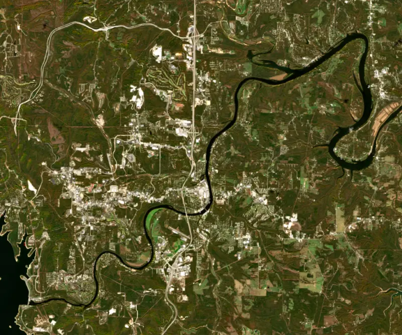
The last 6 satellite passes
75°F · Aug 1360°F · Oct 24
15°F cooler than on Aug 13, 2026.
Estimated from Landsat 8/9 (USGS) passes on clear days: the top layer of the water, a few degrees either way. Coves and the shallows can be warmer.
Lake Taneycomo water temperature: trend, swimming and the fish →
On or near the shore of Lake Taneycomo: 6 boat ramps, 4 marinas, 2 rental outfits, 15 campgrounds, 1 beach and 12 trails. The lake has about 74 miles of shoreline, counting its islands.
Tap an icon for details; use two fingers (or Ctrl + scroll) to move the map. Tap a dot for details. Map and lake outline © OpenStreetMap contributors. Places from OpenStreetMap, Overture Maps and Recreation.gov. Not for navigation.
What you’ll find on the shore
← AllBoating 10
← AllRentals & tours 5
← AllFishing spots 3
← AllBeaches 1
← AllCamping 15
← AllLodging 24+
← AllTrails 12
← AllParks 14
← AllDining 24+
Zebra mussels have been found in Lake Taneycomo. They clog intakes and engines and spread on boats and trailers: clean, drain and dry everything before you go to another lake.
Missouri: Missouri has no clean-drain-dry law; MDC asks boaters to remove plants, animals and mud, drain all water including livewells and transom wells before leaving, let the boat dry completely, and trash unused bait. Prohibited species such as zebra mussels may not be transported alive. State rules
Records: USGS Nonindigenous Aquatic Species database. A species not listed may still be present.
Species with open-licensed records inside Lake Taneycomo's outline, from GBIF.org (surveys, museum collections and angler reports). A record shows a fish was found here, not how many there are now.
Rocky points, gravel and current breaks; deeper rock piles in summer.
Run up the river arms in spring; follow shad to cool, deep water near the dam in summer.
Cool water: near the surface in spring and fall, deep in summer.
Low light and cold water; the inflows in fall.
Tight to rocks, stumps and weed edges in warm shallows; common in small ponds.
Water temperature sets off each spawn; the bars show the usual months at this latitude and elevation, and move with a warm or cold spring. The water is about 55°F now.
Lake Taneycomo is a narrow, river-like lake on the White River in Taney County, Missouri, running past Branson, Hollister and Rockaway Beach down to Forsyth. It is the oldest lake in the White River chain, and since the late 1950s it has been one of the best-known trout waters in the middle of the country. Its name joins the county and the state, Taney County, Missouri.
The lake was formed by Powersite Dam, also called Ozark Beach Dam, which went into service in 1913 a couple of miles above old Forsyth. It was the first hydroelectric dam built in Missouri. The Ambursen Hydraulic Construction Company of Boston built it as a hollow concrete dam, with sloping upstream slabs carried on buttresses set 15 to 20 feet apart. Supplies came in on the railroad at Branson, and barges carried tools and machinery about 16 miles down the river to the site. The job used around 750 carloads of cement, and local men worked beside laborers from Italy and Bulgaria. When the dam was closed, a cloudburst upriver filled the new lake in less than two days and sent water pouring over the spillway. The dam is still privately owned by the Empire District Electric Company.
For its first decades Taneycomo was little more than a wide, slow stretch of the White River, and its native warm-water fish supported a popular fishery. Rockaway Beach became one of the first tourist towns in Missouri, and through the 1920s and 1930s visitors came to swim, water-ski, boat and fish. That changed in 1958, when Table Rock Dam was finished just upstream. Taneycomo's water now comes from about 160 feet below the surface of Table Rock Lake, so it stays cold all year. Most of the warm-water fish declined, swimming lost its appeal, and tourism moved toward Branson and Table Rock Lake.
To replace the lost fishery, the Missouri Department of Conservation built the Shepherd of the Hills hatchery in 1957, just below Table Rock Dam about 6 miles southwest of Branson. It is now the department's largest trout-rearing facility, and about 80 percent of its fish go into Taneycomo. Rainbow trout are stocked monthly and brown trout once a year. Freshwater shrimp gathered from Ozark spring branches were stocked with the early trout and helped them grow fat and fast. By 1969 stringers of 3- to 5-pound rainbows were not unusual, and outdoor writers called Taneycomo the best trophy rainbow lake in North America. Heavy fishing pressure, sediment from Branson's growth, a boom in white suckers and low oxygen in late summer and fall later wore that fishery down. In the early 1990s very large brown trout, some near world-record size, took the spotlight. New rules on the upper lake from March 1997 brought the big rainbows back within a few years. The hatchery grounds have about 3 miles of trails, some reaching the water, and a concrete boat ramp, and the Cooper Creek access lies 5 miles downstream.
No fishing is allowed within 760 feet of the foot of Table Rock Dam. From there to the mouth of Fall Creek, only flies and artificial lures may be used and rainbows fall under a protected slot, so most fish caught there go back. Below Fall Creek the stocking is heavier and any bait is allowed. A trout permit is needed to fish for any species above the U.S. Highway 65 bridge. When Table Rock generates power, the current runs strong, the water gets colder and the upper lake behaves like a deep, fast river, with conditions depending on how many generators are running. Near the dam the shallow water averages about 48 degrees, cold enough for trout and shallow enough for wading and bank fishing. Toward Powersite Dam the lake grows warmer and deeper.
Written by Lake by Lake from Missouri Department of Conservation (The Saga of Lake Taneycomo, Lake Taneycomo special waterbody regulations, Shepherd of the Hills Conservation Education Center), White River Valley Historical Quarterly and Wikipedia (Lake Taneycomo, Powersite Dam). Checked November 2026.
Ozark Beach Dam is a buttress dam 54 feet high and 1,270 feet long on the White River, completed in 1913. It belongs to Empire District Electric Company and is run for hydropower and recreation. At its normal level the reservoir holds 28,000 acre-ft, drained from 4,500 square miles of land.
From the National Inventory of Dams (U.S. Army Corps of Engineers), NID ID MO30088. Lake or reservoir: what’s the difference?
Where the level comes from: Lake Taneycomo at School of the Ozarks, MO (U.S. Geological Survey, used on this page), Lake Taneycomo at Ozark Beach Dam, MO (U.S. Geological Survey) and White River (MO) at Ozark Beach Dam (NOAA National Water Prediction Service).
| Lake | Miles | Level (ft) | vs full | 7 days |
|---|---|---|---|---|
| Table Rock Lake Slightly below full | 4 | 909.55 | −5.45 | −0.53 |
| Beaver Lake Below full | 36 | 1110.86 | −9.14 | −0.45 |
| Bull Shoals Lake Below full | 41 | 652.30 | −6.70 | −0.12 |
| Norfork Lake Slightly below full | 61 | 551.04 | −2.71 | −0.86 |
| Stockton Lake Slightly below full | 80 | 861.97 | −5.03 | −0.10 |
| Pomme de Terre Lake At or near full pool | 89 | 837.68 | −1.32 | −0.14 |
Compare Lake Taneycomo with Table Rock Lake, Beaver Lake, Bull Shoals Lake or Norfork Lake: size, level, ramps and fish side by side.
Lake Taneycomo is about 40 mi from Springfield, MO. See all the lakes near each city.
Lake Taneycomo is at 700.73 feet above sea level — 0.62 ft below normal maximum pool, as of Nov 17, 2026, 8:30 PM CST. It has dropped 0.33 ft in the past 7 days.
Lake Taneycomo's normal maximum pool is 701.35 ft, according to Federal Energy Regulatory Commission. Today the lake is 0.62 ft below that mark.
Today's level is 0.45 ft below the median for this date (701.18 ft), from the gauge’s long-term daily record.
699.05 ft, on July 4, 2019, in the U.S. Army Corps of Engineers record, which starts in 2018. Today the lake is 1.7 ft above that.
704.28 ft, on June 16, 2026, in the U.S. Army Corps of Engineers record since 2018. That is 2.9 ft above normal maximum pool.
Lake Taneycomo has 6 boat ramps on our map, including Boat ramp at Lake Taneycomo, Boat ramp at Scotty's Trout Dock, Cooper Creek Access, and 4 marinas. Low water can close ramps, so check today's level above and the operator before you go.
Yes. There are 15 campgrounds and RV parks within about a mile of the shore, such as Taneycomo Lakefront Resort, Branson Lakeside RV Park, Turkey Creek - Escapes RV Parks.
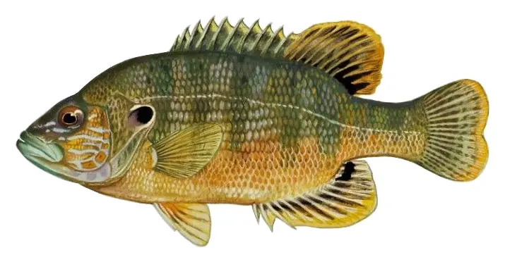
Game fish recorded in Lake Taneycomo include smallmouth bass, striped bass, rainbow trout, brown trout, green sunfish, longear sunfish. In all, 14 fish species have open records inside the lake on GBIF.
The water at Lake Taneycomo is 55°F, measured 1 hr ago by the USGS sensor in the lake. Surface temperature changes through the day and with depth.
Anglers 16 and older need a Missouri fishing license, sold online by the Missouri Department of Conservation. Free fishing days: Saturday and Sunday following the first Monday in June. Size and bag limits can be set lake by lake: check the current regulations.
Lake Taneycomo averages about 13 ft deep. Depth changes with the lake level.
In summer a white Secchi disk lowered into Lake Taneycomo stays visible to about 10.7 ft (the median of 194 readings, 2016–2025, by Univ. of Missouri, Columbia): clear water. With the algae measured too (chlorophyll about 1 µg/L), that makes it oligotrophic: clear, low in nutrients. Clarity drops after storms and during algae blooms.
boating (6 boat ramps and 4 marinas), kayaks, boats & jet skis (2 rental outfits on or near the water), boat tours (3 boat tours and charters), fishing (6 game fish), swimming (1 beach or swimming area) and hiking & walking (12 trails along the shore, the longest White River Valley Trail System - Blue Loop (3.4 mi)), according to our map of the shore.
EPA's CyAN satellite rated cyanobacteria in Lake Taneycomo not detected on November 9. The satellite sees open water only; blooms can be patchy, so avoid water that looks like spilled paint or pea soup and keep dogs out of scum. Swimming advisories come from Missouri health and environment agencies.
Yes. 12 trails run along or near the shore, including South Boardwalk (0.6 mi), White River Valley Trail System - Blue Loop (3.4 mi) and Taneycomo Trail (1.2 mi), according to OpenStreetMap.
Lake Taneycomo is held back by Ozark Beach, completed in 1913 and 54 ft high, according to the National Inventory of Dams.
From the U.S. Geological Survey (Lake Taneycomo at School of the Ozarks, MO). Lake by Lake checks it every hour; the agency's own figure is always the reference, and provisional readings can be revised.
Lake levels are refreshed every hour. Texas and California reservoirs report once a day; most USGS and NOAA gauges report every 15 to 60 minutes.