Sun
- Sunrise
- 6:51 AM
- Sunset
- 4:59 PM
- First light
- 6:24 AM
- Last light
- 5:27 PM
Reservoir · Baxter County, Arkansas
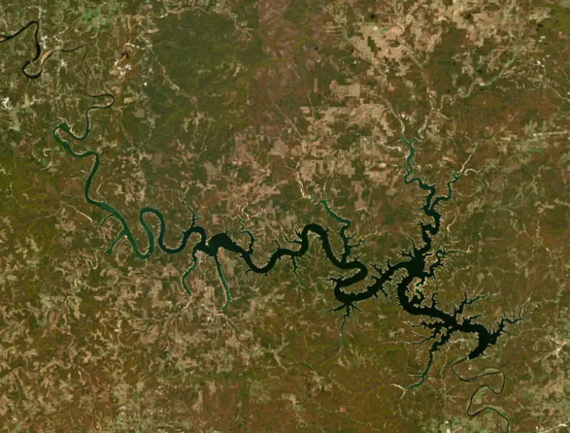
A reservoir on the White in Arkansas and Missouri, held back by Bull Shoals Dam since 1951.

Bull Shoals Lake is at 652.21 feet above sea level — 6.79 ft below top of power pool, as of Nov 19, 2026, 4:00 AM CST. It has dropped 0.26 ft in the past 7 days.
6th fullest of 11 Arkansas lakes today against full pool · See the ranking
Record low 587.45 ft (1954), record high 696.49 ft (2011) · Level history since 1953
A notification from this browser, once, when the level crosses the line (checked every hour). No account and no email. On an iPhone, add Lake by Lake to your home screen first (Share → Add to Home Screen) and open it from there. Or follow the lake in a feed reader: RSS feed.
Bull Shoals Lake is down 0.26 ft over the last 7 days, at 652.21 ft today.
Daily values from the NOAA National Water Prediction Service.
Bull Shoals Lake is down 1.01 ft over the last 30 days, at 652.21 ft today.
Daily values from the NOAA National Water Prediction Service.
Over the past 12 months, Bull Shoals Lake ranged from 652.21 ft (Nov 18, 2026) to 665.40 ft (Jun 26, 2026), a swing of 13.2 ft. Today's level is the lowest of the past 12 months. It is 1.44 ft lower than on this date last year.
Daily values from the NOAA National Water Prediction Service. Why lake levels rise and fall
In the U.S. Army Corps of Engineers record, which starts in 1953, the lowest level was 587.45 ft on September 29, 1954 and the highest 696.49 ft on May 28, 2011. Today’s 652.21 ft is 64.8 ft above the record low and 44.3 ft below the record high.
Bull Shoals Lake level history: every year since 1953, the lowest and highest years →
Solunar periods for Bull Shoals Lake, local time. How they work
High · as of Nov 9, 2026
The satellite sees a likely bloom on part of the lake. Avoid discolored water and scum, and keep dogs out of it. About 457,000 cells/mL at the worst spot, covering 5% of the lake.
Week of Aug 16Week of Nov 1
Each bar is one week, colored by the worst reading of that week.
From the U.S. EPA's Cyanobacteria Assessment Network (CyAN), which reads the color of lakes from the Sentinel-3 satellites; it sees open water only, not coves or the shoreline. Blooms can be patchy: what you see on the water matters more. Swimming closures and health advisories come from Arkansas health and environment agencies. How to read it
Surface water temperature
65°F on Nov 10, 2026
84°F · Aug 565°F · Nov 10
19°F cooler than on Aug 5, 2026.
Estimated from Landsat 8/9 (USGS) passes on clear days: the top layer of the water, a few degrees either way. Coves and the shallows can be warmer.
Bull Shoals Lake water temperature: trend, swimming and the fish →
On or near the shore of Bull Shoals Lake: 20 boat ramps, 14 marinas, 32 campgrounds and 1 beach. The lake has about 761 miles of shoreline, counting its islands.
Tap an icon for details; use two fingers (or Ctrl + scroll) to move the map. Tap a dot for details. Map and lake outline © OpenStreetMap contributors. Places from OpenStreetMap, Overture Maps and Recreation.gov. Not for navigation.
What you’ll find on the shore
← AllBoating 34
← AllFishing spots 7
← AllBeaches 1
← AllCamping 32
← AllLodging 24+
← AllParks 13
← AllDining 4
Zebra mussels have been found in Bull Shoals Lake. They clog intakes and engines and spread on boats and trailers: clean, drain and dry everything before you go to another lake.
Arkansas: Pull every drain plug (bilge, livewell, baitwell and ballast) before and while trailering a boat to or from any access, a rule in force since 2021. Clean, drain and dry is urged, and possessing or moving listed invasive species such as zebra mussels is illegal. State rules
Missouri: Missouri has no clean-drain-dry law; MDC asks boaters to remove plants, animals and mud, drain all water including livewells and transom wells before leaving, let the boat dry completely, and trash unused bait. Prohibited species such as zebra mussels may not be transported alive. State rules
Records: USGS Nonindigenous Aquatic Species database. A species not listed may still be present.
Species with open-licensed records inside Bull Shoals Lake's outline, from GBIF.org (surveys, museum collections and angler reports). A record shows a fish was found here, not how many there are now.
Rocky points, gravel and current breaks; deeper rock piles in summer.
Rocky shorelines at night after ice-out; deep weed edges and humps in summer.
Run up the river arms in spring; follow shad to cool, deep water near the dam in summer.
Cool water: near the surface in spring and fall, deep in summer.
Low light and cold water; the inflows in fall.
Water temperature sets off each spawn; the bars show the usual months at this latitude and elevation, and move with a warm or cold spring. The water is about 65°F now.
Bull Shoals Lake is a long Ozark reservoir on the White River that crosses the Arkansas and Missouri line. Its dam stands in Arkansas about 10 miles west of Mountain Home, between Baxter and Marion counties. Anglers come for bass, walleye and crappie on the lake and for the trout water in the cold river below the dam.
Power companies looked at damming the White River at Wildcat Shoals, above Cotter, as early as 1902, and a 1930 Army Corps of Engineers study also favored that spot. The foundation there proved unsuitable, so a 1940 Corps report moved the dam to Bull Shoals, named for a shoal, a shallow and swift reach of the river. Work began in June 1947, and the dam was finished in July 1951. Concrete came from a quarry on Lee's Mountain by a conveyor belt 7.5 miles long. When it was built, Bull Shoals was the fifth largest dam in the country and its powerhouse was the largest building in Arkansas. President Harry S. Truman spoke at the dedication on July 2, 1952, before a crowd of more than 6,000. The town of Bull Shoals grew out of the project. Charles S. Woods Sr. and his son bought more than 1,000 acres from 17 farmers on what had been the Newton Flat settlement and filed the town plat in August 1946, before ground was broken.
The lake runs about 80 miles from the dam into Missouri, through Marion, Baxter and Boone counties in Arkansas and Ozark and Taney counties in Missouri. It is the last of a chain of White River lakes, below Beaver Lake, Table Rock Lake and Lake Taneycomo, and its narrow upper end below Powersite Dam is known as the Pothole. On the Missouri side, public accesses include Pontiac and Theodosia in Ozark County and Beaver Creek and River Run in Taney County. At the dam, the towns of Bull Shoals and Lakeview face each other, and Bull Shoals-White River State Park reaches from the lake down to the river, with the James A. Gaston Visitor Center looking over the dam. The lake changed the region. In 1940 there were 13 businesses offering overnight lodging nearby, and by 1970 there were 300. It also ended the old multiday float trips for smallmouth bass from Branson down to Cotter that Jim Owen had made famous.
The Missouri Department of Conservation rates the lake for largemouth, spotted and smallmouth bass and calls its walleye numbers very good. Bass hold along rocky points and channel swings in spring, fall and early winter and drop to 30 or 40 feet the rest of the year, while walleye work flats and points near the thermocline. The department has sunk 171 brush structures for crappie. Because bass spawns have been uneven, it asks anglers to release largemouth and smallmouth and keep spotted bass instead. Missouri residents can fish the Arkansas side with a White River Border Lakes Permit.
Cold water released from Bull Shoals and Norfork dams wiped out the warm-water fishery downstream. Arkansas Game and Fish began stocking rainbow trout in the White River in 1951 and stocked it regularly from 1955, and brown trout now reproduce in the river on their own. The commission manages the trout water from the dam to the Highway 58 bridge at Guion. The dam also holds back floods. Record spring rain in 2008 pushed the lake to its highest level since 1957, and the Corps opened the floodgates. On May 27, 2011, the lake set its record crest.
Written by Lake by Lake from CALS Encyclopedia of Arkansas, City of Bull Shoals, Arkansas Game and Fish Commission, Missouri Department of Conservation, Arkansas Democrat-Gazette and Wikipedia. Checked November 2026.
Activities listed by the U.S. Army Corps of Engineers: Biking · Boating · Camping · Hiking · Picnicking · Water sports · Wildlife viewing
Bull Shoals Dam is a concrete dam 256 feet high and 2,256 feet long on the White, completed in 1951. It belongs to the U.S. Army Corps of Engineers (Little Rock District) and is run for flood control, recreation, hydropower and water supply. At its normal level the reservoir holds 3.05 million acre-ft, drained from 6,063 square miles of land.
From the National Inventory of Dams (U.S. Army Corps of Engineers), NID ID AR00160. Lake or reservoir: what’s the difference?
Where the level comes from: White River at Bull Shoals Dam (NOAA National Water Prediction Service).
| Lake | Miles | Level (ft) | vs full | 7 days |
|---|---|---|---|---|
| Norfork Lake Slightly below full | 21 | 550.91 | −2.84 | −0.88 |
| Lake Taneycomo At or near full pool | 41 | 700.81 | −0.54 | −1.30 |
| Table Rock Lake Slightly below full | 44 | 909.55 | −5.45 | −0.47 |
| Greers Ferry Lake Below full | 67 | 454.52 | −7.52 | −0.21 |
| Beaver Lake Below full | 71 | 1110.78 | −9.22 | −0.46 |
| Lake Dardanelle At or near full pool | 84 | 337.73 | −0.27 | −0.05 |
Compare Bull Shoals Lake with Norfork Lake, Lake Taneycomo, Table Rock Lake or Greers Ferry Lake: size, level, ramps and fish side by side.
Bull Shoals Lake is at 652.21 feet above sea level — 6.79 ft below top of power pool, as of Nov 19, 2026, 4:00 AM CST. It has dropped 0.26 ft in the past 7 days.
Bull Shoals Lake's top of power pool is 659.00 ft, according to U.S. Army Corps of Engineers. Today the lake is 6.79 ft below that mark.
Today's level is 0.61 ft below the median for this date (652.82 ft), from the gauge’s long-term daily record.
587.45 ft, on September 29, 1954, in the U.S. Army Corps of Engineers record, which starts in 1953. Today the lake is 64.8 ft above that.
696.49 ft, on May 28, 2011, in the U.S. Army Corps of Engineers record since 1953. That is 37.5 ft above top of power pool.
Bull Shoals Lake has 20 boat ramps on our map, including Boat ramp at Spring Creek Public Use Area, CCC Boat Ramp, Camp Galilee Boat Ramp, and 14 marinas. Low water can close ramps, so check today's level above and the operator before you go.
Yes. There are 32 campgrounds and RV parks within about a mile of the shore, such as Buck Creek Campground, Highway 125 Park Bull Shoals Campground, Theodosia Park Campground.
Game fish recorded in Bull Shoals Lake include striped bass, rainbow trout, yellow perch, white bass, walleye, smallmouth bass. In all, 40 fish species have open records inside the lake on GBIF.
The surface of Bull Shoals Lake was about 65°F on November 10, estimated from a satellite pass on a clear day. It is the top layer of the water, a few degrees either way; coves and shallows run warmer in the sun.
Bull Shoals Lake lies in Arkansas and Missouri: the license of the state where you fish applies. Anglers 16 and older need an Arkansas fishing license, sold online by the Arkansas Game and Fish Commission. Free fishing days: Free Fishing Weekend in June (2026: June 12-14); no trout permit needed either. Anglers 16 and older need a Missouri fishing license, sold online by the Missouri Department of Conservation. Free fishing days: Saturday and Sunday following the first Monday in June. Size and bag limits can be set lake by lake: check the current regulations.
In summer a white Secchi disk lowered into Bull Shoals Lake stays visible to about 8.7 ft (the median of 90 readings, 2016–2025, by Univ. of Missouri, Columbia and Arkansas Department of Environmental Quality): clear water. With the algae measured too (chlorophyll about 4 µg/L), that makes it mesotrophic: moderately rich in nutrients. Clarity drops after storms and during algae blooms.
U.S. Army Corps of Engineers lists biking, boating, camping, hiking, picnicking, water sports and wildlife viewing at Bull Shoals Lake. 9 campgrounds can be booked on Recreation.gov.
EPA's CyAN satellite rated cyanobacteria in Bull Shoals Lake high on November 9. The satellite sees open water only; blooms can be patchy, so avoid water that looks like spilled paint or pea soup and keep dogs out of scum. Swimming advisories come from Arkansas health and environment agencies.
Bull Shoals Lake is held back by Bull Shoals Dam, completed in 1951 and 256 ft high, according to the National Inventory of Dams.
From the NOAA National Water Prediction Service (White River at Bull Shoals Dam). Lake by Lake checks it every hour; the agency's own figure is always the reference, and provisional readings can be revised.
Lake levels are refreshed every hour. Texas and California reservoirs report once a day; most USGS and NOAA gauges report every 15 to 60 minutes.
Cookies for analytics With your OK we use Google Analytics and Microsoft Clarity to count visits and see how the site is used, so we can make it better. No advertising cookies. Privacy policy




