Sun
- Sunrise
- 7:19 AM
- Sunset
- 5:32 PM
- First light
- 6:52 AM
- Last light
- 5:59 PM
Reservoir · Hamilton County, Tennessee
A reservoir on the Tennessee River in Hamilton County, Tennessee, held back by Chickamauga Dam since 1940.

Chickamauga Lake is at 677.23 feet above sea level — 5.27 ft below summer pool, as of Nov 19, 2026, 2:00 AM EST. It has dropped 0.29 ft in the past 7 days.
12th fullest of 23 Tennessee lakes today against full pool · See the ranking
A notification from this browser, once, when the level crosses the line (checked every hour). No account and no email. On an iPhone, add Lake by Lake to your home screen first (Share → Add to Home Screen) and open it from there. Or follow the lake in a feed reader: RSS feed.
Chickamauga Lake is down 0.29 ft over the last 7 days, at 677.23 ft today.
Daily values from the NOAA National Water Prediction Service.
Chickamauga Lake is down 2.91 ft over the last 30 days, at 677.23 ft today.
Daily values from the NOAA National Water Prediction Service. Why lake levels rise and fall
Solunar periods for Chickamauga Lake, local time. How they work
Not detected · as of Nov 9, 2026
The satellite found no cyanobacteria at the surface.
Week of Aug 9Week of Nov 1
Each bar is one week, colored by the worst reading of that week.
From the U.S. EPA's Cyanobacteria Assessment Network (CyAN), which reads the color of lakes from the Sentinel-3 satellites; it sees open water only, not coves or the shoreline. Blooms can be patchy: what you see on the water matters more. Swimming closures and health advisories come from Tennessee health and environment agencies. How to read it
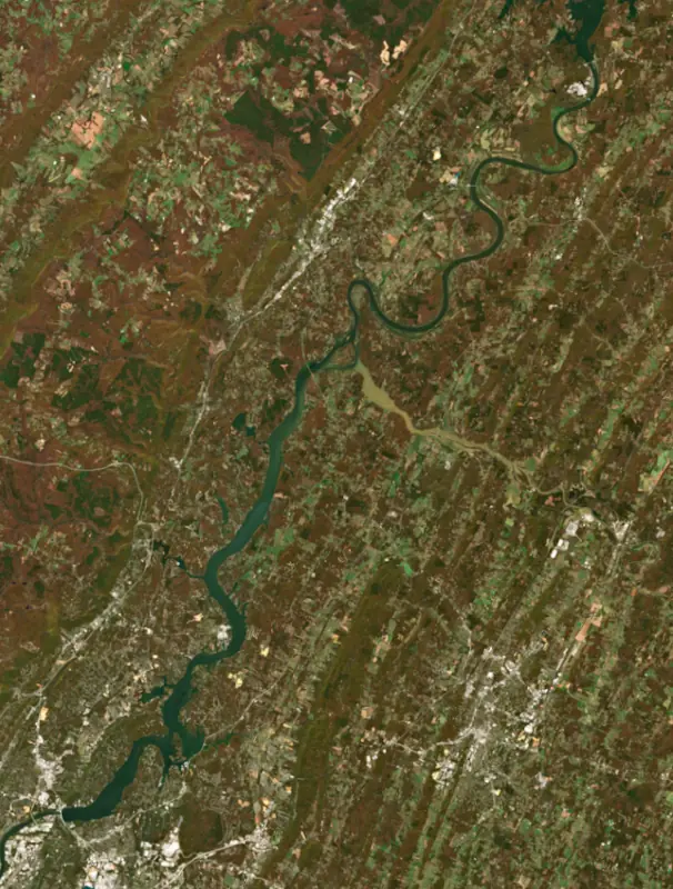
Surface water temperature
61°F on Nov 14, 2026
88°F · Jul 2661°F · Nov 14
27°F cooler than on Jul 26, 2026.
Estimated from Landsat 8/9 (USGS) passes on clear days: the top layer of the water, a few degrees either way. Coves and the shallows can be warmer.
Chickamauga Lake water temperature: trend, swimming and the fish →
On or near the shore of Chickamauga Lake: 47 boat ramps, 18 marinas, 3 rental outfits, 17 campgrounds, 6 beaches, 5 fishing piers and 14 trails. The lake has about 502 miles of shoreline, counting its islands.
Tap an icon for details; use two fingers (or Ctrl + scroll) to move the map. Tap a dot for details. Map and lake outline © OpenStreetMap contributors. Places from OpenStreetMap, Overture Maps and Recreation.gov. Not for navigation.
What you’ll find on the shore
← AllBoating 65
← AllRentals & tours 3
← AllFishing spots 12
← AllBeaches 6
← AllCamping 17
← AllLodging 16
← AllTrails 14
← AllParks 20+
← AllDining 12
Zebra mussels have been found in Chickamauga Lake. They clog intakes and engines and spread on boats and trailers: clean, drain and dry everything before you go to another lake.
Tennessee: Tennessee has no statewide clean-drain-dry law; TWRA urges you to remove plants, animals and mud, drain all water, and dry the boat for five days (or hot-wash it) before moving to another lake. Moving live invasive carp is illegal. State rules
Records: USGS Nonindigenous Aquatic Species database. A species not listed may still be present.
Chickamauga Lake is the Tennessee Valley Authority reservoir on the Tennessee River that starts at Chickamauga Dam in Chattanooga and runs about 59 miles upstream to the foot of Watts Bar Dam. It was built to protect Chattanooga from floods, it drowned the old county seat of Harrison, and since a stocking program began in 2000 it has become one of the country's best lakes for trophy largemouth bass.
By one count Chattanooga flooded 17 times between 1791 and 1936. The worst came in March 1867, when days of rain pushed the river about 58 feet above normal, swept away bridges and left much of the city under water. Serious floods returned in later decades, and residents raised streets and buildings to cope.
The TVA project was authorized on December 31, 1935, and construction began on January 13, 1936. The gates closed on January 15, 1940, the original lock opened on February 26 and the first generator came online on May 4. The dam serves navigation, flood control and power. Its name comes from the Chickamaugas, a breakaway band of the Cherokee whose main village stood just north of the dam site in the 18th century. The original lock was small, and its concrete began to swell from a chemical reaction in the aggregate. Work on a much larger replacement lock began in 2003 and has dragged on for years as costs climbed. State Route 153 crosses the river on top of the dam, and the Tennessee Riverwalk starts beside it.
Filling the lake took 61,350 acres of land. TVA moved 903 families, 24 cemeteries and 81 miles of road, and raised or rebuilt 39 bridges. An embankment was built to protect part of Dayton, and roads and buildings in Soddy were moved. The town of Harrison, named for President William Henry Harrison and once the seat of Hamilton County, was largely flooded when the dam was finished in 1940. Its old roads and house foundations can still be seen, and Harrison Bay takes its name from the drowned town.
The TVA began building a park on the bay in 1938 as a demonstration area for white visitors only, and Civilian Conservation Corps crews built picnic grounds, docks, swimming areas and roads before it opened in 1942. Booker T. Washington State Park was laid out to the south for Black visitors. Today Harrison Bay State Park has a large marina and the Bear Trace golf course, designed by Jack Nicklaus and opened in 1998.
In 2000 the Tennessee Wildlife Resources Agency began stocking Florida-strain largemouth to raise the average size of the lake's bass. The plan worked. Chickamauga produced a 15.2-pound largemouth that set the Tennessee state record, and in 2019 Bassmaster Magazine ranked it sixth among the country's top bass lakes. Late February through March is prime time for big fish, when prespawn bass stage on the channel swings and flats of the main creeks. Below the dam, anglers fish the tailwater for striped, largemouth and smallmouth bass.
About 30 miles above the dam the Hiwassee River joins the lake, and its lower 18 miles are navigable. At that confluence near Birchwood lies the Hiwassee Wildlife Refuge, about 6,000 acres managed by the wildlife agency for waterfowl. Since the early 1990s it has drawn migrating sandhill cranes, and thousands now spend the whole winter there. The Tennessee Sandhill Crane Festival is held each January at the refuge and at the neighboring Cherokee Removal Memorial Park at Blythe Ferry.
Written by Lake by Lake from Wikipedia (Chickamauga Dam, Harrison, Tennessee), Chattanooga Times Free Press, Tennessee Encyclopedia, Bassmaster and The Environmental Journal of Southern Appalachia. Checked November 2026.
Chickamauga Dam is a concrete dam 129 feet high and 5,800 feet long on the Tennessee River, completed in 1940. It belongs to the Tennessee Valley Authority and is run for flood control, navigation, recreation, hydropower and water supply. At its normal level the reservoir holds 622,500 acre-ft, drained from 20,790 square miles of land.
From the National Inventory of Dams (U.S. Army Corps of Engineers), NID ID TN06504. Lake or reservoir: what’s the difference?
Where the level comes from: Tennessee River at Chickamauga Dam (NOAA National Water Prediction Service).
| Lake | Miles | Level (ft) | vs full | 7 days |
|---|---|---|---|---|
| Nickajack Lake At or near full pool | 23 | 633.48 | −1.02 | +0.07 |
| Parksville Lake Slightly below full | 33 | 823.91 | −5.09 | −0.80 |
| Watts Bar Lake Slightly below full | 44 | 737.96 | −3.04 | — |
| Carters Lake Slightly below full | 46 | 1070.80 | −3.20 | −1.66 |
| Apalachia Lake At or near full pool | 53 | 1277.67 | −0.83 | −0.27 |
| Great Falls Lake Well below full | 54 | 787.02 | −17.98 | −0.34 |
Compare Chickamauga Lake with Nickajack Lake, Parksville Lake, Watts Bar Lake or Carters Lake: size, level, ramps and fish side by side.
Chickamauga Lake is about 3 mi from Chattanooga, TN. See all the lakes near each city.
Chickamauga Lake is at 677.23 feet above sea level — 5.27 ft below summer pool, as of Nov 19, 2026, 2:00 AM EST. It has dropped 0.29 ft in the past 7 days.
Chickamauga Lake's summer pool is 682.50 ft, according to Tennessee Valley Authority. Today the lake is 5.27 ft below that mark.
Chickamauga Lake has 47 boat ramps on our map, including Armstrong, Bear Branch Boat Launch, Boat ramp at Island Cove Marina, and 18 marinas. Low water can close ramps, so check today's level above and the operator before you go.
Yes. There are 17 campgrounds and RV parks within about a mile of the shore, such as Cottonport Fish N Camp, Hamilton County Chester Frost Park Campground, Blue Water RV Resort.
The surface of Chickamauga Lake was about 61°F on November 14, estimated from a satellite pass on a clear day. It is the top layer of the water, a few degrees either way; coves and shallows run warmer in the sun.
Anglers 13 and older need a Tennessee fishing license, sold online by the Tennessee Wildlife Resources Agency. Free fishing days: Free Fishing Day, one Saturday in June; children 15 and under fish free that whole week. Size and bag limits can be set lake by lake: check the current regulations.
Chickamauga Lake averages about 17 ft deep. Depth changes with the lake level.
In summer a white Secchi disk lowered into Chickamauga Lake stays visible to about 4.8 ft (the median of 48 readings, 2016–2026, by TDEC Division of Water Resources): somewhat murky water. Silt after rain lowers the reading as much as algae do. Clarity drops after storms and during algae blooms.
boating (47 boat ramps and 18 marinas), kayaks, boats & jet skis (3 rental outfits on or near the water), fishing (5 fishing piers and spots), swimming (6 beaches and swimming areas), hiking & walking (14 trails along the shore, the longest Bay Point Loop Trail (4.1 mi)) and camping (17 campgrounds), according to our map of the shore.
EPA's CyAN satellite rated cyanobacteria in Chickamauga Lake not detected on November 9. The satellite sees open water only; blooms can be patchy, so avoid water that looks like spilled paint or pea soup and keep dogs out of scum. Swimming advisories come from Tennessee health and environment agencies.
Yes. 14 trails run along or near the shore, including Bay Point Loop Trail (4.1 mi), Dayton Walking Track (1.8 mi) and Island Loop Trail (0.4 mi), according to OpenStreetMap.
Chickamauga Lake is held back by Chickamauga Dam, completed in 1940 and 129 ft high, according to the National Inventory of Dams.
From the NOAA National Water Prediction Service (Tennessee River at Chickamauga Dam). Lake by Lake checks it every hour; the agency's own figure is always the reference, and provisional readings can be revised.
Lake levels are refreshed every hour. Texas and California reservoirs report once a day; most USGS and NOAA gauges report every 15 to 60 minutes.
Cookies for analytics With your OK we use Google Analytics and Microsoft Clarity to count visits and see how the site is used, so we can make it better. No advertising cookies. Privacy policy