Guide · updated November 10, 2026
How Lake Levels Are Measured
Staff gauges, pressure sensors, datums and who runs them — and why two gauges on the same lake can show different numbers for the level.
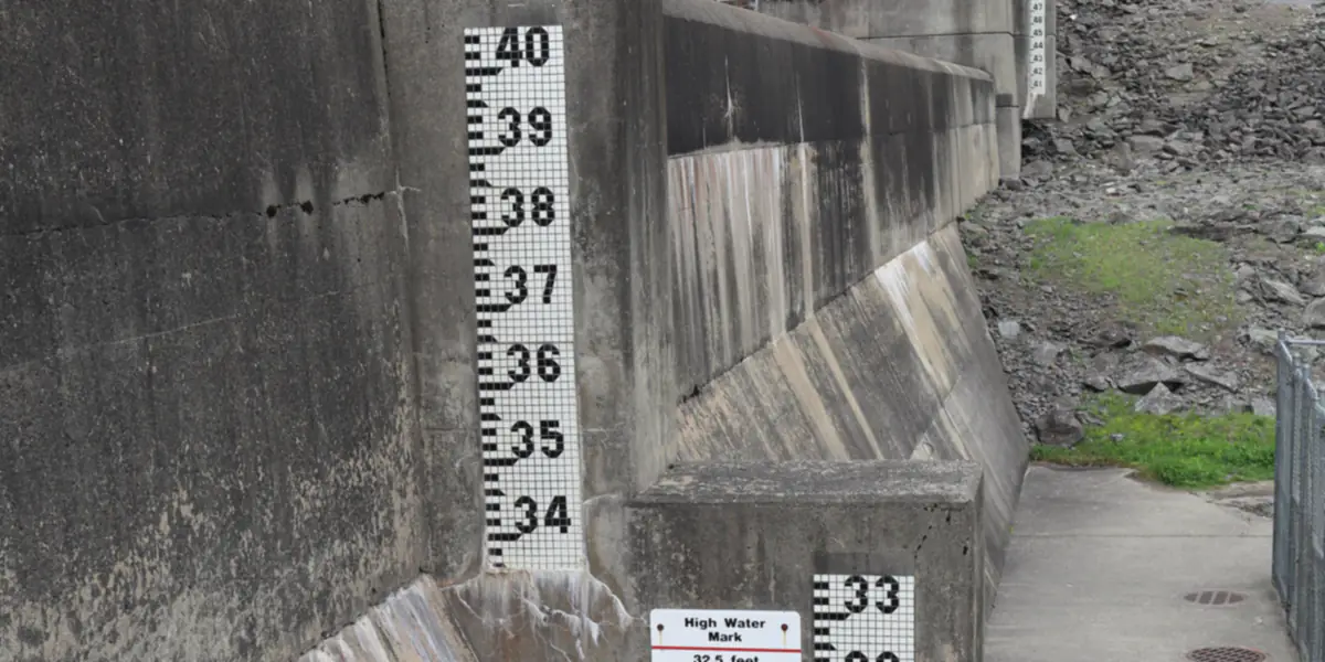
Every lake level you see online comes from a gauge: an instrument fixed at one spot on the shore, usually at the dam. It measures the height of the water surface above a reference level, the datum.
The instruments
- Staff gauge — the painted board with foot and tenth-of-a-foot marks you see on dams and bridge piers. Still used to check the electronic sensors by eye.
- Pressure transducer or bubbler — a sensor under water measures the weight of the water above it and converts it to depth.
- Radar sensor — a box above the water times a radar pulse bouncing off the surface. No parts touch the water.
- Stilling well — a pipe connected to the lake through small holes, so waves don’t make the reading jump.
Readings are sent by satellite (GOES) or cell modem, usually every 15 minutes, to the agency that runs the gauge.
Who runs the gauges
- U.S. Geological Survey (USGS) — the national network, with hundreds of lake and reservoir elevation gauges.
- NOAA National Water Prediction Service — the river forecast centers’ gauges, many of them at dams.
- U.S. Army Corps of Engineers — its own reservoirs, often through the USGS network.
- Bureau of Reclamation — the big reservoirs of the West (Lake Mead, Lake Powell).
- State agencies — the Texas Water Development Board and California’s Department of Water Resources publish every major reservoir in their state with storage and percent full.
- Utilities — Duke Energy, Alabama Power, Ameren and others run lakes for hydropower and share their gauges with NOAA.
Datums: “feet above what?”
Most lake levels are given in feet above mean sea level, but “sea level” is a defined surface, and there are two in use: NGVD 1929 and NAVD 1988. On the same lake they can differ by a foot or more. A few lakes use a local datum: Duke Energy’s lakes read 100 ft at full pond, and Lake Tahoe’s gauge is set so that 6,223 ft is the natural rim. Lake by Lake always compares a reading with a full pool on the same datum.
Why the level changes
Inflow from rivers and rain raises a lake; releases through the dam, water supply withdrawals and evaporation lower it. In a Texas summer, evaporation alone can take a quarter to half an inch off a reservoir every day. On reservoirs the operator decides most of the change, following a seasonal plan called a guide curve or rule curve.
Questions
How accurate is a lake level reading?
Modern pressure and radar sensors read to about a hundredth of a foot. The figure is provisional until the agency reviews it, usually months later, and wind can tilt a large lake by several inches.
Why do two websites show different levels for the same lake?
They may use different gauges, different datums (NGVD 1929 vs. NAVD 1988 can differ by a foot or more), or a reading from a different time. Lake by Lake names the gauge behind every number.
How often are lake levels updated?
Most USGS and NOAA gauges report every 15 to 60 minutes. Texas and California publish a daily reservoir report. Lake by Lake checks all of them every hour.