Sun
- Sunrise
- 6:55 AM
- Sunset
- 5:16 PM
- First light
- 6:29 AM
- Last light
- 5:42 PM
Reservoir · Berkeley County, South Carolina
A reservoir on the Santee River in Berkeley County, South Carolina, held back by Santee Dam, North Dam, South Dam since 1942.

Lake Marion is at 73.23 feet above sea level, as of Nov 19, 2026, 5:45 AM EST. It has dropped 0.19 ft in the past 7 days.
A notification from this browser, once, when the level crosses the line (checked every hour). No account and no email. On an iPhone, add Lake by Lake to your home screen first (Share → Add to Home Screen) and open it from there. Or follow the lake in a feed reader: RSS feed.
Lake Marion is down 0.19 ft over the last 7 days, at 73.23 ft today.
Daily values from the U.S. Geological Survey.
Lake Marion is up 0.13 ft over the last 30 days, at 73.23 ft today.
Daily values from the U.S. Geological Survey.
Over the past 12 months, Lake Marion ranged from 71.84 ft (Oct 10, 2026) to 74.94 ft (Feb 22, 2026), a swing of 3.1 ft. Today's level is in the lower half of that range. It is 0.65 ft lower than on this date last year.
Daily values from the U.S. Geological Survey. Why lake levels rise and fall
Solunar periods for Lake Marion, local time. How they work
Moderate · as of Nov 8, 2026
A bloom may be forming somewhere on the lake. Avoid water that looks like spilled paint or pea soup. About 263,000 cells/mL at the worst spot, covering less than 1% of the lake.
Week of Aug 9Week of Nov 1
Each bar is one week, colored by the worst reading of that week.
From the U.S. EPA's Cyanobacteria Assessment Network (CyAN), which reads the color of lakes from the Sentinel-3 satellites; it sees open water only, not coves or the shoreline. Blooms can be patchy: what you see on the water matters more. Swimming closures and health advisories come from South Carolina health and environment agencies. How to read it
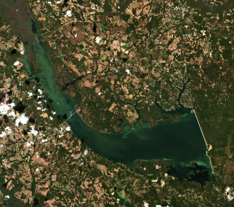
The last 11 satellite passes
90°F · Jul 2965°F · Nov 12
26°F cooler than on Jul 29, 2026.
Estimated from MODIS Aqua (NASA) passes on clear days: the top layer of the water, a few degrees either way. Coves and the shallows can be warmer.
Lake Marion water temperature: trend, swimming and the fish →
On or near the shore of Lake Marion: 32 boat ramps, 16 marinas, 1 rental outfit, 31 campgrounds, 3 beaches, 1 fishing pier and 7 trails. The lake has about 312 miles of shoreline, counting its islands.
Tap an icon for details; use two fingers (or Ctrl + scroll) to move the map. Tap a dot for details. Map and lake outline © OpenStreetMap contributors. Places from OpenStreetMap, Overture Maps and Recreation.gov. Not for navigation.
What you’ll find on the shore
← AllBoating 48
← AllRentals & tours 1
← AllFishing spots 8
← AllBeaches 3
← AllCamping 31
← AllLodging 24+
← AllTrails 7
← AllParks 6
← AllDining 15
These invasive plants and animals have been recorded in Lake Marion: clean, drain and dry everything before you go to another lake.
South Carolina: South Carolina has no clean-drain-dry law for boats, but it is illegal to possess hydrilla, water hyacinth and other listed aquatic plants or put them in state waters, so strip off all plant fragments. Officials urge boaters to clean, drain and dry before moving to another lake. State rules
Records: USGS Nonindigenous Aquatic Species database. A species not listed may still be present.
Species with open-licensed records inside Lake Marion's outline, from GBIF.org (surveys, museum collections and angler reports). A record shows a fish was found here, not how many there are now.
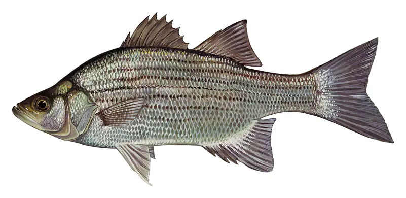
Shallow, protected flats in spring; docks, grass and deep edges in summer heat.
Brush piles, docks and bridge pilings; shallow for a few weeks in spring.
Channel edges and river arms; best after dark in summer, and after a rain.
Run up the river arms in spring; follow shad to cool, deep water near the dam in summer.
Spring runs up the tributaries; schools busting shad in late summer.
Water temperature sets off each spawn; the bars show the usual months at this latitude and elevation, and move with a warm or cold spring. The water is about 60°F now.
Lake Marion is the largest lake in South Carolina and the upper of the two Santee Cooper lakes, spread across Berkeley, Calhoun, Clarendon, Orangeburg and Sumter counties in the coastal plain. Built during the Depression to bring power and jobs to rural parts of the state, it is known for its flooded cypress, its big catfish and the striped bass that showed the species could live its whole life in fresh water.
In 1934 Governor Ibra Blackwood signed the bill that created the South Carolina Public Service Authority, now called Santee Cooper, and allowed it to dam the Santee River, turn its water into the Cooper River and clear land for two reservoirs. Federal Public Works money followed, and it became the largest New Deal program in the state. The goals were jobs, electricity for farms, navigation from Charleston to Columbia, flood control and an end to malaria outbreaks along the river.
Private utilities fought it. So did landowners facing the loss of homes, churches and battlefields, and people who mourned the virgin hardwood of the Santee Swamp. Construction began in 1939 after a four-year court battle. At the peak nearly 15,000 workers, most of them from relief rolls, lived in camps and cleared more than 160,000 acres with handsaws and mule-drawn wagons. They also relocated cemeteries. It was the largest land-clearing job in the nation's history. With war coming the schedule was moved up, and the dam closed in November 1941 before the clearing was done. The power plant at Pinopolis on Lake Moultrie began generating in 1942.
The lake carries the name of Francis Marion, the Revolutionary War general, and his plantation, Pond Bluff, was one of many homes and churches that went under the water. His war is still on the shore. On the Santee National Wildlife Refuge in Clarendon County stands the Santee Indian Mound, a ceremonial and burial mound built between about 1200 and 1400. The British fortified it as Fort Watson. In April 1781 Marion and Lt. Col. Henry Lee laid siege, built a tower to fire down into the stockade, and took the surrender on April 15 after eight days. The refuge was set aside in 1942, and from November through February it draws ring-necked ducks, pintails, teal, wood ducks and Canada geese.
The lake reaches upstream almost to the point where the Congaree and Wateree rivers meet. That upper end is Sparkleberry Swamp, seasonally flooded forest rich in wildlife. Because the clearing was never finished, thousands of stumps, dead trunks and living cypress trees still stand in the lake. At the lower end, the Santee Dams and a spillway on the Santee River hold the water back, and a diversion canal carries it on to Lake Moultrie.
When the dam closed it trapped a population of striped bass. They thrived and showed that stripers could complete their life cycle entirely in fresh water, something long thought unique to these lakes. They still run up the Congaree and Wateree in early spring to spawn, and no other South Carolina reservoir has rivers so well suited to it. The state pioneered striped bass hatchery methods at the Dennis Wildlife Center in Moncks Corner, work that helped start striper fisheries in reservoirs across the country. The lake's own striper fishery has declined at times, and the state has taken steps to rebuild it.
Blue and flathead catfish, introduced in the mid-1960s, now grow to very large sizes. Crappie, bream and catfish hold around the standing timber, while largemouth bass and shellcracker draw anglers each spring.
Written by Lake by Lake from Santee Cooper, South Carolina Encyclopedia, South Carolina Department of Natural Resources (Lake Marion, Striped Bass), U.S. Fish and Wildlife Service and SC Picture Project. Checked November 2026.
Santee Dam, North Dam, South Dam is an earthfill dam 50 feet high and 40,940 feet long on the Santee River, completed in 1942. It belongs to South Carolina Public Service Authority and is run for flood control, navigation, recreation, hydropower and water supply. At its normal level the reservoir holds 1.26 million acre-ft, drained from 14,700 square miles of land.
From the National Inventory of Dams (U.S. Army Corps of Engineers), NID ID SC00732. Lake or reservoir: what’s the difference?
Where the level comes from: LAKE MARION NEAR PINEVILLE, SC (U.S. Geological Survey, used on this page) and LAKE MARION NEAR ELLOREE, SC (U.S. Geological Survey).
| Lake | Miles | Level (ft) | vs full | 7 days |
|---|---|---|---|---|
| Lake Moultrie Live reading | 10 | 73.13 | — | −0.46 |
| Lake Wateree Slightly below full | 69 | 97.70* | −2.30 | −0.33 |
| Lake Murray Below full | 74 | 351.91 | −8.09 | −0.63 |
| Cedar Creek Reservoir At or near full pool | 86 | 98.71* | −1.29 | −0.10 |
| Great Falls Reservoir Slightly below full | 87 | 96.16* | −3.84 | −0.60 |
| Parr Reservoir Live reading | 87 | 262.30 | — | −1.04 |
* Local gauge datum: 100 ft = full pond (Duke Energy lakes).
Compare Lake Marion with Lake Moultrie, Lake Wateree, Lake Murray or Cedar Creek Reservoir: size, level, ramps and fish side by side.
Lake Marion is about 59 mi from Columbia, SC. See all the lakes near each city.
Lake Marion is at 73.23 feet above sea level, as of Nov 19, 2026, 5:45 AM EST. It has dropped 0.19 ft in the past 7 days.
Lake Marion has 32 boat ramps on our map, including Boat ramp at Carolina King Marina/ Lake Marion, Boat ramp at Harry's Fish Camp, Boat ramp at Jack's Creek Marina, and 16 marinas. Low water can close ramps, so check today's level above and the operator before you go.
Yes. There are 31 campgrounds and RV parks within about a mile of the shore, such as Poplar Creek Landing, Deep Water RV Park, Harry's Fish Camp.
Game fish recorded in Lake Marion include bluegill, largemouth bass, striped bass, redear sunfish, blue catfish, yellow perch. In all, 40 fish species have open records inside the lake on GBIF.
The water at Lake Marion is 60°F, measured 59 min ago by the USGS sensor in the lake. Surface temperature changes through the day and with depth.
Anglers 16 and older need a South Carolina fishing license, sold online by the South Carolina Department of Natural Resources. Free fishing days: Memorial Day and July 4 (residents, freshwater only). Size and bag limits can be set lake by lake: check the current regulations.
Lake Marion averages about 13 ft deep. Depth changes with the lake level.
In summer a white Secchi disk lowered into Lake Marion stays visible to about 3.5 ft (the median of 527 readings, 2016–2025, by Santee Cooper - South Carolina Public Service Authority and South Carolina Department of Environmental Services): somewhat murky water. With the algae measured too (chlorophyll about 12 µg/L), that makes it eutrophic: rich in nutrients, greener water. Clarity drops after storms and during algae blooms.
Yes: bathymetric map from the U.S. Geological Survey (1985). It is linked in the lake facts on this page. Depths on a map are measured at a reference level: subtract how far the lake is below it today.
boating (32 boat ramps and 16 marinas), kayaks, boats & jet skis (1 rental outfit on or near the water), fishing (19 game fish and 1 fishing pier or spot), swimming (3 beaches and swimming areas), hiking & walking (7 trails along the shore, the longest Palmetto Trail: Eutaw Springs Passage (20 mi)) and camping (31 campgrounds), according to our map of the shore.
EPA's CyAN satellite rated cyanobacteria in Lake Marion moderate on November 8. The satellite sees open water only; blooms can be patchy, so avoid water that looks like spilled paint or pea soup and keep dogs out of scum. Swimming advisories come from South Carolina health and environment agencies.
Yes. 7 trails run along or near the shore, including Palmetto Trail: Lake Marion Passage, Palmetto Trail: Lake Marion Passage (Unmaintained) (0.7 mi) and South Loop (1.5 mi), according to OpenStreetMap.
Lake Marion is held back by Santee (Wilson) Dam, North Dam, South Dam, completed in 1942 and 50 ft high, according to the National Inventory of Dams.
From the U.S. Geological Survey (LAKE MARION NEAR PINEVILLE, SC). Lake by Lake checks it every hour; the agency's own figure is always the reference, and provisional readings can be revised.
Lake levels are refreshed every hour. Texas and California reservoirs report once a day; most USGS and NOAA gauges report every 15 to 60 minutes.
Cookies for analytics With your OK we use Google Analytics and Microsoft Clarity to count visits and see how the site is used, so we can make it better. No advertising cookies. Privacy policy