Sun
- Sunrise
- 6:51 AM
- Sunset
- 4:26 PM
- First light
- 6:19 AM
- Last light
- 4:57 PM
Lake · Essex County, New York
A lake in Essex County, New York, held back by Lake George Outlet Dam since 1880.

Lake George is at 319.08 feet above sea level, as of Nov 17, 2026, 9:30 PM EST. The level has held steady over the past week.
3rd highest of 8 New York lakes today against normal for the date · See the ranking
Record low 316.78 ft (1941), record high 321.04 ft (1977) · Level history since 1936
A notification from this browser, once, when the level crosses the line (checked every hour). No account and no email. On an iPhone, add Lake by Lake to your home screen first (Share → Add to Home Screen) and open it from there. Or follow the lake in a feed reader: RSS feed.
Lake George is down 0.19 ft over the last 30 days, at 319.08 ft today.
Daily values from the U.S. Geological Survey.
Over the past 12 months, Lake George ranged from 318.86 ft (Feb 19, 2026) to 319.97 ft (May 26, 2026), a swing of 1.1 ft. Today's level is near the bottom of that range. It is 0.31 ft lower than on this date last year.
Daily values from the U.S. Geological Survey. Why lake levels rise and fall
In the U.S. Geological Survey record, which starts in 1936, the lowest level was 316.78 ft on December 12, 1941 and the highest 321.04 ft on March 17, 1977. Today’s 319.08 ft is 2.3 ft above the record low and 2.0 ft below the record high.
Lake George level history: every year since 1936, the lowest and highest years →
Solunar periods for Lake George, local time. How they work
Not detected · as of Nov 9, 2026
The satellite found no cyanobacteria at the surface.
Week of Aug 16Week of Nov 1
Each bar is one week, colored by the worst reading of that week.
From the U.S. EPA's Cyanobacteria Assessment Network (CyAN), which reads the color of lakes from the Sentinel-3 satellites; it sees open water only, not coves or the shoreline. Blooms can be patchy: what you see on the water matters more. Swimming closures and health advisories come from New York health and environment agencies. How to read it
The ice usually goes out of Lake George around Apr 12 (median of 97 springs on record). The record we have ends in 2005, when the ice went out on Apr 10. The earliest on record was Mar 20, 1983; the latest, May 2, 1971.
Each dot is one of the last 30 springs on record; the dashed line is the median of all of them; the orange dot is 2005.
Source: NSIDC Global Lake and River Ice Phenology Database. Ice is never safe everywhere: check local conditions before going out on it. About ice-out
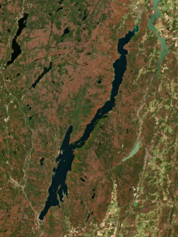
Surface water temperature
55°F on Oct 27, 2026
72°F · Jul 2355°F · Oct 27
17°F cooler than on Jul 23, 2026.
Estimated from Landsat 8/9 (USGS) passes on clear days: the top layer of the water, a few degrees either way. Coves and the shallows can be warmer.
Lake George water temperature: trend, swimming and the fish →
On or near the shore of Lake George: 11 boat ramps, 38 marinas, 10 rental outfits, 14 campgrounds, 20 beaches, 20 trails and 1 fishing guide. The lake has about 157 miles of shoreline, counting its islands.
Tap an icon for details; use two fingers (or Ctrl + scroll) to move the map. Tap a dot for details. Map and lake outline © OpenStreetMap contributors. Places from OpenStreetMap, Overture Maps and Recreation.gov. Not for navigation.
What you’ll find on the shore
← AllBoating 49
← AllRentals & tours 25
← AllFishing spots 6
← AllBeaches 20
← AllCamping 14
← AllLodging 24+
← AllTrails 20+
← AllParks 10
← AllDining 24+
Zebra mussels have been found in Lake George. They clog intakes and engines and spread on boats and trailers: clean, drain and dry everything before you go to another lake.
New York: Before launching into public water, drain all water and remove any plants or animals from the boat, trailer and gear. In and within 10 miles of the Adirondack Park, motorboats must carry a clean-drain-dry certificate (free from a launch steward or self-issued), and trailered boats must pass an inspection before launching on Lake George. State rules
Records: USGS Nonindigenous Aquatic Species database. A species not listed may still be present.
The last stocking on record was in October 2025 (landlocked salmon).
Source: New York State Department of Environmental Conservation stocking records.
Species with open-licensed records inside Lake George's outline, from GBIF.org (surveys, museum collections and angler reports). A record shows a fish was found here, not how many there are now. marks fish the state stocks here.
Brush piles, docks and bridge pilings; shallow for a few weeks in spring.
Low light and cold water; the inflows in fall.
Deep and cold most of the year; shallow reefs in fall and right after ice-out.
Cold, clear water near springs and inlets.
Soft, weedy bottoms in shallow bays; bites best after dark in late spring and summer.
Water temperature sets off each spawn; the bars show the usual months at this latitude and elevation, and move with a warm or cold spring.
Lake George is a long, narrow natural lake at the southeastern foot of the Adirondack Mountains in New York, running north from Lake George Village to Ticonderoga. Its clear water, its scores of islands and its part in the wars of the 1700s have made it a summer destination since the late 1800s, and New York rates it Class AA-Special and treats it as a drinking water source.
The Mohawk name for the lake, Kaniá:taro'kte, means lake end. The first European to see it was the Jesuit missionary Isaac Jogues, who in 1646 called it Lac du Saint-Sacrement and named its outlet La Chute. On August 28, 1755, Sir William Johnson arrived with British forces and renamed it for King George II, and on September 8 his troops and their Iroquois allies won the Battle of Lake George. Johnson built Fort William Henry at the south end, while the French began Fort Carillon, later Fort Ticonderoga, where La Chute meets Lake Champlain. In 1757 the Marquis de Montcalm besieged Fort William Henry and burned it after the British surrendered, and Native allies of the French then attacked the British column retreating toward Fort Edward. James Fenimore Cooper later used this country in The Last of the Mohicans, where he called the lake Horican. Thomas Jefferson and James Madison toured it in 1791, and Jefferson wrote to his daughter that it was the most beautiful water he had ever seen.
The lake runs about 32 miles from south to north and is 1 to 3 miles wide. It drains north. Its outlet, La Chute, drops 226 feet in about 3.5 miles to Lake Champlain, and the water then flows through the Richelieu River to the St. Lawrence. The Narrows squeeze between the Tongue Mountain Range on the west and Black Mountain on the east, a stretch of about 5 miles thick with islands. The lake has more than 170 islands in all, and the state owns most of them. Lake George Village sits at the south end, Bolton Landing is on the west shore near Millionaires' Row, where wealthy families once built summer mansions, Huletts Landing is on the east side, and Ticonderoga guards the outlet. Interstate 87 serves the lake, and Albany International Airport is about 45 miles away.
Rain and snow are the lake's only sources of water, reaching it as runoff, snowmelt and groundwater. A dam on La Chute at Ticonderoga holds the surface perhaps 2 to 3 feet above its natural level. The Lake George Park Commission tracks the level every business day against a rule curve, with a summer target fixed by Section 38 of the state Navigation Law. The lake is drawn down each winter to leave room for spring snowmelt, and in a typical year it rises and falls only about 12 to 16 inches. The outlet can lower the lake by only about an inch a day, so heavy late-spring rain in 2005 and 2006 kept levels above normal even with the gates wide open.
The Asian clam turned up in 2010, and the lake now has six known invasive species, among them Eurasian watermilfoil, zebra mussels and the spiny water flea. Since 2014 the Park Commission has required every trailered boat to be inspected before launching, at one of seven regional stations around the lake. The check is free and takes about five minutes, and boats that are not clean, drained and dry are washed at no charge. In deep water, anglers fish for lake trout and landlocked salmon. The state stocks roughly 28,000 to 30,000 young salmon a year, switched to the Sebago strain between 2013 and 2016, and has seen better fish since. The salmon depend on smelt for food, and in years with few smelt the stocked fish have survived poorly.
Written by Lake by Lake from Wikipedia, Lake George Park Commission (Lake Level Information, Invasive Species Prevention) and Glens Falls Chronicle. Checked November 2026.
Lake George Outlet Dam is a concrete dam 8 feet high and 114 feet long, completed in 1880. It belongs to LaChute Hydro Company, LLC and is run for hydropower, fire protection and livestock water. At its normal level the lake holds 2.25 million acre-ft, drained from 234 square miles of land.
From the National Inventory of Dams (U.S. Army Corps of Engineers), NID ID NY00230. Lake or reservoir: what’s the difference?
Where the level comes from: LAKE GEORGE AT ROGERS ROCK NY (U.S. Geological Survey).
| Lake | Miles | Level (ft) | vs full | 7 days |
|---|---|---|---|---|
| Indian Lake Live reading | 41 | — | — | — |
| Great Sacandaga Lake Live reading | 41 | 755.17 | — | −0.12 |
| Lake Champlain Live reading | 48 | 93.74 | — | −0.08 |
| Waterbury Reservoir Live reading | 52 | 589.73 | — | +0.05 |
| Saratoga Lake Live reading | 54 | 201.36 | — | −0.19 |
| Mascoma Lake Live reading | 65 | 748.08 | — | −0.09 |
Compare Lake George with Indian Lake, Great Sacandaga Lake, Lake Champlain or Waterbury Reservoir: size, level, ramps and fish side by side.
Lake George is at 319.08 feet above sea level, as of Nov 17, 2026, 9:30 PM EST. The level has held steady over the past week.
Today's level is 0.19 ft below the median for this date (319.27 ft), from the gauge’s long-term daily record.
316.78 ft, on December 12, 1941, in the U.S. Geological Survey record, which starts in 1936. Today the lake is 2.3 ft above that.
321.04 ft, on March 17, 1977, in the U.S. Geological Survey record since 1936.
Lake George has 11 boat ramps on our map, including Boat ramp at Million Dollar Beach, Boat ramp near East Lake George House, Boat ramp near Lake George Beach State Park, and 38 marinas. Low water can close ramps, so check today's level above and the operator before you go.
Yes. There are 14 campgrounds and RV parks within about a mile of the shore, such as Glen Island, Long Island Campsite, Fork Island.
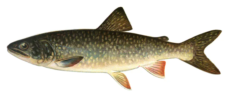
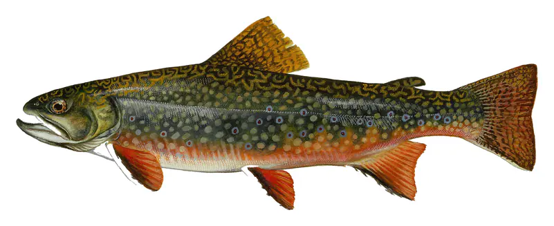
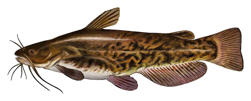
Game fish recorded in Lake George include black crappie, brown trout, lake trout, brook trout, brown bullhead, rock bass. In all, 19 fish species have open records inside the lake on GBIF.
Anglers 16 and older need a New York fishing license, sold online by the New York State Department of Environmental Conservation. Free fishing days: Presidents’ Day weekend, a weekend in late June, National Hunting and Fishing Day (September) and Veterans Day. Size and bag limits can be set lake by lake: check the current regulations.
Lake George is about 197 ft deep at its deepest point. Depth changes with the lake level.
In summer a white Secchi disk lowered into Lake George stays visible to about 25.2 ft (the median of 102 readings, 2017–2020, by North American Lake Management Society): very clear water. Silt after rain lowers the reading as much as algae do. Clarity drops after storms and during algae blooms.
Yes: fishing map with depth contours (north half) from the New York State Department of Environmental Conservation and fishing map with depth contours (south half) from the New York State Department of Environmental Conservation. It is linked in the lake facts on this page. Depths on a map are measured at a reference level: subtract how far the lake is below it today.
boating (11 boat ramps and 38 marinas), kayaks, boats & jet skis (10 rental outfits on or near the water), boat tours (15 boat tours and charters), fishing (8 game fish and 1 fishing guide; stocked by the state), swimming (20 beaches and swimming areas) and hiking & walking (20+ trails along the shore, the longest Tongue Mountain Range Trail (9.1 mi)), according to our map of the shore.
EPA's CyAN satellite rated cyanobacteria in Lake George not detected on November 9. The satellite sees open water only; blooms can be patchy, so avoid water that looks like spilled paint or pea soup and keep dogs out of scum. Swimming advisories come from New York health and environment agencies.
Usually around April 12, the median of 97 springs in the records of NSIDC Global Lake and River Ice Phenology Database.
Yes. New York State Department of Environmental Conservation stocked landlocked salmon in Lake George; the latest stocking on record was in October 2025.
Yes. 20 trails run along or near the shore, including Lakeside Trail (3.3 mi), Northwest Bay Trail (5.0 mi) and Spruce mountain path (1.4 mi), according to OpenStreetMap.
Lake George is held back by Lake George Outlet, completed in 1880 and 8 ft high, according to the National Inventory of Dams.
From the U.S. Geological Survey (LAKE GEORGE AT ROGERS ROCK NY). Lake by Lake checks it every hour; the agency's own figure is always the reference, and provisional readings can be revised.
Lake levels are refreshed every hour. Texas and California reservoirs report once a day; most USGS and NOAA gauges report every 15 to 60 minutes.