Sun
- Sunrise
- 6:23 AM
- Sunset
- 4:36 PM
- First light
- 5:56 AM
- Last light
- 5:03 PM
Reservoir · Franklin County, Tennessee
A reservoir on the Elk River in Franklin County, Tennessee, held back by Tims Ford Dam since 1970.

Tims Ford Lake is at 881.28 feet above sea level — 6.72 ft below summer pool, as of Nov 19, 2026, 2:00 AM CST. It has dropped 1.56 ft in the past 7 days.
11th lowest of 23 Tennessee lakes today against full pool · See the ranking
A notification from this browser, once, when the level crosses the line (checked every hour). No account and no email. On an iPhone, add Lake by Lake to your home screen first (Share → Add to Home Screen) and open it from there. Or follow the lake in a feed reader: RSS feed.
Tims Ford Lake is down 1.56 ft over the last 7 days, at 881.28 ft today.
Daily values from the Tennessee Valley Authority.
Tims Ford Lake is down 5.64 ft over the last 30 days, at 881.28 ft today.
Daily values from the Tennessee Valley Authority.
Over the past 12 months, Tims Ford Lake ranged from 873.86 ft (Jan 1, 2026) to 889.18 ft (Jun 2, 2026), a swing of 15.3 ft. Today's level is in the upper half of that range. It is 0.11 ft higher than on this date last year.
Daily values from the Tennessee Valley Authority. Why lake levels rise and fall
Solunar periods for Tims Ford Lake, local time. How they work
Moderate · as of Nov 9, 2026
A bloom may be forming somewhere on the lake. Avoid water that looks like spilled paint or pea soup. About 179,000 cells/mL at the worst spot, covering 12% of the lake.
Week of Aug 9Week of Nov 1
Each bar is one week, colored by the worst reading of that week.
From the U.S. EPA's Cyanobacteria Assessment Network (CyAN), which reads the color of lakes from the Sentinel-3 satellites; it sees open water only, not coves or the shoreline. Blooms can be patchy: what you see on the water matters more. Swimming closures and health advisories come from Tennessee health and environment agencies. How to read it
Surface water temperature
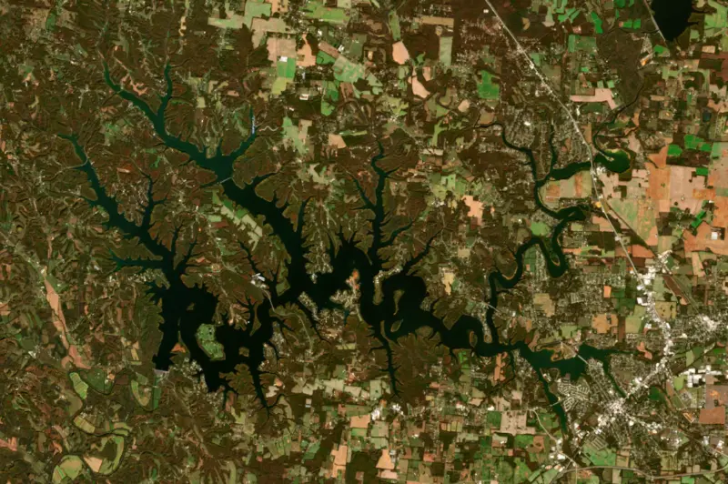
62°F on Nov 14, 2026
86°F · Aug 1062°F · Nov 14
24°F cooler than on Aug 10, 2026.
Estimated from Landsat 8/9 (USGS) passes on clear days: the top layer of the water, a few degrees either way. Coves and the shallows can be warmer.
Tims Ford Lake water temperature: trend, swimming and the fish →
On or near the shore of Tims Ford Lake: 20 boat ramps, 6 marinas, 10 campgrounds, 1 beach and 9 trails. The lake has about 247 miles of shoreline, counting its islands.
Tap an icon for details; use two fingers (or Ctrl + scroll) to move the map. Tap a dot for details. Map and lake outline © OpenStreetMap contributors. Places from OpenStreetMap, Overture Maps and Recreation.gov. Not for navigation.
What you’ll find on the shore
← AllBoating 26
← AllBeaches 1
← AllCamping 10
← AllLodging 7
← AllTrails 9
← AllParks 9
← AllDining 4
No aquatic invasive species are on record for Tims Ford Lake in the USGS database. Keep it that way: clean, drain and dry your boat between lakes.
Tennessee: Tennessee has no statewide clean-drain-dry law; TWRA urges you to remove plants, animals and mud, drain all water, and dry the boat for five days (or hot-wash it) before moving to another lake. Moving live invasive carp is illegal. State rules
Records: USGS Nonindigenous Aquatic Species database. A species not listed may still be present.
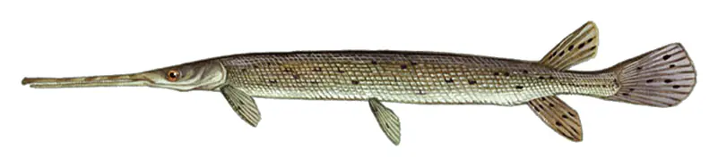
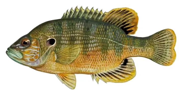
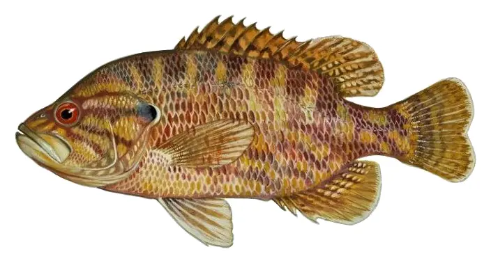
Species with open-licensed records inside Tims Ford Lake's outline, from GBIF.org (surveys, museum collections and angler reports). A record shows a fish was found here, not how many there are now.
Near the surface over weedy shallows and backwaters on calm, warm days.
Tight to rocks, stumps and weed edges in warm shallows; common in small ponds.
Stumps, brush and weedbeds over soft bottoms; fish tight to cover.
Water temperature sets off each spawn; the bars show the usual months at this latitude and elevation, and move with a warm or cold spring. The water is about 62°F now.
Tims Ford Lake is a Tennessee Valley Authority reservoir on the Elk River in southern Middle Tennessee, spread across Franklin and Moore counties near Winchester. Anglers know it for big smallmouth bass, and the cold water released from the dam keeps a trout fishery alive in the river below.
The name goes back to a pioneer crossing of the Elk near Winchester, on or near land owned by an early settler named Abner Mansfield Tims. People forded the river there until a bridge went up around 1885. TVA began building the dam in 1966 and finished it in December 1970. Besides making power, the project was meant to supply water and reduce flooding downstream, mainly for Fayetteville, and to provide recreation.
The price was paid by the people of the Elk River valley. The farming community of Awalt, founded in the 1840s and home to about 400 people by the mid-1960s, knew by 1966 that it would have to go. TVA bought the land, and the buildings came down one by one. Many owners felt the payments were unfair. Most graves were moved to higher ground, but the Shasteen Cemetery on what is now Devils Step Island was left in place because it sat above the new waterline. In early 1971 the valley was filling at about an inch an hour.
Six islands, Leatherwood, Big, Little, Maple Bend, Goose and Devils Step, are open for primitive camping with no facilities, reached only by boat or kayak. Winchester, Decherd, Estill Springs, Tullahoma and Lynchburg all sit near the shore. The water level normally moves about 15 feet over the course of a year.
Tims Ford State Park opened on the north shore in 1978, about 10 miles from Winchester. It began small, grew when the state bought 1,600 acres from TVA in 1997, and now has cabins, two campgrounds, a marina, 11 trails and the Bear Trace, an 18-hole golf course designed by Jack Nicklaus that opened in 1999.
Smallmouth bass are the main draw. Bill Dance has written that the lake holds big smallmouth, from around 4 pounds up toward 10, and that winter can be a good time to find them, with small baits worked slowly along the banks and toward the backs of coves, with the Lost Creek area a good place to start. In December 2021 Tims Ford was named a Bill Dance Signature Lake, a state program that pays for docks, fishing piers and other improvements for anglers.
Below the dam the Elk changes character. Water drawn from deep in the reservoir comes out cold, and the state wildlife agency stocks rainbow and brown trout in a put-and-take fishery that summer releases keep going. The state lists the river as a trout stream from the dam down to Fayetteville. That same cold water is a problem for the boulder darter, a small endangered fish whose only known natural population lives in the Elk River system, and for endangered mussels downstream. Starting in 2008, TVA and the U.S. Fish and Wildlife Service changed how the dam is run, blending warm and cold water so the tailwater stays cool enough for trout near the dam while the river farther down warms like a natural stream. When the turbines are off, water flows through a sluiceway to keep a minimum flow in the river, and an oxygen system in front of the dam helps keep the released water healthy for trout.
Written by Lake by Lake from Tennessee Valley Authority (Tracking water temperatures on the Elk River, News release on Tims Ford Dam releases, June 24, 2008), MTSU Sidelines, Bassmaster and Wikipedia (Tims Ford Lake, Tims Ford State Park). Checked November 2026.
Tims Ford Dam is a rockfill dam 163 feet high and 1,580 feet long on the Elk River, completed in 1970. It belongs to the Tennessee Valley Authority and is run for flood control, recreation, hydropower and water supply. At its normal level the reservoir holds 529,983 acre-ft, drained from 529 square miles of land.
From the National Inventory of Dams (U.S. Army Corps of Engineers), NID ID TN05102. Lake or reservoir: what’s the difference?
Where the level comes from: Tims Ford Lake (Tennessee Valley Authority).
| Lake | Miles | Level (ft) | vs full | 7 days |
|---|---|---|---|---|
| Normandy Lake Below full | 19 | 866.54 | −8.46 | −0.64 |
| Nickajack Lake At or near full pool | 37 | 633.48 | −1.02 | +0.07 |
| Great Falls Lake Well below full | 54 | 787.02 | −17.98 | −0.34 |
| Lake Guntersville At or near full pool | 54 | 593.71 | −1.29 | −0.38 |
| Chickamauga Lake Slightly below full | 57 | 677.23 | −5.27 | −0.29 |
| Center Hill Lake Well below full | 66 | 629.36 | −18.64 | −0.61 |
Compare Tims Ford Lake with Normandy Lake, Nickajack Lake, Great Falls Lake or Lake Guntersville: size, level, ramps and fish side by side.
Tims Ford Lake is about 43 mi from Huntsville, AL, 47 mi from Murfreesboro, TN and 56 mi from Chattanooga, TN. See all the lakes near each city.
Tims Ford Lake is at 881.28 feet above sea level — 6.72 ft below summer pool, as of Nov 19, 2026, 2:00 AM CST. It has dropped 1.56 ft in the past 7 days.
Tims Ford Lake's summer pool is 888.00 ft, according to the Tennessee Valley Authority operating guide. Today the lake is 6.72 ft below that mark.
Tims Ford Lake has 20 boat ramps on our map, including Boat ramp at Holiday Landing Marina, Boat ramp at Red Roof Pavilion, Boat ramp at Tim's Ford Marina & Resort, and 6 marinas. Low water can close ramps, so check today's level above and the operator before you go.
Yes. There are 10 campgrounds and RV parks within about a mile of the shore, such as Tims Ford Turkey Creek Campground, Tims Ford Fairview Campground, Camp Riva-Lake for Girls.
Game fish recorded in Tims Ford Lake include longnose gar, green sunfish, warmouth. In all, 25 fish species have open records inside the lake on GBIF.
The surface of Tims Ford Lake was about 62°F on November 14, estimated from a satellite pass on a clear day. It is the top layer of the water, a few degrees either way; coves and shallows run warmer in the sun.
Anglers 13 and older need a Tennessee fishing license, sold online by the Tennessee Wildlife Resources Agency. Free fishing days: Free Fishing Day, one Saturday in June; children 15 and under fish free that whole week. Size and bag limits can be set lake by lake: check the current regulations.
Tims Ford Lake averages about 51 ft deep. Depth changes with the lake level.
boating (20 boat ramps and 6 marinas), fishing (3 game fish), swimming (1 beach or swimming area), hiking & walking (9 trails along the shore, the longest Ray Branch Shoreline Trail (3.3 mi)), camping (10 campgrounds) and cabins & lodging (7 places to stay close to the water), according to our map of the shore.
EPA's CyAN satellite rated cyanobacteria in Tims Ford Lake moderate on November 9. The satellite sees open water only; blooms can be patchy, so avoid water that looks like spilled paint or pea soup and keep dogs out of scum. Swimming advisories come from Tennessee health and environment agencies.
Yes. 9 trails run along or near the shore, including Ray Branch Shoreline Trail (3.3 mi), Weavers Point Bicycle Trail (1.9 mi) and Clifton Doyle Trail (0.5 mi), according to OpenStreetMap.
Tims Ford Lake is held back by Tims Ford Dam, completed in 1970 and 163 ft high, according to the National Inventory of Dams.
From the Tennessee Valley Authority (Tims Ford Lake). Lake by Lake checks it every hour; the agency's own figure is always the reference, and provisional readings can be revised.
Lake levels are refreshed every hour. Texas and California reservoirs report once a day; most USGS and NOAA gauges report every 15 to 60 minutes.
Cookies for analytics With your OK we use Google Analytics and Microsoft Clarity to count visits and see how the site is used, so we can make it better. No advertising cookies. Privacy policy