Sun
- Sunrise
- 6:17 AM
- Sunset
- 4:37 PM
- First light
- 5:51 AM
- Last light
- 5:04 PM
Reservoir · Cherokee County, Alabama
A reservoir on the Coosa in Cherokee County, Alabama, held back by Weiss - Main Dam since 1961.

Weiss Lake is at 561.77 feet above sea level — 2.23 ft below full summer pool, as of Nov 17, 2026, 8:00 PM CST. It has dropped 0.26 ft in the past 7 days.
6th lowest of 13 Alabama lakes today against full pool · See the ranking
Record low 556.98 ft (2004), record high 570.95 ft (2019) · Level history since 2004
A notification from this browser, once, when the level crosses the line (checked every hour). No account and no email. On an iPhone, add Lake by Lake to your home screen first (Share → Add to Home Screen) and open it from there. Or follow the lake in a feed reader: RSS feed.
Weiss Lake is down 0.26 ft over the last 7 days, at 561.77 ft today.
Daily values from the NOAA National Water Prediction Service.
Weiss Lake is down 1.38 ft over the last 30 days, at 561.77 ft today.
Daily values from the NOAA National Water Prediction Service.
Over the past 12 months, Weiss Lake ranged from 560.70 ft (Jan 31, 2026) to 564.02 ft (May 25, 2026), a swing of 3.3 ft. Today's level is in the lower half of that range. It is 0.09 ft higher than on this date last year.
Daily values from the NOAA National Water Prediction Service. Why lake levels rise and fall
In the U.S. Army Corps of Engineers record, which starts in 2004, the lowest level was 556.98 ft on December 30, 2004 and the highest 570.95 ft on February 25, 2019. Today’s 561.77 ft is 4.8 ft above the record low and 9.2 ft below the record high.
Weiss Lake level history: every year since 2004, the lowest and highest years →
Solunar periods for Weiss Lake, local time. How they work
High · as of Nov 9, 2026
The satellite sees a likely bloom on part of the lake. Avoid discolored water and scum, and keep dogs out of it. About 603,000 cells/mL at the worst spot, covering 19% of the lake.
Week of Aug 9Week of Nov 1
Each bar is one week, colored by the worst reading of that week.
From the U.S. EPA's Cyanobacteria Assessment Network (CyAN), which reads the color of lakes from the Sentinel-3 satellites; it sees open water only, not coves or the shoreline. Blooms can be patchy: what you see on the water matters more. Swimming closures and health advisories come from Alabama health and environment agencies. How to read it
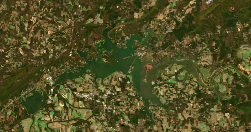
Surface water temperature
58°F on Nov 14, 2026
91°F · Jul 2658°F · Nov 14
33°F cooler than on Jul 26, 2026.
Estimated from Landsat 8/9 (USGS) passes on clear days: the top layer of the water, a few degrees either way. Coves and the shallows can be warmer.
Weiss Lake water temperature: trend, swimming and the fish →
On or near the shore of Weiss Lake: 14 boat ramps, 2 marinas, 1 rental outfit and 24 campgrounds. The lake has about 322 miles of shoreline, counting its islands.
Tap an icon for details; use two fingers (or Ctrl + scroll) to move the map. Tap a dot for details. Map and lake outline © OpenStreetMap contributors. Places from OpenStreetMap, Overture Maps and Recreation.gov. Not for navigation.
No aquatic invasive species are on record for Weiss Lake in the USGS database. Keep it that way: clean, drain and dry your boat between lakes.
Alabama: Alabama has no clean-drain-dry law for boaters, but the state asks you to remove mud, plants and animals, drain all water and dry your boat and gear before moving them. Releasing bait or stocking any fish or aquatic organism without a permit is illegal, as is putting non-native aquatic plants into public waters. State rules
Records: USGS Nonindigenous Aquatic Species database. A species not listed may still be present.
Species with open-licensed records inside Weiss Lake's outline, from GBIF.org (surveys, museum collections and angler reports). A record shows a fish was found here, not how many there are now.
Weiss Lake is an Alabama Power reservoir on the Coosa River in northeast Alabama, spreading across the middle of Cherokee County and reaching east into Floyd County, Georgia. Locals say the name like Wice. It is best known as the Crappie Capital of the World, and the campgrounds, motels and rental cabins along its shore make it the main engine of the county's economy.
The idea of taming the Coosa is old. In the 1890s Capt. William Patrick Lay helped organize a campaign for federal work to open the river to boats from Mobile up to Gadsden, and in 1906 he incorporated Alabama Power, partly to harness the Coosa for electricity. He sold the company in 1912, and the plans sat for nearly 50 years until demand for power after World War II revived them. In the 1950s Alabama Power persuaded Congress to lift federal limits on building dams on the upper Coosa. Ground was broken near Leesburg on April 26, 1958, before a crowd of more than 10,000 with Gov. Jim Folsom on hand and a free barbecue lunch. The dam began making power on June 5, 1961, at a cost of $30 million, the first of the company's new Coosa projects. It is named for Fernand C. Weiss, a former chief engineer of Alabama Power. Not everyone wanted it, and local farmers fought the dams for years.
Weiss is laid out unlike any other dam in the company's system. The spillway gates stand about 4 miles from the powerhouse. Water reaches the turbines through a man-made canal about a mile long and returns to the riverbed through a dug tailrace. The three generators together are rated at 87,750 kilowatts. Weiss is a storage lake, so its level follows the seasons under guidelines from the Army Corps of Engineers. It is held highest in summer, lowered through the fall to make room for flood water, usually bottoms out in December, and refills with winter and spring rain. In 2021 the Corps approved Alabama Power's request to raise the normal winter level by 3 feet, from 558 to 561 feet.
Three rivers feed the lake: the Coosa from Georgia, the Chattooga and the Little River, which comes down from Lookout Mountain through Little River Canyon, a national preserve since 1992. The lake has broad shallow flats, big coves, drop-offs and deep channels, and 11 bridges cross it. Centre is the county seat, and Leesburg lies near the dam, joined to Centre by the Avenue of Flags, where 306 flags honor local veterans. Cedar Bluff, founded in 1836, was the first county seat. Nearby stands Cornwall Furnace, a limestone furnace built in 1862 that made iron for Confederate cannons and survived Sherman's orders to destroy it. Cherokee Rock Village, a maze of sandstone formations on Lookout Mountain, has overlooks high above the water. The Rome Sailing Club has sailed here since 1980, and the lake is part of the Alabama Scenic River Trail.
Crappie made Weiss famous, and the lake hosts local, state and national tournaments. The best crappie fishing runs from March through May, with a second run from September through November. State biologists also rate Weiss among Alabama's better largemouth lakes, with most bass in the 15- to 18-inch range. Striped bass mostly weigh 3 to 7 pounds, though fish over 25 pounds have been caught. White, spotted and hybrid striped bass, three kinds of catfish, freshwater drum and several sunfish fill out the list. There are four free public access areas and dozens of private marinas.
Written by Lake by Lake from Encyclopedia of Alabama (Weiss Dam and Lake, Cherokee County), Alabama Department of Conservation and Natural Resources, Alabama Power Shorelines (Weiss Dam, Winter pool levels will be raised at Weiss and Logan Martin lakes) and Wikipedia. Checked November 2026.
Weiss - Main Dam is an earthfill dam 86 feet high and 19,253 feet long on the Coosa, completed in 1961. It belongs to Alabama Power Company and is run for hydropower and recreation. At its normal level the reservoir holds 306,400 acre-ft, drained from 5,273 square miles of land.
From the National Inventory of Dams (U.S. Army Corps of Engineers), NID ID AL01415. Lake or reservoir: what’s the difference?
Where the level comes from: Coosa River at Weiss Dam (NOAA National Water Prediction Service).
| Lake | Miles | Level (ft) | vs full | 7 days |
|---|---|---|---|---|
| Neely Henry Lake At or near full pool | 32 | 506.77 | −1.23 | −0.30 |
| Lake Guntersville At or near full pool | 40 | 593.62 | −1.38 | — |
| Nickajack Lake At or near full pool | 58 | 633.21 | −1.29 | — |
| Allatoona Lake Below full | 59 | 830.63 | −9.37 | −1.01 |
| Logan Martin Lake Slightly below full | 62 | 462.62 | −2.38 | −0.50 |
| Lake Wedowee Below full | 64 | 786.74 | −6.26 | −0.83 |
Compare Weiss Lake with Neely Henry Lake, Lake Guntersville, Nickajack Lake or Allatoona Lake: size, level, ramps and fish side by side.
Weiss Lake is at 561.77 feet above sea level — 2.23 ft below full summer pool, as of Nov 17, 2026, 8:00 PM CST. It has dropped 0.26 ft in the past 7 days.
Weiss Lake's full summer pool is 564.00 ft, according to U.S. Army Corps of Engineers. Today the lake is 2.23 ft below that mark.
Today's level is 1.45 ft above the median for this date (560.32 ft), from the gauge’s long-term daily record.
556.98 ft, on December 30, 2004, in the U.S. Army Corps of Engineers record, which starts in 2004. Today the lake is 4.8 ft above that.
570.95 ft, on February 25, 2019, in the U.S. Army Corps of Engineers record since 2004. That is 7.0 ft above full summer pool.
Weiss Lake has 14 boat ramps on our map, including Boat ramp near Bay Springs Country Inn Campground and Marina, Boat ramp near Pruett's Lakeside Campground, Boat ramp near Lake Haven RV Retreat, and 2 marinas. Low water can close ramps, so check today's level above and the operator before you go.
Yes. There are 24 campgrounds and RV parks within about a mile of the shore, such as Cherokee RV Park, Lake Haven RV Retreat, Burger Landing Campground.
Game fish recorded in Weiss Lake include shadow bass. In all, 11 fish species have open records inside the lake on GBIF.
The surface of Weiss Lake was about 58°F on November 14, estimated from a satellite pass on a clear day. It is the top layer of the water, a few degrees either way; coves and shallows run warmer in the sun.
Anglers 16 and older need an Alabama fishing license, sold online by the Alabama Department of Conservation and Natural Resources. Free fishing days: One Saturday in June (2026: June 13). Size and bag limits can be set lake by lake: check the current regulations.
NOAA's flood categories for the Weiss Lake gauge: action stage at 564.5 ft, minor flooding at 567.0 ft, moderate flooding at 572.0 ft and major flooding at 575.0 ft. Today the lake is 5.23 ft below the first flooding level.
Weiss Lake averages about 10 ft deep. Depth changes with the lake level.
In summer a white Secchi disk lowered into Weiss Lake stays visible to about 3.0 ft (the median of 168 readings, 2016–2025, by ALABAMA DEPT. OF ENVIRONMENTAL MANAGEMENT - WATER QUALITY DATA and Alabama Water Watch): murky water. With the algae measured too (chlorophyll about 19 µg/L), that makes it eutrophic: rich in nutrients, greener water. Clarity drops after storms and during algae blooms.
boating (14 boat ramps and 2 marinas), kayaks, boats & jet skis (1 rental outfit on or near the water), fishing (1 game fish), camping (24 campgrounds), cabins & lodging (11 places to stay close to the water) and parks & picnics (2 parks on the shore), according to our map of the shore.
EPA's CyAN satellite rated cyanobacteria in Weiss Lake high on November 9. The satellite sees open water only; blooms can be patchy, so avoid water that looks like spilled paint or pea soup and keep dogs out of scum. Swimming advisories come from Alabama health and environment agencies.
Weiss Lake is held back by Weiss - Main Dam, completed in 1961 and 86 ft high, according to the National Inventory of Dams.
From the NOAA National Water Prediction Service (Coosa River at Weiss Dam). Lake by Lake checks it every hour; the agency's own figure is always the reference, and provisional readings can be revised.
Lake levels are refreshed every hour. Texas and California reservoirs report once a day; most USGS and NOAA gauges report every 15 to 60 minutes.